Peyton, Colorado

Last updated
Peyton, Colorado
El Paso County Colorado Incorporated and Unincorporated areas Peyton Highlighted 0858675.svg
Location of the Peyton CDP in El Paso County, Colorado.
Usa edcp location map.svg
Red pog.svg
Peyton
Location of the Peyton CDP in the United States.
Coordinates: 39°01′59″N104°29′25″W / 39.0329789°N 104.4904020°W / 39.0329789; -104.4904020 (Peyton CDP, Colorado) Coordinates: 39°01′59″N104°29′25″W / 39.0329789°N 104.4904020°W / 39.0329789; -104.4904020 (Peyton CDP, Colorado) [1]
Country Flag of the United States.svg  United States
State Flag of Colorado.svg  Colorado
County El Paso County
Government
[2]
  Type unincorporated community
Area
[1]
  Total2.297 sq mi (5.950 km2)
  Land2.297 sq mi (5.950 km2)
  Water0.000 sq mi (0.000 km2)
Population
 (2020) [3]
  Total214
  Density93/sq mi (36/km2)
Time zone UTC-7 (MST)
  Summer (DST) UTC-6 (MDT)
ZIP Code [4]
80831
Area code 719
GNIS feature [2] Peyton CDP

Peyton is an unincorporated town, a post office, and a census-designated place (CDP) located in and governed by El Paso County, Colorado, United States. The CDP is a part of the Colorado Springs, CO Metropolitan Statistical Area. The Peyton post office has the ZIP Code 80831. [4] At the United States Census 2020, the population of the Peyton CDP was 214. [3]

Contents

The nearby unincorporated area of Falcon also uses zip code 80831. [4] Peyton and towns such as Falcon, Calhan, Ramah, Simla, and Matheson straddle U.S. Highway 24 between Colorado Springs and Limon, Colorado where US 24 intersects with Interstate 70.

History

Peyton was settled by George Peyton in 1888 and was surveyed and platted on December 25 of that year. Originally called Mayfield, the settlement was renamed Peyton after the post office had been refused under that name because there was already a Mayfield, California. [5]

Among the first settlers of Peyton were James and Susan McDermott. With the coming of the Rock Island Railroad they settled in Calhan in 1888 and in 1890 moved to Peyton where Mr. McDermott was the first postmaster and ran a general store for 25 years. His home, which still stands at the southwest corner of Main and Front Streets, was a popular boarding house. [6]

A few years later, Russell Gates opened a mercantile store. He had previously established general stores in Limon, Calhan, Eastonville, Elbert and Elizabeth, Colorado. These enterprises carried everything from pins to coffins plus running a creamery. The store closed in 1920. At one time, there were five general stores in Peyton, one of which also sold gasoline.

By 1900, 50 people lived in Peyton. While farming and coal mining comprised the main occupation, supporting services included a blacksmith, physician, general store, creamery, hotel, and clergy. Joseph Zimmerman built a hall above a storage building attached to the Gates store. This meeting place hosted Odd Fellows, Modern Woodmen, elections, community dances, and fundraising events.

The first telephone in Peyton arrived in 1904. It ran on a dry cell battery and had a crank to turn to get your party. Telephone lines ran as the top strand on the barbed wire fences. Eventually, the area had enough phones that a central switchboard was installed. Mrs. George Hayes became the switchboard operator until 1922.

In 1923, a devastating fire took out several buildings, a number of automobiles and the stock in a general store. The town rebuilt and by the 1930s boasted 13 businesses.

In 1945, the original railroad depot was torn down and replaced with a new one. Ten years later, that depot was no longer needed, and the railroad sold it to the Methodist Church in 1958. They tore it down and used the materials for an addition to their church.

When the school house burned down in 1954, Peyton residents were alarmed that they didn't have their own fire protection. A group of people met at the Grange Hall and created the Peyton Volunteer Fire Department. The town chose their board members and Clarence Cook became the first Fire Chief. A few months later, by-laws were drawn up and regular meetings established. To support their activities, the Department held benefits such as dances or street carnivals. Eventually, they raised enough money to build a fire station. The department continues today as an all volunteer department.

In June 1965, a flood badly damaged the railroad tracks in the Peyton area. The water washed out 500 feet of fill beneath the track, leaving it suspended in mid-air. The flood also damaged the underpass east of Peyton by taking out several tons of concrete supports leaving that track several feet above the original road base. It took county, state, and railroad crews working double shifts to make the necessary repairs to make the tracks operational again. [5]
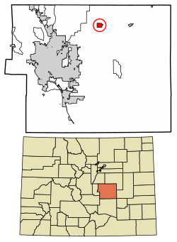
Geography

The Peyton CDP has an area of 1,470 acres (5.950 km2), all land. [1]

Demographics

The United States Census Bureau initially defined the Peyton CDP for the United States Census 2010.

Peyton CDP, Colorado
YearPop.±%
2010 250    
2020 214−14.4%
Source: United States Census Bureau

Arts and culture

Education

Students are served by Peyton School District 23JT in the Peyton area and by Falcon School District 49 in the Falcon area and nearby areas of Colorado Springs.

Notable people

See also

Related Research Articles

<span class="mw-page-title-main">El Paso County, Colorado</span> County in Colorado, United States

El Paso County is a county located in the U.S. state of Colorado. The 2020 Census recorded its population as 730,395. The Census Bureau's 2020 result indicates it is the most populous county in Colorado, surpassing the City and County of Denver. The county seat is Colorado Springs, the second most populous city in Colorado. El Paso County is included in the Colorado Springs, Colorado, Metropolitan Statistical Area and is located in Colorado's 5th congressional district, except for the far eastern extremities, which are located in the 4th.

<span class="mw-page-title-main">Franktown, Colorado</span> Census Designated Place in Colorado, United States

Franktown is an unincorporated town, a post office, and a census-designated place (CDP) located in and governed by Douglas County, Colorado, United States. The CDP is a part of the Denver–Aurora–Lakewood, CO Metropolitan Statistical Area. The Franktown post office has the ZIP Code 80116. At the United States Census 2020, the population of the Franktown CDP was 409.

<span class="mw-page-title-main">Air Force Academy, Colorado</span> Census Designated Place in State of Colorado, United States

The Air Force Academy is a census-designated place (CDP) located in El Paso County, Colorado, United States. The CDP includes the developed portion of the United States Air Force Academy, including the cadet housing facilities. The CDP is a part of the Colorado Springs, CO Metropolitan Statistical Area. The USAF Academy post office (ZIP Codes 80840 and 80841 serves the area. At the United States Census 2020, the population of the Air Force Academy CDP was 6,680.

<span class="mw-page-title-main">Black Forest, Colorado</span> Census Designated Place in Colorado, United States

Black Forest is an unincorporated community and a census-designated place (CDP) located in and governed by El Paso County, Colorado, United States. The CDP is a part of the Colorado Springs, CO Metropolitan Statistical Area. The population of the Black Forest CDP was 15,097 at the United States Census 2020. Both the Colorado Springs post office and the Elbert post office serve the area.

<span class="mw-page-title-main">Calhan, Colorado</span> Town in Colorado, United States

The Town of Calhan is a Statutory Town located in El Paso County, Colorado, United States. The town population was 762 at the 2020 United States Census. Calhan is a part of the Colorado Springs, CO Metropolitan Statistical Area and the Front Range Urban Corridor. The town straddles U.S. Highway 24. With Calhan sitting at an elevation of 6,535 feet above sea level, Calhan is the highest non-mountain town in the United States. It is the site of the Calhan Paint Mines Archeological District, a popular natural attraction.

<span class="mw-page-title-main">Cascade-Chipita Park, Colorado</span> Census Designated Place in Colorado, United States

Cascade-Chipita Park is a census-designated place (CDP) comprising the unincorporated communities of Cascade and Chipita Park located in and governed by El Paso County, Colorado, United States. The CDP is a part of the Colorado Springs, CO Metropolitan Statistical Area. The population of the Cascade-Chipita Park CDP was 1,628 at the United States Census 2020. The Cascade post office serves the area.

<span class="mw-page-title-main">Cimarron Hills, Colorado</span> Census Designated Place in Colorado, United States

Cimarron Hills is an unincorporated community and a census-designated place (CDP) located in and governed by El Paso County, Colorado, United States. Cimarron Hills is an enclave of the City of Colorado Springs. The CDP is a part of the Colorado Springs, CO Metropolitan Statistical Area. The population of the Cimarron Hills CDP was 19,311 at the United States Census 2020. The Colorado Springs post office serves the area.

<span class="mw-page-title-main">Fort Carson</span> Census Designated Place in Colorado, United States

Fort Carson is a United States Army post located directly south of Colorado Springs in El Paso, Pueblo, Fremont, and Huerfano counties, Colorado, United States. The developed portion of Fort Carson is located near the City of Colorado Springs in El Paso County.

<span class="mw-page-title-main">Gleneagle, Colorado</span> Census Designated Place in Colorado, United States

Gleneagle is an unincorporated community and a census-designated place (CDP) located in and governed by El Paso County, Colorado, United States. The CDP is a part of the Colorado Springs, CO Metropolitan Statistical Area. The population of the Gleneagle CDP was 6,649 at the United States Census 2020. The Colorado Springs post office serves the area.

<span class="mw-page-title-main">Stratmoor, Colorado</span> Census Designated Place in Colorado, United States

Stratmoor is an unincorporated community and a census-designated place (CDP) located in and governed by El Paso County, Colorado, United States. The CDP is a part of the Colorado Springs, CO Metropolitan Statistical Area. The population of the Stratmoor CDP was 6,518 at the United States Census 2020. The Colorado Springs post office serves the area.

<span class="mw-page-title-main">Woodmoor, Colorado</span> Census Designated Place in Colorado, United States

Woodmoor is an unincorporated community and a census-designated place (CDP) located in and governed by El Paso County, Colorado, United States. The CDP is a part of the Colorado Springs, CO Metropolitan Statistical Area. The population of the Woodmoor CDP was 9,536 at the United States Census 2020. The Monument post office serves the area.

<span class="mw-page-title-main">Security-Widefield, Colorado</span> Census Designated Place in Colorado, United States

Security-Widefield is a census-designated place (CDP) comprising the unincorporated communities of Security and Widefield located in and governed by El Paso County, Colorado, United States. The CDP is a part of the Colorado Springs, CO Metropolitan Statistical Area. The population of the Security-Widefield CDP was 38,639 at the United States Census 2020. El Paso County governs the unincorporated communities. Both the Colorado Springs post office and the Fountain post office serve the area.

<span class="mw-page-title-main">Florissant, Colorado</span> Census Designated Place in Colorado, United States

Florissant is an unincorporated town, a post office, and a census-designated place (CDP) located in and governed by Teller County, Colorado, United States. The CDP is a part of the Colorado Springs, CO Metropolitan Statistical Area. The Florissant post office has the ZIP Code 80816. At the United States Census 2020, the population of the Florissant CDP was 128, while the population of the 80816 ZIP Code Tabulation Area was 5,180 including adjacent areas.

Falcon is an unincorporated community exurb in El Paso County, Colorado, United States. It lies along US 24 about 14 miles northeast of Colorado Springs. A railroad hub in the early 20th century, the town spent several decades as a quiet ranching community until it experienced rapid residential growth throughout the 1990s which has continued increasingly through today. The population of Falcon as of 2009 was estimated to be 10,514. The U.S. Post Office in Peyton, Colorado serves Falcon postal addresses.

<span class="mw-page-title-main">Colorado Springs metropolitan area</span>

The Colorado Springs, CO, Metropolitan Statistical Area is a United States Office of Management and Budget defined Metropolitan Statistical Area (MSA) located in the Colorado Springs region of the State of Colorado. The 2020 United States census counted a population of 755,105, an increase of 17.0% since the 2010 United States Census. The Colorado Springs MSA is the 79th-most populous MSA in the United States. The Colorado Springs MSA encompasses El Paso County and Teller County, Colorado. Approximately 88.40% percent of the MSA's population live in cities or CDPs. The Colorado Springs Metropolitan Statistical Area is the second-most populous component of the Front Range Urban Corridor.

<span class="mw-page-title-main">Briggsdale, Colorado</span> Census Designated Place in Colorado, United States

Briggsdale is an unincorporated town, a post office, and a census-designated place (CDP) located in and governed by Weld County, Colorado, United States. The CDP is a part of the Greeley, CO Metropolitan Statistical Area. The Briggsdale post office has the ZIP Code 80611. At the United States Census 2020, the population of the Briggsdale CDP was 134.

<span class="mw-page-title-main">South Central Colorado Urban Area</span> Metropolitan area of Colorado

The South Central Colorado Urban Area comprises the Colorado Springs Metropolitan Statistical Area, the Pueblo Metropolitan Statistical Area, and the Cañon City Micropolitan Statistical Area in the central and south central region of the State of Colorado. With the exception of northern Teller County and small portions of northern El Paso County, the entire South Central Colorado Urban Area is drained by the Arkansas River and its tributaries. The South Central Colorado Urban Area is the southernmost of the three primary subregions of the Front Range Urban Corridor.

<span class="mw-page-title-main">Ellicott, Colorado</span> Census Designated Place in Colorado, United States

Ellicott is an unincorporated community and a census-designated place (CDP) located in and governed by El Paso County, Colorado, United States. The CDP is a part of the Colorado Springs, CO Metropolitan Statistical Area. The population of the Ellicott CDP was 1,248 at the United States Census 2020. The Calhan post office serves the area.

<span class="mw-page-title-main">Eastonville, Colorado</span> Unincorporated community in Colorado, United States

Eastonville was a town in eastern Colorado from c. 1880-1935. It is no longer incorporated. The former town limits now reside in El Paso County, in the Colorado Springs metro area, near Black Forest.

<span class="mw-page-title-main">Rock Creek Park, Colorado</span> Census Designated Place in Colorado, United States

Rock Creek Park is an unincorporated community and a census-designated place (CDP) located in and governed by El Paso County, Colorado, United States. The CDP is a part of the Colorado Springs, CO Metropolitan Statistical Area. The population of the Rock Creek Park CDP was 68 at the United States Census 2020. The Colorado Springs post office serves the area.

References

  1. 1 2 3 "State of Colorado Census Designated Places - BAS20 - Data as of January 1, 2020". United States Census Bureau . Retrieved December 22, 2020.
  2. 1 2 "U.S. Board on Geographic Names: Domestic Names". United States Geological Survey . Retrieved December 22, 2020.
  3. 1 2 United States Census Bureau. "Peyton CDP, Colorado" . Retrieved April 16, 2023.
  4. 1 2 3 "Look Up a ZIP Code". United States Postal Service . Retrieved December 22, 2020.
  5. 1 2 http://adm2.elpasoco.com/planning/falcon_peyton_masterplan/library/Print/Chapter2.pdf El Paso County Falcon Peyton Area Master Plan
  6. 1926 obituary, Colorado Springs Gazette