Eastonville, Colorado

Last updated
Eastonville, Colorado
USA Colorado location map.svg
Red pog.svg
Eastonville
Coordinates: 39°03′40″N104°33′44″W / 39.0611°N 104.5622°W / 39.0611; -104.5622 (Eastonville)
Country United States
State Colorado
County El Paso
Elevation
[1]
7,235 ft (2,205 m)
Time zone UTC-6 (Mountain Standard Time)
  Summer (DST) UTC-5 (Mountain Daylight Time)
Area code 719

Eastonville is an extinct town in El Paso County, Colorado, United States. [2] A post office named Easton opened on May 6, 1872, but the name was changed to Eastonville on September 28, 1883. The post office closed on May 11, 1932. [3] Eastonville is no longer incorporated. The former town limits now lie in the Colorado Springs metropolitan area, near the Black Forest.

Contents

History

Abandoned house at Eastonville Eastonville side house.JPG
Abandoned house at Eastonville
Eastonville Cemetery Eastonville cemetery 2007.JPG
Eastonville Cemetery

The area around Eastonville began settlement around 1872 when a post office was established a mile to the south of its eventual location on Squirrel Creek. The area was located in the Black Forest of Colorado and was found to be suitable for potato farming and many pioneers homesteaded in the vicinity. In 1881 the Denver and New Orleans Railroad (later the Colorado and Southern Railway) laid their tracks through the area and created a stop named "McConnellsville" near what is now Eastonville; this was the main standard gauge line from Colorado Springs to Denver until the 3-foot-gauge Denver and Rio Grande was 3-railed. Shortly after, in 1883, the area post office was moved north and named "Easton" for a local pioneer, John Easton. The town soon became Eastonville. At the behest of the railroad, the town moved a short distance to its current site. [2]

By the 1900s the town had 350-500 people. It had three churches, three hotels, a newspaper, a school house, race track, ball field, and many businesses. Nine to ten passenger trains passed through everyday, and with at least that many freight trains using the tracks a constant rolling of locomotives could be heard day and night in the burgeoning city. It had become the self-proclaimed "potato capital of the world" and some years couldn't find enough workers to harvest the crops. Colorado Springs newspapers would print large advertisements offering work at respectable wages on the potato farms of Eastonville. It was one of the most prosperous farm centers in eastern Colorado that are now ghost towns. [2]

Eastonville continued as a stable town until the 1930s when drought and depression hit the west. In 1935 the area endured a potato blight and a flood which washed away many buildings in Elbert, the next town north on the railroad; the railroad was then abandoned. The town couldn't recover without the railroad, especially since Peyton (6 miles away) still had the Rock Island railroad. [2] Although little remains but a few buildings and the cemetery, [4] as of May 2013 the United States Board on Geographic Names still lists Eastonville as a populated place. [1]

As the town died, the Eastonville school district was merged into the Peyton School District 23jt. Eastonville is, however, in the Falcon fire district.

Climate

Climate data for Eastonville 2 NNW, Colorado, 1991–2020 normals, 2004-2023 records: 7210ft (2198m)
MonthJanFebMarAprMayJunJulAugSepOctNovDecYear
Record high °F (°C)66
(19)
70
(21)
75
(24)
81
(27)
87
(31)
94
(34)
95
(35)
93
(34)
94
(34)
81
(27)
74
(23)
68
(20)
95
(35)
Mean maximum °F (°C)59.3
(15.2)
60.8
(16.0)
68.8
(20.4)
75.8
(24.3)
79.2
(26.2)
89.6
(32.0)
90.7
(32.6)
87.4
(30.8)
86.9
(30.5)
76.2
(24.6)
68.8
(20.4)
61.3
(16.3)
91.9
(33.3)
Mean daily maximum °F (°C)41.4
(5.2)
42.4
(5.8)
49.5
(9.7)
56.4
(13.6)
65.7
(18.7)
76.1
(24.5)
80.9
(27.2)
78.8
(26.0)
72.0
(22.2)
60.3
(15.7)
49.5
(9.7)
39.9
(4.4)
59.4
(15.2)
Daily mean °F (°C)25.4
(−3.7)
27.5
(−2.5)
35.4
(1.9)
41.8
(5.4)
50.6
(10.3)
59.8
(15.4)
65.1
(18.4)
63.5
(17.5)
55.6
(13.1)
43.8
(6.6)
33.5
(0.8)
24.6
(−4.1)
43.9
(6.6)
Mean daily minimum °F (°C)9.3
(−12.6)
12.6
(−10.8)
21.3
(−5.9)
27.2
(−2.7)
35.4
(1.9)
43.5
(6.4)
49.2
(9.6)
48.2
(9.0)
39.2
(4.0)
27.3
(−2.6)
17.4
(−8.1)
9.2
(−12.7)
28.3
(−2.0)
Mean minimum °F (°C)−14.3
(−25.7)
−14.6
(−25.9)
−2.5
(−19.2)
8.3
(−13.2)
21.3
(−5.9)
32.6
(0.3)
41.8
(5.4)
39.6
(4.2)
28.1
(−2.2)
6.6
(−14.1)
−2.9
(−19.4)
−14.4
(−25.8)
−19.2
(−28.4)
Record low °F (°C)−22
(−30)
−26
(−32)
−11
(−24)
−11
(−24)
10
(−12)
28
(−2)
35
(2)
33
(1)
23
(−5)
−10
(−23)
−20
(−29)
−27
(−33)
−27
(−33)
Average precipitation inches (mm)0.63
(16)
0.64
(16)
1.50
(38)
2.39
(61)
2.72
(69)
2.26
(57)
3.88
(99)
3.48
(88)
1.43
(36)
1.24
(31)
0.85
(22)
0.61
(15)
21.63
(548)
Average snowfall inches (cm)11.50
(29.2)
9.90
(25.1)
19.00
(48.3)
22.20
(56.4)
6.70
(17.0)
0.70
(1.8)
0.00
(0.00)
0.00
(0.00)
1.40
(3.6)
8.10
(20.6)
10.90
(27.7)
11.30
(28.7)
101.7
(258.4)
Average precipitation days (≥ 0.01 in)5.66.27.79.010.89.311.812.05.95.25.65.694.7
Average snowy days (≥ 0.1 in)6.06.27.57.32.40.30.00.00.62.65.45.643.9
Source 1: NOAA [5]
Source 2: XMACIS2 (records & monthly max/mins) [6]

See also

Related Research Articles

<span class="mw-page-title-main">Eldora, Colorado</span> Census Designated Place in Colorado, United States

Eldora, previously known as "Eldorado" then "El-Dora", then Eldora or Camp Eldorado, and still called Happy Valley, is an unincorporated community and a census-designated place (CDP) located in and governed by Boulder County, Colorado, United States. The CDP is a part of the Boulder, CO Metropolitan Statistical Area. The population of the Eldora CDP was 140 at the United States Census 2020. The Nederland post office serves the area.

<span class="mw-page-title-main">Ward, Colorado</span> Town in Colorado, United States

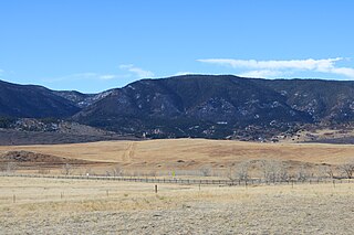
Ward is a home rule municipality in Boulder County, Colorado, United States. The population was 128 at the 2020 census. The town is a former mining settlement founded in 1860 in the wake of the discovery of gold at nearby Gold Hill. Once one of the richest towns in the state during the Colorado Gold Rush, it is located on a mountainside at the top of Left Hand Canyon, near the Peak to Peak Highway northwest of Boulder at an elevation of 9,450 feet (2,880 m) above sea level.

<span class="mw-page-title-main">Perry Park, Colorado</span> Census Designated Place in Colorado, United States

Perry Park is an unincorporated community and a census-designated place (CDP) located in Douglas County, Colorado, United States. The CDP is a part of the Denver–Aurora–Lakewood, CO Metropolitan Statistical Area. The population of the Perry Park CDP was 1,932 at the United States Census 2020. The Perry Park Metropolitan District and the Perry Park Water & Sanitation District provide services. The Larkspur post office serves the area.

<span class="mw-page-title-main">Black Forest, Colorado</span> Census Designated Place in Colorado, United States

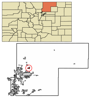
Black Forest is an unincorporated community and a census-designated place (CDP) located in and governed by El Paso County, Colorado, United States. The CDP is a part of the Colorado Springs, CO Metropolitan Statistical Area. The population of the Black Forest CDP was 15,097 at the United States Census 2020. Both the Colorado Springs post office and the Elbert post office serve the area.

<span class="mw-page-title-main">La Veta, Colorado</span> Town in Colorado, United States

La Veta is a statutory town in Huerfano County, Colorado, United States. The town population was 862 as of the 2020 United States Census.

<span class="mw-page-title-main">Eaton, Colorado</span> Town in Colorado, United States

The Town of Eaton is a Statutory Town located in Weld County, Colorado, United States. The town population was 5,802 at the 2020 United States Census, a +32.92% increase since the 2010 United States Census. Eaton is a part of the Greeley, CO Metropolitan Statistical Area and the Front Range Urban Corridor.

Serene, Colorado is an extinct coal mining company town that was owned by the Rocky Mountain Fuel Company. Serene was located at the site of the Columbine Mine and had company housing and a coal preparation plant. The Serene post office operated from January 25, 1923, until August 31, 1942. Serene was the site of the Columbine Mine Massacre on November 21, 1927.

<span class="mw-page-title-main">Chivington, Colorado</span> Unincorporated community in Kiowa County, Colorado, United States

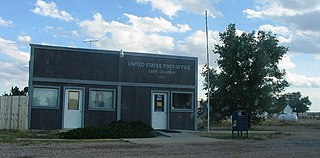
Chivington is an unincorporated community in Kiowa County, Colorado, United States. The Chivington post office operated from October 24, 1887, until January 1, 1991. The U.S. Post Office at Eads now serves Chivington postal addresses.

<span class="mw-page-title-main">Elbert, Colorado</span> Census Designated Place in Colorado, United States

Elbert is an unincorporated town, a post office, and a census-designated place (CDP) located in and governed by Elbert County, Colorado, United States. The CDP is a part of the Denver–Aurora–Lakewood, CO Metropolitan Statistical Area. The Elbert post office has the ZIP Code 80106. At the United States Census 2020, the population of the Elbert CDP was 188.

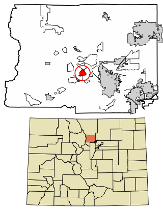
Falcon is an unincorporated community exurb in El Paso County, Colorado, United States. It lies along US 24 about 14 miles northeast of Colorado Springs. A railroad hub in the early 20th century, the town spent several decades as a quiet ranching community until it experienced rapid residential growth throughout the 1990s which has continued increasingly through today. The population of Falcon as of 2009 was estimated to be 10,514. The U.S. Post Office in Peyton, Colorado serves Falcon postal addresses.

<span class="mw-page-title-main">Carr, Colorado</span> Unincorporated community in Colorado, United States

Carr is an unincorporated community that used to have a U.S. Post Office in Weld County, Colorado, United States. The ZIP Code of Carr is 80612. Some consider Carr a ghost town. Today, a few old houses remain plus a church and the schoolhouse, but the old store fronts are gone. There are some scattered old foundations throughout the town. There are a growing number of year-round residents, so the town no longer appears abandoned.

<span class="mw-page-title-main">Peyton, Colorado</span> Census Designated Place in Colorado, United States

Peyton is an unincorporated town, a post office, and a census-designated place (CDP) located in and governed by El Paso County, Colorado, United States. The CDP is a part of the Colorado Springs, CO Metropolitan Statistical Area. The Peyton post office has the ZIP Code 80831. At the United States Census 2020, the population of the Peyton CDP was 214.

<span class="mw-page-title-main">Carpenter, Colorado</span> Ghost town

Carpenter is an extinct coal mining town located in Mesa County, Colorado, United States, twelve miles northeast of Grand Junction at the end of an extension to 27¼ Road. The townsite is located at 39.1944°N 108.4733°W, at an elevation of 5,808 feet (1,770 m). The Carpenter post office operated from June 11, 1890, only until August 3, 1891.

<span class="mw-page-title-main">Crisman, Colorado</span> Census Designated Place in Colorado, United States

Crisman is an unincorporated community and a census-designated place (CDP) located in and governed by Boulder County, Colorado, United States. The CDP is a part of the Boulder, CO Metropolitan Statistical Area. The population of the Crisman CDP was 179 at the United States Census 2020. The Boulder post office serves the area.

<span class="mw-page-title-main">Goldfield, Colorado</span> Census Designated Place in Colorado, United States

Goldfield is an unincorporated community and a census-designated place (CDP) located in and governed by Teller County, Colorado, United States. The CDP is a part of the Colorado Springs, CO Metropolitan Statistical Area. The population of the Goldfield CDP was 63 at the United States Census 2020. The Cripple Creek post office (Zip Code 80813) serves the area.

<span class="mw-page-title-main">Ironton, Colorado</span> Ghost town in Ouray County, Colorado

Ironton is an extinct town located in Ouray County, Colorado, United States. It lay south of the present town of Ouray, adjacent to the sites Guston of Red Mountain Town, fellow ghost towns. During the 1880s and 1890s, Ironton formed part of the Red Mountain Pass mining district, the second largest silver mining district in Colorado. The Ironton post office operated from May 2, 1883, until August 2, 1920.

<span class="mw-page-title-main">Gillett, Colorado</span> Town in Colorado, United States of America

Gillett is a ghost town located near Cripple Creek in Teller County, Colorado, United States. The town underwent two name changes, first becoming known as West Beaver Park, then as Cripple City, and finally being named after W.K. Gillett, a railroad man. His partners, Henry Collbran, Irving Howbert, and Harlan Lillibridge created the Midland Terminal railroad, a branch of Colorado Midland Railroad. The Gillett post office operated from August 29, 1894, until March 15, 1913. Gillett is famous for being the site of the only bullfight ever held in the US.

<span class="mw-page-title-main">Franceville, Colorado</span>

Franceville was a coal mining town and railroad post office in eastern El Paso County, Colorado, about five miles from the town of Falcon and twelve miles east of Colorado Springs. The Franceville post office operated from November 2, 1881, until May 14, 1894. The town was located on land owned by Matt France. There were 120 people in the town in 1885.

<span class="mw-page-title-main">Guston, Colorado</span> Ghost town in Ouray County, Colorado, United States

Guston is a silver mining ghost town in Ouray County, Colorado, United States, 11 miles (18 km) south of Ouray following the "Million Dollar Highway". Nestled in Champion Gulch, it is located near Red Mountain and the remnants of Red Mountain Town and Ironton. The Silverton Railroad ran from Guston in the Red Mountain Pass to Silverton in San Juan County. The silver mining camp was established in 1883. The Guston post office operated from January 26, 1892, until November 16, 1898.

References

  1. 1 2 "Eastonville". Geographic Names Information System . United States Geological Survey, United States Department of the Interior.
  2. 1 2 3 4 Eberhart, Perry. Ghost of the Colorado Plains. Swallow Press, Athens, Ohio, 1986. p. 50
  3. Bauer, William H.; Ozment, James L.; Willard, John H. (1990). Colorado Post Offices 1859–1989. Golden, Colorado: Colorado Railroad Historical Foundation. ISBN   0-918654-42-4.
  4. Eberhart, Perry. Ghost of the Colorado Plains. Swallow Press, Athens, Ohio, 1986. P. 51
  5. "Eastonville 2 NNW, Colorado 1991-2020 Monthly Normals" . Retrieved January 5, 2024.
  6. "xmACIS". National Oceanic and Atmospheric Administration. Retrieved January 5, 2024.