Enfield, New South Wales

Last updated

Enfield
Sydney,  New South Wales
Enfield Liverpool Road.JPG
Former theatre on Liverpool Road, in Enfield
Enfield, New South Wales
Map
Population2,833 (2016 census) [1]
Postcode(s) 2136
Elevation42 m (138 ft)
Location11 km (7 mi) from Sydney CBD
LGA(s) Municipality of Burwood
State electorate(s) Strathfield
Federal division(s) Watson
Suburbs around Enfield:
Strathfield Burwood Burwood Heights
South Strathfield Enfield Croydon Park
Belfield Croydon Park Croydon Park

Enfield is a suburb in the Inner West [2] of Sydney, in the state of New South Wales, Australia. It is 11 kilometres south-west of the Sydney central business district in the local government area of Municipality of Burwood.

Contents

History

The suburb is named after Enfield, a suburb of London, England.

Aboriginal culture

Before the arrival of the First Fleet in 1788, the Enfield area belonged to the Wangal people, a clan of the Eora tribe, which covered most of Sydney. In the early years, the Eora people were badly affected by smallpox, which arrived with the British. Many of the clans became unsustainably small and the survivors formed new bands who lived where they could. While it would be wrong to say that the local indigenous population gave no resistance to British land claims (Pemulwuy being a notable example), within thirty years or so of the colony's establishment, most of the land in the inner-west had been conceded to British settlers.

European settlement

William Faithful was granted 100 acres (40 hectares) in 1810 covering what is now Enfield as well as much of Croydon Park and parts of Burwood and Croydon. In 1812, Liverpool Road was built through Faithful's land and the high position of Enfield made it a sensible spot for a staging post along the road. By the mid-1840s a small village had formed and the surrounding area supported vegetable gardening and a timber industry. St Thomas' Anglican Church was built in 1848 and is the oldest surviving building in the suburb. [3]

Former Enfield Council Chambers, now in Strathfield South Enfield Town Hall.JPG
Former Enfield Council Chambers, now in Strathfield South

In 1853, a post office was built. This was the first recorded use of the name Enfield for the area although it may already have been unofficially known as that. In 1889, Enfield was deemed large enough to have its own municipal council which covered a larger area than the current suburb including those parts of the current Burwood and Strathfield councils south of Liverpool Rd. In 1891, its municipal population of 2,050 was larger than that of neighbouring Strathfield (1,850) and only just smaller than another neighbour Canterbury (2,426). Enfield retained its separate identity until 1949 when the NSW state government decided to abolish a number of small local councils by amalgamating them with their neighbours. [4] The Municipality of Enfield was split, with the eastern part (present-day Enfield and the western part of Croydon Park) absorbed into the Municipality of Burwood, and the western part (present-day Strathfield South, historically part of Druitt Town) absorbed into the Municipality of Strathfield. [5]

Enfield Olympic Pool, located in Henley Park is the oldest freshwater pool in Sydney, completed in 1933 and officially opened by Bertram Stevens, NSW Premier and Colonial Treasurer, on 18 November 1933.

The Enfield War Memorial, now in Strathfield South, is situated on the corner of Liverpool Road and Coronation Parade on the lawn outside the former Enfield Council Chambers. The memorial is a rectangular sandstone pedestal with four marble plaque panels with the engraved names of the men and women who served during World War I. The top of the pedestal displays a 105mm French howitzer gun that was donated to the Australian Government by the French government as recognition of Australia's wartime assistance during World War I. The Memorial was unveiled on 11 October 1924 by the NSW Attorney-General and later by the Premier of New South Wales from 1927–1930. Erection of the memorial was made possible by Mayor and Mayoress of Enfield, Mr and Mrs Ebenezer Ford. The wheel treads of the French howitzer gun which are made of wood are still intact. [6]

Enfield tram lines

Enfield tram depot, in present-day Croydon Park, in the late 1940s Enfield tram depot late 1940's.jpg
Enfield tram depot, in present-day Croydon Park, in the late 1940s

Between 1891 and 1948, Enfield was served by a tram line centred around a depot in present-day Croydon Park, in Tangarra Street. The line began as a steam tramway, opened in 1891, between Ashfield Station and Enfield. In 1901, this line was extended north via Liverpool Road and Burwood Road through Burwood to Mortlake, and in 1909 a branch to Cabarita Park was opened. The system was electrified in 1912. [7] The line was never connected to any of the other tram lines in Sydney, although its eastern terminus, at Ashfield station, was only one station away (on the main suburban railway line) from the nearest tram terminus at Summer Hill station.

The northern part of Coronation Reserve (the grassy green space that runs down the centre of Coronation Parade) lies on top of the original tram tracks that led, in a straight line, directly north to the intersection with Liverpool Road and the Boulevarde. In the other direction, the line led from Ashfield station.

The Coronation Parade Arch, built in 1937 and now on the boundary between Enfield and Strathfield South, displays 4 light bulbs in sockets which were originally the holders for the four electricity cables that ran along the former tram line Enfield Coronation Parade.JPG
The Coronation Parade Arch, built in 1937 and now on the boundary between Enfield and Strathfield South, displays 4 light bulbs in sockets which were originally the holders for the four electricity cables that ran along the former tram line

Services operated from Ashfield Station along Liverpool Road, Georges River Road and Tangarra Street, then north along Coronation Parade in a straight line passing what is now the Enfield War Memorial and back to Liverpool Road along the boundary between Enfield and Burwood, and then north along Burwood Road through Burwood. The line then turned into Crane Street, then Majors Bay Road and Brewer Street to Cabarita Junction. [8] The line was double track until this point, it then split into single-track branches to Mortlake and Cabarita. Short services were turned back at Brighton Avenue, Plymouth Street, Enfield, Burwood Station and Wellbank St.

Services operated every five minutes between Ashfield and Wellbank Street in peak periods, and every 15 minutes (30 minutes at off-peak times) on the two branches. A depot on Tangarra Street [9] served the lines. The lines closed in 1948, and were replaced by buses.

The roadway to the east of Coronation Reserve, now used for motor through-traffic as part of Coronation Parade, was built beside the original tram track until the main intersection where the road was then built over the tracks and became the Boulevarde. The Coronation Parade Arch, built in 1937 to commemorate the coronation of King George VI, formerly led into the Coronation Parade tram station. The arch displays four light bulbs in sockets which were originally the holders for the four electricity cables that ran along the old tram line.

Features

Enfield itself is a small suburb, bounded by Liverpool Road to the north, Coronation Parade to the west, Mitchell Street to the south and Burwood Road to the east.

There is a small commercial area along Liverpool Road centred on the intersection with Coronation Parade and The Boulevarde. There are other commercial premises around that junction but within the boundaries of the suburbs of Strathfield, Burwood and Strathfield South. There are larger commercial areas nearby around Strathfield and Burwood stations.

Because Enfield the modern-day suburb is much smaller than the historical Enfield municipality or locality, there are a number of establishments in nearby suburbs that are named "Enfield", but are not in Enfield itself. An example is the Enfield Intermodal Logistics Centre, a large rail yard and logistics hub, which is located in neighbouring Strathfield South. Likewise, neither the historic Enfield Town Hall nor the associated war memorial are in the suburb of Enfield.

Churches

St Thomas's Anglican Church (1848) EnfieldNSWStThomas.jpg
St Thomas's Anglican Church (1848)

St Joseph's Catholic Church on Liverpool Road was built 1930–31. [10] The church was designed by architect Clement Glancy in Inter-War Academic Classical style inspired by Église de la Madeleine, Paris.

St Thomas's Anglican Church, Coronation Parade was built in 1848 in a Gothic Revival style and is now listed on the Register of the National Estate. [11]

Schools

Enfield Public School is on Beaumaris Street. St Joseph's Primary School is located on the corner of Burwood and Liverpool Roads and is a Catholic school for kindergarten to Year 6.

Other places of interest

Transport

Liverpool Road intersects with Coronation Parade and The Boulevarde at Enfield.

Transit Systems operates eight bus services through Enfield:

U-Go Mobility operates route 450, from Hurstville to Strathfield via Lakemba and Enfield. [21]

Prior to the 1960s, there was a tramline which ran from Ashfield to Mortlake and Cabarita via Enfield and Burwood following the route of the modern day 464 & 466 bus services.

People

NASA image of Sydney's CBD and inner west suburbs, with borders of Enfield shown in orange EnfieldNSWsatellite.jpg
NASA image of Sydney's CBD and inner west suburbs, with borders of Enfield shown in orange

Demographics

In the 2016 Census, there were 2,833 people in Enfield. 49.6% of people were born in Australia. The next most common countries of birth were China 10.3% and South Korea 3.9%. 40.0% of people spoke only English at home. Other languages spoken at home included Mandarin 10.2%, Cantonese 6.9%, Arabic 6.1%, Italian 6.0% and Korean 5.1%. The most common responses for religion were Catholic 35.8% and No Religion 22.2%. [1]

Notable residents


Related Research Articles

<span class="mw-page-title-main">Municipality of Strathfield</span> Local government area in New South Wales, Australia

The Municipality of Strathfield is a local government area in the Inner West of Sydney, in the state of New South Wales, Australia.

<span class="mw-page-title-main">Inner West</span> Region in New South Wales, Australia

The Inner West of Sydney is an area directly west of the Sydney central business district, New South Wales, Australia. The suburbs that make up the Inner West are predominantly located along the southern shore of Port Jackson, stretching south to the shores of the Cooks River. The western boundary of the Inner West is approximately the A3 arterial road, which divides the Inner West from the Greater Western Sydney region. The Inner West is much larger than the Inner West Council local government area. The Inner West roughly corresponds with the Parish of Petersham and Parish of Concord, two cadastral divisions used for land titles.

<span class="mw-page-title-main">Ashfield, New South Wales</span> Suburb of New South Wales, Australia

Ashfield is a suburb in the Inner West of Sydney, in the state of New South Wales, Australia. Ashfield is about 8 kilometres west of the Sydney central business district.

<span class="mw-page-title-main">Strathfield, New South Wales</span> Suburb of Sydney, New South Wales, Australia

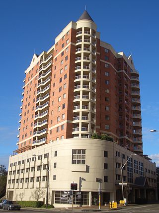
Strathfield is a suburb in the Inner West of Sydney, in the state of New South Wales, Australia. It is located 12 kilometres west of the Sydney central business district and is the administrative centre of the Municipality of Strathfield. A small section of the suburb north of the railway line lies within the City of Canada Bay, while the area east of The Boulevard lies within the Municipality of Burwood. North Strathfield and Strathfield South are separate suburbs to the north and south, respectively.

<span class="mw-page-title-main">Croydon, New South Wales</span> Suburb of Sydney, New South Wales, Australia

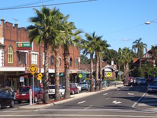
Croydon is a suburb in the Inner West of Sydney, in the state of New South Wales, Australia. It is located 9 kilometres (5.6 mi) west of the Sydney central business district. Croydon is split between the two local government areas of Municipality of Burwood and the Inner West Council.

<span class="mw-page-title-main">Burwood, New South Wales</span> Suburb of Sydney, New South Wales, Australia

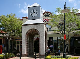
Burwood is a suburb in the Inner West of Sydney, in the state of New South Wales, Australia. It is 10 kilometres (6.2 mi) west of the Sydney central business district and is the administrative centre for the local government area of Municipality of Burwood.

<span class="mw-page-title-main">Strathfield railway station</span> Railway station in Sydney, New South Wales, Australia

Strathfield railway station is a heritage-listed railway station located on the Main Suburban line in the Sydney suburb of Strathfield in the Municipality of Strathfield local government area of New South Wales, Australia. The station is served by Sydney Trains T1 North Shore & Western Line, T9 Northern Line and T2 Inner West & Leppington Line suburban services as well as NSW TrainLink Intercity and regional services. The station is located on the Main Northern and Main Western railway lines, forming a major junction for regional and suburban rail services. The station and associated infrastructure was added to the New South Wales State Heritage Register on 2 April 1999.

<span class="mw-page-title-main">Five Dock</span> Suburb of Sydney, New South Wales, Australia

Five Dock is a suburb in the Inner West of Sydney, in the state of New South Wales, Australia. Five Dock is located 10 kilometres west of the Sydney central business district, in the local government area of the City of Canada Bay.

<span class="mw-page-title-main">Division of Lowe</span> Former Australian federal electoral division

The Division of Lowe was an Australian Electoral Division in the state of New South Wales. It was located in the inner western suburbs of Sydney, on the south shore of the Parramatta River. It included the suburbs of Drummoyne, Five Dock, Croydon, Croydon Park, Burwood, Enfield, Homebush, Strathfield, Concord, Rhodes, Canada Bay, Cabarita, Abbotsford and Mortlake.

<span class="mw-page-title-main">Ashfield railway station, Sydney</span> Railway station in Sydney, New South Wales, Australia

Ashfield railway station is located on the Main Suburban line, serving the suburb of Ashfield, in Sydney, Australia. It is served by Sydney Trains T2 Inner West & Leppington line services.

<span class="mw-page-title-main">Strathfield South, New South Wales</span> Suburb of Sydney, New South Wales, Australia

Strathfield South is a suburb, in the Inner West of Sydney, Australia in the state of New South Wales, 13 kilometres west of the Sydney central business district, in the Strathfield local government area. The area was historically part of Druitt Town. Later it was part of Enfield, until Enfield Council was absorbed into Strathfield and Burwood councils, after which the part within Strathfield council was renamed Strathfield South.

<span class="mw-page-title-main">Mortlake, New South Wales</span> Suburb of Sydney, New South Wales, Australia

Mortlake is a suburb in the Inner West of Sydney, in the state of New South Wales, Australia. It is 10 kilometres west of the Sydney central business district, in the local government area of the City of Canada Bay.

<span class="mw-page-title-main">Concord, New South Wales</span> Suburb of Sydney, New South Wales, Australia

Concord is a suburb in the inner West of Sydney, in the state of New South Wales, Australia. It is 10 kilometres (6.2 mi) west of the Sydney central business district, in the local government area of the City of Canada Bay. Concord West is a separate suburb, to the north-west.

<span class="mw-page-title-main">Croydon Park, New South Wales</span> Suburb of Sydney, New South Wales, Australia

Croydon Park is a suburb in the Inner West of Sydney, in the state of New South Wales, Australia. Croydon Park is 10 kilometres south-west of the Sydney central business district and is divided between the local government areas of the City of Canterbury-Bankstown, Municipality of Burwood and Inner West Council. Croydon is a separate suburb, to the north.

<span class="mw-page-title-main">Burwood railway station, Sydney</span> Railway station in Sydney, New South Wales, Australia

Burwood railway station is a heritage-listed railway station located on the Main Suburban line in the Sydney suburb of Burwood in the Municipality of Burwood local government area of New South Wales, Australia. The station is served by Sydney Trains T9 Northern line and T2 Inner West & Leppington line services.

<span class="mw-page-title-main">Trams in Sydney</span> History of the tramway system closed in Sydney NSW Australia

The Sydney tramway network served the inner suburbs of Sydney, Australia, from 1879 until 1961. In its heyday, it was the largest in Australia, the second largest in the Commonwealth of Nations, and one of the largest in the world. The network was heavily worked, with about 1,600 cars in service at any one time at its peak during the 1930s . Patronage peaked in 1945 at 405 million passenger journeys. Its maximum street trackage totalled 291 km in 1923.

<span class="mw-page-title-main">Parramatta River ferry services</span>

Parramatta River ferry services connect suburbs along the Parramatta River in Sydney with Circular Quay by commuter ferry. The services are numbered F3 and form part of the Sydney Ferries network.

<span class="mw-page-title-main">The Priory, Burwood</span> Heritage-listed residence in Sydney

The Priory is a heritage-listed residence at 213 Burwood Road, in the Sydney suburb of Burwood in the Municipality of Burwood local government area of New South Wales, Australia. It was built in 1877. The Priory and its grounds was added to the New South Wales State Heritage Register on 2 April 1999.

<span class="mw-page-title-main">Burwood Post Office</span> Historic site in New South Wales, Australia

The Burwood Post Office is a heritage-listed former Aboriginal land, farm and former post office and now retail building located at 168a Burwood Road in the Sydney suburb of Burwood in the Municipality of Burwood local government area of New South Wales, Australia. It was designed by Walter Liberty Vernon and George Oakeshott and built by New South Wales Works Branch. It is also known as Burwood Post Office (former). It was added to the New South Wales State Heritage Register on 18 May 2001.

<span class="mw-page-title-main">St Paul's Anglican Church, Burwood</span> Church in New South Wales, Australia

St Paul's Anglican Church and Pipe Organ is a heritage-listed Anglican church building and pipe organ located at 205 Burwood Road in the Sydney suburb of Burwood in the Municipality of Burwood local government area of New South Wales, Australia. The church was designed by Edmund Blacket and the organ was designed by William Davidson, with some consultation from Montague Younger. The church and organ were built from 1889 to 1891. The church is also known as St. Paul's Anglican Church and Pipe Organ, St Paul's Anglican Church and Davidson Pipe Organ. The property is owned by Anglican Church Property Trust. It was added to the New South Wales State Heritage Register on 2 April 1999.

References

  1. 1 2 Australian Bureau of Statistics (27 June 2017). "Enfield (State Suburb)". 2016 Census QuickStats. Retrieved 11 April 2018. OOjs UI icon edit-ltr-progressive.svg
  2. Australian Suburb Guide: Sydney Inner West Archived 26 December 2012 at the Wayback Machine Retrieved 8 August 2013.
  3. Book of Sydney Suburbs, Frances Pollon (Angus and Robertson) 1990, p.96
  4. "Enfield Council Chambers". Archived from the original on 18 October 2009. Retrieved 5 March 2010.
  5. burwood.nsw.gov Archived 27 August 2006 at the Wayback Machine
  6. "Enfield War Memorial". Archived from the original on 18 October 2009. Retrieved 31 January 2010.
  7. "Local History | Burwood Council". Burwood.nsw.gov.au. 10 February 2011. Retrieved 22 August 2013.
  8. Gabor Sandi. "Sydney 1947". Tundria.com. Retrieved 22 August 2013.
  9. "Tram Ride". Lockhart.olsen.tripod.com. Retrieved 22 August 2013.
  10. A Pictorial Guide to Identifying Australian Architecture, Apperly (Angus and Robertson) 1994, p.155
  11. The Heritage of Australia, Macmillan Company, 1981, p.2/15
  12. Vision Australia [ permanent dead link ]
  13. "Transit Systems route 420". Transport for NSW.
  14. "Transit Systems route 420N". Transport for NSW.
  15. "Transit Systems route 464". Transport for NSW.
  16. "Transit Systems route 480". Transport for NSW.
  17. "Transit Systems route 483". Transport for NSW.
  18. "Transdev NSW route 913". Transport for NSW.
  19. "Transdev NSW route 914". Transport for NSW.
  20. "Transdev NSW route M90". Transport for NSW.
  21. "Punchbowl Bus Co route 450". Transport for NSW.
  22. Cornford, Philip (23 April 2005). "How the trap snapped shut". The Age. Melbourne. Retrieved 26 June 2011.
  23. Who's Who in Australia (Herald and Weekly Times Melb, 1988) pp 681: Norton, Robert York (1922 – )
  24. "Smith, Norman Leslie (1890–1958)". Australian Dictionary of Biography. National Centre of Biography, Australian National University.

33°53′26″S151°05′33″E / 33.89059°S 151.09246°E / -33.89059; 151.09246