High Bradfield is a rural village 6.5 miles (10 km) north-west of the centre of Sheffield in South Yorkshire, England and within the city's boundaries. The village lies just within the Peak District National Park, 1.3 miles (2 km) inside the park's north-eastern border, is at an altitude of 260 metres (850 feet) AOD, and has extensive views across Bradfield Dale towards Derwent Edge and the Dark Peak.

Low Bradfield is a village within the civil parish of Bradfield in South Yorkshire, England. It is situated within the boundary of the city of Sheffield in the upper part of the Loxley Valley, 6¼ miles west-northwest of the city centre and just inside the northeast boundary of the Peak District National Park. Low Bradfield and the surrounding area is noted for its attractive countryside which draws many visitors from the more urban parts of Sheffield. At weekends the village can become quite crowded, especially when there is a match on the village cricket pitch. Low Bradfield which stands in the shadow of Agden Reservoir has a sister village High Bradfield which is located at a higher altitude, ½ mile to the northeast. The two villages are joined by the steep Woodfall Lane.

The Great Sheffield Flood was a flood that devastated parts of Sheffield, England, on 11 March 1864, when the Dale Dyke Dam broke as its reservoir was being filled for the first time. At least 240 people died and more than 600 houses were damaged or destroyed by the flood. The immediate cause was a crack in the embankment, the cause of which was never determined. The dam's failure led to reforms in engineering practice, setting standards on specifics that needed to be met when constructing such large-scale structures. The dam was rebuilt in 1875.

Damflask Reservoir is situated at grid reference SK277907 five miles west of the centre of Sheffield in the Loxley valley close to the village of Low Bradfield and within the city's boundaries. The hamlet of Stacey Bank is located to the east. The reservoir has a capacity of 4,250.9 million litres and has a surface area of 47 hectares with a maximum depth of 27 metres. The dam wall is approximately 400 metres wide with a height of 28 metres.

Agden Reservoir is a water storage reservoir, situated at grid reference SK260925, 6.5 miles (10 km) west of the centre of Sheffield, South Yorkshire, England. It is owned by Yorkshire Water / Kelda Group. The reservoir covers an area of 25 hectares (62 acres) and has a capacity of 559 million gallons (2.11x10⁹ litres) of water, the dam wall has a width of approximately 380 feet (120 m) with a height of 100 feet (30 m). 'Agden' means 'Valley of the Oak Trees'.

Dale Dike Reservoir or Dale Dyke Reservoir is a reservoir in the north-east Peak District, in the City of Sheffield, South Yorkshire, England, a mile (1.6 km) west of Bradfield and eight miles (13 km) from the centre of Sheffield, on the Dale Dike, a tributary of the River Loxley.

Hillsborough Barracks is a walled complex of buildings between Langsett Road and Penistone Road in the Hillsborough District of Sheffield, South Yorkshire, England.

The Church of St. Nicholas, Bradfield is situated in the small village of High Bradfield, which is located 6 miles (10 km) north west of the centre of the city of Sheffield in South Yorkshire, England. It is one of only five Grade One Listed buildings in Sheffield. The church is situated 260 metres (850 ft) above sea level, overlooking the Peak District National Park.
Mellor Hall is a country house in Mellor, Greater Manchester, England, 0.4 miles (0.64 km) north of the Devonshire Arms off Longhurst Lane.

Dungworth is a hamlet in the civil parish of Bradfield, west of Sheffield in South Yorkshire, England.

Strines Reservoir is a water storage reservoir situated at 53.4099°N 1.6557°W, 8 miles (13 km) west of the centre of Sheffield in South Yorkshire, England.

Saighton Lane Farm is a farm, originating as a model farm, in Saighton Lane, 0.5 miles (1 km) to the north-northeast of the village of Saighton, Cheshire, England. The farmhouse and the farm buildings are recorded separately in the National Heritage List for England as designated Grade II listed buildings.

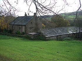
Hallfield House is a Grade II listed building situated in Bradfield Dale, 1.7 miles (2.74 km) west of the village of Low Bradfield, near Sheffield in England.

Revell Grange is a Grade II listed English country house situated on Bingley Lane in the suburb of Stannington overlooking the Rivelin valley within the City of Sheffield, England. The house played an important role as a focal point of early Catholicism within the city and still houses a private chapel to this day.

Christ Church is an Anglican place of worship situated on Church Street in the Stannington area of the City of Sheffield, England. It is a Commissioners' church or “Million Church” as it was built partly with money provided by the Church Building Act of 1824. It is recorded in the National Heritage List for England as a designated Grade II listed building.

Underbank Chapel is a Unitarian place of worship in Stannington, a suburb of Sheffield, South Yorkshire. It is a member of the General Assembly of Unitarian and Free Christian Churches, the umbrella organisation for British Unitarians.

Fulwood Hall, is an English country house situated on Harrison Lane in the suburb of Fulwood in Sheffield, England. It is a Grade II listed building. The hall stands in a lofty position on the north side of the Mayfield Valley at a height of 270 metres. The hall is referred to as Fullwood Hall on old maps and the gate to the hall uses this spelling with two Ls.

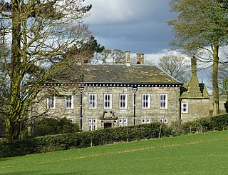
Sugworth Hall is an English country house on Sugworth Road in Bradfield Dale, near Sheffield, England. It is situated approximately 8 miles (13 km) west from Sheffield City Centre. The hall is a Grade II listed building which stands within the Peak District National Park at a height of 984 feet (300 m) above sea level.

Bradfield Dale is a rural valley 12 kilometres (7.5 mi) west-northwest of the City of Sheffield in England. The valley stands within the north-eastern boundary of the Peak District National Park just west of the village of Low Bradfield. The dale is drained by the Strines Dike which becomes the Dale Dike lower down the valley, these being the headwaters of the River Loxley. The dale contains two reservoirs, Strines and Dale Dike, and a third, Agden Reservoir, stands in a side valley just above Low Bradfield. The dale is characterised by agricultural land interspersed with farming and residential buildings. It is approximately 5 kilometres (3.1 mi) long from its foot at Low Bradfield to its head on Strines Moor.

Loxley United Reformed Church is a derelict Grade II* listed building located on Loxley Road in Loxley, a western suburb of the City of Sheffield, England. It is currently in a fire damaged state.