Farmersville, New York

Last updated

Farmersville, New York
USA New York location map.svg
Red pog.svg
Farmersville
Location within the state of New York
Coordinates: 42°24′4″N78°23′56″W / 42.40111°N 78.39889°W / 42.40111; -78.39889
Country United States
State New York
County Cattaraugus
Government
  Type Town Council
   Town Supervisor Joseph C. Brodka (R)
   Town Council
Members' List
Area
[1]
  Total47.97 sq mi (124.25 km2)
  Land47.84 sq mi (123.89 km2)
  Water0.14 sq mi (0.36 km2)
Elevation
1,824 ft (556 m)
Population
 (2020) [2]
  Total1,081
  Estimate 
(2021) [2]
1,072
  Density22.35/sq mi (8.63/km2)
Time zone UTC-5 (Eastern (EST))
  Summer (DST) UTC-4 (EDT)
ZIP code
14060 and 14737
Area code 716
FIPS code 36-009-25340
GNIS feature ID0978952
Website www.farmersvilleny.org

Farmersville is a town located in the eastern border of Cattaraugus County, New York, United States. The population was 1,081 at the 2020 census. [2]

Contents

History

The area was first settled circa 1805, but no permanent settlement was made until approximately 1817. Farmersville became a town in 1821 from part of the "Town of Ischua" (now Franklinville).

The town gained notoriety because of the "Farmersville Garbage Scandal" during the 2000 New York State senatorial race between Rudy Giuliani (who later dropped out in favor of Rick Lazio) and Hillary Clinton. Giuliani had made a statement during a campaign press conference that any community that wanted to refuse taking garbage from New York City was free to do so. The town, eager to get out of a contract that they believed was harmful to them, took Giuliani up on his offer. Giuliani then claimed that he never made the statement and threatened the town with legal action in retaliation. The area where the landfill would have been placed has been the subject of significant controversy and numerous failed attempts to sell the property (Cattaraugus County, owners of the site, have put the parcel of land up for auction at its property auction every year, but the county's insistence on numerous restrictions on the land and its refusal to lower its minimum asking price have ensured it has gone unsold every year) since that time.

Geography

According to the United States Census Bureau, the town has a total area of 48.0 square miles (124.2 km2), of which 47.8 square miles (123.9 km2) is land and 0.15 square miles (0.4 km2), or 0.29%, is water. [3]

Farmersville is located in northeastern Cattaraugus County. The eastern town line is the border of Allegany County.

New York State Route 16, New York State Route 98, and New York State Route 243 pass through the town.

Adjacent towns and areas

Farmersville is south of the town of Freedom and north of the towns of Lyndon and Franklinville. The east town line is shared with the town of Rushford in Allegany County. To the west is the town of Machias.

Demographics

Historical population
CensusPop.Note
1830 1,005
1840 1,29428.8%
1850 1,55420.1%
1860 1,389−10.6%
1870 1,114−19.8%
1880 1,1281.3%
1890 1,082−4.1%
1900 1,043−3.6%
1910 948−9.1%
1920 9995.4%
1930 719−28.0%
1940 7788.2%
1950 733−5.8%
1960 721−1.6%
1970 7544.6%
1980 97829.7%
1990 869−11.1%
2000 1,02818.3%
2010 1,0906.0%
2020 1,081−0.8%
2021 (est.)1,072 [2] −0.8%
U.S. Decennial Census [4]

As of the census [5] of 2000, there were 1,028 people, 389 households, and 282 families residing in the town. The population density was 21.5 people per square mile (8.3/km2). There were 656 housing units at an average density of 13.7 per square mile (5.3/km2). The racial makeup of the town was 99.32% White, 0.19% African American, 0.29% Pacific Islander, 0.10% from other races, and 0.10% from two or more races. Hispanic or Latino of any race were 0.68% of the population.

There were 389 households, out of which 34.2% had children under the age of 18 living with them, 60.7% were married couples living together, 7.5% had a female householder with no husband present, and 27.5% were non-families. 19.8% of all households were made up of individuals, and 8.2% had someone living alone who was 65 years of age or older. The average household size was 2.64 and the average family size was 3.08.

In the town, the population was spread out, with 27.7% under the age of 18, 4.8% from 18 to 24, 31.6% from 25 to 44, 25.0% from 45 to 64, and 10.9% who were 65 years of age or older. The median age was 37 years. For every 100 females, there were 100.4 males. For every 100 females age 18 and over, there were 103.0 males.

The median income for a household in the town was $37,813, and the median income for a family was $42,500. Males had a median income of $31,389 versus $22,137 for females. The per capita income for the town was $16,291. About 6.8% of families and 11.1% of the population were below the poverty line, including 18.4% of those under age 18 and none of those age 65 or over.

Notable people

Communities and locations in Farmersville

Related Research Articles

<span class="mw-page-title-main">Cattaraugus County, New York</span> County in New York, United States

Cattaraugus County is a county in Western New York, with one side bordering Pennsylvania. As of the United States 2020 census, the population was 77,042. The county seat is Little Valley. The county was created in 1808 and later organized in 1817. The county is part of the Western New York region of the state.

<span class="mw-page-title-main">Centerville, New York</span> Town in New York, United States

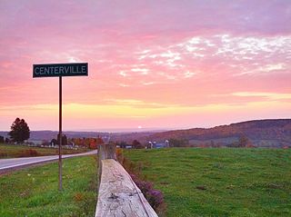
Centerville is a town in Allegany County, New York, United States. The population was 822 at the 2010 census. The town is in the northwest corner of Allegany County and is named after its principal settlement.

Genesee is a town in Allegany County, New York, United States. The population was 1,653 at the 2020 census. Genesee is in the southwestern corner of the county, southeast of Olean.

New Hudson is a town in Allegany County, New York, United States. The population was 801 at the 2020 census. The town is on the west border of the county, northeast of Olean.

<span class="mw-page-title-main">Rushford, New York</span> Town in New York, United States

Rushford is a town in Allegany County, New York, United States. The population was 1,085 at the 2020 census. Rushford is in the northwest part of Allegany County and is northeast of Olean.

<span class="mw-page-title-main">Carrollton, New York</span> Town in New York, United States

Carrollton is a town in Cattaraugus County, New York, United States. The population was 1,214 at the 2020 census. The town was named after Guy Carrollton Irvine, an early settler of the region.

Coldspring is a town in Cattaraugus County, New York, United States. As of the 2020 census it had a population of 661. It is located in the southwest part of the county, west of the city of Salamanca.

<span class="mw-page-title-main">East Otto, New York</span> Town in New York, United States

East Otto is a town in Cattaraugus County, New York, United States. The population was 977 at the 2020 census. The town, along with neighboring Otto, is named after an agent of the Holland Land Company, Jacob Otto. The town of East Otto is on the northern border of the county.

Freedom is a town in Cattaraugus County, New York, United States. The population was 2,244 at the 2021 census. The town is in the northeast corner of Cattaraugus County.

Great Valley is a town in Cattaraugus County, New York, United States. The population was 1,991 at the 2020 census. The town is named after its local geographical setting, a relative comparison of two tributaries of the Allegheny River.

<span class="mw-page-title-main">Hinsdale, New York</span> Town in New York, United States

Hinsdale is a town in Cattaraugus County, New York, United States. The population was 2,119 at the 2020 census. The town was named after Hinsdale in New Hampshire.

Humphrey is a town in Cattaraugus County, New York, United States. The population was 701 at the 2020 census. The town is named after Charles Humphrey, who at the time of the town's founding was Speaker of the New York State Assembly.

<span class="mw-page-title-main">Ischua, New York</span> Town in New York, United States

IschuaISH-way is a town in Cattaraugus County, New York, United States. The population was 736 at the 2020 census. Ischua is also the name of a hamlet in the town. The town is on the eastern border of the county, north of Olean.

Lyndon is a town in Cattaraugus County, New York, United States. The population was 686 at the 2020 census. The town is on the east border of the county and is north of Olean.

<span class="mw-page-title-main">Machias, New York</span> Town in New York, United States

Machias is a town in Cattaraugus County, New York, United States. The population was 2,309 at the 2020 census. Machias is an interior town in the northeast quadrant of the county. It is northeast of the city of Salamanca.

Allegany is a town in Cattaraugus County, New York, United States. The population was 7,493 at the 2020 census.

<span class="mw-page-title-main">Ellicottville, New York</span> Town in New York, United States

Ellicottville is a town in Cattaraugus County, New York, United States. The population was 1,317 at the 2020 census. The town is named after Joseph Ellicott, principal land agent of the Holland Land Company.

Franklinville is a town in Cattaraugus County, New York, United States. The population was 2,811 at the 2020 census.

Salamanca is a town in Cattaraugus County, New York, United States. The population was 470 at the 2020 census. The name is from José de Salamanca y Mayol, Marquis of Salamanca, a major Spanish investor in the Atlantic and Great Western Railroad, a local railroad.

<span class="mw-page-title-main">Yorkshire, New York</span> Town in New York, United States

Yorkshire is a town in Cattaraugus County, New York, United States. The population was 3,840 at the 2020 census. The town is located on the northern edge and in the northeast quadrant of the county.

References

  1. "2016 U.S. Gazetteer Files". United States Census Bureau. Retrieved July 4, 2017.
  2. 1 2 3 4 Bureau, US Census. "City and Town Population Totals: 2020-2021". Census.gov. US Census Bureau. Retrieved July 5, 2022.
  3. "Geographic Identifiers: 2010 Demographic Profile Data (G001): Farmersville town, Cattaraugus County, New York". U.S. Census Bureau, American Factfinder. Archived from the original on February 12, 2020. Retrieved October 24, 2014.
  4. "Census of Population and Housing". Census.gov. Retrieved June 4, 2015.
  5. "U.S. Census website". United States Census Bureau . Retrieved January 31, 2008.

42°23′15″N78°22′34″W / 42.38750°N 78.37611°W / 42.38750; -78.37611