Farmington, New York

Last updated

Farmington
USA New York location map.svg
Red pog.svg
Farmington
Location within the state of New York
Coordinates: 42°58′51″N77°19′19″W / 42.98083°N 77.32194°W / 42.98083; -77.32194
Country United States
State New York
County Ontario
Government
  Type Town Council
   Town Supervisor Peter Ingalsbe (R)
   Town Council
Members' List
Area
[1]
  Total39.43 sq mi (102.12 km2)
  Land39.43 sq mi (102.12 km2)
  Water0.00 sq mi (0.00 km2)
Elevation
577 ft (176 m)
Population
 (2020) [2]
  Total14,275 Increase2.svg
  Estimate 
(2021) [2]
12,528
  Density328.30/sq mi (126.76/km2)
Time zone UTC-5 (Eastern (EST))
  Summer (DST) UTC-4 (EDT)
ZIP code
14425 and 14564
Area code(s) 585 and 315/680
FIPS code 36-25406
GNIS feature ID0978953

Farmington is a town located in the northern part of Ontario County, New York, United States. The population was 14,275 at the 2020 census. [2]

Contents

History

Farmington was part of the Phelps and Gorham Purchase. The town was formed along with its county in 1789, and settlement of the region began the same year. Many of the early settlers were Quakers from Berkshire County, Massachusetts. In 1824, Arthur Power left Farmington with two of his sons and other Quakers to found Farmington, Michigan.

The Farmington Quaker Crossroads Historic District was listed on the National Register of Historic Places in 2007. [3]

Geography

The land, at an average elevation of 600 feet above sea level, is compressed by the Wisconsin glaciation and slopes from an elevation of 700 feet at the southern border with the town of Canandaigua, to 500 feet at the north boundary with the town of Macedon. The land comprises drumlins and eskers. Other than streams and ponds, there are no major water landmarks. Public drinking water is provided by treated water piped from Canandaigua Lake.

According to the United States Census Bureau, the town has a total area of 39.5 square miles (102 km2), all land.

The New York State Thruway (Interstate 90) passes across the town. New York State Route 332 is a north-south highway, and New York State Route 96 is an east-west highway.

The northern town line is shared by the town of Macedon in Wayne County.

Demographics

Historical population
CensusPop.Note
1820 4,214
1830 1,773−57.9%
1840 2,12219.7%
1850 1,876−11.6%
1860 1,858−1.0%
1870 1,8962.0%
1880 1,9784.3%
1890 1,703−13.9%
1900 1,607−5.6%
1910 1,568−2.4%
1920 1,465−6.6%
1930 1,4770.8%
1940 1,453−1.6%
1950 1,399−3.7%
1960 2,11451.1%
1970 3,56568.6%
1980 8,933150.6%
1990 10,38116.2%
2000 10,5852.0%
2010 11,82511.7%
2020 14,27520.7%
2021 (est.)14,528 [2] 1.8%
U.S. Decennial Census [4]

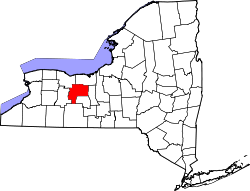
As of the census [5] Farmington is approximately 25 miles southeast of Rochester. The town was named after Farmington, Connecticut. [6] of 2000, there were 10,585 people, 3,870 households, and 2,894 families residing in the town. The population density was 268.3 inhabitants per square mile (103.6/km2). There were 4,046 housing units at an average density of 102.6 per square mile (39.6/km2). The racial makeup of the town was 96.53% White, 1.02% African American, 0.26% Native American, 0.94% Asian, 0.01% Pacific Islander, 0.26% from other races, and 0.97% from two or more races. Hispanic or Latino of any race were 1.21% of the population.

There were 3,870 households, out of which 40.4% had children under the age of 18 living with them, 60.2% were married couples living together, 10.7% had a female householder with no husband present, and 25.2% were non-families. 18.6% of all households were made up of individuals, and 4.7% had someone living alone who was 65 years of age or older. The average household size was 2.73 and the average family size was 3.14.

In the town, the population was spread out, with 28.7% under the age of 18, 7.6% from 18 to 24, 32.0% from 25 to 44, 25.0% from 45 to 64, and 6.6% who were 65 years of age or older. The median age was 35 years. For every 100 females, there were 95.8 males. For every 100 females age 18 and over, there were 93.4 males.

The median income for a household in the town was $49,863, and the median income for a family was $54,769. Males had a median income of $39,645 versus $26,097 for females. The per capita income for the town was $20,756. About 3.7% of families and 5.6% of the population were below the poverty line, including 6.8% of those under age 18 and 5.0% of those age 65 or over.

Notable people

Communities and other locations in the town

Business

Public safety

Fire protection is provided by the Farmington Volunteer Fire Assoc., which has two fire stations within the town: Station #1, located in "Pumpkin Hook" in the north section and Station #2, located at State Route 96 and Hook Rd near the business district.

The Ontario County Sheriff's department provides law enforcement in the town as well as the New York State Police. The New York State Police Troop E headquarters is located in Farmington and serves a 10-county region.

Victor-Farmington Volunteer Ambulance provides EMS service to the town. [7]

Related Research Articles

<span class="mw-page-title-main">Hanover, New York</span> Town in New York, United States

Hanover is a town in Chautauqua County, New York, United States. The population was 6,893 at the 2020 census. The town lies in the northeast corner of Chautauqua County.

<span class="mw-page-title-main">Danube, New York</span> Town in New York, United States

Danube is a town in Herkimer County, New York, United States. The population was 801 at the 2020 census, down from 1,039 in 2010. Early Palatine German immigrants in the eighteenth century named the town after the Danube River in Europe.

<span class="mw-page-title-main">Cambria, New York</span> Town in New York, United States

Cambria is a town in Niagara County, New York, United States. The population was 5,743 at the 2020 census. Cambria is an early name for Wales.

<span class="mw-page-title-main">Hartland, New York</span> Town in New York, United States

Hartland is a town in Niagara County, New York, United States. The population was 4,117 at the 2010 census. The town is named after Hartland, Vermont, the homeplace of some early settlers.

<span class="mw-page-title-main">Royalton, New York</span> Town in New York, United States

Royalton is a town in Niagara County, New York, United States. The population was 7,660 at the 2010 census.

<span class="mw-page-title-main">Somerset, New York</span> Town in New York, United States

Somerset is a town in Niagara County, New York, United States. The population was 2,662 at the 2010 census. The town is believed to be named after Somerset, New Jersey, the source of some early settlers.

Gorham is a town in Ontario County, New York, United States. The population was 4,130 at the 2020 census. The town is named after Nathaniel Gorham.

Hopewell is a town in Ontario County, New York, United States. The population was 3,931 at the 2020 census.

South Bristol is a town in Ontario County, New York, United States. The population was 1,651 at the 2020 census. The name is derived from its separation from the Town of Bristol.

<span class="mw-page-title-main">Junius, New York</span> Town in New York, United States

Junius is a town in Seneca County, New York, United States. The population was 1,370 at the 2020 census.

Enfield is a town in Tompkins County, New York, United States. The population was 3,401 at the 2020 census.

<span class="mw-page-title-main">Middlesex, New York</span> Town in New York, United States

Middlesex is a town in Yates County, New York, United States. The population was 1,495 at the 2010 census. The name originates from the county of Middlesex, England.

<span class="mw-page-title-main">West Seneca, New York</span> Town in New York, United States

West Seneca is a town in Erie County, New York, United States. The population was 45,500 at the 2020 census. West Seneca is a centrally located interior town of the county, and a suburb of Buffalo. West Seneca, Orchard Park and Hamburg form the inner "Southtowns", a cluster of middle-class suburban towns.

<span class="mw-page-title-main">Lockport (town), New York</span> Town in New York, United States

Lockport is a town in Niagara County, New York, United States. The population was 20,529 at the 2010 census. The name is derived from the series of canal locks on the Erie Canal. The locks lift boats from the lowland of Lake Ontario past the Niagara Escarpment.

Canandaigua is a town in Ontario County, New York, United States. The population was 11,109 at the 2020 census.

<span class="mw-page-title-main">Phelps, New York</span> Town in New York, United States

Phelps is a town in Ontario County, New York, United States. The population was 6,637 at the 2020 census. The Town of Phelps contains a village called Phelps. Both are north of Geneva.

<span class="mw-page-title-main">Macedon, New York</span> Town in New York, United States

Macedon is a town in Wayne County, New York, United States. The population was 9,148 at the 2010 census.

Victor is an incorporated town in Ontario County, New York, United States. The population was 15,969 at the time of the 2020 census. The town is named after Claudius Victor Boughton, an American hero of the War of 1812.

<span class="mw-page-title-main">Manchester, New York</span> Town in New York, United States

Manchester is a town in Ontario County, New York, United States. The population was 9,406 at the 2020 census. The town was named after one of its villages, which in turn was named after the original Manchester in England. It was formed in 1822 from the town of Farmington.

<span class="mw-page-title-main">New York State Route 332</span> State highway in Ontario County, New York, US

New York State Route 332 (NY 332) is a north–south state highway that extends for 9.05 miles (14.56 km) through Ontario County in the Finger Lakes region of New York in the United States. The southern terminus of the route is at an intersection with U.S. Route 20 (US 20), NY 5, and NY 21 just south of downtown Canandaigua. Its northern terminus is located at the toll barrier preceding New York State Thruway exit 44 in Farmington. NY 332 is the primary route for travelers destined for Canandaigua from locales such as Rochester and Victor to the northwest of the city.

References

  1. "2016 U.S. Gazetteer Files". United States Census Bureau. Retrieved July 5, 2017.
  2. 1 2 3 4 Bureau, US Census. "City and Town Population Totals: 2020—2021". Census.gov. US Census Bureau. Retrieved October 12, 2022.
  3. "National Register Information System". National Register of Historic Places . National Park Service. March 13, 2009.
  4. "Census of Population and Housing". Census.gov. Retrieved June 4, 2015.
  5. "U.S. Census website". United States Census Bureau . Retrieved January 31, 2008.
  6. "Town of Farmington, NY Official Website - History". www.townoffarmingtonny.com. Retrieved November 20, 2017.
  7. "Victor Farmington Volunteer Ambulance Corps, Inc" . Retrieved June 17, 2009.