Manchester, New York

Last updated

Manchester
Hill Cumorah Visitor Center.JPG
Hill Cumorah Visitor Center
USA New York location map.svg
Red pog.svg
Manchester
Location of Manchester in New York state
Usa edcp location map.svg
Red pog.svg
Manchester
Manchester (the United States)
Coordinates: 42°58′10″N077°13′34″W / 42.96944°N 77.22611°W / 42.96944; -77.22611
CountryUnited States
State New York
County Ontario
Government
   Town Supervisor David W. Phillips (R)
   Town Council
Members
  • Douglas J. Davis (D)
  • Matt A. Schaertl (R)
  • Charles M. Denosky (R)
Area
[1]
  Total37.85 sq mi (98.03 km2)
  Land37.82 sq mi (97.95 km2)
  Water0.03 sq mi (0.08 km2)
Population
 (2020) [2]
  Total9,406 Increase2.svg
  Estimate 
(2021) [2]
9,393
  Density246.36/sq mi (95.12/km2)
Time zone UTC-5 (EST)
  Summer (DST) UTC-4 (EDT)
Zip Code
14504
Area code(s) 315, 585 and 680
FIPS code 36-069-44864
Website Town website

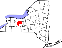
Manchester is a town in Ontario County, New York, United States. The population was 9,406 at the 2020 census. [2] The town was named after one of its villages, which in turn was named after the original Manchester in England. [3] It was formed in 1822 from the town of Farmington.

Contents

The Town of Manchester includes a village also named Manchester. The town is northeast of the city of Canandaigua.

Lehigh Valley Railroad

Manchester was an important division point and car classification yard for the Lehigh Valley Railroad and was, at one time, the largest such facility in the world. As a division point, crews and locomotives were exchanged. Freight cars were switched from track to track, organizing them for delivery to their destinations. Support services included the 30-stall roundhouse, the coaling tower, facilities for ash removal, track maintenance, car repair, a control tower, the yard office, an ice house, and the bunkhouse-restaurant.

With the failure of the Pennsylvania Railroad (which had taken over operations of the Lehigh Valley Railroad in 1962) in the mid-60s, the division yard's purpose was largely unneeded. By the next decade, all that remained in use at the yard was the mainline travelling through the town. The yard closed on October 30, 1972. [4]

Today only a few crumbling structures, some old track, and a couple of rusted boxcars remain.

Geography

According to the United States Census Bureau, the town has a total area of 37.8 square miles (97.9 km2), of which 37.8 square miles is land and (0.08%) is water.

The Erie Canal, a part called the Wide Waters, briefly passes through the northeastern corner of the town, and the New York State Thruway (Interstate 90) passes through the center. New York State Route 96 is a major highway that parallels the Thruway and intersects New York State Route 21 in Manchester village.

The northern town line is the border of Wayne County (Palmyra).

Cumorah, a hill in Manchester, is the location where Joseph Smith is said to have found a set of golden plates which he translated into English and published as the Book of Mormon.

Demographics

Historical population
CensusPop.Note
1830 2,811
1840 2,9123.6%
1850 2,9401.0%
1860 3,28011.6%
1870 3,5468.1%
1880 3,92010.5%
1890 4,43913.2%
1900 4,7336.6%
1910 4,8893.3%
1920 5,56713.9%
1930 5,8825.7%
1940 5,252−10.7%
1950 5,7559.6%
1960 6,2428.5%
1970 7,84025.6%
1980 9,00214.8%
1990 9,3513.9%
2000 9,258−1.0%
2010 9,3951.5%
2020 9,4060.1%
2021 (est.)9,393 [2] −0.1%
U.S. Decennial Census [5]

As of the census of 2000, there were 9,258 people, 3,589 households, and 2,447 families residing in the town. The population density was 245.0 inhabitants per square mile (94.6/km2). There were 3,815 housing units at an average density of 39.0 persons/km2 (101.0 persons/sq mi). The racial makeup of the town was 97.69% White, 0.53% African American, 0.37% Native American, 0.21% Asian, 0.00% Pacific Islander, 0.14% from other races, and 1.07% from two or more races. 1.14% of the population were Hispanic or Latino of any race.

There were 3,589 households, out of which 32.2% had children under the age of 18 living with them, 53.2% were married couples living together, 10.4% have a woman whose husband does not live with her, and 31.8% were non-families. 25.2% of all households were made up of individuals, and 12.7% had someone living alone who was 65 years of age or older. The average household size was 2.51 and the average family size was 3.01.

In the town, the population was spread out, with 24.8% under the age of 18, 6.5% from 18 to 24, 29.8% from 25 to 44, 23.7% from 45 to 64, and 15.2% who were 65 years of age or older. The median age was 38 years. For every 100 females, there were 95.8 males. For every 100 females age 18 and over, there were 92.6 males.

The median income for a household in the town was $39,154, and the median income for a family was $47,117. Males had a median income of $32,444 versus $25,041 for females. The per capita income for the town was $19,285. About 6.3% of families and 8.4% of the population were below the poverty line, including 13.0% under the age of 18 and 3.5% age 65 or older.

Communities and locations in town

Related Research Articles

<span class="mw-page-title-main">Owasco, New York</span> Town in New York, United States

Owasco is a town in Cayuga County, New York, United States. It is part of the traditional territory of the Cayuga nation. The population was 3,793 at the 2010 census. Owasco is in the eastern part of Cayuga County and is at the southeast city line of Auburn. The town borders Owasco Lake, from where it gets its name.

<span class="mw-page-title-main">Newstead, New York</span> Town in New York, United States

Newstead is the northeasternmost town in Erie County, New York, United States. The population was 8,689 at the 2020 census. The name is reportedly derived from Newstead Abbey in England.

<span class="mw-page-title-main">Pembroke, New York</span> Town in New York, United States

Pembroke is a town in Genesee County, Western New York, United States. The population was 4,292 at the 2010 census. The town is named for a town in west Wales. Pembroke lies on the west border of Genesee County, west of Batavia.

<span class="mw-page-title-main">Stafford, New York</span> Town in New York, United States

Stafford is a town in Genesee County, New York, United States. The population was 2,459 at the 2010 census. The town was named after a town of the same name in England.

Jefferson Heights is a hamlet and census-designated place (CDP) in Greene County, New York, United States. The population was 1,122 at the 2020 census.

Lenox is a town in Madison County, New York, United States. The population was 8,768 as of the 2020 census.

<span class="mw-page-title-main">Westmoreland, New York</span> Town in New York, United States

Westmoreland is a town in Oneida County, New York, United States. The population was 6,138 at the 2010 census.

<span class="mw-page-title-main">Whitestown, New York</span> Town in New York, United States

Whitestown is a town in Oneida County, New York, United States. The population was 18,667 at the 2010 census. The name is derived from Judge Hugh White, an early settler. The town is immediately west of Utica and the New York State Thruway passes across the town. The offices of the town of Whitestown are in the Village of Whitesboro.

Bristol is a town in Ontario County, New York, United States. The population was 2,298 at the 2020 census. Bristol was named after Bristol County, Massachusetts, by settlers from New England. The town of Bristol is in the western half of the county, southwest of the city of Canandaigua.

Farmington is a town located in the northern part of Ontario County, New York, United States. The population was 14,275 at the 2020 census.

Gorham is a town in Ontario County, New York, United States. The population was 4,130 at the 2020 census. The town is named after Nathaniel Gorham.

Hopewell is a town in Ontario County, New York, United States. The population was 3,931 at the 2020 census.

<span class="mw-page-title-main">Shortsville, New York</span> Village in New York, United States

Shortsville, officially the Village of Shortsville, is a village in Ontario County, New York, United States. The population was 1,439 at the time of the 2010 U.S. Census. Shortsville encompasses the southwestern part of the Town of Manchester and is located north of the City of Canandaigua.

South Bristol is a town in Ontario County, New York, United States. The population was 1,651 at the 2020 census. The name is derived from its separation from the Town of Bristol.

<span class="mw-page-title-main">Hamptonburgh, New York</span> Town in New York, United States

Hamptonburgh is a town located in the north central part of Orange County, New York, United States. The population was 5,489 at the 2020 census. The municipal offices are at the hamlet of Campbell Hall.

Campbell is a town in Steuben County, New York, United States. The population was 3,163 at the 2020 census. The name is from Robert Campbell, an early landowner. The town is centrally located in the county and is northwest of Corning.

Canandaigua is a town in Ontario County, New York, United States. The population was 11,109 at the 2020 census.

Manchester is a village located within the Town of Manchester in Ontario County, New York, United States. The population was 1,709 at the 2010 census. The village was named after Manchester in England.

<span class="mw-page-title-main">Phelps, New York</span> Town in New York, United States

Phelps is a town in Ontario County, New York, United States. The population was 6,637 at the 2020 census. The Town of Phelps contains a village called Phelps. Both are north of Geneva.

Victor is an incorporated town in Ontario County, New York, United States. The population was 15,969 at the time of the 2020 census. The town is named after Claudius Victor Boughton, an American hero of the War of 1812.

References

  1. "2016 U.S. Gazetteer Files". United States Census Bureau. Retrieved July 5, 2017.
  2. 1 2 3 4 Bureau, US Census. "City and Town Population Totals: 2020—2021". Census.gov. US Census Bureau. Retrieved October 12, 2022.
  3. Gannett, Henry (1905). The Origin of Certain Place Names in the United States. U.S. Government Printing Office. p.  197.
  4. Bailey, Kathy (October 30, 1972). "Yardmasters Phased Out". The Daily Messenger. Canandaigua, New York. pp. 1, 3 . Retrieved March 24, 2021 via Newspapers.com. Open Access logo PLoS transparent.svg
  5. "Census of Population and Housing". Census.gov. Retrieved June 4, 2015.
  6. "National Register Information System". National Register of Historic Places . National Park Service. March 13, 2009.