Fleet Brook

Last updated

Fleet Brook
River Hart (Eastern Arm)- Downstream of Fleet Pond (geograph 5940471).jpg
A long straight section of Fleet Brook below Fleet Pond
Hampshire UK relief location map.jpg
Red pog.svg
Location
Country England
Counties Hampshire
Districts / Boroughs Hart
Physical characteristics
Source 
  location Fleet Pond
  coordinates 51°17′31″N0°49′46″W / 51.2920°N 0.8294°W / 51.2920; -0.8294
Mouth River Hart
  location
Hartley Wintney
  coordinates
51°18′27″N0°52′38″W / 51.3075°N 0.8773°W / 51.3075; -0.8773 Coordinates: 51°18′27″N0°52′38″W / 51.3075°N 0.8773°W / 51.3075; -0.8773
Basin features
ProgressionFleet Brook, Hart, Whitewater, Blackwater, Loddon, Thames
River system Thames Basin

Fleet Brook is a small river in northern Hampshire, England and tributary of the River Hart.

Contents

Route

Fleet Brook
BSicon uexCONTg.svg
River Hart
BSicon uexABZgl.svg
BSicon uexSTR+r.svg
Fleet Brook
BSicon uexCONTfaq.svg
BSicon uexSTRr.svg
BSicon uexSTR.svg
River Hart
BSicon uexSKRZ-Eu.svg
Bakers Bridge
BSicon uexSKRZ-Eu.svg
Pale Lane Bridge
BSicon BUILDING.svg
BSicon uexABZgr.svg
Sewage Treatment Works
BSicon uexABZgl.svg
BSicon uexSTR+r.svg
Minley Brook
BSicon uexSTR.svg
BSicon uexSKRZ-Yu.svg
B3013 Bridge
BSicon uexSTR.svg
BSicon uexABZgl.svg
BSicon uexKHSTeq.svg
Source of Minley Brook
BSicon uexSKRZ-Bu.svg
UK-Motorway-icon.svg M3 motorway
BSicon uexSKRZ-Eu.svg
Bridge
BSicon uexSTR.svg
BSicon uxMILL.svg
Site of Fleet Mill
BSicon uexSTRl.svg
BSicon uexABZg+r.svg
BSicon uexSKRZ-Yu.svg
B3013 Minley Road Bridge
BSicon uexSKRZ-Au.svg
A3013 Cove Road Bridge
BSicon uexRESVGe.svg
Fleet Pond
BSicon CONTgq.svg
BSicon STRq.svg
BSicon uxmKRZu.svg
BSicon CONTfq.svg
South West railway
BSicon uexSTR+l.svg
BSicon uexDOCKS.svg
BSicon uexSTR+r.svg
Fleet Pond
BSicon uexSTR.svg
BSicon uextSTRl.svg
BSicon uextSTR+r.svg
BSicon uexSTR.svg
Brookly Gardens culvert
BSicon uexSKRZ-Yu.svg
BSicon uexSTR.svg
BSicon uexSTR.svg
B3010 Kings Road
BSicon uexSTR+l.svg
BSicon uexABZgr.svg
BSicon uexSTR.svg
BSicon uexSTR.svg
BSicon uexSTR.svg
BSicon uexSTR+FEATURE@r.svg
BSicon uexSTR.svg
BSicon uexSTR.svg
Oakley Park
BSicon uexSTR.svg
BSicon uextSTR.svg
BSicon uexSKRZ-Yu.svg
BSicon uexSTR.svg
B3010 Kings Road
BSicon uexSKRZ-Au.svg
BSicon RAq.svg
BSicon uextSTR.svg
BSicon uexSKRZ-Au.svg
A323 Aldershot Road
BSicon uCONTgq.svg
BSicon uHWEIRf.svg
BSicon uSTRq.svg
BSicon uextSTR.svg
BSicon uxKRZu.svg
BSicon uxKRZu.svg
BSicon uCONTfq.svg
Basingstoke Canal
BSicon uextSTR.svg
BSicon uextSTR.svg
BSicon uexSTR.svg
culverts
BSicon uextSTR.svg
BSicon uexKHSTe.svg
BSicon uexSTR.svg
spring in Forest of Eversley
BSicon uexSKRZ-Eu.svg
Aldershot Road
BSicon uexSTR.svg
BSicon uexSTR.svg
BSicon uextSTR.svg
BSicon uexSTR.svg
sports ground culvert
BSicon uexKHSTe.svg
BSicon uexSTR.svg
Spring in Greendane Copse
BSicon uexSKRZ-Eu.svg
Bourley Road
BSicon uexSTR+l.svg
BSicon uexSTRq.svg
BSicon uexABZgr.svg
BSicon uexSTR.svg
BSicon BUILDING.svg
Water Treatment Works
1
BSicon uexRESVGe.svg
2
BSicon uexRESVGe.svg
Reservoirs No.1, No.2
3
BSicon uexKBHFe.svg
Reservoir No.3

The source is somewhere near the town of Fleet, and the river that flows out from Fleet Pond is marked as Fleet Brook by the Ordnance Survey. The permanent streams that flow into Fleet Pond are known as the Gelvert and Brookly Streams. They are all treated as part of Fleet Brook by the Environment Agency, for the purposes of monitoring water quality.

Reservoirs near Parkhurst Hill are №s 1-5 to exclude non-existent 4, south-east of Fleet. Their water treatment is north of №2. The Environment Agency measure water quality from downstream of the intake. The Gelvert stream wends north, passing under Bourley Road, and is joined by another, which rises from a spring to the west. The stream gets its name from Gelvert Bottom, marshy terrain as it passes under Aldershot Road. Another stream and surface water drains join before it is crossed by the A323 Norris Hill Road and passes under the Basingstoke Canal where it receives overflow water from a pair of weirs. Others join before it dissipates into reed beds on the south-eastern edge of Fleet Pond. [1]

The Brookly stream begins on Greendane Copse, a little to the north-west of the reservoirs. It is culverted under a sports ground, and then reappears until it reaches Aldershot Road, beyond which it crosses housing estates in Church Crookham and Fleet, largely in culvert, but with short open sections. In Oakley Park, it is exposed again, and has an inflowing stream, an overflow on the Basingstoke Canal, and passes under the A323 road and Albany Road to reach the south end of the park. Three more bridges carry the B3010 Kings Road, Southby Drive, and Avondale Road over the watercourse. At this point it is joined by a further stream described below. It then flows into the south-west corner of Fleet Pond.

A third stream begins in the Forest of Eversley near a five-sided enclosure, the ex-Church Crookham Military sewage works, [2] licensed to discharge at most 1.56 Ml per day in the early 1990s. [3] The stream passes by Fleet Infants School, designed by Michael Hopkins and Partners replacing the Victorian school, under the canal and through housing estates, remaining on the surface until it reaches Brookly Gardens, beneath which it is now culverted to join the second stream. An old OS [4] shows that this stream originally entered Fleet Pond directly and shows a Brookly Bridge over it. The school is statutorily recognised and protected as grade II listed. The teachers and the architect saw that the boggy heath, south not be drained for playing fields, but kept as a biodiverse habitat enhancing learning. [5]

Fleet Pond is part of a nature reserve, and covers around half of the 141-acre (57 ha) of the designated Site of Special Scientific Interest.

A weir maintains the level of it. The river exits over it, passes under the A3013 Cove Road, and runs parallel to Minley Road. It then crosses under the road and heads north-west through Broomhurst Wood, under the M3 motorway and is joined by Minley Brook on its right bank. [1] Formerly, this section was less important, and the main river continued northwards from before the Minley Road Bridge. Fleet millpond and Mill were located just to the north of the bridge, [6] but an office block has been built on the site. Beyond Ancells Road, the original course is still in water, passing under Barley Way and the M3 motorway and then weaving between buildings at Brook House, to join Minley Brook. It is now marked as a drain on maps. Minley Brook rises a little further to the east as a series of drains and springs in marshy ground. [1] Brook House is not a listed structure, but predates the town of Fleet by at least 50 years, and possibly considerably more. It appeared as Brook Farm on maps from 1806, when it was already well-established. [7] The remains of a brick-lined moat are located close to the house, and this is a locally listed asset because of its archaeological interest. [8] The stable block and clock tower contain a clock manufactured by John Moore & Sons of Clerkenwell in 1830, and repaired by Smith & Sons, also of Clerkenwell, in 1921. [9]

Beyond the junction with Minley Brook, the main river continues westwards, taking treated sewage from the Fleet works on its left bank. In 1991 it was licensed to discharge at most 23.7 Ml per day into the river. [3] A little further downstream from the works, the river passes under Pale Lane Bridge. After meandering across partially wooded countryside, it is crossed by Home Farm Lane, and briefly enters Elvetham Park, the grounds of Elvetham Hall, where it joins the Hart on the park's north limit near Hartley Wintney. [1]

Milling

There is clear evidence for at least one water mill on the Fleet Brook. Isaac Taylor's map of Hampshire, produced in 1759, names Fleet Mill, Fleet Pond and Fleet Farm, and it was marked as a corn mill in 1872. [10] It continued in use until around 1940, and in 1990, English Heritage inspected it to see whether it should become a listed building, but decided that it did not have sufficient merit. The site is now occupied by office buildings, although a small part of the mill has been incorporated into the design. [11]

Water quality

The Environment Agency measure water quality of the river systems in England. Each is given an overall ecological status, which may be one of five levels: high, good, moderate, poor and bad. Components used to determine this include biological status, which looks at the quantity and varieties of invertebrates, angiosperms and fish, and chemical status, which compares the concentrations of various chemicals against known safe concentrations. Chemical status is rated good or fail. [12]

The water quality of the Fleet Brook was, in 2019:

SectionEcological StatusChemical StatusOverall StatusLengthCatchmentChannel
Fleet Brook [13] Moderate Fail Moderate 10.0 miles (16.1 km)12.77 square miles (33.1 km2)heavily modified

Reasons for the quality being such include: discharge from sewage treatment works; runoff from agricultural land; physical barriers such as weirs and impounding of the water which prevent the free migration of fish and other species; runoff from roads; and leaching from landfill sites.

Bibliography

Related Research Articles

<span class="mw-page-title-main">River Rother, South Yorkshire</span> River in South Yorkshire, England

The River Rother, a waterway in the northern midlands of England, gives its name to the town of Rotherham and to the Rother Valley parliamentary constituency. It rises in Pilsley in Derbyshire and flows in a generally northwards direction through the centre of Chesterfield, where it feeds the Chesterfield Canal, and on through the Rother Valley Country Park and several districts of Sheffield before joining the River Don at Rotherham in Yorkshire. Historically, it powered mills, mainly corn or flour mills, but most had ceased to operate by the early 20th century, and few of the mill buildings survive.

<span class="mw-page-title-main">The Moss</span> River in England

The Moss is a brook in North East Derbyshire, England.

<span class="mw-page-title-main">River Blackwater (River Loddon)</span> Tributary of the River Loddon in England

The River Blackwater is a tributary of the Loddon in England and sub-tributary of the Thames. It rises at two springs in Rowhill Nature Reserve between Aldershot, Hampshire and Farnham, Surrey. It curves a course north then west to join the Loddon in Swallowfield civil parish, central Berkshire. Part of the river splits Hampshire from Surrey; a smaller part does so as to Hampshire and Berkshire.

<span class="mw-page-title-main">River Poulter</span> River in England

The River Poulter which rises near Scarcliffe in Derbyshire, England is a tributary river of the River Idle in Nottinghamshire. It supplied power to mills along its route, most of which are now gone, although their mill ponds remain. Cuckney mill building is used as a primary school. The river has been dammed to create several lakes in the Dukeries estates of Welbeck Abbey and Clumber House now the National Trust property of Clumber Park. The ornamental Gouldsmeadow Lake, Shrubbery Lake and Great Lake on the Welbeck estate are supplied by a tributary of the Poulter, while Carburton Forge Dam and Carburton Dam were built to power a forge and a mill. Clumber Lake, consisting of an upper and lower lake, which is spanned by a Grade II* listed ornamental bridge, is part of the Clumber estate, and has suffered from subsidence.

<span class="mw-page-title-main">River Loddon</span> River in southern England

The River Loddon is a tributary of the River Thames in southern England. It rises at Basingstoke in Hampshire and flows northwards for 28 miles (45 km) to meet the Thames at Wargrave in Berkshire. Together, the Loddon and its tributaries drain an area of 400 square miles (1,036 km2).

<span class="mw-page-title-main">Foudry Brook</span> River in Hampshire and Berkshire, England

Foudry Brook is a small stream in southern England. It rises from a number of springs near the Hampshire village of Baughurst, and flows to the east and then the north, to join the River Kennet to the south of Reading. The upper section is called Silchester Brook, and beyond that, Bishop's Wood Stream. The underlying geology is chalk, covered by a layer of clay, and so it has the characteristics of a clay stream, experiencing rapid increases in level after heavy rain due to run-off from the surrounding land. It passes a number of listed buildings and scheduled monuments, including the site of the Roman town of Calleva Atrebatum or Silchester.

<span class="mw-page-title-main">River Perry</span> River in Shropshire, England

The River Perry is a river in Shropshire, England. It rises near Oswestry and flows south to meet the River Severn above Shrewsbury. Along its 24 miles (39 km) length, its level drops by some 320 feet (95 m). The channel has been heavily engineered, both to enable water mills to be powered by it, and to improve the drainage of the surrounding land. There were at least seven corn mills in the 1880s, and the last one remained operational until 1966. The middle section of the river crosses Baggy Moor, where major improvements were made in 1777 to drain the moor. The scheme was one of the largest to enclose and improve land in North Shropshire, and the quality of the reclaimed land justified the high cost. A section of the river bed was lowered in the 1980s, to continue the process.

<span class="mw-page-title-main">Meers Brook</span> Stream in Sheffield, England

The Meers Brook is a stream in Sheffield, England and one of the main tributaries of the River Sheaf. The Meers Brook originates in Gleadless and flows downhill through Gleadless Valley and Meersbrook then, culverted, continues underneath Heeley to pour into the River Sheaf near Saxon Road and Clyde Road in Lowfield.

<span class="mw-page-title-main">Blackburn Brook</span> Stream in Sheffield, South Yorkshire, England

The Blackburn Brook is a stream in Sheffield, South Yorkshire, England which flows through the Blackburn Valley along the M1 and Ecclesfield Road and joins the River Don near the Meadowhall shopping centre. Downstream from the A61 road at Chapeltown the Blackburn Brook is defined as a main river by the Environment Agency, which requires new building development to be at least 26 feet (8 m) from the bank side as a flood defence measure and to allow access to the watercourse for maintenance.

<span class="mw-page-title-main">Cove Brook</span> River in Hampshire, England

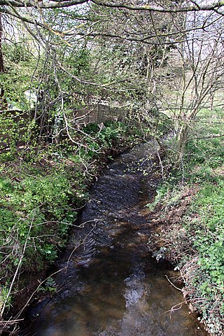
Cove Brook runs 4 miles (6.4 km) from near Farnborough Airport in Farnborough, Hampshire, England and flows through the former Southwood Golf Course where it is joined by Marrow Brook and other smaller streams. It runs north through Cove before joining the Blackwater at Hawley Meadows near the M3 motorway.

<span class="mw-page-title-main">River Hipper</span> River in England

The River Hipper is a tributary of the River Rother in Derbyshire, England. Its source is a large expanse of wetlands, fed by the surrounding moors between Chatsworth and Chesterfield, known as the Hipper Sick on Beeley Moor, which is part of the Chatsworth Estate. It then passes through Holymoorside and down into Chesterfield, just south of the town centre, before flowing into the River Rother. In July 2007, parts of Chesterfield flooded when the River Hipper burst its banks during a substantial storm that caused extensive flooding in North Derbyshire and South Yorkshire. The surrounding landscape is known as the Hipper Valley.

<span class="mw-page-title-main">River Drone</span> River in Derbyshire, England

The River Drone is a river which flows south from its source on the Sheffield, South Yorkshire, border. It flows through Dronfield, Unstone and Unstone Green in Derbyshire before merging at Sheepbridge to the north of Chesterfield with the Barlow Brook. Below the junction, it is often referred to as the River Whitting. It then flows south-east till it merges with the River Rother at Brimington Road North (B6050) at Chesterfield. It is one of the three main tributaries of the Rother.

<span class="mw-page-title-main">The Cut, Berkshire</span> River in Berkshire, England

The Cut is a river in England that rises in North Ascot, Berkshire. It flows for around 14 miles (23 km), through the rural Northern Parishes of Winkfield, Warfield and Binfield in Bracknell Forest on its way down to Bray, where it meets the River Thames just above Queens Eyot on the reach below Bray Lock, having been joined by the Maidenhead Waterways.

Lockram Brook is a small stream in southern England. It rises near the Berkshire village of Mortimer, and is a tributary of Burghfield Brook.

<span class="mw-page-title-main">West End Brook</span> River in England

West End Brook is a small stream in southern England. It rises near the Hampshire village of Tadley. Its name is probably related to the parish, and village, it passes through for some of its course: Mortimer West End.

<span class="mw-page-title-main">River Hart</span> Tributary of the River Whitewater in north Hampshire, England

The River Hart is a tributary of the River Whitewater in north Hampshire, England. It rises at Ashley Head spring in Crondall and flows north to meet the Whitewater at Bramshill.

<span class="mw-page-title-main">Oldcotes Dyke</span> River in England

Oldcotes Dyke is the name of the final section of a river system that drains parts of north Nottinghamshire and the Metropolitan Borough of Rotherham in South Yorkshire, England. Historically, it has supported milling, with seven water mills drawing their power from its water, and ran through the grounds of the Cistercian Roche Abbey. It is a tributary of the River Ryton.

<span class="mw-page-title-main">Twyford Brook</span> River in Berkshire, England

Twyford Brook is a small English river in the county of Berkshire. It drains a rural area to the east of Twyford, starting at the foot of the M4 motorway embankment, and is a tributary of the River Loddon. It was once part of a larger river system, draining the area now occupied by the new town of Bracknell. Because of issues with flooding, a new channel was cut to carry the water to the River Thames at Bray. The new channel and the river upstream from there is now known as The Cut, and the old channel became known as Twyford Brook.

<span class="mw-page-title-main">Bow Brook, Hampshire</span> River in Hampshire, England

Bow Brook is a small river in the English county of Hampshire, which is a tributary of the River Loddon. Contributary streams rise near Ramsdell and Sherborne St John, and after flowing through rural countryside, it joins the Loddon near Sherfield on Loddon. Historically it has powered at least two watermills.

<span class="mw-page-title-main">Barkham Brook</span> River in Berkshire, England

Barkham Brook is a small river in the English county of Berkshire. It has sources to the north and west of Finchampstead in the Wokingham Borough, flows past the village of Barkham, and joins the River Loddon to the west of Winnersh.

References

  1. 1 2 3 4 Ordnance Survey, 1:2500 map
  2. Ordnance Survey, 1:2500 map, 1972-75
  3. 1 2 NRA 1991, p. 3.
  4. Hampshire & Isle of Wight Sheet XX.NE, Revised: 1938, Published: ca. 1946 p
  5. Historic England. "Fleet Infant School (1440165)". National Heritage List for England . Retrieved 10 July 2020.
  6. Ordnance Survey, 1:2500 map, 1896
  7. Killilea & O'Fegan 2017, S3.1-S3.3.
  8. Killilea & O'Fegan 2017, S1.2.
  9. Killilea & O'Fegan 2017, S3.5.
  10. Ordnance Survey, 1:2500 map, 1872
  11. Vaidya 2013, pp. 80–81.
  12. "Glossary (see Biological quality element; Chemical status; and Ecological status)". Catchment Data Explorer. Environment Agency. 17 February 2016. UKOpenGovernmentLicence.svg Text was copied from this source, which is available under an Open Government Licence v3.0. © Crown copyright.
  13. "Fleet Brook". Catchment Data Explorer. Environment Agency.

External sources

Commons-logo.svg Media related to Fleet Brook, Hampshire at Wikimedia Commons