Ludshott Common and Waggoners Wells

Last updated
The middle pond, Waggoners Wells Waggoners Wells - geograph.org.uk - 1297098.jpg
The middle pond, Waggoners Wells

Ludshott Common and Waggoners Wells (the latter sometimes written with an apostrophe: Waggoners' Wells) is a National Trust reserve; Ludshott Common is an area of heathland and Waggoners Wells a series of man-made ponds with a connecting stream. The reserve is situated between Grayshott, Bramshott and Headley Down in East Hampshire, England. To the south is the large heathland area of Bramshott Common. [1] Some 415 acres (168 ha) is under the care of the Woodland Trust. [2]

Contents

Ludshott Common

Description

Ludshott Common is one of the largest remaining areas of heathland in East Hampshire. [3] It lies parallel to and south of the B3002 road between Headley Down to the west and Grayshott to the east. It covers 285 hectares (700 acres) and is designated a Site of Special Scientific Interest (SSSI) and Special Protection Area (SPA) due to the number of endangered species, including woodlark, nightjar and Dartford warbler. There are also a great many spiders and butterflies, including silver-studded blue, grayling and green hairstreak. [4] [5] Adders, grass snakes and sand lizards also inhabit the common. [6] Rabbits are widespread and roe deer may occasionally be seen. [7] The most common trees are Scots pine and silver birch, with some oak.

While much of the common is heather and gorse scrub on a fine sandy soil, there was an elevated stand of mature Scots pine trees with little or no undergrowth known locally as "the cathedral" or "cathedral pines". [8] [9] Many had been removed by the end of 2020, owing to their roots having been damaged by fires. [10]

In 2013 consultations were underway with a view to seeking permission to resume grazing on 550 acres of the common. [11]

History

Ludshott Common constituted half of the ancient Manor of Ludshott, in the Hundred of Neatham, dating back to Saxon times. It is described as being under the lordship of Hugh de Port in the Domesday Book of 1086, where it was listed as comprising 10 households; in 1066 the overlord had been King Edward the Confessor. [12] Court baron rolls go back to about 1400. [13]

Ludshott Common owes its present state to the traditional use made of common land by local people: to graze their cattle, pigs, sheep, and ponies and to collect gorse, heather, wood, and bracken for fuel, and for animal bedding and winter fodder. Such uses ceased around the beginning of the 20th century. The land was acquired by the National Trust in 1908 in response to the growing pressure from housing development in Headley Down. [14]

During the Second World War in the 1940s, Ludshott Common was used as a tank manoeuvres training ground, and the heather was largely turned to mud. The heather recovered, and was managed from the 1970s onwards. A camp (named Superior Camp) for Canadian troops, one of several in the vicinity, was built at the eastern corner of the common. Evidence of the layout can be seen even though it was demolished in the 1950s/1960s.

Periodically, fires would break out on the common. In 1962, 200 acres (0.81 km2) were burnt and, in 1965, 400 acres (1.6 km2). Further serious fires occurred in 1969 and 1976, the latter being the worst ever known in Hampshire, spreading rapidly and burning 600 acres (2.4 km2), lasting eight days. On 12 May 1980, 600 of the 695 acres (2.81 km2) were burnt by a fire fanned by high winds. Residents of roads in Headley Down which bordered the common were evacuated. Firefighters brought the fire under control in just over seven hours at 19:55. Relief crews remained on site overnight controlling small outbreaks of fire and damping down, with further relief crews taking over at 06:00 the following morning. [15]

Waggoners Wells

Wishing well plaque commemorating composition of Flower in the Crannied Wall National Trust wishing well sign, Waggoners Wells, Grayshott.jpg
Wishing well plaque commemorating composition of Flower in the Crannied Wall

Waggoners Wells is set amongst woodland in a steep valley situated between Ludshott Common to the north west and Bramshott Common to the south east.

The original name of the series of ponds was Wakeners' Wells. They were created in the 17th century by the Hooke family of Bramshott.  [16] They were possibly originally intended as hammer ponds, that is, to serve the local iron industry, but they appear never to have been so used. [5] The woodland surrounding the ponds is notable for its mature beech trees.

Vehicular access is via Waggoners Wells Lane from Grayshott as far as the ford and a small car park beyond; the lane originally continued south-eastwards to Kingswood Lane, and thence to the London to Portsmouth road (A3), but today only a footpath through the woodland remains.

Catch and release fishing for carp, roach, tench, perch and other species is a popular pursuit, [17] as is nature rambling and birdwatching.

Summerden "Summerden" on Waggoners Wells - geograph.org.uk - 1160317.jpg
Summerden

The stream that emerges from the pond furthest to the south-west is called Cooper's Stream. The house situated at the bottom of the ponds is Summerden and is a private residence of the National Trust warden of the area. Near it is a wishing well, mentioned by Flora Thompson in her writings of the locality, and recorded by a National Trust plaque as being the place at which Alfred, Lord Tennyson was inspired to compose his short poem Flower in the Crannied Wall. The stream flowing from Waggoners Wells runs west to Standford, around the west of Headley, and eventually into the River Wey. The stream powered many mills that worked ironworks, including Headley Mill. Paper mills were also run along the water that flowed from Waggoners Wells.

The gatefold photo of Fleetwood Mac's 1973 album Penguin was shot on location at Waggoners Wells. [18]

Related Research Articles

<span class="mw-page-title-main">Ashdown Forest</span> Natural area in East Sussex, England

Ashdown Forest is an ancient area of open heathland occupying the highest sandy ridge-top of the High Weald Area of Outstanding Natural Beauty. It is situated some 30 miles (48 km) south of London in the county of East Sussex, England. Rising to an elevation of 732 feet (223 m) above sea level, its heights provide expansive vistas across the heavily wooded hills of the Weald to the chalk escarpments of the North Downs and South Downs on the horizon.

<span class="mw-page-title-main">Chobham Common</span> Location near Chobham, Surrey, of a British tank research centre

Chobham Common is a 655.7-hectare (1,620-acre) biological Site of Special Scientific Interest north of Chobham in Surrey. It is a Nature Conservation Review site, Grade I and a national nature reserve. It is part of the Thames Basin Heaths Special Protection Area and the Thursley, Ash, Pirbright and Chobham Special Area of Conservation. It contains three scheduled monuments. Most of the site is managed by the Surrey Wildlife Trust as the Chobham Common nature reserve, but the SSSI also includes a small private reserve managed by the Trust, Gracious Pond.

<span class="mw-page-title-main">Selborne Common</span>

Selborne Common is a 99.6-hectare (246-acre) biological Site of Special Scientific Interest west of Selborne in Hampshire. It is a Nature Conservation Review site, Grade I, and is part of the East Hampshire Hangers Special Area of Conservation. It is managed by the National Trust.

<span class="mw-page-title-main">Grayshott</span> Human settlement in England

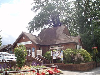
Grayshott is a village and civil parish in the East Hampshire district of Hampshire, England. It is on the Hampshire / Surrey border 4 miles (6.4 km) northwest of Haslemere by road, and 46 miles (74 km) southwest of central London. The nearest rail link is Haslemere railway station.

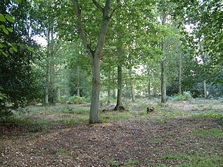
Bramshott Common is part of a large expanse of heathland, including Ludshott Common, near Bramshott, Hampshire, England.

<span class="mw-page-title-main">Bramshott</span> Human settlement in England

Bramshott is a village and parish with mediaeval origins in the East Hampshire district of Hampshire, England. It lies 0.9 miles (1.4 km) north of Liphook, and with Liphook forms the civil parish of Bramshott and Liphook.

<span class="mw-page-title-main">Bramshott and Liphook</span> Civil parish in Hampshire, England

Bramshott and Liphook, formerly just Bramshott is a civil parish in the East Hampshire district, in Hampshire, England, on the main route from London to Portsmouth. Formerly local government was solely in the hands of the ecclesiastical parish, but in the 19th century became a separate, civil, entity. The parish includes the village of Bramshott, the larger village of Liphook and several smaller settlements, as well as a considerable area of mixed woodland and heathland.

<span class="mw-page-title-main">Downs Banks</span> National Trust-owned woodland and heath in Staffordshire, England

Downs Bank, also known as Barlaston Downs, is an area of open countryside, located two miles (3 km) north of the town of Stone in Staffordshire, and four miles (6 km) south of the city of Stoke-on-Trent. It is owned and managed by the National Trust.

<span class="mw-page-title-main">Scotstown Moor</span>

Scotstown Moor is in the north of Aberdeen, Scotland.

<span class="mw-page-title-main">Stelling Minnis</span> Human settlement in England

Stelling Minnis is a village and civil parish in the Folkestone and Hythe district in Kent, England. The village lies 13 kilometres (8 mi) to the south of Canterbury, and to the east of the B2068, Stone Street, the Roman road, which takes traffic between Lympne and Canterbury.

Lowland heath is a Biodiversity Action Plan habitat as it is a type of ancient wild landscape. Natural England's Environmental Stewardship scheme describes lowland heath as containing dry heath, wet heath and valley mire communities, usually below 250 metres (820 ft) in altitude, on acidic soils and shallow peat, typically comprising heathers, gorses, fine grasses, wild flowers and lichens in a complex mosaic. Heathers and other dwarf shrubs usually account for at least 25% of the ground cover. By contrast, upland heath, which is above 300 metres (980 ft) in altitude, is called moorland, Dartmoor being an example.

Headley Down is a village within the civil parish of Headley in the East Hampshire district of Hampshire, England, bounded on two sides by Ludshott Common, a National Trust heathland reserve. The village began with a few buildings in the 1870s and became a thriving community that in the 20th century outgrew the parish centre of Headley.

<span class="mw-page-title-main">Woolmer Forest</span> Forest in Hampshire and West Sussex, England

Woolmer Forest is a 1,298.5-hectare (3,209-acre) biological Site of Special Scientific Interest south of Bordon in Hampshire and West Sussex. It is also a Special Area of Conservation and part of the Wealden Heaths Phase II Special Protection Area. Two areas are Nature Conservation Review sites, Grade I.

<span class="mw-page-title-main">Südheide Nature Park</span> Nature park in Lower Saxony, Germany

The Südheide Nature Park is a large protected area of forest and heathland in the southern part of the Lüneburg Heath in North Germany. It has been designated as a protected nature park since 1964.

<span class="mw-page-title-main">Pamber Forest and Silchester Common</span> Nature reserve

Pamber Forest and Silchester Common is a 341.7-hectare (844-acre) biological Site of Special Scientific Interest in Tadley in Hampshire. Pamber Forest and Upper Inhams Copse is managed by the Hampshire and Isle of Wight Wildlife Trust. Upper Inhams Copse was purchased by the Trust in 2001 and added to Pamber Forest.

<span class="mw-page-title-main">Highgate Common</span>

Highgate Common is a Staffordshire Wildlife Trust reserve containing a mix of heathland and woodland. It is about 129 hectares or 320 acres in size. The common is a popular leisure destination and a Site of Special Scientific Interest, located in Southern Staffordshire, England.

<span class="mw-page-title-main">Decoy Pit, Pools and Woods</span>

Decoy Pit, Pools and Woods is a 17.7-hectare (44-acre) biological Site of Special Scientific Interest south of Aldermaston in Berkshire. An area of 8 hectares is a nature reserve called Decoy Heath, which is managed by the Berkshire, Buckinghamshire and Oxfordshire Wildlife Trust.

<span class="mw-page-title-main">Rosenannon Downs</span> Nature reserve in mid Cornwall, England

Rosenannon Downs is a nature reserve in mid Cornwall, England, UK, being designated Rosenannon Bog and Downs Site of Special Scientific Interest (SSSI), noted for its biological characteristics. The site supports a wide variety of flora and fauna and includes Bronze Age barrows. Conservation work is carried out on the site by the owners, the Cornwall Wildlife Trust.

<span class="mw-page-title-main">Danbury Common</span> Area of heathland in Essex, England

Danbury Common is a 70.2-hectare (173-acre) biological Site of Special Scientific Interest in Danbury in Essex, England. Most of it is common land owned by the National Trust, and two areas, the Backwarden and Hitchcock's Meadows, are part of Essex Wildlife Trust's Danbury Ridge Nature Reserves.

<span class="mw-page-title-main">Bramshott and Ludshott Commons</span>

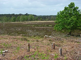
Bramshott and Ludshott Commons is a 374.4-hectare (925-acre) biological Site of Special Scientific Interest near Grayshott in Hampshire. It is part of Wealden Heaths Phase II Special Protection Area.

References

  1. Ordnance Survey
  2. "Woodland Trust: Ludshott Common and Waggoners Wells" . Retrieved 6 March 2023.
  3. "National Trust - Ludshott Commons" . Retrieved 2 Mar 2014.
  4. "National Trust: Ludshott Commons" . Retrieved 14 September 2021.
  5. 1 2 National Trust | South East | Ludshott Common & Waggoner's Wells Archived 2009-09-17 at the Wayback Machine
  6. "National Trust: Ludshott: Reptiles" . Retrieved 11 Mar 2014.
  7. "National Trust: Ludshott: Animals" . Retrieved 11 Mar 2014.
  8. "Ludshott Common cathedral" . Retrieved 3 Mar 2014.
  9. "National Trust: Commons Link newsletter" (PDF). Retrieved 3 Mar 2014.
  10. "Headley History timeline" . Retrieved 14 September 2021.
  11. "National Trust: Ludshott: Grazing" . Retrieved 11 Mar 2014.
  12. "Open Domesday: Ludshott" . Retrieved 16 October 2021.
  13. "Ludshott Manor Court Rolls" . Retrieved 11 Mar 2014.
  14. "Ludshott Common in the 20th century" . Retrieved 2 Mar 2014.
  15. The History of Grayshott Fire Station 1906 - 2007, Hampshire Fire & Rescue, 2007.
  16. Grayshott Village Archive - History of Grayshott (via Internet Archive)
  17. "Grayshott Angling Club: Waggoners Wells" . Retrieved 3 Mar 2014. (Details and photographs)
  18. "Dave Walker Q&A; Session, October 2000". Archived from the original on 2016-10-31. Retrieved 2017-01-26.

51°6′12″N0°46′10.45″W / 51.10333°N 0.7695694°W / 51.10333; -0.7695694