West End Brook

Last updated

West End Brook
Kiln Pond Benyons Inclosure.jpg
West End Brook at Kiln Pond, Benyon's Inclosure, Hampshire.
Location
Country England
Counties, Hampshire
Towns Tadley, Mortimer West End
Physical characteristics
Source Tadley
  location Hampshire, United Kingdom
  coordinates 51°21′36″N1°08′43″W / 51.359924°N 1.145153°W / 51.359924; -1.145153
  elevation103 m (338 ft)
Mouth Foudry Brook
  location
Hampshire, United Kingdom
  coordinates
51°21′44″N1°03′11″W / 51.362296°N 1.053164°W / 51.362296; -1.053164 Coordinates: 51°21′44″N1°03′11″W / 51.362296°N 1.053164°W / 51.362296; -1.053164
  elevation
59 m (194 ft)
Discharge 
  location Foudry Brook, south of Mortimer Common, Berkshire

West End Brook is a small stream in southern England. It rises near the Hampshire village of Tadley. Its name is probably related to the parish, and village, it passes through for some of its course: Mortimer West End.

Contents

Route

West End Brook
BSicon uexCONTg.svg
Foudry Brook
BSicon uexABZgl.svg
BSicon uexCONTgeq.svg
Silchester Brook
BSicon uexSTR.svg
West End Brook
BSicon uexSKRZ-Eu.svg
Tanhouse Bridge
BSicon uexSKRZ-Eu.svg
Turk's Lane Bridge
BSicon uexSTR+l.svg
BSicon uexSKRZ-Euq.svg
BSicon uexABZgr.svg
West End Road
BSicon uexABZgl.svg
BSicon uexSTR+r.svg
BSicon uexSTR.svg
BSicon uexKBHFe.svg
BSicon uexSTR.svg
BSicon uexSTR.svg
Pond Bay
BSicon uexKHSTe.svg
BSicon uexSTR.svg
Hundred Acre Piece springs
BSicon uexSKRZ-Eu.svg
Church Road
BSicon uexRESVGe.svg
Kiln Pond
BSicon uexKHSTaq.svg
BSicon uexABZq+l.svg
BSicon uexABZgr.svg
Benyon's Inclosure springs
BSicon uexKHSTe.svg
BSicon uexSKRZ-Eu.svg
Soke Road
BSicon uexABZgl.svg
BSicon uexKHSTeq.svg
Roundwood Gulley springs
BSicon uexKBHFaq.svg
BSicon uexSKRZ-Euq.svg
BSicon uexABZgr.svg
Decoy Pond, AWE
BSicon uexSKRZ-Eu.svg
Winkworth Lane
BSicon uexKHSTe.svg
Strawberry Farm springs

The source of West End Brook is from springs near Strawberry Farm, to the north of Tadley and south of the Atomic Weapons Establishment at the former airfield of RAF Aldermaston. The springs are just above the 330-foot (100 m) contour, to the north of the Hampshire county boundary in Berkshire, [1] and very close to West's Meadow, Aldermaston Site of Special Scientific Interest (SSSI), 2.96 acres (1.20 ha) of unimproved meadows which are unusual, as the well-drained sandy soils remain damp, probably due to a layer of clay material beneath them. The meadows provide habitat for over 80 species of grassland plants, which for a small meadow is quite a high number. [2] The stream travels east in a wooded corridor, passing through Upper Moor's Gulley to the south of AWE Aldermaston. A tributary joins the stream on its left bank, flowing south from Decoy Pond, a large pond within the AWE site. This particular area, identified on maps as Roundwood Copse, is also an SSSI, known as Decoy Pit, Pools and Woods, which covers an area of 50.08 acres (20.27 ha) and consists of multiple habitats, including grassland, heathland, woodland and small waterbodies. It is notable because it contains more species of breeding dragonfly and damselfly than anywhere else in Berkshire, and also includes rare Alder woodland. [3]

Further east the stream is joined by another small stream on its right bank, rising from springs in Roundwood Gulley, and passes under Soke Road, which at that point briefly follows the course of a Roman road. It also crosses the county boundary into Hampshire at this location. The river continues through the woodland of Benyon's Inclosure, and enters Kiln Pond. [1] An embankment carries a track over the pond, dividing it into two. In 1872, both ponds were fish ponds, but by 1896, only the lower pond, covering an area of 1.637 acres (0.662 ha), was used for this purpose, and the upper pond, covering 1.717 acres (0.695 ha), was marshy ground. [4] By 1969, the upper area was again a pond, covering 4.72 acres (1.91 ha), and there were three sluices to allow water to pass through the embankment, with another sluice controlling the outflow from the lower pond. [5] Just to the south of the pond is The Frith, an Iron Age Hill fort, where a single line of earthworks, which are quite modest in scale, enclose the top of a hill. The enclosure is 520 feet (160 m) by 390 feet (120 m) and there are no records of archaeological excavation being carried out on the site, although parts of it near its entrance have been damaged by tree planting. Silchester Roman Town is located around 0.6 miles (1 km) to the south-east, and the fort may have been associated with the Iron Age town that pre-dated the Roman one. [6]

A stream flowing from two springs on Benyon's Inclosure joins on the left bank as it passes under Church Road, at which point it has already descended to 240 feet (73 m) Above Ordnance Datum (AOD). The course of another Roman road crosses at Lovegrove's Farm and it is joined by another stream, draining from Hundred Acre Piece, a large area of woodland to the north. It passes under Turk's Lane, and as it turns to the south, it forms the county boundary between Hamsphire and Berkshire. After passing through Tanhouse Bridge, carrying Pitfield Lane over the river, it joins Foudry Brook on its left bank. [1]

Water quality

The Environment Agency measure water quality of the river systems in England. Each is given an overall ecological status, which may be one of five levels: high, good, moderate, poor and bad. There are several components that are used to determine this, including biological status, which looks at the quantity and varieties of invertebrates, angiosperms and fish. Chemical status, which compares the concentrations of various chemicals against known safe concentrations, is rated good or fail. [7]

The water quality of West End Brook was as follows in 2019.

SectionEcological
Status
Chemical
Status
Overall
Status
LengthCatchment
West End Brook (tributary of Foudry Brook) [8] Poor Fail Poor 1.1 miles (1.8 km)4.27 square miles (11.1 km2)

Water quality on West End Brook dropped from moderate to bad in 2015, and the reasons for it not being good are mainly to do with physical modification of the channel, which prevents fish freely moving around the system, and the presence of the invasive species, the North American signal crayfish.

Related Research Articles

<span class="mw-page-title-main">Tadley</span> Town in Hampshire, England

Tadley is a town and civil parish in the English county of Hampshire.

<span class="mw-page-title-main">The Moss</span> River in England

The Moss is a brook in North East Derbyshire, England.

<span class="mw-page-title-main">River Blackwater (River Loddon)</span> Tributary of the River Loddon in England

The River Blackwater is a tributary of the Loddon in England and sub-tributary of the Thames. It rises at two springs in Rowhill Nature Reserve between Aldershot, Hampshire and Farnham, Surrey. It curves a course north then west to join the Loddon in Swallowfield civil parish, central Berkshire. Part of the river splits Hampshire from Surrey; a smaller part does so as to Hampshire and Berkshire.

<span class="mw-page-title-main">River Loddon</span> River in southern England

The River Loddon is a tributary of the River Thames in southern England. It rises at Basingstoke in Hampshire and flows northwards for 28 miles (45 km) to meet the Thames at Wargrave in Berkshire. Together, the Loddon and its tributaries drain an area of 400 square miles (1,036 km2).

<span class="mw-page-title-main">Foudry Brook</span> River in Hampshire and Berkshire, England

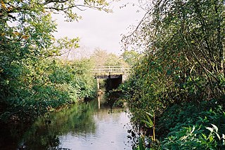
Foudry Brook is a small stream in southern England. It rises from a number of springs near the Hampshire village of Baughurst, and flows to the east and then the north, to join the River Kennet to the south of Reading. The upper section is called Silchester Brook, and beyond that, Bishop's Wood Stream. The underlying geology is chalk, covered by a layer of clay, and so it has the characteristics of a clay stream, experiencing rapid increases in level after heavy rain due to run-off from the surrounding land. It passes a number of listed buildings and scheduled monuments, including the site of the Roman town of Calleva Atrebatum or Silchester.

<span class="mw-page-title-main">Stratfield Mortimer</span> Human settlement in England

Stratfield Mortimer is a village and civil parish, just south of Reading, in the English ceremonial county of Berkshire and unitary authority area of West Berkshire.

<span class="mw-page-title-main">Padworth</span> Human settlement in England

Padworth is a dispersed settlement and civil parish in the English county of Berkshire, with the nearest town being Tadley. Padworth is in the unitary authority of West Berkshire, and its main settlement is at Aldermaston Wharf or Lower Padworth, where it has Aldermaston railway station. It has its southern boundary with Mortimer West End, Hampshire. The south of the parish is wooded towards its edges and the north of the parish is agricultural with a hotel beside the Kennet and Avon Canal. In the centre of the parish is a school, Padworth College, which is Georgian and a later incarnation of its manor house.

<span class="mw-page-title-main">Baughurst</span> Human settlement in England

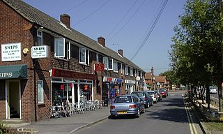
Baughurst is a village and civil parish in Hampshire, England. It is located west of the town of Tadley, 6 miles (9.7 km) north of Basingstoke. In the 2001 census it had a population of 2,473.

<span class="mw-page-title-main">Wasing</span> Village in England

Wasing is an agricultural and woodland village, country estate and parish in West Berkshire, England owned almost wholly by the descendants of the Mount family, currently Joshua Dugdale. In local administration, its few inhabitants convene their own civil parish, but share many facilities with Brimpton which was in its civil parish at the time of the 2011 Census.

<span class="mw-page-title-main">Blackburn Brook</span> Stream in Sheffield, South Yorkshire, England

The Blackburn Brook is a stream in Sheffield, South Yorkshire, England which flows through the Blackburn Valley along the M1 and Ecclesfield Road and joins the River Don near the Meadowhall shopping centre. Downstream from the A61 road at Chapeltown the Blackburn Brook is defined as a main river by the Environment Agency, which requires new building development to be at least 26 feet (8 m) from the bank side as a flood defence measure and to allow access to the watercourse for maintenance.

<span class="mw-page-title-main">Cove Brook</span> River in Hampshire, England

Cove Brook runs 4 miles (6.4 km) from near Farnborough Airport in Farnborough, Hampshire, England and flows through the former Southwood Golf Course where it is joined by Marrow Brook and other smaller streams. It runs north through Cove before joining the Blackwater at Hawley Meadows near the M3 motorway.

Aldermaston Soke is a hamlet that lies on the county boundary between Berkshire and Hampshire, and is administratively part of the civil parish of Mortimer West End, which was transferred from Berkshire to Hampshire in 1879.

<span class="mw-page-title-main">The Cut, Berkshire</span> River in Berkshire, England

The Cut is a river in England that rises in North Ascot, Berkshire. It flows for around 14 miles (23 km), through the rural Northern Parishes of Winkfield, Warfield and Binfield in Bracknell Forest on its way down to Bray, where it meets the River Thames just above Queens Eyot on the reach below Bray Lock, having been joined by the Maidenhead Waterways.

Lockram Brook is a small stream in southern England. It rises near the Berkshire village of Mortimer, and is a tributary of Burghfield Brook.

<span class="mw-page-title-main">Burghfield Brook</span> River in England

Burghfield Brook is a small stream in southern England. It rises in Wokefield Common between the Berkshire villages of Mortimer and Burghfield Common. It is a tributary of Foudry Brook, which it joins near Hartley Court Farm, just to the south of the M4 motorway.

The Teg is a small stream in southern England, in the county of Berkshire. It rises in Burghfield Common and flows northwards and then eastwards to join Burghfield Brook, a tributary of Foudry Brook.

<span class="mw-page-title-main">Decoy Pit, Pools and Woods</span>

Decoy Pit, Pools and Woods is a 17.7-hectare (44-acre) biological Site of Special Scientific Interest south of Aldermaston in Berkshire. An area of 8 hectares is a nature reserve called Decoy Heath, which is managed by the Berkshire, Buckinghamshire and Oxfordshire Wildlife Trust.

<span class="mw-page-title-main">Bow Brook, Hampshire</span> River in Hampshire, England

Bow Brook is a small river in the English county of Hampshire, which is a tributary of the River Loddon. Contributary streams rise near Ramsdell and Sherborne St John, and after flowing through rural countryside, it joins the Loddon near Sherfield on Loddon. Historically it has powered at least two watermills.

<span class="mw-page-title-main">Fleet Brook</span> River in northern Hampshire, England

Fleet Brook is a small river in northern Hampshire, England and tributary of the River Hart.

<span class="mw-page-title-main">Barkham Brook</span> River in Berkshire, England

Barkham Brook is a small river in the English county of Berkshire. It has sources to the north and west of Finchampstead in the Wokingham Borough, flows past the village of Barkham, and joins the River Loddon to the west of Winnersh.

References

  1. 1 2 3 Ordnance Survey, 1:2500 map
  2. "West's Meadow, Aldermaston" (PDF). Natural England. 1986.
  3. "Decoy Pit, Pools and Wood" (PDF). Natural England. 1993.
  4. Ordnance Survey, 1:2500 map, 1872 and 1896
  5. Ordnance Survey, 1:2500 map, 1969
  6. Historic England. "Hillfort south-west of Pond Farm, near Silchester (1008726)". National Heritage List for England . Retrieved 14 July 2020.
  7. "Glossary (see Biological quality element; Chemical status; and Ecological status)". Catchment Data Explorer. Environment Agency. 17 February 2016. UKOpenGovernmentLicence.svg Text was copied from this source, which is available under an Open Government Licence v3.0. © Crown copyright.
  8. "West End Brook (tributary of Foudry Brook)". Catchment Data Explorer. Environment Agency.