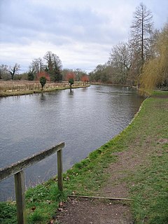
The Kennet is a tributary of the River Thames in Southern England. Most of the river is straddled by the North Wessex Downs AONB. The lower reaches have been made navigable as the Kennet Navigation, which – together with the Avon Navigation, the Kennet and Avon Canal and the Thames – links the cities of Bristol and London.

The River Churn is a tributary of the River Thames in central England. It rises at Seven Springs in Gloucestershire and flows south for approximately 37.3 km (23.2 mi) to meet the Thames at Cricklade in Wiltshire. Its length from its source to the confluence with the Thames is greater than that of the Thames from Thames Head, though the Churn is regarded as a tributary rather than the main river.
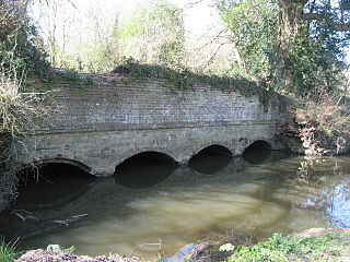
The Holy Brook is a channel of the River Kennet that flows through the English town of Reading. While of considerable historical significance, the origin and nature of the brook is still unclear. It is probable that some parts of the channel are natural, while other parts were created in medieval times by the monks of Reading Abbey to supply water mills and fish ponds. John Speed's map of Reading (c.1610) shows the brook flowing in the open air throughout, but a map from 1835 shows the town centre section to have been largely culverted by then, as is the case now.

The River Allen is a river in the county of Dorset in South West England. It flows for 14 miles (23 km) and has its confluence with the River Stour in Wimborne Minster. It has two main tributaries, the Gussage Stream and the Crichel Stream.

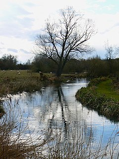
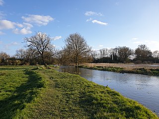
Foudry Brook is a small stream in southern England. It rises from a number of springs near the Hampshire village of Baughurst, and flows to the east and then the north, to join the River Kennet to the south of Reading. The upper section is called Silchester Brook, and beyond that, Bishop's Wood Stream. The underlying geology is chalk, covered by a layer of clay, and so it has the characteristics of a clay stream, experiencing rapid increases in level after heavy rain due to run-off from the surrounding land. It passes a number of listed buildings and scheduled monuments, including the site of the Roman town of Calleva Atrebatum or Silchester.

Sulhamstead is a village and civil parish in West Berkshire, England. It occupies an approximate rectangle of land south of the (Old) Bath Road (A4) between Reading, its nearest town and Thatcham. It has several small clusters of homes and woodland covering about a fifth of the land, in the centre and north beside which is Thames Valley Police's main Training Centre at Sulhamstead House. Its main amenities are its Church of England parish church and a shop and visitor centre by the Kennet & Avon Canal.
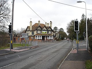
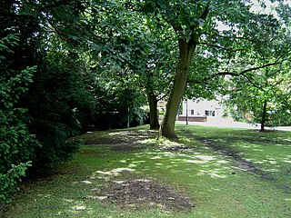
Burghfield is a village and large civil parish in West Berkshire, England, with a boundary with Reading. Burghfield can trace its history back to before the Domesday book, and was once home to three manors: Burghfield Regis, Burghfield Abbas and Sheffield. Since the 1980s the population of Burghfield has nearly doubled with the construction of many new housing estates, making it a dormitory for Reading, Newbury, Basingstoke and the M4 corridor which crosses the north of the parish.
The River Anton is a chalk stream in Hampshire in south east England. It rises in Andover and flows southwards for approximately 8 miles (13 km) to meet the River Test near Chilbolton. The principal tributary of the Anton, the Pillhill Brook, joins the river at Upper Clatford.

The River Alre is a tributary of the River Itchen in Hampshire in the south of England. It rises in Bishop's Sutton and flows west for 6 km (3.7 mi) to meet the Itchen below New Alresford.

Cove Brook runs 4 miles (6.4 km) from near Farnborough Airport in Farnborough, Hampshire, England and flows through the former Southwood Golf Course where it is joined by Marrow Brook and other smaller streams. It runs north through Cove before joining the Blackwater at Hawley Meadows near the M3 motorway.
The Rythe is a river or stream in north Surrey, England which is generally open and which is a natural woodland feature for approximately half of its course before being variously culverted and a suburban garden feature, passing between Thames Ditton and Long Ditton, then discharging into the Thames. Its longest branch is the Arbrook which drains Arbrook Common, a woodland of the mainly wooded Esher Commons.
Lockram Brook is a small stream in southern England. It rises near the Berkshire village of Mortimer, and is a tributary of Burghfield Brook.

Burghfield Brook is a small stream in southern England. It rises in Wokefield Common between the Berkshire villages of Mortimer and Burghfield Common. It is a tributary of Foudry Brook, which it joins near Hartley Court Farm, just to the south of the M4 motorway.

West End Brook is a small stream in southern England. It rises near the Hampshire village of Tadley. Its name is probably related to the parish, and village, it passes through for some of its course: Mortimer West End.

Oakhanger Stream is a tributary of the River Slea that lies in Hampshire, England.
The Cranleigh Waters or Bramley Wey is a tributary of the River Wey in Surrey.
The Pipp Brook is a left-bank tributary of the River Mole, Surrey, England. It rises at two main springs north of Leith Hill on the Greensand Ridge, then descends steeply in a northward direction, before flowing eastwards along the Vale of Holmesdale. It runs to the north of Dorking High Street, before discharging into the Mole at Pixham.

Pilhill Brook is a 9.9-kilometre-long (6.2 mi) tributary of the River Anton in Hampshire, England. It is a chalk stream, known for its trout fishing.
The River Sem is a natural waterway that flows through the ceremonial county of Wiltshire in England. It flows approximately 4+1⁄4 miles (7 km) from its source near East Knoyle to join the River Nadder near Wardour.

Bow Brook is a small river in the English county of Hampshire, which is a tributary of the River Loddon. Contributary streams rise near Ramsdell and Sherborne St John, and after flowing through rural countryside, it joins the Loddon near Sherfield on Loddon. Historically it has powered at least two watermills.
