Bibliography
- Atkins (May 2007). "AWE Aldermaston, Burghfield and Blacknest Historic Characterisation and Management Strategy" (PDF). www.nuclearinfo.org. Archived (PDF) from the original on 20 July 2020.
- Burghfield PC (August 2011). "Village Design Statement" (PDF). Burghfield Parish Council. Archived (PDF) from the original on 20 July 2020.
Related Research Articles
The Atomic Weapons Establishment (AWE) is a United Kingdom Ministry of Defence research facility responsible for the design, manufacture and support of warheads for the UK's nuclear weapons. It is the successor to the Atomic Weapons Research Establishment (AWRE) with its main site on the former RAF Aldermaston and has major facilities at Burghfield, Blacknest and RNAD Coulport.

The River Blackwater is a tributary of the Loddon in England and sub-tributary of the Thames. It rises at two springs in Rowhill Nature Reserve between Aldershot, Hampshire and Farnham, Surrey. It curves a course north then west to join the Loddon in Swallowfield civil parish, central Berkshire. Part of the river splits Hampshire from Surrey; a smaller part does so as to Hampshire and Berkshire.

The River Loddon is a tributary of the River Thames in southern England. It rises at Basingstoke in Hampshire and flows northwards for 28 miles (45 km) to meet the Thames at Wargrave in Berkshire. Together, the Loddon and its tributaries drain an area of 400 square miles (1,036 km2).

Pingewood is a hamlet in the civil parish of Burghfield, to the south of Reading, in the English county of Berkshire. It lies to the Southwest of Burghfield Bridge The name Pingewood derives from the old Celtic word 'pen' meaning head, peak, tip or end. The 'ge' is a contraction of the Celtic word for wood, 'coed'. When the Saxons moved into the area in the 5th century, they did not understand the meaning and added their own descriptive word 'wood' on the end.

Southcote is a suburb of Reading in the English county of Berkshire. Located to the south-west of Reading town centre, Southcote has a population of about 8,500. The settlement lies primarily between the London-to-Bath road and the River Kennet.

Foudry Brook is a small stream in southern England. It rises from a number of springs near the Hampshire village of Baughurst, and flows to the east and then the north, to join the River Kennet to the south of Reading. The upper section is called Silchester Brook, and beyond that, Bishop's Wood Stream. The underlying geology is chalk, covered by a layer of clay, and so it has the characteristics of a clay stream, experiencing rapid increases in level after heavy rain due to run-off from the surrounding land. It passes a number of listed buildings and scheduled monuments, including the site of the Roman town of Calleva Atrebatum or Silchester.

Stratfield Mortimer is a village and civil parish, just south of Reading, in the English ceremonial county of Berkshire and district of West Berkshire.
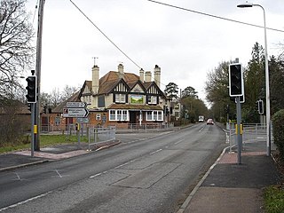
Burghfield is a village and large civil parish in West Berkshire, England, with a boundary with Reading. Burghfield can trace its history back to before the Domesday book, and was once home to three manors: Burghfield Regis, Burghfield Abbas and Sheffield. Since the 1980s the population of Burghfield has nearly doubled with the construction of many new housing estates, dependent for its employment on, for instance, Reading, Newbury and Basingstoke and the M4 corridor which bisects the edge of the area.

Wokefield is a hamlet and civil parish in the West Berkshire district of Berkshire, England, south of the borough of Reading. The parish includes the hamlets of Grazeley Green, Goddard's Green and Bloomfield Hatch, and the 18th-century mansion of Wokefield Park. It includes part of the former parish of Sulhamstead Bannister Upper End and Grazeley. To the north are Burghfield, and Burghfield Common. to the east are Grazeley and Shinfield and to the south are Stratfield Mortimer and Mortimer Common. It lies between 40m and 95m above sea level.

Cove Brook runs 4 miles (6.4 km) from near Farnborough Airport in Farnborough, Hampshire, England and flows through the former Southwood Golf Course where it is joined by Marrow Brook and other smaller streams. It runs north through Cove before joining the Blackwater at Hawley Meadows near the M3 motorway.

A Gravel Gertie is a type of bunker designed to provide containment during the nuclear weapons assembly process, when the plutonium or highly enriched uranium "pit" is mated with the high explosive components and wired into the electronics of the warhead.
The Cut is a river in England that rises in North Ascot, Berkshire. It flows for around 14 miles (23 km), through the rural Northern Parishes of Winkfield, Warfield and Binfield in Bracknell Forest on its way down to Bray, where it meets the River Thames just above Queens Eyot on the reach below Bray Lock, having been joined by the Maidenhead Waterways.
Lockram Brook is a small stream in southern England. It rises near the Berkshire village of Mortimer, and is a tributary of Burghfield Brook.

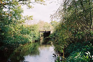
Burghfield Brook is a small stream in southern England. It rises in Wokefield Common between the Berkshire villages of Mortimer and Burghfield Common. It is a tributary of Foudry Brook, which it joins near Hartley Court Farm, just to the south of the M4 motorway.

Clayhill Brook is a small stream in southern England, in the county of Berkshire.

West End Brook is a small stream in southern England. It rises near the Hampshire village of Tadley. Its name is probably related to the parish, and village, it passes through for some of its course: Mortimer West End.

The River Hart is a tributary of the River Whitewater in north Hampshire, England. It rises at Ashley Head spring in Crondall and flows north to meet the Whitewater at Bramshill.

Wish Stream is a small, steep English river, which is a tributary of the River Blackwater. Mostly it demarcates Berkshire and Surrey. It rises on heath land to the north of Camberley, and descends in a south-westerly direction, passing through the grounds of the Royal Military Academy Sandhurst. Two large lakes have been made before it leaves the grounds, to pass through a culvert under a retail park and bridges under major roads to discharge into the Blackwater.

Bow Brook is a small river in the English county of Hampshire, which is a tributary of the River Loddon. Contributary streams rise near Ramsdell and Sherborne St John, and after flowing through rural countryside, it joins the Loddon near Sherfield on Loddon. Historically is has powered at least two watermills.

Fleet Brook is a small river in northern Hampshire, England and tributary of the River Hart.
References
- 1 2 Burghfield PC 2011, p. 8.
- ↑ Ordnance Survey, 1:2500 map, 1911
- ↑ Burghfield PC 2011, p. 10.
- 1 2 3 4 Ordnance Survey, 1:2500 map
- ↑ Historic England. "Church of St. Mary the Virgin (1135772)". National Heritage List for England . Retrieved 20 July 2020.
- ↑ Atkins 2007, p. 18.
- ↑ Atkins 2007, pp. 19-20.