Twyford Brook is a small English river in the county of Berkshire. It drains a rural area to the east of Twyford, starting at the foot of the M4 motorway embankment, and is a tributary of the River Loddon. It was once part of a larger river system, draining the area now occupied by the new town of Bracknell. Because of issues with flooding, a new channel was cut to carry the water to the River Thames at Bray. The new channel and the river upstream from there is now known as The Cut, and the old channel became known as Twyford Brook.
The river begins at the foot of the M4 motorway embankment near Pondwood Fisheries. Formerly, The Cut, which now makes a sharp turn on the other side of the embankment, flowed to the west along what is now the Twyford Brook. However, further downstream there was an area of low-lying land on Ruscombe Common, known as Ruscombe Lake, because it was always flooded, as there was no proper outlet to allow the water to reach the River Loddon. In order to rectify this, a new cut was created to carry the water to the River Thames at Bray.[1][2] Further east, the river was as some time known as How Brook,[3] although in 1813, prior to the construction of The Cut, the whole river appears to have been known as the Broadwater,[4] and the river to the west of Ruscombe Lake was still known as the River Broadwater in 1923, rather than Twyford Brook. The construction of the cut and the draining of Ruscombe Lake took place around 1820.[5] There was an area of swampy ground between the sharp turn and the Twyford Brook, but the connection was severed by the construction of the motorway embankment.[6]
The start of the river is now known as Snake Water, and forms part of Pondwood Fisheries. In 1986, the present owner bought the seven plots of land at Pondwood which had been created when the motorway was built in the 1970s, and opened a fishery using two lakes to the north of the river in 1987. The course of the river here was known as West End Ditch, and maintenance by Thames Water ceased in the late 1980s. Faced with large volumes of run-off water from the motorway flooding the area, in the early 1990s the owner widened the stream to create a series of lakes, and built weirs to control the flow of flood water. These made a valuable addition to the fishery, and a fourth lake was created in 2008, which was excavated in swampy ground that had previously been used as a training ground for the Badminton horse trials.[7]
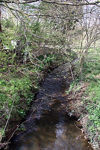
To the west of the fishery, the river passes under Smewins Road. Just to the north is Smewins Farm, where the grade II listed Smewins Cottage, probably dating from Tudor times, sits in the middle of a large moat. The moat is filled with water and its ditches are about 16 feet (5m) wide and 5 feet (1.5m) deep. The site is a scheduled monument, around 66 yards (60m) from east to west and between 44 and 55 yards (40 and 50m) from north to south. The moat is open at the eastern end, and although there are about 6,000 moated sites in England, few are known to exist in Berkshire, and so the site is particularly important.[8]
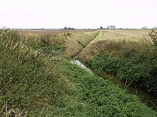
The river heads generally westwards, meandering across land which is just below the 130-foot (40m) contour for most of its length. Occasional drains join it from time to time, and just before it reaches Callin's Bridge, it is joined by a drain that collects water from Beenham's Heath, and after crossing the heath, from a drain that runs along the foot of the motorway embankment. The course then meanders to the north to pass under Crockford's Bridge, and then to the east to reach Sill Bridge. This is an early 18th century humpback bridge with three semi-circular arches and is grade II listed.[9] Next, it makes a larger deviation to the north, where it is crossed by three tracks, Mire Lane, another unnamed track and Garthing Lane at Garthinglane Bridge. It runs around the northern and western edge of a large tract of land called Ruscombe Lake, the area that used to flood and caused The Cut to be built. The lake was famous for fishing, prior to it being drained around 1820, but claims that it formerly covered an area of 3,000 acres (12km2) appear to be exaggerated, in view of the geography,[10] and 100 acres (0.40km2) seems more likely. It was somewhat seasonal in nature, expanding to its maximum size in winter, and drying out to a large extent in summer.[11] As it makes a horseshoe turn to run along the northern edge of Stanlake Park, the river is joined by another drain which carries water from an extensive area to the south and east.[12] Nearby is another moat, this time completely enclosing an area, in the centre of which is a fishpond, believed to be contemporary with the moat. The pond retains water all year, but the moat is only filled with water seasonally. It is at the western end of Botany Bay copse.[13]
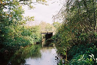
Stanlake Park is a large country house dating from the 16th century, to which alterations were made in the 18th and subsequent centuries. It is grade II listed,[14] as is the adjacent stable block, which was converted from a 16th-century timber-framed barn in the 18th century. Its east front includes a clock dating from 1681.[15] To the west of the house, the river passes under the B3018 road at Stanlake Bridge, and then curves around the edge of modern housing that forms part of Twyford. Two more drains join from the south before it passes under the A321 Hurst Road, and turns to the north, to run parallel to the River Loddon as it crosses the 115-foot (35m) contour. It is crossed by the Great Western Main Line railway just to the west of Twyford railway station, and the branch line from Twyford for Henley-on-Thames crosses it twice. There are two culverts on the final section, which have allowed housing on Weavers Way to be built over it, and then it enters the Loddon just below the site of Twyford flour mill.[12]
There have been mills at Twyford since at least 1365, and a silk mill was built in 1810[16] by two brothers, Thomas and George Billing. The enterprise was fairly short-lived, as the law was changed to allow silk to be imported more freely from France, and only mills equipped with up-to-date equipment could compete. Thomas died in 1824, and the mill was sold to become a flour mill soon afterwards.[17] The mill building spanned both Twyford Brook and the River Loddon, with the Brook joining the tailrace of the mill on the downstream side of the building.[18] By 1899 it was served by a long railway siding which ran alongside the Henley branchline from Twyford station.[19] The wooden building was burnt down in a fire in 1891, but a new mill was built, which was bought by Berks, Bucks and Oxon Farmers Ltd in 1927, a group of farmers who operated as a co-operative to mill animal feed.[20] The mill was powered by water wheels and diesel engines until the early 1960s, when it was converted to use electric motors. By 1969 the railway siding had been lifted, and a distribution warehouse covering 20,000 square feet (1,900m2) was added,[21] but another fire destroyed the building in 1976, and construction of a new mill was completed in 1979.[16] The new building was much larger than the old, and a section of Twyford Brook was culverted, to allow the buildings to extend onto a piece of land between the brook and the Loddon which had formerly been marsh.[22] The owners became bankrupt[23] in the 1990s, and the site was redeveloped for housing.[20] Although none of it is original, much of the building has four storeys, as did the pre-1976 building, and incorporates cosmetic features to suggest the previous use of the site.[24]
Water quality
The Environment Agency measure water quality of the river systems in England. Each is given an overall ecological status, which may be one of five levels: high, good, moderate, poor and bad. There are several components that are used to determine this, including biological status, which looks at the quantity and varieties of invertebrates, angiosperms and fish. Chemical status, which compares the concentrations of various chemicals against known safe concentrations, is rated good or fail.[25]
The water quality of Twyford Brook was as follows in 2019.
The water quality has fluctuated. The chemical status was Fail in 2013 and 2014, but Good in 2015 and 2016. The ecological status and overall status was Poor in 2013, moderate in 2014, and bad in 2015 and 2016. Reasons for the status not being good include sewage discharge, run-off from the M4 motorway, and contamination by fertilisers leeching into the river from agricultural land.
The River Rother, a waterway in the northern midlands of England, gives its name to the town of Rotherham and to the Rother Valley parliamentary constituency. It rises in Pilsley in Derbyshire and flows in a generally northwards direction through the centre of Chesterfield, where it feeds the Chesterfield Canal, and on through the Rother Valley Country Park and several districts of Sheffield before joining the River Don at Rotherham in Yorkshire. Historically, it powered mills, mainly corn or flour mills, but most had ceased to operate by the early 20th century, and few of the mill buildings survive.
The River Blackwater is a tributary of the Loddon in England and sub-tributary of the Thames. It rises at two springs in Rowhill Nature Reserve between Aldershot, Hampshire and Farnham, Surrey. It curves a course north then west to join the Loddon in Swallowfield civil parish, central Berkshire. Part of the river splits Hampshire from Surrey; a smaller part does so as to Hampshire and Berkshire.
The River Loddon is a tributary of the River Thames in southern England. It rises at Basingstoke in Hampshire and flows northwards for 28 miles (45 km) to meet the Thames at Wargrave in Berkshire. Together, the Loddon and its tributaries drain an area of 400 square miles (1,036 km2).
Twyford is a large village and civil parish in the Borough of Wokingham in Berkshire, England. It had a population of 6,618 in the 2011 Census. It is in the Thames Valley and on the A4 between Reading and Maidenhead, close to Henley-on-Thames and Wokingham.
Foudry Brook is a small stream in southern England. It rises from a number of springs near the Hampshire village of Baughurst, and flows to the east and then the north, to join the River Kennet to the south of Reading. The upper section is called Silchester Brook, and beyond that, Bishop's Wood Stream. The underlying geology is chalk, covered by a layer of clay, and so it has the characteristics of a clay stream, experiencing rapid increases in level after heavy rain due to run-off from the surrounding land. It passes a number of listed buildings and scheduled monuments, including the site of the Roman town of Calleva Atrebatum or Silchester.
The River Bourne is the name given to a Thames tributary in northwest Surrey, England which has a longer tributary, the Windle Brook, that rises nears Bagshot Park in the south of Swinley Forest, Berkshire, merging with it while flowing through villages north of Woking; downstream the Bourne joins the Thames near Weybridge.
Cove Brook runs 4 miles (6.4 km) from near Farnborough Airport in Farnborough, Hampshire, England and flows through the former Southwood Golf Course where it is joined by Marrow Brook and other smaller streams. It runs north through Cove before joining the Blackwater at Hawley Meadows near the M3 motorway.
Shurlock Row is a village in the Royal Borough of Windsor and Maidenhead in Berkshire, England.
The Colne Brook is a river in England that is a distributary of the River Colne which runs from Uxbridge Moor, there forming the western border of Greater London, to the River Thames just below Bell Weir Lock in Hythe End, Wraysbury, Berkshire.
The Cut is a river in England that rises in North Ascot, Berkshire. It flows for around 14 miles (23 km), through the rural Northern Parishes of Winkfield, Warfield and Binfield in Bracknell Forest on its way down to Bray, where it meets the River Thames just above Queens Eyot on the reach below Bray Lock, having been joined by the Maidenhead Waterways.
Burghfield Brook is a small stream in southern England. It rises in Wokefield Common between the Berkshire villages of Mortimer and Burghfield Common. It is a tributary of Foudry Brook, which it joins near Hartley Court Farm, just to the south of the M4 motorway.
West End Brook is a small stream in southern England. It rises near the Hampshire village of Tadley. Its name is probably related to the parish, and village, it passes through for some of its course: Mortimer West End.
The River Dove is a river that extends through the Low Valley in Barnsley, England. It flows from Worsbrough Reservoir to its confluence with the River Dearne.
The River Foulness is a river in the East Riding of Yorkshire, England. Its name is derived from Old English fūle[n] ēa, meaning “dirty water”. Maintenance responsibilities for the river transferred from the Environment Agency to the Market Weighton Drainage Board on 1 October 2011. Market Weighton Drainage Board subsequently amalgamated with the Lower Ouse Internal Drainage Board on 1 April 2012 to create the Ouse and Humber Drainage Board. The river discharges into the Humber Estuary via Market Weighton Canal. Water levels within the river, its tributaries and the canal are managed and controlled by the Environment Agency. The river lies in an area known as the Humberhead Levels.
The River Hart is a tributary of the River Whitewater in north Hampshire, England. It rises at Ashley Head spring in Crondall and flows north to meet the Whitewater at Bramshill.
Oldcotes Dyke is the name of the final section of a river system that drains parts of north Nottinghamshire and the Metropolitan Borough of Rotherham in South Yorkshire, England. Historically, it has supported milling, with seven water mills drawing their power from its water, and ran through the grounds of the Cistercian Roche Abbey. It is a tributary of the River Ryton.
The River Lyde or Lyde River is a small river in the English county of Hampshire. It rises near Mapledurwell, where the water is used in watercress beds before entering the main channel. It flows in a generally northerly direction, and used to supply power to watermills along its route. Near Sherfield on Loddon it joins the River Loddon, which is a tributary of the River Thames.
Bow Brook is a small river in the English county of Hampshire, which is a tributary of the River Loddon. Contributary streams rise near Ramsdell and Sherborne St John, and after flowing through rural countryside, it joins the Loddon near Sherfield on Loddon. Historically it has powered at least two watermills.
Fleet Brook is a small river in northern Hampshire, England and tributary of the River Hart.
Barkham Brook is a small river in the English county of Berkshire. It has sources to the north and west of Finchampstead in the Wokingham Borough, flows past the village of Barkham, and joins the River Loddon to the west of Winnersh.
This page is based on this Wikipedia article Text is available under the CC BY-SA 4.0 license; additional terms may apply. Images, videos and audio are available under their respective licenses.