Barkham Brook

Last updated
Barkham Brook
Barkham Brook (geograph 3435589).jpg
Barkham Brook looking downstream from the B3030 road bridge at Barkham
Location
Country England
Counties Berkshire
Districts / Boroughs Wokingham Borough
Physical characteristics
Source 
  location Finchampstead
  coordinates 51°23′18″N0°51′28″W / 51.3884°N 0.8578°W / 51.3884; -0.8578
Mouth River Loddon
  location
Winnersh
  coordinates
51°25′32″N0°53′52″W / 51.4256°N 0.8977°W / 51.4256; -0.8977 Coordinates: 51°25′32″N0°53′52″W / 51.4256°N 0.8977°W / 51.4256; -0.8977

Barkham Brook is a small river in the English county of Berkshire. It has sources to the north and west of Finchampstead in the Wokingham Borough, flows past the village of Barkham, and joins the River Loddon to the west of Winnersh.

Contents

Route

Barkham Brook
BSicon uexCONTg.svg
River Loddon
BSicon uexABZgl.svg
BSicon uexSTR+r.svg
BSicon uxMILL.svg
BSicon uexSTR.svg
Sindlesham Mill
BSicon uexSKRZ-Yu.svg
Mill Lane bridges
BSicon uxWEIRr.svg
BSicon uexABZgr.svg
BSicon uexSKRZ-Bu.svg
UK-Motorway-icon.svg M4 bridge
BSicon uexCONTfaq.svg
BSicon uexSTR+l.svg
BSicon uexSTRr.svg
BSicon uexSTRr.svg
River Loddon
BSicon uxWEIRf.svg
Mole Bridge Farm weir
BSicon uexABZgl.svg
BSicon uexSTR+r.svg
BSicon uexSKRZ-Eu.svg
B3030 Mole Road
BSicon uexSTR.svg
BSicon uexSTRl.svg
BSicon uexDOCKS.svg
Bear Wood Lake
BSicon uexABZgl.svg
BSicon BUILDING.svg
Arborfield STW
BSicon uexSKRZ-Yu.svg
B3349 Barkham Road
BSicon uexSTR+l.svg
BSicon uexSTRq.svg
BSicon uexABZgr.svg
BSicon uexSTR.svg
BSicon uexSKRZ-Eu.svg
Barkham Street bridge
BSicon uexDOCKS.svg
BSicon uexSTR.svg
Arborfield Garrison lake
BSicon uexSKRZ-Eu.svg
BSicon uexSTR.svg
Biggs Lane
BSicon uexSKRZ-Eu.svg
BSicon uexSTR.svg
Park Lane
BSicon uexDOCKS.svg
BSicon uexABZgl.svg
BSicon uexSTR+r.svg
Longmoor Lake
BSicon uexSTR.svg
BSicon uexSKRZ-Eu.svg
Nash Grove Lane
BSicon uexKHSTe.svg
BSicon uexSTR.svg
drains
BSicon uexKHSTaq.svg
BSicon uexSTRr.svg
drains on The Moors

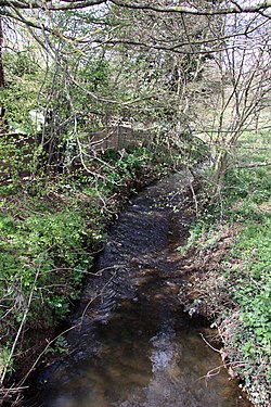
Barkham Brook begins as a series of drains on The Moors, an area of woodland to the north of Finchampstead close to Sand Martins Golf Course. It is augmented by other drains before it passes under Nash Grove Lane, and heads in a westerly direction, where it is joined on its left bank by another stream, fed by a network of drains to the west of Finchampstead. [1] As it approaches Barkham, it passes to the north of a moated site and enclosure. The irregular-shaped moat is between 16 and 23 feet (5 and 7 m) wide, and is around 160 feet (50 m) by 245 feet (75 m) in size. A raised field with ditch to the north-east of the moat is thought to be the farmyard of a manor, and the whole complex is a scheduled monument. [2] Between the moated site and the brook is the grade II listed church of St. James, an Early English style building the nave of which was constructed in 1862 by John B. Clacy and Son, while the chancel and transepts were added 25 years later. It contains an effigy of a woman in a long flowing dress and linen headdress, made from oak in the 13th century. [3] In Barkham, the brook flows under Barkham Street and is then joined by a tributary on its left bank, flowing northwards from California. [1]

The tributary begins at Longmoor Lake, which covers 6 acres (2.4 ha) and is situated in California Country Park. [4] It was created by John Walter III, who extended an original pond after he bought the land to expand his Bearwood Estate in 1873. The clay which was excavated to construct the lake was used to make bricks. In the 1930s, the area became the California-in-England holiday camp, with attractions including a speedway track, but became a designated Country Park in 1980. [5] The outflow from Longmoor Lake flows through Longmoor Bog, a Site of Special Scientific Interest (SSSI) covering 35.5 acres (14.4 ha), notable because it is one of the few base-poor valley mires in Berkshire. It includes an area of wet heathland, where peat sits on top of an underlying layer of clay, resulting in a ferruginous swamp, characterised by rust-coloured iron bacteria. Around the waterlogged mire are carrs of alder, grey willow, downy birch and alder buckthorn, while the swamp is populated by purple moor grass and cross-leaved heath. [6]

At the western edge of Longmoor Bog, the brook is crossed by Park Lane, and turns to the north along the perimeter of the former Arborfield Garrison, which closed in 2015 to be re-developed for housing. [7] After passing under Biggs Lane, it enters another lake, and then crosses open countryside to join the main channel, the combined flow continuing northwards until it is crossed by the B3349 Barkham Road. It is joined by a stream flowing westwards from the lakes at Barkham Manor. The grade II listed manor house was built on a moated site in the 17th century, and was enlarged in the 18th and 19th centuries, after which it was altered in the 20th century. It was the home of John Walter, and Mary Ball, the mother of George Washington, was born there. [8] The brook continues to the north-west, and its flow is augmented by the treated effluent from Arborfield Sewage Treatment Works. The works is authorised to discharge 4.75 Ml per day into the river, [9] but on 29 September 2013 discharged untreated effluent, resulting in serious pollution and the death of fish, other fauna and vegetation. Thames Water were fined £150,000 for that particular incident, as part of a much larger fine for five other incidents elsewhere. [10]

To the west of the works, the brook turns to the north, and passes under the B3030 Mole Road at Mole Bridge Farm, where there is a weir. Shortly afterwards, it is joined by the outflow from Bear Wood Lake, which is located in the grade II* listed parks and gardens belonging to Bearwood College. John Walter II bought the Bearwood Estate in the early 19th century, and employed J W Sanderson to build a classical villa. He also enlarged the lake to its present size of 49 acres (20 ha). Walter's son, John Walter III rebuilt the house between 1865 and 1874, employing Robert Kerr as the architect. In 1919 the building became the Merchant Seamen's Orphanage, and then a boarding school. [11] The lake was created by constructing a compacted clay dam across the small stream than ran through the grounds. The catchment area for supplying the lake is very small, at only 0.55 square miles (1.42 km2), encompassing the school grounds, a golf course, a large area of woodland and runoff from a small residential area. The lake was estimated to hold around 313.6 Ml, but this was increased to 327.2 Ml by raising the surface level by 6 inches (150 mm) in the 1990s. Historically, water from the lake powered a sawmill situated near the dam, which had ceased to operate by the 1960s. A pumping station is located on the crest of the dam, and water is abstracted for irrigation of the golf course. Because the volume of water impounded by the dam exceeds 25 Ml, the lake is considered to be a reservoir under the terms of the Reservoir (Safety Provisions) Act 1930, and visual imspections are made every week by a Reservoir Supervisor Engineer, while the crest of the dam is regularly surveyed for any signs of settlement of the dam, of which there were none as of 2014. [12]

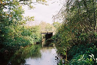
As part of the work associated with raising the level in the 1990s, a concrete spillway was constructed for the normal discharge from the reservoir. There are no other provisions for draining the reservoir down. From the spillway, water runs in a ditch beside a minor road, passes under Mole Road, and then runs through a 12-inch (300 mm) diameter culvert to reach another ditch which carries to water to the right bank of Barkham Brook. [13] The brook continues in a north-westerly direction, until it almost reaches the River Loddon, but then turns to the north-east to pass under the M4 motorway embankment in its own culvert. It runs parallel to the Loddon for a short distance and joins it on its right bank below the weir for Sindlesham watermill. [1]

Water quality

The Environment Agency measure water quality of the river systems in England. Each is given an overall ecological status, which may be one of five levels: high, good, moderate, poor and bad. There are several components that are used to determine this, including biological status, which looks at the quantity and varieties of invertebrates, angiosperms and fish, and chemical status, which compares the concentrations of various chemicals against known safe concentrations. Chemical status is rated good or fail. [14]

The water quality of the Barkham Brook was as follows in 2019.

SectionEcological
Status
Chemical
Status
Overall
Status
LengthCatchment
Barkham Brook [15] Moderate Fail Moderate 4.8 miles (7.7 km)7.23 square miles (18.7 km2)

The main reasons for the water quality being less than good are discharges from sewage treatment works, and physical modification of the channel, mostly in connection with land drainage, which presents obstacles to the movement of fish around the system.

Bibliography

Related Research Articles

Borough of Wokingham Place in England

The Borough of Wokingham is a local government district in Berkshire, United Kingdom. It is named after its main town, Wokingham. Other places in the district include Arborfield, Barkham, Charvil, Earley, Finchampstead, Hurst, Sonning, Remenham, Ruscombe, Shinfield, Twyford, Wargrave, Three Mile Cross, Winnersh, Spencers Wood and Woodley.

River Blackwater (River Loddon) Tributary of the River Loddon in England

The River Blackwater is a tributary of the Loddon in England and sub-tributary of the Thames. It rises at two springs in Rowhill Nature Reserve between Aldershot, Hampshire and Farnham, Surrey. It curves a course north then west to join the Loddon in Swallowfield civil parish, central Berkshire. Part of the river splits Hampshire from Surrey; a smaller part does so as to Hampshire and Berkshire.

River Loddon River in southern England

The River Loddon is a tributary of the River Thames in southern England. It rises at Basingstoke in Hampshire and flows northwards for 28 miles (45 km) to meet the Thames at Wargrave in Berkshire. Together, the Loddon and its tributaries drain an area of 400 square miles (1,036 km2).

Barkham Human settlement in England

Barkham is a village and civil parish in the borough of Wokingham in Berkshire, England, located around 2 miles (3.2 km) southwest of the town of Wokingham.

Reading East (UK Parliament constituency)

Reading East is a constituency represented in the House of Commons of the UK Parliament since 2017 by Matt Rodda, of the Labour Party. The seat is one of two won by a Labour candidate in 2017 from a total of eight covering its county. Rodda's 2017 win was one of 30 net gains of the Labour Party.

California is a village in the north of the civil parish of Finchampstead in the English county of Berkshire. It is situated approximately 1.9 mi (3.1 km) south of Wokingham.

Foudry Brook

Foudry Brook is a small stream in southern England. It rises from a number of springs near the Hampshire village of Baughurst, and flows to the east and then the north, to join the River Kennet to the south of Reading. The upper section is called Silchester Brook, and beyond that, Bishop's Wood Stream. The underlying geology is chalk, covered by a layer of clay, and so it has the characteristics of a clay stream, experiencing rapid increases in level after heavy rain due to run-off from the surrounding land. It passes a number of listed buildings and scheduled monuments, including the site of the Roman town of Calleva Atrebatum or Silchester.

Loddon River

The Loddon River, an inland river of the north–central catchment, part of the Murray-Darling basin, is located in the lower Riverina bioregion and Central Highlands and Loddon Mallee regions of the Australian state of Victoria. The headwaters of the Loddon River rise on the northern slopes of the Great Dividing Range east of Daylesford and descend to flow north into the Little Murray River, near Swan Hill. The river is impounded by the Cairn Curran and Laanecoorie reservoirs. The Tullaroop Creek tributary which joins just above Laanecoorie Reservoir, is impounded by the Tullaroop Reservoir (72,950ML).

Finchampstead Human settlement in England

Finchampstead is a village and civil parish in the Wokingham Borough in the shire of Royal Berkshire, England. Its northern extremity is 2 miles (3 km) south of Wokingham, 5 miles (8 km) west of Bracknell, 8 miles (13 km) south-east of Reading, and 34 miles (55 km) west of Central London. It is an affluent area, with the village ranking as Britain's 31st wealthiest. It has a high standard of living and is rated as one of the most desirable places to live in the UK.

River Ching Tributary of the River Lea / Lee Navigation, southeast England

The River Ching is a tributary of the River Lea, flowing from Epping Forest, in southeast England.

California Country Park

California Country Park is a 100-acre (40 ha) country park covering Long Moor in the north of the civil parish of Finchampstead in the English county of Berkshire. It consists of lowland heath and bogland, including Longmoor Bog, a Site of Special Scientific Interest (SSSI) and Local Nature Reserve. The park is managed by Wokingham Borough Council and is open every day throughout the year.

Rainworth Water Tributary of the River Maun near Rainworth, Nottinghamshire, England

Rainworth Water is a watercourse that is a tributary of the River Maun near Rainworth, Nottinghamshire, England. It is characterised by a number of lakes, including that which forms part of the country park at Rufford Abbey. L Lake at Rainworth forms part of the Rainworth Lakes Site of Special Scientific Interest. There are two designated Local Nature Reserves along its length, one of which is also known by the name Rainworth Water. The Rainworth Water LNR is owned and managed by Nottinghamshire County Council.

Swithland Reservoir

Swithland Reservoir is a reservoir in the English county of Leicestershire. It is north-east of the village of Swithland from which it takes its name, north-west of Rothley and approximately 133 metres (145 yd) south-west of Mountsorrel Quarry. It is part of the 187.1-hectare (462-acre) Buddon Wood and Swithland Reservoir Site of Special Scientific Interest (SSSI).

The Cut, Berkshire

The Cut is a river in England that rises in North Ascot, Berkshire. It flows for around 14 miles (23 km), through the rural Northern Parishes of Winkfield, Warfield and Binfield in Bracknell Forest on its way down to Bray, where it meets the River Thames just above Queens Eyot Island on the reach below Bray Lock, having been joined by the Maidenhead Waterways.

Roman River river in Essex, England

The Roman River is a river that flows entirely through the English county of Essex. It is a tributary of the River Colne, flowing into its tidal estuary below Colchester. The lower end of the Roman River is also tidal, with tidal water flowing upstream to just above Fingringhoe.

Twyford Brook

Twyford Brook is a small English river in the county of Berkshire. It drains a rural area to the east of Twyford, starting at the foot of the M4 motorway embankment, and is a tributary of the River Loddon. It was once part of a larger river system, draining the area now occupied by the new town of Bracknell. Because of issues with flooding, a new channel was cut to carry the water to the River Thames at Bray. The new channel and the river upstream from there is now known as The Cut, and the old channel became known as Twyford Brook.

Bow Brook, Hampshire

Bow Brook is a small river in the English county of Hampshire, which is a tributary of the River Loddon. Contributary streams rise near Ramsdell and Sherborne St John, and after flowing through rural countryside, it joins the Loddon near Sherfield on Loddon. Historically is has powered at least two watermills.

Fleet Brook

Fleet Brook is a small river in northern Hampshire, England and tributary of the River Hart.

References

  1. 1 2 3 Ordnance Survey, 1:2500 map
  2. Historic England. "Moated site and associated enclosure at Church Farm (1013181)". National Heritage List for England . Retrieved 26 July 2020.
  3. Historic England. "Church of St James (1118116)". National Heritage List for England . Retrieved 26 July 2020.
  4. "California Country Park". Visit South East England. Retrieved 26 July 2020.
  5. "Walk 3 – California Country Park". Finchampstead Parish Council. Archived from the original on 26 July 2020. Retrieved 26 July 2020.
  6. "Longmoor Bog SSSI" (PDF). Natural England. 1986.
  7. "MoD confirms Arborfield Garrison closure". BBC. 19 July 2011.
  8. Historic England. "Barkham Manor (1313101)". National Heritage List for England . Retrieved 26 July 2020.
  9. "Environmental permit application". Environment Agency. 13 March 2020. Archived from the original on 26 July 2020.
  10. "Thames Water ordered to pay record £20 million for river pollution". Croner-i. 4 April 2017. Archived from the original on 26 July 2020.
  11. Historic England. "Bearwood College (1000414)". National Heritage List for England . Retrieved 26 July 2020.
  12. Comrie 2014, pp. 42,44.
  13. Comrie 2014, p. 42.
  14. "Glossary (see Biological quality element; Chemical status; and Ecological status)". Catchment Data Explorer. Environment Agency. 17 February 2016.
  15. "Barkham Brook". Catchment Data Explorer. Environment Agency.

External sources