
Mill Hill is a suburb in the London Borough of Barnet, England. It is situated around 9 miles (14 km) northwest of Charing Cross. Mill Hill was in the historic county of Middlesex until 1965, when it became part of Greater London. Its population counted 18,451 inhabitants as of 2011.

Totteridge is a former village, now a residential area in the London Borough of Barnet, England. It is a mixture of suburban development and open land situated 8 miles (13 km) north north-west of Charing Cross. It is part of the Whetstone postal district (N20).

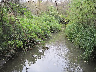
Dollis Brook runs through the London Borough of Barnet in north London. It is a tributary of the River Brent, which is itself a tributary of the River Thames. The Dollis Valley Greenwalk follows almost all of Dollis Brook, apart from a short section at the beginning which passes through private land, and the London Loop follows it as far as Barnet Lane. The name Dollis is probably derived from the Middle English word 'dole', meaning the shares of land in the common field.
The London Borough of Barnet, located on the northern periphery of London and having much of the area within its boundaries in the Metropolitan Green Belt, has many parks and open spaces. In addition there are large areas taken over by cemeteries and golf courses, and part of Hampstead Heath.

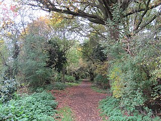
The Dollis Valley Greenwalk is a footpath route in the London Borough of Barnet in London, England, between Moat Mount Nature Reserve in Mill Hill and Hampstead Heath. The route is designed to act as a link between the Capital Ring and the London Loop, and between the many green spaces and wildlife corridors along the way. It is approximately 10 miles (16 km) long. It mainly follows the Dollis Brook and is one of the many parks and open spaces in Barnet.

The Silk Stream is a brook just over 4 kilometres (2.5 mi) long in the London Borough of Barnet. It is one of the major components of the Blue Ribbon Network.

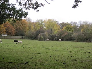
Totteridge Fields is a 97-hectare Site of Metropolitan Importance for Nature Conservation (SINC) in Totteridge in the London Borough of Barnet. The SINC includes the privately owned Highwood Hill, and at the western end is a seven-hectare Local Nature Reserve owned by Barnet Council and managed by the London Wildlife Trust.

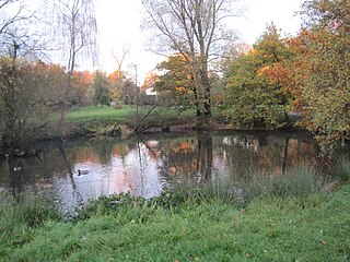
Darland's Lake Nature Reserve is a nature reserve south of Totteridge Village in Barnet, England. It is owned by the London Borough of Barnet and was managed from 1971 by the Hertfordshire and Middlesex Wildlife Trust, and more recently by the borough council. In 2007 the council spent £215,000 on repairing the dam and other works, and then proposed leasing the reserve to the Wildlife Trust. The transfer did not take place and in September 2017 a trust was set up by the London Wildlife Trust and local residents associations which took over the management of Darland's Lake. In 2020 Darlands Conservation Trust launched an appeal to raise £450,000 for excavation to prevent the lake drying up.

Woodridge Nature Reserve or Woodridge School Nature Reserve is a 0.7 hectare Site of Local Importance for Nature Conservation in Woodside Park, London, owned and managed by the London Borough of Barnet. It was designed as a nature trail for local primary schools, but is now very neglected.
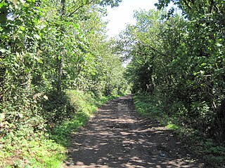
Burtonhole Lane and Pasture is a 6.5 hectare Site of Borough Importance for Nature Conservation, Grade II, between Mill Hill and Totteridge in the London Borough of Barnet. It consists of Burtonhole Lane between Partingdale Lane and Burtonhole Close, a footpath east from Burtonhole Lane towards Folly Brook, two fields south of the footpath, and a narrow belt of privately owned woodland north of the footpath. Burtonhole Brook, a tributary of Folly Brook, crosses Burtonhole Lane and the fields.

Arrandene Open Space and Featherstone Hill is a 25 hectare Site of Metropolitan Importance for Nature Conservation in Mill Hill in the London Borough of Barnet.

Scratchwood is an extensive, mainly wooded, country park in Mill Hill in the London Borough of Barnet. The 57-hectare site is a Site of Metropolitan Importance for Nature Conservation and together with the neighbouring Moat Mount Open Space. It is a Local Nature Reserve.
Ashley Lane is a one hectare Site of Borough Importance for Nature Conservation, Grade II, in Hendon in the London Borough of Barnet. It is over 400 years old, and was an important medieval road. Cardinal Wolsey travelled along it on his final journey to York in 1530. It is now a bridleway which runs between Hendon Golf Course and Hendon Cemetery.
Mill Hill Substation Pastures is a fifteen-hectare Site of Metropolitan Importance for Nature Conservation in Mill Hill in the London Borough of Barnet.
Totteridge Green is a five hectare Site of Borough Importance for Nature Conservation, Grade II, in Totteridge in the London Borough of Barnet. It is also registered common land.
Deans Brook is a two-kilometre-long stream which runs between Mill Hill and Edgware in the London Borough of Barnet. It is a tributary of the Silk Stream, which is a tributary of the River Brent, which is a tributary of the River Thames.

Mutton Brook is a stream which runs between East Finchley and Hendon in the London Borough of Barnet. It is a tributary of the River Brent, which is itself a tributary of the River Thames.

Brent Park is a small public park of 2.24 hectares in Hendon in the London Borough of Barnet. It is part of the 'Lower Dollis Brook' Site of Borough Importance for Nature Conservation, Grade II.

Burnt Oak Brook is a one-mile-long stream between Mill Hill and Burnt Oak in the London Borough of Barnet. It is a tributary of the Silk Stream, which is a tributary of the River Brent, which is a tributary of the River Thames.

