The London Borough of Barnet, located on the northern periphery of London and having much of the area within its boundaries in the Metropolitan Green Belt, has many parks and open spaces. In addition there are large areas taken over by cemeteries and golf courses, and part of Hampstead Heath.

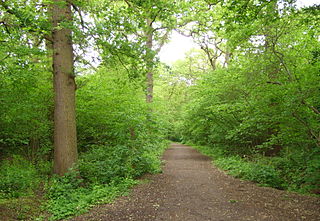
Folly Brook is a 2+1⁄4-mile (3.6 km) long brook in the London Borough of Barnet. It is a tributary of Dollis Brook, which is a tributary of the River Brent, which is a tributary of the River Thames. Folly Brook is lined for most of its length by narrow strips of woodland and scrub, with a good variety of trees and shrubs. It is one of the best streams in Barnet for small aquatic invertebrates, including several species of caddis fly and a stonefly, which are only found in unpolluted waters.

Moat Mount Open Space is a 110-hectare park and nature reserve in Mill Hill in the London Borough of Barnet. It is part of Moat Mount Open Space and Mote End Farm Site of Borough Importance for Nature Conservation, Grade II, which includes Barnet Gate Wood and Scratchwood Countryside Park, but is separate from Scratchwood itself, which is a neighbouring park and nature reserve. Most of the site is open to the public, but Mote End Farm and some other areas are private. Scratchwood and Moat Mount are a Local Nature Reserve.
Hendon Park is a 12 hectare London suburban park situated 7 miles (11 km) north west of Charing Cross. It borders the Northern line, and Hendon Park and Northern line Railway Cutting are a Site of Local Importance for Nature Conservation.

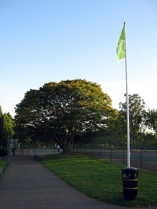
Cherry Tree Wood is a 5.3-hectare park in East Finchley in the London Borough of Barnet. It is a Site of Local Importance for Nature Conservation. Located opposite East Finchley Underground station, it contains woodland and grassland, a playground, tennis courts, a cafe and toilets.

Totteridge Fields is a 97-hectare Site of Metropolitan Importance for Nature Conservation (SINC) in Totteridge in the London Borough of Barnet. The SINC includes the privately owned Highwood Hill, and at the western end is a seven-hectare Local Nature Reserve owned by Barnet Council and managed by the London Wildlife Trust.

Woodridge Nature Reserve or Woodridge School Nature Reserve is a 0.7-hectare (1.7-acre) Site of Local Importance for Nature Conservation in Woodside Park, London, owned and managed by the London Borough of Barnet. It was designed as a nature trail for local primary schools, but is now very neglected.

Rowley Green Common is a six hectare Local Nature Reserve and a Site of Importance Metropolitan for Nature Conservation in Arkley, north London. It is owned by the London Borough of Barnet. It is also registered common land.
Burtonhole Lane and Pasture is a 6.5-hectare (16-acre) Site of Borough Importance for Nature Conservation, Grade II, between Mill Hill and Totteridge in the London Borough of Barnet. It consists of Burtonhole Lane between Partingdale Lane and Burtonhole Close, a footpath east from Burtonhole Lane towards Folly Brook, two fields south of the footpath, and a narrow belt of privately owned woodland north of the footpath. Burtonhole Brook, a tributary of Folly Brook, crosses Burtonhole Lane and the fields.

Arrandene Open Space and Featherstone Hill is a 25 hectare Site of Metropolitan Importance for Nature Conservation in Mill Hill in the London Borough of Barnet.

Hadley Green is a 10-hectare (25-acre) Site of Metropolitan Importance for Nature Conservation in Hadley in the London Borough of Barnet. The reserve straddles the Great North Road between Hadley Green Road and Fold Lane.

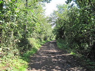
Arkley Lane and Pastures is a 50-hectare (120-acre) Site of Borough Importance for Nature Conservation, Grade II, in Arkley in the London Borough of Barnet. Arkley Lane, off Barnet Road, is an old drovers' road. Located on the Barnet Plateau, it is now a quiet country lane with a traditional bank and ditch. The thick hedges are composed of beech and hornbeam, ash, field maple and magnificent old pedunculate oaks.

Oak Hill Wood is a 10-hectare Local Nature Reserve (LNR) and a Site of Borough Importance for Nature Conservation Grade I, in East Barnet, London. It is owned by the London Borough of Barnet, and part of it is a 5.5-hectare nature reserve managed by the London Wildlife Trust.

Copthall Railway Walk and Copthall Old Common is a 9-hectare (22-acre) Site of Borough Importance for Nature Conservation, Grade II, in Mill Hill in the London Borough of Barnet.
Totteridge Green is a five hectare Site of Borough Importance for Nature Conservation, Grade II, in Totteridge in the London Borough of Barnet. It is also registered common land.

Totteridge Common is a 3.7 hectare Site of Borough Importance for Nature Conservation, Grade II, in Totteridge in the London Borough of Barnet. The nature reserve is the southern verge of the road Totteridge Common, between Totteridge Park and Oak Lodge. It is registered common land owned by the Totteridge Manor Association and comprised the lands of the former Manor of Totteridge which were transferred to the association in 1954.
Stoneyfields Park is a three-hectare public park in The Hale in the London Borough of Barnet.
Big Wood and Little Wood are two patches of woodland in Hampstead Garden Suburb in the London Borough of Barnet. They are a Site of Borough Importance for Nature Conservation, Grade 1, and a Local Nature Reserve. Big Wood is 7.3 hectares and Little Wood is 1.2 hectares.

Covert Way is the only Local Nature Reserve in the London Borough of Enfield. It is also part of the Hadley Wood Golf Course and Covert Way Field Site of Borough Importance for Nature Conservation, Grade I, and it has an area of 7 hectares. It is on the southern border of Enfield between the road named Covert Way and Monken Hadley Common in Barnet.

