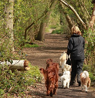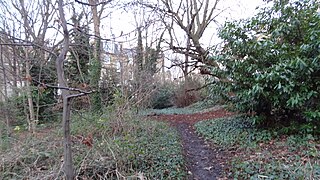
Camley Street Natural Park is an urban nature reserve in King's Cross in central London and within the London Borough of Camden. It is a local nature reserve.

Ingrebourne Marshes are a 74.8 hectare biological Site of Special Scientific Interest in Hornchurch in the London Borough of Havering. Ingrebourne Valley Local Nature Reserve includes a small part of the SSSI west of the River Ingrebourne. The site is managed by the Essex Wildlife Trust

Moat Mount Open Space is a 110-hectare park and nature reserve in Mill Hill in the London Borough of Barnet. It is part of Moat Mount Open Space and Mote End Farm Site of Borough Importance for Nature Conservation, Grade II, which includes Barnet Gate Wood and Scratchwood Countryside Park, but is separate from Scratchwood itself, which is a neighbouring park and nature reserve. Most of the site is open to the public, but Mote End Farm and some other areas are private. Scratchwood and Moat Mount are a Local Nature Reserve.

Stanmore Common is a 49.2-hectare public park, Local Nature Reserve and Site of Metropolitan Importance for Nature Conservation in Stanmore in the London Borough of Harrow in England. It is owned by Harrow Council and managed by the council with a local group. It was a biological Site of Special Scientific Interest, but was de-notified in the early 1990s.

Rowley Green Common is a six hectare Local Nature Reserve and a Site of Importance Metropolitan for Nature Conservation in Arkley, north London. It is owned by the London Borough of Barnet and according to the Natural England details page it is jointly managed by the Hertfordshire and Middlesex Wildlife Trust and the London Wildlife Trust, but as of August 2015 it is not on the list of reserves of either Trust. It is also registered common land.

Scratchwood is an extensive, mainly wooded, country park in Mill Hill in the London Borough of Barnet. The 57-hectare site is a Site of Metropolitan Importance for Nature Conservation and together with the neighbouring Moat Mount Open Space. It is a Local Nature Reserve.

Coppett's Wood and Scrublands is a 14.5 hectare Site of Borough Importance for Nature Conservation, Grade I, between Muswell Hill and Friern Barnet in the London Borough of Barnet. It is part of the Coppett's Wood and Glebelands Local Nature Reserve.

Glebelands is Site of Borough Importance for Nature Conservation, Grade I, in Colney Hatch in the London Borough of Barnet. It is also part of the Coppett's Wood and Glebelands Local Nature Reserve.

Oak Hill Wood is a 10-hectare Local Nature Reserve (LNR) and a Site of Borough Importance for Nature Conservation Grade I, in East Barnet, London. It is owned by the London Borough of Barnet, and part of it is a 5.5-hectare nature reserve managed by the London Wildlife Trust.

Gunnersbury Triangle is a 2.57-hectare (6.4-acre) local nature reserve in the London boroughs of Ealing and Hounslow, immediately to the east of Gunnersbury. It was created in 1983 when, for the first time in Britain, a public inquiry ruled that a planned development of the land could not go ahead because of its value for nature. It opened as a nature reserve in 1985.

Cranham Marsh is a 15.3 hectare Local Nature Reserve and a Site of Metropolitan Importance for Nature Conservation in Cranham in the London Borough of Havering. It is owned by Havering Council and managed by the Essex Wildlife Trust.

Dulwich Upper Wood is a 2.4 hectare local nature reserve and Site of Borough Importance for Nature Conservation, Grade 1, in Crystal Palace in the London Borough of Southwark. It is owned by Southwark Council and managed by the Trust for Urban Ecology.

Fishpond Wood and Beverley Meads is a 5.8 hectare local nature reserve adjacent to Wimbledon Common in the London Borough of Merton. It is owned and managed by Merton Council.

Perivale Wood is an 11.6 hectare Local Nature Reserve (LNR) and Site of Metropolitan Importance for Nature Conservation in Perivale in the London Borough of Ealing. It is one of the oldest nature reserves in Britain. The Selborne Society has managed it since 1902, at first as a bird sanctuary. In 1914 it leased the site and in 1923 it purchased it. The wood was designated an LNR in 1974.

Barnsbury Wood is a Local Nature Reserve and Site of Borough Importance for Nature Conservation, Grade I, in Barnsbury in the London Borough of Islington. With an area of only 0.35 hectares, it is the smallest Local Nature Reserve in London It is owned and managed by Islington Council.

Hutchinson's Bank is 21.8 hectare Local Nature Reserve and Site of Metropolitan Importance for Nature Conservation in New Addington in the London Borough of Croydon. It is owned by Croydon Council and managed by the London Wildlife Trust.

Wilderness Island is the 2.7 hectare island between the Wandle and Wrythe in Carshalton in the London Borough of Sutton. It is designated a Local Nature Reserve and a Site of Metropolitan Importance for Nature Conservation, is owned by Sutton Council and is managed by the London Wildlife Trust.

Sutton Ecology Centre Grounds is a 1.3 hectare Local Nature Reserve and Site of Borough Importance for Nature Conservation, Grade 1, in Carshalton in the London Borough of Sutton. It is owned by Sutton Council and managed by the Council together with the Friends of Sutton Ecology Centre.

Myrna Close is a linear walk along the line of a former railway line in Colliers Wood in the London Borough of Merton. It is a 0.75 hectare Local Nature Reserve and a Site of Borough Importance for Nature Conservation, Grade II, which is owned and managed by Merton Council.
Hogsmill River Park or Hogsmill Valley is a linear park along the banks of the Hogsmill River in the Royal Borough of Kingston upon Thames in London. It stretches from the junction of Surbiton Hill Park and Elmbridge Avenue in Berrylands in the north to the junction between the river and a footpath to Manor Close in Old Malden in the south.


