South Norwood Country Park is a park in South Norwood, close to Elmers End and Birkbeck train stations. The historic Kent-Surrey border runs through the site, and since 1965 it has been located wholly in the London Borough of Croydon. It is a 47 hectare green space which opened in 1989. The park is a mix of countryside and parkland, and land formerly used for sewage farms serving the growing London population.

Dollis Brook runs through the London Borough of Barnet in north London. It is a tributary of the River Brent, which is itself a tributary of the River Thames. The Dollis Valley Greenwalk follows almost all of Dollis Brook, apart from a short section at the beginning which passes through private land, and the London Loop follows it as far as Barnet Lane. The name Dollis is probably derived from the Middle English word 'dole', meaning the shares of land in the common field.
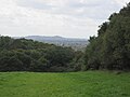
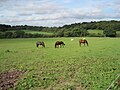
The London Borough of Barnet, located on the northern periphery of London and having much of the area within its boundaries in the Metropolitan Green Belt, has many parks and open spaces. In addition there are large areas taken over by cemeteries and golf courses, and part of Hampstead Heath.

The London Borough of Brent, an Outer London borough to the north west of the conurbation, has about 100 parks and open spaces within its boundaries. These include recreation and sports grounds, a large country park, and a large reservoir. The main areas of open space are:

Folly Brook is a 2+1⁄4-mile (3.6 km) long brook in the London Borough of Barnet. It is a tributary of Dollis Brook, which is a tributary of the River Brent, which is a tributary of the River Thames. Folly Brook is lined for most of its length by narrow strips of woodland and scrub, with a good variety of trees and shrubs. It is one of the best streams in Barnet for small aquatic invertebrates, including several species of caddis fly and a stonefly, which are only found in unpolluted waters.

Barnet Gate is a hamlet on the northern edge of the London Borough of Barnet to the west of Arkley, in England. There was a settlement there during the Roman occupation of Britain and in the Anglo-Saxon period it was known as Grendeles Gatan after Grendel, the monster in the epic poem Beowulf. Manor courts were held there and brickmaking was an important local industry. It was on the edge of Southaw wood which was cleared when nearby Chipping Barnet was developed after which it was known as Barnet Gate. The Gate referred to no longer exists but was either a gate used to prevent cattle straying onto Barnet Common or a gate that marked the boundary between Hertfordshire and Middlesex.

The Dollis Brook Viaduct, also known as the Dollis Road Viaduct, Dollis Viaduct or Mill Hill Viaduct, is a railway viaduct to the west of Finchley, North London, United Kingdom. It carries the London Underground's Northern line from Mill Hill East station to Finchley Central station. It is the highest point on the London Underground above ground level, reaching nearly 60 feet (18 m). It is located on a branch that was formerly part of the Edgware, Highgate and London Railway.

The Dollis Valley Greenwalk is a footpath route in the London Borough of Barnet in London, England, between Moat Mount Nature Reserve in Mill Hill and Hampstead Heath. The route is designed to act as a link between the Capital Ring and the London Loop, and between the many green spaces and wildlife corridors along the way. It is approximately 10 miles (16 km) long. It mainly follows the Dollis Brook and is one of the many parks and open spaces in Barnet.

Totteridge Fields is a 97-hectare Site of Metropolitan Importance for Nature Conservation (SINC) in Totteridge in the London Borough of Barnet. The SINC includes the privately owned Highwood Hill, and at the western end is a seven-hectare Local Nature Reserve owned by Barnet Council and managed by the London Wildlife Trust.

Barnet Gate Wood is a public open space in Barnet Gate, Barnet, London. It is owned and managed by the London Borough of Barnet, and is part of the Watling Chase Community Forest.

Woodridge Nature Reserve or Woodridge School Nature Reserve is a 0.7-hectare (1.7-acre) Site of Local Importance for Nature Conservation in Woodside Park, London, owned and managed by the London Borough of Barnet. It was designed as a nature trail for local primary schools, but is now very neglected.

Rowley Green Common is a six hectare Local Nature Reserve and a Site of Importance Metropolitan for Nature Conservation in Arkley, north London. It is owned by the London Borough of Barnet. It is also registered common land.

Hadley Green is a 10-hectare (25-acre) Site of Metropolitan Importance for Nature Conservation in Hadley in the London Borough of Barnet. The reserve straddles the Great North Road between Hadley Green Road and Fold Lane.

Scratchwood is an extensive, mainly wooded, country park in Mill Hill in the London Borough of Barnet. The 57-hectare site is a Site of Metropolitan Importance for Nature Conservation and together with the neighbouring Moat Mount Open Space. It is a Local Nature Reserve.

Coppetts Wood and Scrublands is a 14.5-hectare (36-acre) Site of Borough Importance for Nature Conservation, Grade I, between Muswell Hill and Friern Barnet in the London Borough of Barnet. It is part of the Coppetts Wood and Glebelands Local Nature Reserve.

Monken Hadley Common lies within the Monken Hadley Conservation Area, and is listed as a “Site of Borough Importance for Nature Conservation, Grade I,” by the London Borough of Barnet. It is registered common land, and it is owned by the Trustees of Monken Hadley Common.

Mutton Brook is a stream which runs between East Finchley and Hendon in the London Borough of Barnet. It is a tributary of the River Brent, which is itself a tributary of the River Thames.

Brent Park is a small public park of 2.24 hectares in Hendon in the London Borough of Barnet. It is part of the 'Lower Dollis Brook' Site of Borough Importance for Nature Conservation, Grade II.

Barnet Countryside Centre is a 3.3 hectare Site of Local Importance for Nature Conservation in High Barnet in the London Borough of Barnet. It is run by the Friends of Barnet Countryside Centre as a nature reserve and to provide environmental education for schools.