Forest of Birse

Last updated
Forest of Birse
Aberdeenshire UK location map.svg
Red pog.svg
Forest of Birse
Forest of Birse shown within Aberdeenshire
OS grid reference NO5390
Council area
Lieutenancy area
Country Scotland
Sovereign state United Kingdom
Post town Banchory
Postcode district AB31
Dialling code 01330
Police Scottish
Fire Scottish
Ambulance Scottish
EU Parliament Scotland
UK Parliament
Scottish Parliament
List of places
UK
Scotland
57°00′N2°46′W / 57.00°N 2.77°W / 57.00; -2.77 Coordinates: 57°00′N2°46′W / 57.00°N 2.77°W / 57.00; -2.77

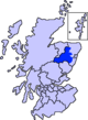
The Forest of Birse is a remote upland area in the upper catchment of the Water of Feugh, which forms the south-western portion of the Parish of Birse, Aberdeenshire, Scotland. It also forms the western part of the community of Finzean, but has a separate, complex history of landownership relating to its status as a commonty, which has involved a large number of disputes since the 16th century. In more recent decades, the forest has been a popular destination for people from Aberdeen taking picnics, as it is the closest area of Highland scenery to the city.

Water of Feugh stream in Aberdeenshire, Scotland

The Water of Feugh is a stream in Aberdeenshire that is the largest tributary to the River Dee. This stream rises in the Grampian Mountains of Scotland, in an area known as the Forest of Birse, and has a particularly scenic aspect in a series of cascades at the Bridge of Feugh slightly above its point of discharge to the Dee.

Birse village in United Kingdom

Birse is a parish in the Lower Deeside area of Aberdeenshire, Scotland, which includes the communities of Finzean and Ballogie. However the name Birse is often used to refer only to the northwestern part of the parish which lies on the south side of the River Dee, Aberdeenshire, opposite the village of Aboyne. The south-west part of the parish is a sparsely populated upland area known as the Forest of Birse.

Aberdeenshire Council area of Scotland

Aberdeenshire is one of the 32 council areas of Scotland.

Contents

Looking north from Tampie hill over the Forest of Birse towards Birse castle and Ballochan Forest of Birse1.jpg
Looking north from Tampie hill over the Forest of Birse towards Birse castle and Ballochan

Description

The eastern boundary of the Forest of Birse is marked by the Finlets and Laird's burns; two minor tributaries of the Feugh (itself a tributary of the River Dee) which join the river about 1 kilometre upstream from Woodend. Otherwise the boundary generally follows the watershed of the Feugh, which runs along the tops of the following hills (clockwise from the south): Baudnacauner, Cock Hill, Hill of Cammie, Mudlee Bracks, Tampie, Gannoch, Hill of St, Colm, Craigmahandle, Hill of Duchery, Brackenstake, Lamahip and Corybeg. The Forest of Birse extends to approximately 35 square kilometres, and reaches its highest point at Gannoch (731 m).

River Dee, Aberdeenshire river in Aberdeenshire, Scotland

The River Dee is a river in Aberdeenshire, Scotland. It rises in the Cairngorms and flows through southern Aberdeenshire to reach the North Sea at Aberdeen. The area it passes through is known as Deeside, or Royal Deeside in the region between Braemar and Banchory because Queen Victoria came to love the place and built Balmoral Castle there.

Drainage divide Elevated terrain that separates neighbouring drainage basins

A drainage divide, water divide, divide, ridgeline,, watershed, water parting or height of land is elevated terrain that separates neighbouring drainage basins. On rugged land, the divide lies along topographical ridges, and may be in the form of a single range of hills or mountains, known as a dividing range. On flat terrain, especially where the ground is marshy, the divide may be harder to discern.

The underlying bedrock of the Forest of Birse is granite, from which most of the soil in the area is derived. However, a thick layer of peat has formed over many of the higher hills, creating extensive areas of blanket bog. Historically, a 'Forest' was an uncultivated area set aside for hunting and was not necessarily wooded, and indeed Heather moorland is the principal habitat in the Forest of Birse. However, native pine woodland has regenerated across approximately 5 square kilometres of the northern slopes of the Forest of Birse since the Second World War, principally on the Finlets, Lamahip and Bogturk hills. There are also fragments of riparian woodland along many of the watercourses of the forest, containing a diverse range of native trees including birch, hazel, aspen and holly. Within the Forest of Birse there are two small areas of cultivated land at Auchabrack and Ballochan, which also contain the forest's only inhabited buildings. These comprise Birse Castle and three other houses.

Bedrock Lithified rock under the regolith

In geology, bedrock is the lithified rock that lies under a loose softer material called regolith at the surface of the Earth or other terrestrial planets. The broken and weathered regolith includes soil and subsoil. The surface of the bedrock beneath the soil cover is known as rockhead in engineering geology, and its identification by digging, drilling or geophysical methods is an important task in most civil engineering projects. Superficial deposits can be extremely thick, such that the bedrock lies hundreds of meters below the surface.

Granite A common type of intrusive, felsic, igneous rock with granular structure

Granite is a common type of felsic intrusive igneous rock that is granular and phaneritic in texture. Granites can be predominantly white, pink, or gray in color, depending on their mineralogy. The word "granite" comes from the Latin granum, a grain, in reference to the coarse-grained structure of such a holocrystalline rock. Strictly speaking, granite is an igneous rock with between 20% and 60% quartz by volume, and at least 35% of the total feldspar consisting of alkali feldspar, although commonly the term "granite" is used to refer to a wider range of coarse-grained igneous rocks containing quartz and feldspar.

Soil mixture of organic matter, minerals, gases, liquids, and organisms that together support life

Soil is a mixture of organic matter, minerals, gases, liquids, and organisms that together support life. Earth's body of soil, called the pedosphere, has four important functions:

The rich wildlife of the Forest of Birse includes the mountain hare, red and roe deer, red grouse, black grouse, golden plover, hen harrier, merlin, peregrine falcons, crossbills and the area is occasionally visited by golden eagles and capercaillie. Part of the area was declared an Important Bird Area by BirdLife International and there was an unsuccessful attempt to have part of the area designated as a Site of Special Scientific Interest in the early 1990s.

Wildlife undomesticated organisms that grow or live wild in an area without being introduced by humans

Wildlife traditionally refers to undomesticated animal species, but has come to include all organisms that grow or live wild in an area without being introduced by humans. Wildlife can be found in all ecosystems. Deserts, forests, rain forests, plains, grasslands and other areas including the most developed urban areas, all have distinct forms of wildlife. While the term in popular culture usually refers to animals that are untouched by human factors, most scientists agree that much wildlife is affected by human activities.

Mountain hare species of mammal

The mountain hare, also known as blue hare, tundra hare, variable hare, white hare, snow hare, alpine hare, and Irish hare, is a Palearctic hare that is largely adapted to polar and mountainous habitats.

Red deer Species of mammal

The red deer is one of the largest deer species. The red deer inhabits most of Europe, the Caucasus Mountains region, Asia Minor, Iran, parts of western Asia, and central Asia. It also inhabits the Atlas Mountains region between Morocco and Tunisia in northwestern Africa, being the only species of deer to inhabit Africa. Red deer have been introduced to other areas, including Australia, New Zealand, United States, Canada, Peru, Uruguay, Chile and Argentina. In many parts of the world, the meat (venison) from red deer is used as a food source.

History

A typical clearance cairn. Eglinton clearance cairn.JPG
A typical clearance cairn.

The earliest inhabitants of the forest were mesolithic hunter-gatherers about 8000 years ago. However, the first evidence of settlement comes from the Bronze Age, about 3000 years ago, in the form of field systems, clearance cairns and hut circles, of which there are several good examples in the Forest of Birse. At this time, cereal crops were probably grown on areas that are now covered with heather. At the beginning of the Iron Age there was a climatic deterioration and these farms were probably abandoned at that time and gradually reclaimed by nature. The Forest of Birse remained uninhabited from then until the 17th century.

Mesolithic Prehistoric period, second part of the Stone Age

In Old World archaeology, Mesolithic is the period between the Upper Paleolithic and the Neolithic. The term Epipaleolithic is often used synonymously, especially for outside northern Europe, and for the corresponding period in the Levant and Caucasus. The Mesolithic has different time spans in different parts of Eurasia. It refers to the final period of hunter-gatherer cultures in Europe and Western Asia, between the end of the Last Glacial Maximum and the Neolithic Revolution. In Europe it spans roughly 15,000 to 5,000 BP; in Southwest Asia roughly 20,000 to 8,000 BP. The term is less used of areas further east, and not at all beyond Eurasia and North Africa.

Hunter-gatherer human living in a society in which most or all food is obtained by foraging (collecting wild plants and pursuing wild animals)

A hunter-gatherer is a human living in a society in which most or all food is obtained by foraging. Hunter-gatherer societies stand in contrast to agricultural societies, which rely mainly on domesticated species.

Bronze Age Britain refers to the period of British history that spanned from c. 2500 until c. 800 BC

Bronze Age Britain is an era of British history that spanned from c. 2500 until c. 800 BC. Lasting for approximately 1,700 years, it was preceded by the era of Neolithic Britain and was in turn followed by the period of Iron Age Britain. Being categorised as the Bronze Age, it was marked by the use of copper and then bronze by the prehistoric Britons, who used such metals to fashion tools. Great Britain in the Bronze Age also saw the widespread adoption of agriculture.

By the 10th century AD, the Forest of Birse (along with the rest of Birse) had become the personal property of the King of Scots, and was used as a Royal Hunting Forest. Kenneth II hunted here in 995 AD and Kenneth III in 1005 AD. In 1170, King William the Lion gave Birse to Matthew, Bishop of Aberdeen. The charter associated with this transfer is the first reference to the uninhabited Forest of Birse as a distinct area from the rest of Birse, where most of the population lived. Over the following 400 years the Bishops allowed the inhabitants of the wider parish of Birse the common right to use the forest for the collection of timber and peat and for summer grazing.

Common land land owned collectively

Common land is land owned collectively by a number of persons, or by one person, but over which other people have certain traditional rights, such as to allow their livestock to graze upon it, to collect wood, or to cut turf for fuel.

Lumber wood that has been processed into beams and planks

Lumber or timber is a type of wood that has been processed into beams and planks, a stage in the process of wood production. Lumber is mainly used for structural purposes but has many other uses as well.

Peat accumulation of partially decayed vegetation

Peat, also known as turf, is an accumulation of partially decayed vegetation or organic matter. It is unique to natural areas called peatlands, bogs, mires, moors, or muskegs. The peatland ecosystem is the most efficient carbon sink on the planet, because peatland plants capture CO2 naturally released from the peat, maintaining an equilibrium. In natural peatlands, the "annual rate of biomass production is greater than the rate of decomposition", but it takes "thousands of years for peatlands to develop the deposits of 1.5 to 2.3 m [4.9 to 7.5 ft], which is the average depth of the boreal [northern] peatlands". Sphagnum moss, also called peat moss, is one of the most common components in peat, although many other plants can contribute. The biological features of Sphagnum mosses act to create a habitat aiding peat formation, a phenomenon termed 'habitat manipulation'. Soils consisting primarily of peat are known as histosols. Peat forms in wetland conditions, where flooding obstructs the flow of oxygen from the atmosphere, slowing the rate of decomposition.

The Bishop of Aberdeen sold off their properties in Birse between 1549 and 1620, around the time of the reformation. All of the new landowners (and their tenants) were also granted the common right to use the forest for timber, peat and grazing. The forest itself was sold to William Gordon of Cluny in 1585 and in 1610 the Gordons enclosed the best part of the common grazing, brought in tenant farmers and built a castle. However, after falling into debt, the Gordons of Cluny sold the forest to William Douglas of Glenbervie in 1636 and in 1640 the other landowners in Birse burnt down Birse castle and drove the tenant farmers out of the forest in order to re-establish their common rights there. In 1666 the forest was sold to the Earl of Aboyne.

In 1724 the Earl of Aboyne enclosed the land around Birse Castle again and once more tenant farmers were brought into the forest. At around the same time, the Farquharsons of Finzean enclosed another area of land in the forest at Auchabrack, which had previously been the site of a shieling for one of their tenants. This encroachment onto the common grazing led to legal disputes with the other landowners with rights in the forest, which were resolved by the Court of Session in 1755. The ruling allowed the two enclosed areas to remain as the private property of the Earl of Aboyne and the Farquharsons of Finzean respectively, but reconfirmed the common rights of everyone in Birse over the remainder of the forest.

During the 19th century, the rise in the popularity and economic value of grouse shooting associated with the Victorian era led to a series of legal disputes over the hunting rights in the forest that were not fully resolved until 1897. The final ruling was that, while the Earl of Aboyne owned the land in the forest, the hunting rights were divided between the Earl of Aboyne and the neighbouring estate of Ballogie, which had been bought by the Nicol family in the 1850s. The division of hunting rights (which remains to this day) follows a line from the summit of Gannoch, down the Allanstank burn, along the Feugh to the Forest of Birse kirk and then along a track which runs north to Glencat. Ballogie estate have the hunting rights to the south and east of this line (the majority of the forest).

In the same year as the final ruling on the hunting rights, the Earl of Aboyne sold the Forest of Birse to Joseph Robert Heaven, who rebuilt Birse Castle. After Heaven died in 1911, the Forest of Birse was bought by Weetman Pearson, 1st Viscount Cowdray and became part of his Dunecht estate. In 1978, ownership of Dunecht estates (including the Forest of Birse) was passed by the 3rd Viscount Cowdray to his younger son, Charles Pearson, who is the current owner. The farmland at Auchabrack was sold by the Farquharsons of Finzean to the Nicols of Ballogie in 1938. [1]

Throughout most of the 20th century, the Forest of Birse was largely treated as an extension of the two estates which shared the hunting rights, as the older, common uses, such as summer grazing, peat cutting and timber had largely fallen into disuse. However, in the 1970s the regeneration of woodland in part of the forest and the felling of a small area of mature woodland by Dunecht estate raised awareness of the ancient common rights held by all the inhabitants of Birse parish, as the use of timber was one of these common rights.

After several years of negotiation, a historic agreement was reached in 1999, in which the ancient rights over the forest held by all the inhabitants of Birse parish were vested in a body known as Birse Community Trust, which uses these rights to manage the 5 square kilometres of woodland that is regenerating in the north-east part of the forest. Ballogie and Dunecht estates continue to manage the remainder of the forest primarily for grouse shooting, and all three parties have regular meetings to discuss matters of common interest in the forest.

Native pinewood regenerating in the Forest of Birse Forest of Birse.JPG
Native pinewood regenerating in the Forest of Birse

Related Research Articles

Balmoral Castle estate house in Royal Deeside, Aberdeenshire, Scotland

Balmoral Castle is a large estate house in Royal Deeside, Aberdeenshire, Scotland, near the village of Crathie, 6.2 miles (10 km) west of Ballater and 6.8 miles (11 km) east of Braemar.

Ashdown Forest heathland area in the county of East Sussex

Ashdown Forest is an ancient area of tranquil open heathland occupying the highest sandy ridge-top of the High Weald Area of Outstanding Natural Beauty. It is situated some 30 miles (48 km) south of London in the county of Sussex, England. Rising to an elevation of 732 feet (223 m) above sea level, its heights provide expansive vistas across the heavily wooded hills of the Weald to the chalk escarpments of the North Downs and South Downs on the horizon.

Mounth mountains in the United Kingdom

The Mounth is the range of hills on the southern edge of Strathdee in northeast Scotland. It was usually referred to with the article, i.e. "the Mounth". The name is a corruption of the Scottish Gaelic monadh which in turn is akin to the Welsh mynydd, and may be of Pictish origin. Traditionally the people of northern Scotland did not consider the Grampians to be a single range, but several, and these were known as the Mounth or the Mounths. Mountain ranges to the west are known as Monadh Liath and the Monadh Ruadh, which could be glossed as the Grey Mounth and the Red Mounth.

Duffield Frith was, in medieval times, an area of Derbyshire in England, part of that bestowed upon Henry de Ferrers by King William, controlled from his seat at Duffield Castle. From 1266 it became part of the Duchy of Lancaster and from 1285 it was a Royal Forest with its own Forest Courts.

Hanbury, Worcestershire village in the United Kingdom

Hanbury is a rural village in Worcestershire, England near Droitwich Spa and the M5 motorway.

Finzean village in the United Kingdom

Finzean is a rural community, electoral polling district, community council area and former ecclesiastical parish, which forms the southern part of the Parish of Birse, Aberdeenshire, Scotland. Finzean was the subject of many well-known landscape paintings by the artist Joseph Farquharson, whose family have owned Finzean Estate since the 17th century. Finzean extends to approximately 8000 hectares in area and had a population of approximately 270 in 2002.

Hatfield Forest biological Site of Special Scientific Interest in Essex, three miles east of Bishops Stortford, England

Hatfield Forest is a 403.2 hectare biological Site of Special Scientific Interest in Essex, three miles east of Bishop's Stortford. It is also a National Nature Reserve and a Nature Conservation Review site. It is owned and managed by the National Trust. A medieval warren in the forest is a Scheduled Monument.

Wentwood is a forested area of hills, rising to 309 metres (1,014 ft), in Monmouthshire, South Wales. It is located to the north east of, and partly within the boundaries of, the city of Newport.

The deer forest is a sporting estate which is kept and managed largely or solely for the purposes of maintaining a resident population of red deer for sporting purposes. It is an institution and phenomenon peculiar to the Highlands of Scotland.

The Dunecht Estate is one of the largest private estates in Aberdeenshire, Scotland at 53,000 acres (210 km2). It is owned by The Hon Charles Anthony Pearson, the younger son of the 3rd Viscount Cowdray. Dunecht’s business interests include farming, forestry, field sports, minerals, let houses, commercial lets and tourism.

Ballogie human settlement in United Kingdom

Ballogie is a rural community and an estate in the Lower Deeside area of Aberdeenshire, Scotland. Most of Ballogie lies within the parish of Birse, although the northern part extends into the parish of Aboyne and Glentanar.

Needwood Forest Ancient forest in England

Needwood Forest was a large area of ancient woodland in Staffordshire which was largely lost at the end of the 18th century.

Charles Anthony Pearson British noble

The Hon. Charles Pearson is the younger son of the Third Viscount Cowdray and owner of Dunecht estate in Aberdeenshire.

Forests of Mara and Mondrem

The Forests of Mara and Mondrem were adjacent medieval forests in Cheshire, England, which in the 11th century extended to over 60 square miles (160 km2), stretching from the Mersey in the north almost to Nantwich in the south, and from the Gowy in the west to the Weaver in the east. Mara and Mondrem were a hunting forest of the Norman Earls of Chester, established soon after 1071 by the first earl, Hugh d'Avranches. They might earlier have been an Anglo-Saxon hunting forest. Game included wild boar, and red, fallow and roe deer.

The common land of Ashdown Forest in East Sussex, England, a former royal hunting forest created soon after the Norman conquest of England, covers some 6,400 acres. The map of the common land today largely dates back to 1693, when more than half the medieval Forest was taken into private hands, with the remainder being set aside as common land. The latter is today administered by a Board of Conservators. It is entirely open for public access and it is the largest area of its kind in south-east England.

Leicester Forest was a Royal Forest that existed to the West of Leicester.

Malvern Chase

Malvern Chase was a Royal chase that occupied the land between the Malvern Hills and the River Severn in Worcestershire and extended to Herefordshire from the River Teme to Cors Forest.

Mols Bjerge National Park Danish national park

Mols Bjerge National Park or Nationalpark Mols Bjerge is a Danish national park in the area known as Mols Bjerge in Syddjurs Municipality, Central Jutland, inaugurated on 29 August 2009. The protected area, measures 180 square kilometres (69 sq mi) in size. The Mols Hills, reaching a height of 137 metres (449 ft), are centrally located in the park, and take up 2,500 ha. "More than half of all wild Danish plant species" can be found at Mols Bjerge.

References

  1. Callander, R. (2000). History in Birse. Birse Community Trust