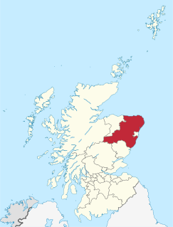
Bognie Castle is a ruined castle near Huntly, in the Aberdeenshire region of Scotland. It was built in the 17th century and is now ruined. It once rose 4 storeys high.

The Clava cairn is a type of Bronze Age circular chamber tomb cairn, named after the group of three cairns at Balnuaran of Clava, to the east of Inverness in Scotland. There are about 50 cairns of this type in an area round about Inverness. They fall into two sub-types, one typically consisting of a corbelled passage grave with a single burial chamber linked to the entrance by a short passage and covered with a cairn of stones, with the entrances oriented south west towards midwinter sunset. In the other sub-type an annular ring cairn encloses an apparently unroofed area with no formal means of access from the outside. In both sub-types a stone circle surrounds the whole tomb and a kerb often runs around the cairn. The heights of the standing stones vary in height so that the tallest fringe the entrance and the shortest are directly opposite it.
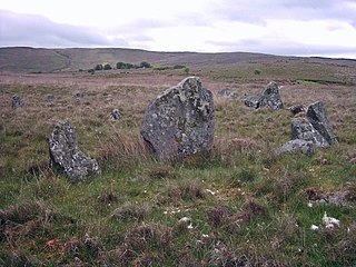
Corick is a megalithic site and townland in the civil parish of Ballynascreen, County Londonderry, Northern Ireland. It includes a stone circle and a stone row. The Corick stone circles and alignments are located 2 km north east of Ballybriest court-tomb, 400 metres south of Corick clachan, near a stream. There are some 5 circles and 3 stone-rows. The stone alignments and circle are Scheduled Historic Monuments in Corick at grid reference: Area of H780 896.

Swinside, which is also known as Sunkenkirk and Swineshead, is a stone circle lying beside Swinside Fell, part of Black Combe in southern Cumbria, North West England. One of around 1,300 recorded stone circles in the British Isles and Brittany, it was constructed as a part of a megalithic tradition that lasted from 3,300 to 900 BC, during what archaeologists categorise as the Late Neolithic and Early Bronze Ages.

The Callanish II stone circle is one of many megalithic structures around the better-known Calanais I on the west coast of the Isle of Lewis, in the Outer Hebrides, Scotland.

The Callanish III stone circle is one of many megalithic structures around the better-known Calanais I on the west coast of the Isle of Lewis, in the Outer Hebrides, Scotland.

The Callanish IV stone circle is one of many megalithic structures around the better-known Calanais I on the west coast of the Isle of Lewis, in the Outer Hebrides, Scotland.

The Callanish VIII stone setting is one of many megalithic structures around the better-known Calanais I on the west coast of the Isle of Lewis, in the Outer Hebrides, Scotland. It is also known locally as Tursachan.
Bohonagh is a recumbent stone circle located 2.4 km east of Rosscarbery, County Cork, Ireland. The circle is thought to date from the Bronze Age. A boulder burial is sited nearby.
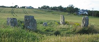
Templebryan Stone Circle is a stone circle, located 2.5 km (1.6 mi) north of Clonakilty, County Cork, Ireland. Grid ref: W386 438. Close by lies an Early Christian site.

Glantane East is a megalithic complex situated 6.4 kilometres (4.0 mi) from Millstreet, County Cork, Ireland. It is set in the Keel River valley on the north-west upper slopes of Musherabeg mountain, in the townland of Glantane. The complex includes a wedge tomb, two stone circles and a pair of stone alignments.

Boskednan stone circle is a partially restored prehistoric stone circle near Boskednan, around 4 miles northwest of the town of Penzance in Cornwall, United Kingdom. The megalithic monument is traditionally known as the Nine Maidens or Nine Stones of Boskednan, although the original structure may have contained as many as 22 upright stones around its 69-metre perimeter.

Strichen Stone Circle is a small Megalithic stone circle located in the north east of Scotland, near Strichen, Aberdeenshire.

The Uragh Stone Circle is a neolithic stone circle near Gleninchaquin Park, Tuosist, County Kerry, Ireland.
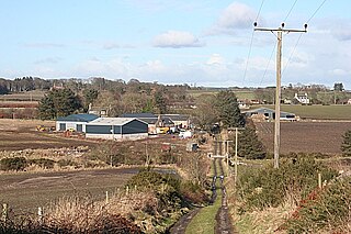
The Causey Mounth is an ancient drovers' road over the coastal fringe of the Grampian Mountains in Aberdeenshire, Scotland. This route was developed as the main highway between Stonehaven and Aberdeen around the 12th century AD and it continued to function as the principal route connecting these two cities until the mid 20th century, when modern highway construction of the A90 road occurred in this area. There are extant paved and usable sections of this road over part of the alignment; however, many parts of the ancient route are no more than footpaths, and in some cases the road has vanished into agricultural fields. Constructed in the Middle Ages, the Causey Mounth was created as an elevated rock causeway to span many of the boggy areas such as the Portlethen Moss. A considerable portion of the alignment of the Causey Mounth is illustrated on the UK Ordnance Survey Map, although a large fraction of the route cannot be navigated by a conventional passenger vehicle.

Sheldon Stone Circle is a prehistoric stone circle, located at grid reference NJ822249, to the south-east of Oldmeldrum, Aberdeenshire, Scotland.
May Craig is a rocky island situated along the North Sea coast of Aberdeenshire, Scotland. May Craig lies about one half mile south of Newtonhill and a mile northeast of the village of Muchalls. A small islet of the same name lies three miles to the north-northeast.

Auld Bourtreebush is a prehistoric stone circle in Aberdeenshire, Scotland. This megalithic construction is situated near the Causey Mounth ancient trackway, which connects the Scottish lowlands to the highlands.
The Callanish X stone circle is one of many megalithic structures around the more well-known and larger Calanais I on the west coast of the isle of Lewis, in the Western Isles of the Outer Hebrides, Scotland.

The Colmeallie stone circle is a recumbent stone circle in Glen Esk, Angus, Scotland. It is located 8 km north of Edzell at Colmeallie Farm, adjacent to the unclassified road leading from the B966 to Tarfside and Loch Lee.
