Fort Glenn Army Air Base

Last updated
Cape Air Force Base
Fort Glenn Army Airfield
Cape Field at Fort Glenn
Eleventh Air Force - Emblem (World War II).svg
Part of Eleventh Air Force
Umnak, Alaska
USA Alaska location map.svg
Red pog.svg
Cape AFB
Coordinates 53°22′39″N167°53′24″W / 53.37750°N 167.89000°W / 53.37750; -167.89000 (Cape Air Force Base)
TypeMilitary Airbase
Site information
Controlled by Us army air corps shield.svg   United States Army Air Forces
Site history
In use1942-1950
Battles/wars Aleutian Islands campaign
Map all coordinates using: OpenStreetMap

Cape Air Force Base also known as Fort Glenn Army Air Base, is a site significant for its role in World War II fighting, operating alongside Naval Air Facility Otter Point.

Contents

It was listed on the National Register of Historic Places and declared a National Historic Landmark in 1987 as Cape Field at Fort Glenn. [1] [2]

History

Origins

Because of the perceived vulnerability of Alaska immediately following the Pearl Harbor Attack, additional Army Air Corps units were authorized by General Henry H. Arnold for Alaska and plans were made to send modern aircraft to the Territory to replace the obsolete aircraft assigned. However, the Alaskan Air Force had few airfields to accommodate the additional aircraft and units being assigned. [3]

Along with new airfields on the mainland and Southwest Alaska, new air bases were planned for the air defense of the Aleutians to Dutch Harbor. Construction of the new bases on Umnak and Cold Bay began in January 1942 in secret, with construction reportedly disguised as a cannery. Originally, the equipment was supposed to construct McGrath Army Airbase, but the ground had frozen by the time that the equipment arrived. [4] The first United States Army engineers landed at what would become Fort Glenn Army Air Base on 17 January and construction began by the end of the month. A Naval airfield, Naval Air Facility Otter Point, was adjacent to the Army Airbase. The 807th Engineering Battalion (Aviation) was brought in from Yukat to perform the construction along with a detachment of the Navy Seabee 8th Construction Battalion. [3] [5]

Cape Field, later Fort Glenn Army Air Base, was secretly built at Otter Point on Umnak Island in 1942. Fort Glenn Army Airfield 1942.jpg
Cape Field, later Fort Glenn Army Air Base, was secretly built at Otter Point on Umnak Island in 1942.
Personnel tents at Fort Glenn Army Air Base, May 1942 Fort Glenn AAF - May 1942.jpg
Personnel tents at Fort Glenn Army Air Base, May 1942

Plans called for three hard-surfaced runways (four were eventually built), but time was of the essence in the construction of the base, as the air defense of Dutch Harbor was dependent on them. Instead of a hard surface, engineers chose to use a new material, pierced steel planking (PSP), which could be laid down quickly over a compressed gravel subsurface to provide the airfield with an all-weather capability. 80,000 pieces of matting needed to be barged to the island. Construction crews worked in three shifts, 24 hours a day laying down the runways and constructing a rudimentary support station, water and sewer lines, an electrical grid, communications, fuel and munitions storage sites and all the other necessities to convert a remote island site into an operational airfield capable of supporting heavy bombers. A 5,000-foot (1,500 m) PSP runway was completed on 5 April although a C-53 was the first plane to land on the field, on 31 March. The main runway was officially opened on 23 May. [3] [6] Fort Glenn's first runway was then the U.S. Army's most westerly airfield in the Aleutian Islands." [1]

The first operational unit, the 11th Fighter Squadron, moved into Fort Glenn with P-40 Warhawk fighters on 26 May from Elmendorf Field. Additional construction continued throughout 1942 with four 5,000-foot (1,500 m) × 175-foot (53 m) runways were completed (06/24, 07/35), two of which (03/21, 04/22) were situated only 10 degrees apart. All runways had four layers of asphalt laid down over the PSP. Two additional emergency landing fields were built, one on the north coast of the island (North Shore) 53°30′45″N167°55′18″W / 53.51250°N 167.92167°W / 53.51250; -167.92167 (North Shore Emergency Field) , 9.4 miles north; the other 7.7 miles to the west-southwest of the base near the Tullk Volcano (Pacifier) 53°19′35″N168°03′23″W / 53.32639°N 168.05639°W / 53.32639; -168.05639 (South Pacifier Emergency Field) . [3] [5]

Morrison-Knudsen Construction Company built hundreds of Quonset hut structures on the base, replacing the temporary tents which exposed the construction crews to the sudden storms which swept the island frequently. Housing and messing facilities for 119 officers and 359 men were constructed as well as recreational and service buildings. Storage facilities consisted of 6,975 square feet for general stores and a 150-cubic-foot freezer. Buildings for aircraft included a kodiak-type hangar, 160-foot (49 m) x 90-foot (27 m), a squadron warehouse, and a terminal for air transport service. Administration offices were housed in five buildings with a total floor space of 3,850 square feet. Radio facilities included a transmitting station, a direction-finder station, and a radar station, all with separate power houses, and with housing and messing provisions for personnel. The hospital, located in one small building, contained eight beds. The maintenance force of the station was installed in seven buildings. Electric power was provided by three diesel-electric generators. [3] [5]

Aleutian Islands campaign

11th Fighter Squadron P-40 Warhawks at Fort Glenn AAB, June 1942 11th Fighter Squadron Fort Glenn AAF - 1942.jpg
11th Fighter Squadron P-40 Warhawks at Fort Glenn AAB, June 1942

On 3 June 1942 the Imperial Japanese Navy launched two aircraft carrier raids on the United States Army barracks and the US Navy base at Dutch Harbor on nearby Amaknak Island. The attack was a surprise, but the base been on alert for an attack for many days, although there was no specific warning of the attack before the Japanese planes arrived over Dutch Harbor. The attack signaled the beginning of the Aleutian Islands campaign. In response, the P-40s of the 11th Fighter Squadron from Fort Glenn AAB along with Naval land-based fighters attacked the Japanese aircraft. Eleventh Air Force also dispatched aircraft from Elmendorf Field. In the ensuring battle, the United States Navy lost four PBYs, and Eleventh AF lost one B-17, two B-26s and one LB-30 (B-24A) bombers and two P-40 fighters. The Japanese lost two A6M "Zero" fighters, and possibly a third due to ground anti-aircraft fire. One A6M "Zero", three D3A "Val" dive bombers and one E8N "Dave"reconnaissance seaplane were shot down in aerial combat. [3]

Eleventh Air Force also dispatched B-26 Marauder medium bombers of the 77th Bombardment Squadron. They arrived at about noon to locate the Japanese aircraft carriers and counterattack; however, they landed at Fort Glenn about 1:30pm due to fog and low visibility. The Marauders were carrying airborne torpedoes, rather than contact bombs which they were designed to carry. In addition to the Dutch Harbor attack, Japanese forces landed on Kiska Island on 6 June; Attu Island on 7 June, seizing both. [3]

The Japanese attacks on Dutch Harbor, however, inflicted only minor damage on the base, which were quickly repaired. [3] The mission of Fort Glen Army Air Base was changed to serve as the initial forward base to launch bombing attacks against the Japanese forces in the Aleutians. [1] Known Air Force units deployed to Fort Glenn were:

36th Bombardment Squadron LB-30 Liberator and a Boeing B-17E Fortress (41-9126) at Fort Glenn AAB, June 1942 36th Bomb Squadron Fort Glenn AAF June 1942.jpg
36th Bombardment Squadron LB-30 Liberator and a Boeing B-17E Fortress (41-9126) at Fort Glenn AAB, June 1942

By the close of 1942, Fort Glenn AAB had 10,579 personnel assigned, but its role as an advanced air base had been supplanted by new air bases on Adak and Amchitka Islands in early 1943 farther to the west. By the end of the year, the base had become a backwater; its mission to provide housing and rations for transient personnel and the servicing of transient aircraft.

Closure

After the war ended, Fort Glenn remained open as a refueling stop for transient aircraft in the Aleutians along with Military Air Transport Service flights using the Great Circle Route from Japan to the United States. The main runway, however, was extended to 8,300-foot (2,500 m) to accommodate large, long range aircraft. By 1946, the base was manned only by skeleton staff due to the rapid demobilization of the Air Force.

The last Air Force personnel were withdrawn by 30 September 1947, and the base was put on inactive status and was effectively abandoned. [7] It was decommissioned in 1950 and the site was excessed between 1952-55 to the Bureau of Land Management. It was later transferred to numerous owners (Native corporations and the State of Alaska). Today hundreds of buildings, runways, and World War II artillery emplacements remain in various states of deterioration." [1]

In 1987, the site was added to the National Register of Historic Places as Cape Field at Fort Glenn. The remains of the base are "the most comprehensive and intact World War II base in the Aleutian Islands" It is located on Umnak Island in the Aleutian Islands.

Today, Fort Glenn AAF is a virtual ghost town except for a family of cattle ranchers who have renovated several World War II buildings and who call the base home. The expanse and undisturbed quality of the resource make Fort Glenn AAF an outstanding conceptual model for landscape preservation. In 1991, National Park Service historians visited the site to review the World War II-related construction, infrastructure, landscape, and objects.

It was determined that any environmental cleanup should be designed to remove loose cables, transformers, hazardous material, toxic waste, and ordnance. Nontoxic World War II-related objects such as empty barrels could be left in place; full barrels would be, of course, another issue. All other buildings, structures, and infrastructure—no matter how "unsightly"—would be left intact and preserved: in this case preservation can simply mean avoidance and the acceptance that the buildings and structures have a definite place within the landscape.

On Saturday July 12, 2008, nearby Mount Okmok, erupted, sending ash 50,000 feet in the air and forcing the evacuation of the residents of the ranch. The eruption obliterated all remains of the South Pacifier Emergency landing strip, although some evidence of remains still are visible in aerial imagery. [8]

See also

Related Research Articles

<span class="mw-page-title-main">Nichols Field</span> Airfield

Nichols Field was a U.S. military airfield located south of Manila in Pasay and Parañaque, Metro Manila, Luzon, the Philippines. The complex is located at Andrews Avenue by the north, Domestic Road by the west, NAIA Road and Ninoy Aquino Avenue by the southwest, Multinational Avenue by the south, South Luzon Expressway and the Metro Manila Skyway by the east, and Sales Street by the northeast.
<span class="mw-page-title-main">Umnak</span> Island in Alaska, United States

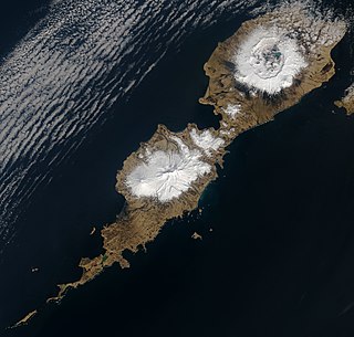
Umnak is one of the Fox Islands of the Aleutian Islands. With 686.01 square miles (1,776.76 km2) of land area, it is the third largest island in the Aleutian archipelago and the 19th largest island in the United States. The island is home to a large volcanic caldera on Mount Okmok and the only field of geysers in Alaska. It is separated from Unalaska Island by Umnak Pass. In 2000, Umnak was permanently inhabited by only 39 people and by 2010, around 18, placing the settlement of Nikolski in difficulty and its school was closed.

<span class="mw-page-title-main">Aleutian Islands campaign</span> World War II campaign between Allied and Imperial Japanese forces

The Aleutian Islands campaign was a military campaign fought between 3 June 1942 and 15 August 1943 on and around the Aleutian Islands in the American Theater of World War II. It was the only military campaign of World War II fought on North American soil.

<span class="mw-page-title-main">Eareckson Air Station</span> US Air Force military airport on Shemya island in the Aleutian Islands, Alaska

Eareckson Air Station, formerly Shemya Air Force Base, is a United States Air Force military airport located on the island of Shemya, in the Alaskan Aleutian Islands.

<span class="mw-page-title-main">Eleventh Air Force</span> US Air Force division in Alaska

The Eleventh Air Force (11 AF) is a Numbered Air Force of the United States Air Force Pacific Air Forces (PACAF). It is headquartered at Joint Base Elmendorf–Richardson, Alaska.

<span class="mw-page-title-main">Alaskan Air Command</span> Inactive United States Air Force unit

The Alaskan Air Command (AAC) is an inactive United States Air Force Major Command originally established in 1942 under the United States Army Air Forces. Its mission was to organize and administer the air defense system of Alaska, exercise direct control of all active measures, and coordinate all passive means of air defense. In addition, the command also supported Strategic Air Command elements operating through and around Alaska. It was redesignated Eleventh Air Force on 9 August 1990 and, concurrently, status changed from a major command of the United States Air Force to a subordinate organization of Pacific Air Forces.

<span class="mw-page-title-main">Marks Air Force Base</span> Airport in Nome, Alaska

Marks Air Force Base is a former United States Air Force facility located two nautical miles (4 km) west of the central business district of Nome, a city in the Nome Census Area of the U.S. state of Alaska. It was named in honor of Major Jack S. Marks, a United States Army Air Forces pilot based at Ladd Army Airfield who died when his aircraft was shot down over the Aleutians in July 1942. Following its closure, it was redeveloped into Nome Airport.

<span class="mw-page-title-main">343d Wing</span> Military unit

The 343d Wing is an inactive United States Air Force unit. Its last assignment was with Pacific Air Forces at Eielson Air Force Base, Alaska, where it was inactivated on 20 August 1993. The unit was formed at Eielson as the 343d Composite Wing and activated in October 1981 to replace the 5010th Combat Support Group. It operated both fighter and forward air control aircraft. In 1991, it also became the administrator for periodic Exercise Cope Thunder operations, which moved to Alaska from the Philippines after the eruption of Mount Pinatubo resulted in the evacuation of units from Clark Air Base When the wing was inactivated, it was replaced at Eielson by the 354th Fighter Wing.
<span class="mw-page-title-main">Battle of Dutch Harbor</span> 1942 aerial bombing of a U.S. Army base on Amaknak Island, Alaska by the Japanese Navy

The Battle of Dutch Harbor took place on 3-4 June 1942, when the Imperial Japanese Navy launched two aircraft carrier raids on the Dutch Harbor Naval Operating Base and U.S. Army Fort Mears at Dutch Harbor on Amaknak Island, opening the Aleutian Islands campaign of World War II. The bombing marked the first aerial attack by an enemy on the continental United States and was the second time in history that the continental U.S. was bombed by someone working for a foreign power, the first being the accidental bombing of Naco, Arizona, in 1929.

<span class="mw-page-title-main">Cape Field at Fort Glenn</span> United States historic place

Cape Field at Fort Glenn was a military site significant for its role in World War II. It consists of Fort Glenn, an airfield of the United States Army Air Corps later renamed Cape Air Force Base, and the adjacent Naval Air Facility Otter Point, both located on Umnak Island in the Aleutian Islands of southwestern Alaska. The site was listed on the National Register of Historic Places and declared a National Historic Landmark in 1987.

During World War II, Alaska was a major United States Army Air Forces (USAAF) location for personnel, aircraft, and airfields to support Lend-Lease aid for the Soviet Union. In addition, it was in Alaska that the Empire of Japan bombed and seized United States soil and as a result the USAAF was actively engaged in combat operations against them.
<span class="mw-page-title-main">North Field (Tinian)</span> Former World War II airfield on Tinian in the Mariana Islands

North Field was a World War II airfield on Tinian in the Mariana Islands. Abandoned after the war, today North Field is a tourist attraction. Along with several adjacent beaches on which U.S. Marines landed during the Battle of Tinian, the airfield is the major component of the National Historic Landmark District Tinian Landing Beaches, Ushi Point Field, Tinian Island.

<span class="mw-page-title-main">Thornbrough Air Force Base</span> Airport

Thornbrough Air Force Base is a former facility of the United States Air Force in Cold Bay, Alaska. Following its closure, it was redeveloped into Cold Bay Airport.

<span class="mw-page-title-main">Lakeland Army Air Field</span>

Lakeland Army Airfield, was a World War II United States Army Air Force located 5.3 miles southwest of Lakeland, Florida. From 1960 to 2017 it was Lakeland Linder Regional Airport. In 2017 it was renamed Lakeland Linder International Airport.

Amchitka Air Force Base is an abandoned Air Force Base located on Amchitka, in the Rat Islands group of the Aleutian Islands in southwest Alaska.

Alexai Point Army Airfield is an abandoned World War II airfield with two runways laid across Alexai Point on Attu Island, Alaska. The remains of the Seabee built airbase are located about 4 miles east of the closed Casco Cove Coast Guard Station, directly across Massacre Bay.

<span class="mw-page-title-main">Elmendorf Air Force Base</span> United States military facility in Anchorage, Alaska

Elmendorf Air Force Base is a United States Air Force (USAF) facility in Anchorage, Alaska. Originally known as Elmendorf Field, it became Elmendorf Air Force Base after World War II.

<span class="mw-page-title-main">344th Fighter Squadron</span> Military unit

The 344th Fighter Squadron is an inactive United States Air Force unit. Its last assignment was with 343d Fighter Group stationed at Shemya Army Airfield, Alaska Territory.
<span class="mw-page-title-main">Naval Air Facility Adak</span> United States Navy airport in the U.S. state of Alaska

Naval Air Facility Adak, was a United States Navy airport located west of Adak, on Adak Island in the U.S. state of Alaska. After its closure in 1997, it was reopened as Adak Airport. The facility was designated a National Historic Landmark for its role in World War II, although most of its elements from that period have been demolished or lie in ruins.
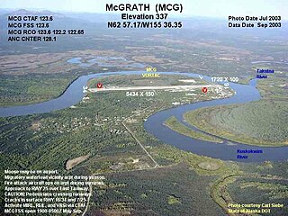
<span class="mw-page-title-main">McGrath Army Airbase</span> Airport

McGrath Army Airbase is former United States Army airbase located in McGrath, a city in the Yukon-Koyukuk Census Area of the U.S. state of Alaska.

References

PD-icon.svg This article incorporates public domain material from the Air Force Historical Research Agency

  1. 1 2 3 4 "Cape Field at Fort Glenn". National Historic Landmark summary listing. National Park Service. Archived from the original on 2011-06-06. Retrieved 2008-01-10. If link is not working, a cached version as of 2008-01-09 [ permanent dead link ] is available from Google.
  2. Note: A National Register of Historic Places Inventory-Nomination document should be available upon request from the National Park Service for this site, but it appears not to be available on-line from the NPS Focus search site Archived 2012-08-03 at the Wayback Machine .
  3. 1 2 3 4 5 6 7 8 Chloe, John Hale, (1984), Top Cover for America. the Air Force in Alaska. 1920–1983, Pictorial Histories Publishing Company, ISBN   0-933126-47-6
  4. "HISTORY OF THE ELEVENTH AIR FORCE". Eleventh Air Force. Archived from the original on 17 February 2015. Retrieved 15 September 2015.
  5. 1 2 3 Fort Glenn Army Airfield / Naval Air Facility Otter Point, Umnak Island, Alaska
  6. AFHRA Document 00001959
  7. AFHRA Document 00001996
  8. "Alaska volcano erupts; island residents evacuated". Reuters. July 13, 2008. Retrieved 2008-07-13.