Fort Worth, Virginia

Last updated
Fort Worth
Part of the Civil War defenses of Washington, D.C.
Alexandria, Virginia
Coordinates 38°48′54″N77°05′56″W / 38.815°N 77.099°W / 38.815; -77.099 Coordinates: 38°48′54″N77°05′56″W / 38.815°N 77.099°W / 38.815; -77.099
TypeEarthwork fort
Site information
Controlled by Union Army
ConditionDismantled
Site history
Built1861
Built by U.S. Army Corps of Engineers
In use1861–1865
MaterialsEarth, timber
Demolished1865
Battles/wars American Civil War

Fort Worth was a timber and earthwork fortification constructed west of Alexandria, Virginia as part of the defenses of Washington, D.C. during the American Civil War.

Contents

Built in the weeks following the Union defeat at Bull Run, Fort Worth was situated on a hill north of Hunting Creek, and Cameron Run, (which feeds into it). From its position on one of the highest points west of Alexandria, the fort overlooked the Orange and Alexandria Railroad, the Little River Turnpike, and the southern approaches to the city of Alexandria, the largest settlement in Union-occupied Northern Virginia. In modern times, the site of Fort Worth sits within the boundaries the City of Alexandria (the land west of Quaker Lane, was annexed from Fairfax County in the 1950s) just off Seminary Road. Fort Worth Ave, a residential street approximates Fort Worth's Civil War location.

It was named for William Jenkins Worth.

Occupation of Alexandria

The occupation of Northern Virginia was peaceful, with the sole exception of the town of Alexandria. There, as Colonel Elmer E. Ellsworth, commander of the New York Fire Zouaves (11th New York Volunteer Infantry Regiment), entered a local hotel to remove the Confederate flag flying above it, he was shot and killed by James Jackson, the proprietor. Ellsworth was one of the first men killed in the American Civil War. [1] Throughout the remainder of the war, Alexandria would lean strongly towards the Confederate government, necessitating continued occupation by a Union garrison. [2]

Washington D.C. Fortifications

Washington D.C. Fortifications map 1865 Washington.jpg
Washington D.C. Fortifications map

Over the seven weeks that followed the occupation of northern Virginia, forts were constructed along the banks of the Potomac River and at the approaches to each of the three major bridges (Chain Bridge, Long Bridge, and Aqueduct Bridge) connecting Virginia to Washington and Georgetown. [3]

While the Potomac River forts were being built, planning and surveying was ordered for an enormous new ring of forts to protect the city. Unlike the fortifications under construction, the new forts would defend the city in all directions, not just the most direct route through Arlington. In mid-July, this work was interrupted by the First Battle of Bull Run. As the Army of Northeastern Virginia marched south to Manassas, the soldiers previously assigned to construction duties marched instead to battle. In the days that followed the Union defeat at Bull Run, panicked efforts were made to defend Washington from what was perceived as an imminent Confederate attack. [4] The makeshift trenches and earthworks that resulted were largely confined to Arlington and the direct approaches to Washington.

On July 26, 1861, five days after the battle, Maj. Gen. George B. McClellan was named commander of the military district of Washington and the subsequently renamed Army of the Potomac. Upon arriving in Washington, McClellan was appalled by the condition of the city's defenses.

In no quarter were the dispositions for defense such as to offer a vigorous resistance to a respectable body of the enemy, either in the position and numbers of the troops or the number and character of the defensive works... not a single defensive work had been commenced on the Maryland side. There was nothing to prevent the enemy shelling the city from heights within easy range, which could be occupied by a hostile column almost without resistance. [5]

To remedy the situation, one of McClellan's first orders upon taking command was to greatly expand the defenses of Washington. At all points of the compass, forts and entrenchments would be constructed in sufficient strength to defeat any attack. [6] Alexandria, which contained the southern terminus of the Chesapeake and Ohio Canal and one of the largest ports in the Chesapeake Bay, was an object of "anxious study." [7]

Planning and construction

In August 1861, Gen. McClellan assigned Gen. John G. Barnard to take charge of construction to begin creation of a complete system of defenses. [8]

Gen. Horatio Wright, who had overseen the construction of Fort Ellsworth, and Gen. John Newton, who was in charge of the forts south of Four Mile Run, supervised the construction and managed the flow of men and materials. [9] The fort was constructed upon Vaucluse, a plantation that was seized from the Fairfax family.

Construction began on September 1, 1861. The perimeter was 463 yards, with places for 25 guns, including one 100-pound Parrott rifle. [10]

Wartime use

On Wednesday, November 27, 1861, Col. J. Howard Kitching marched with the 6th New York Artillery to occupy the Fort, and complete construction. [11] [12]

My dearest L : I received your lovely letter, and would have answered it immediately, but that I was taken sick the day after I got it, and have been sick ever since. We received orders late Wednesday night to move our two companies which had been guarding Fort Ellsworth to Fort Worth, the next morning, Thanksgiving Day. So we were obliged to give up our comfortable quarters, and take up our line of march for an unfinished earthwork, on the outskirts of our line of fortifications; where instead of spending our time drilling on the guns, and teaching our men something useful, we are forced to take up our axes and shovels, and go to work upon the Fort. In Ellsworth we had very nice quarters within the works, and everything convenient, and were able to crib a little time every day to ourselves. Here we are encamped on a side hill, outside the work, the mud about eight inches deep, very little to eat, and plenty of work. If you could just look in upon us now, and see how I live, you would scarcely believe your eyes. Major Doull has not, as yet, received his tents, and he and I have to occupy the same tent, which of course is pitched right in the mud, such things as boards for flooring being quite unheard of, and it is so full of trunks, cooking utensils, our beds, etc., besides our saddles, which we have to keep there, having no stable, that it is almost impossible to move around. We almost froze the first night, and as I was sick in bed, and felt the cold very much, we foraged around and found a little cast-iron stove, which we rigged up in the tent, and except that we were smoked out like two woodchucks nine or ten times in twenty-four hours, we were more comfortable. Then our "Bill of Fare," my I told the boys this morning when we succeeded in getting our morning meal (a piece of government beef and a tin cup of coffee) at one o'clock, after running around in the cold and snow for three or four hours, that I thought I would give about one month's pay to have one good meal at home. You must not think that we complain, however.

They moved on to Fort Blenker, on Friday January 17, 1862. [13]

Fort Blenker, January 19, 1862. .... On Friday morning, while we were all hard at work in Fort Worth, Major Doull received orders to march, immediately to this post with two companies. In less than two hours' time, we had torn down our nice winter quarters, which we had built with so much trouble; left our nice log cook-houses and stables, and were on the march; I, in command of the troops, Doull having gone ahead to arrange for our relieving the troops at Blenker.

Related Research Articles

<span class="mw-page-title-main">George B. McClellan</span> American major general (1826–1885)

George Brinton McClellan was an American soldier, Civil War Union general, civil engineer, railroad executive, and politician who served as the 24th governor of New Jersey. A graduate of West Point, McClellan served with distinction during the Mexican–American War (1846–1848), and later left the Army to serve as an executive and engineer on railroads until the outbreak of the American Civil War (1861–1865). Early in the conflict, McClellan was appointed to the rank of major general and played an important role in raising a well-trained and disciplined army, which would become the Army of the Potomac in the Eastern Theater; he served a brief period as Commanding General of the United States Army of the Union Army.

<span class="mw-page-title-main">Army of the Potomac</span> Principal Union army in the eastern theatre of the American Civil War

The Army of the Potomac was the principal Union Army in the Eastern Theater of the American Civil War. It was created in July 1861 shortly after the First Battle of Bull Run and was disbanded in June 1865 following the surrender of the Confederate Army of Northern Virginia in April.

<span class="mw-page-title-main">Peninsula campaign</span> 1862 Union offensive in southeast Virginia during the American Civil War

The Peninsula campaign of the American Civil War was a major Union operation launched in southeastern Virginia from March to July 1862, the first large-scale offensive in the Eastern Theater. The operation, commanded by Major General George B. McClellan, was an amphibious turning movement against the Confederate States Army in Northern Virginia, intended to capture the Confederate capital of Richmond. McClellan was initially successful against the equally cautious General Joseph E. Johnston, but the emergence of the more aggressive General Robert E. Lee turned the subsequent Seven Days Battles into a humiliating Union defeat.

<span class="mw-page-title-main">Eastern theater of the American Civil War</span> Military operations in Virginia, Maryland and Pennsylvania

The eastern theater of the American Civil War consisted of the major military and naval operations in the states of Virginia, West Virginia, Maryland, and Pennsylvania, the District of Columbia, and the coastal fortifications and seaports of North Carolina.
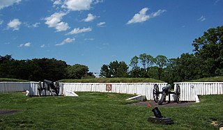
<span class="mw-page-title-main">Fort Ward (Virginia)</span> United States historic place

Fort Ward is a former Union Army installation now located in the city of Alexandria in the U.S. state of Virginia. It was the fifth largest fort built to defend Washington, D.C. in the American Civil War. It is currently well-preserved with 90-95% of its earthen walls intact.

<span class="mw-page-title-main">Fort Reynolds (Virginia)</span>

Fort Reynolds was a Union Army redoubt built as part of the defenses of Washington, D.C., in the American Civil War.

<span class="mw-page-title-main">Arlington Line</span>

The Arlington Line was a series of fortifications that the Union Army erected in Alexandria County, Virginia, to protect the City of Washington during the American Civil War.

<span class="mw-page-title-main">Fort Stanton (Washington, D.C.)</span> Historical fort in Washington, D.C., US

Fort Stanton was a Civil War-era fortification constructed in the hills above Anacostia in the District of Columbia, USA, and was intended to prevent Confederate artillery from threatening the Washington Navy Yard. It also guarded the approach to the bridge that connected Anacostia with Washington. Built in 1861, the fort was expanded throughout the war and was joined by two subsidiary forts: Fort Ricketts and Fort Snyder. Following the surrender of the Army of Northern Virginia, it was dismantled and the land returned to its original owner. It never saw combat. Abandoned after the war, the site of the fort was planned to be part of a grand "Fort Circle" park system encircling the city of Washington. Though this system of interconnected parks never was fully implemented, the site of the fort is today a park maintained by the National Park Service, and a historical marker stands near the fort's original location.

<span class="mw-page-title-main">Fort Bayard (Washington, D.C.)</span> Historic fort in Washington, D.C.

Fort Bayard was an earthwork fort constructed in 1861 northwest of Tenleytown in the District of Columbia as part of the defenses of Washington, D.C., during the American Civil War. It never faced major opposition during the conflict and was decommissioned following the surrender of Robert E. Lee's Army of Northern Virginia. Named after Brigadier General George Dashiell Bayard, who was killed at the Battle of Fredericksburg, the site of the fort is in Boundary Park, located at the intersection of River Road and Western Avenue NW in Washington, D.C., and is maintained by the U.S. National Park Service. No trace of the fort remains, though a marker commemorating its existence has been erected by the Park Service.

<span class="mw-page-title-main">Fort Corcoran</span>

Fort Corcoran was a wood-and-earthwork fortification constructed by the Union Army in northern Virginia as part of the defenses of Washington, D.C. during the American Civil War. Built in 1861, shortly after the occupation of Arlington, Virginia by Union forces, it protected the southern end of the Aqueduct Bridge and overlooked the Potomac River and Theodore Roosevelt Island, known as Mason's Island.

<span class="mw-page-title-main">Fort Runyon</span>

Fort Runyon was a timber and earthwork fort constructed by the Union Army following the occupation of northern Virginia in the American Civil War in order to defend the southern approaches to the Long Bridge as part of the defenses of Washington, D.C. during that war. The Columbia Turnpike and Alexandria and Loudon Railroad ran through the pentagonal structure, which controlled access to Washington via the Long Bridge. With a perimeter of almost 1,500 yards (1,400 m), and due to its unusual shape it was approximately the same size, shape, and in almost the same location as the Pentagon, built 80 years later.

<span class="mw-page-title-main">Fort Jackson (Virginia)</span> Historical fort in Virginia

Fort Jackson was an American Civil War-era fortification in Virginia that defended the southern end of the Long Bridge, near Washington, D.C. Long Bridge connected Washington, D.C. to Northern Virginia and served as a vital transportation artery for the Union Army during the war. Fort Jackson was named for Jackson City, a seedy suburb of Washington that had been established on the south side of the Long Bridge in 1835. It was built in the days immediately following the Union Army's occupation of Northern Virginia in May 1861. The fort was initially armed with four cannon used to protect the bridge, but these were removed after the completion of the Arlington Line, a line of defenses built to the south. After 1862, the fort lacked weapons except for small arms and consisted of a wooden palisade backed by earthworks. Two cannon were restored to the fort in 1864 following the Battle of Fort Stevens. The garrison consisted of a single company of Union soldiers who inspected traffic crossing the bridge and guarded it from potential saboteurs.

<span class="mw-page-title-main">Fort Lyon (Virginia)</span> Historic fort in Virginia, USA

Fort Lyon was a timber and earthwork fortification constructed south of Alexandria, Virginia as part of the defenses of Washington, D.C. during the American Civil War. Built in the weeks following the Union defeat at Bull Run, Fort Lyon was situated on Ballenger's Hill south of Hunting Creek, and Cameron Run, near Mount Eagle. From its position on one of the highest points south of Alexandria, the fort overlooked Telegraph Road, the Columbia Turnpike, the Orange and Alexandria Railroad, the Little River Turnpike, and the southern approaches to the city of Alexandria, the largest settlement in Union-occupied Northern Virginia.
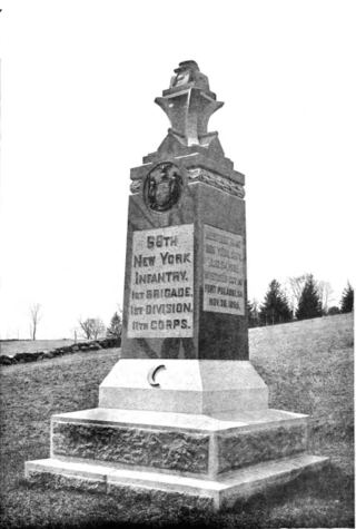
<span class="mw-page-title-main">68th New York Infantry Regiment</span> American infantry regiment

The 68th New York Infantry Regiment served in the Union Army during the American Civil War. Also known as the Cameron Rifles or the Second German Rifle Regiment, the men were mostly German immigrants. Organized in July 1861, three months after the outbreak of war, the 68th saw service in the Eastern and Western theaters.

<span class="mw-page-title-main">Centreville Military Railroad</span>

The Centreville Military Railroad was a 5.5-mile (8.9 km) spur running from the Orange and Alexandria Railroad east of Manassas Junction across Bull Run and up the south side of the Centreville Plateau. Built by the Confederate States Army between November 1861 and February 1862, it was the first exclusively military railroad. Ultimately, the Centreville Military Railroad reached a point near a modern McDonald's restaurant on Virginia State Route 28, south of the modern junction with U.S. Route 29 in Virginia.

<span class="mw-page-title-main">Fort Ellsworth</span>

Fort Ellsworth was a timber and earthwork fortification constructed west of Alexandria, Virginia, as part of the defenses of Washington, D.C. during the American Civil War. Built in the weeks following the Union defeat at Bull Run, Fort Ellsworth was situated on a hill north of Hunting Creek, and Cameron Run,. From its position on one of the highest points west of Alexandria, the fort overlooked the Orange and Alexandria Railroad, the Little River Turnpike, and the southern approaches to the city of Alexandria, the largest settlement in Union-occupied Northern Virginia.

<span class="mw-page-title-main">Arlington Ridge, Virginia</span> Neighborhood in Arlington, Virginia

Arlington Ridge is a neighborhood in Arlington County, Virginia, United States. It is bordered on the north by The Pentagon, on the west by the Army Navy Country Club, and on the south the City of Alexandria. The main thoroughfare is the eponymous Arlington Ridge Road, a mansion-lined boulevard that, due to its high elevation, offers picturesque views of Washington, D.C., and the surrounding areas. Also known simply as "The Ridge", this community is home to two historical points of interest: the Hume School, currently the site of the Arlington Country Historical Society and Museum, and Fort Scott, currently the site of Fort Scott Park.

<span class="mw-page-title-main">Fort Willard</span>

Fort Willard is a former Union Army installation now located in the Belle Haven area of Fairfax County in the U.S. state of Virginia. It is currently undergoing preservation treatment to protect its earthen walls and trenches.

Fort O'Rourke is a former Union Army installation now located in the Belle Haven area of Fairfax County in the U.S. state of Virginia. It was the southernmost fort built to defend Washington, D.C. in the American Civil War.

<span class="mw-page-title-main">Fort Farnsworth</span>

Fort Farnsworth is a former Union Army installation now located in the Huntington area of Fairfax County, Virginia. It was a timber and earthwork fortification constructed south of Alexandria, Virginia as part of the defenses of Washington, D.C. during the American Civil War. Nothing survives of the fort's structure as the Huntington Station of the Washington Metro occupies Fort Farnsworth's former hilltop site.

References

  1. Ames W. Williams, "The Occupation of Alexandria," Virginia Cavalcade, Volume 11, (Winter 1961–62), pp. 33–34.
  2. "Alexandria Library, Diary of Henry B. Whittington, May 31, 1861".
  3. J.G. Barnard and W.F. Barry, "Report of the Engineer and Artillery Operations of the Army of the Potomac from Its Organization to the Close of the Peninsular Campaign," (New York: D. Van Nostrand, 1863), pp. 9–10.
  4. Margaret Leech, Reveille in Washington (New York: Harper & Brothers Publishers, 1941), pp. 101–110.
  5. U.S., War Department, The War of the Rebellion: A Compilation of the Official Records of the Union and Confederate Armies, 70 Volumes (Washington, DC: The Government Printing Office, 1880–1901) I, Volume 5, p. 11.
  6. Official Records, Series I, Volume 5, Chapter 14, p. 679.
  7. Official Records, Series I, Volume 5, Chapter 14, p. 680.
  8. Civil War Defences, Chronology, NPS, 29-Oct-2004 Archived May 21, 2009, at the Wayback Machine
  9. Official Records, Series I, Volume 5, Chapter 14, p. 684.
  10. Cooling III, Benjamin Franklin; Owen II, Walton H. (6 October 2009). Mr. Lincoln's Forts: A Guide to the Civil War Defenses of Washington. Scarecrow Press. pp. 70–72. ISBN   978-0-8108-6307-1.
  11. Kitching, J. Howard. "More than a Conqueror". p. 31.
  12. "Fort Ward Museum, "Voices from the Past." Kitching, J. Howard Letter, December 3, 1861".
  13. Kitching, J. Howard. "More than a Conqueror". p. 39.