
Rock Creek Park is a large urban park that bisects the Northwest quadrant of Washington, D.C. The park was created by an Act of Congress in 1890 and today is administered by the National Park Service. In addition to the park proper, the Rock Creek administrative unit of the National Park Service administers various other federally owned properties in the District of Columbia located to the north and west of the National Mall, including Meridian Hill Park on 16th Street, N.W., the Old Stone House in Georgetown, and certain of the Fort Circle Parks, a series of batteries and forts encircling the District of Columbia for its defense during the U.S. Civil War.
The Potomac Heritage Trail, also known as the Potomac Heritage National Scenic Trail or the PHT, is a designated National Scenic Trail corridor spanning parts of the mid-Atlantic region of the United States that will connect various trails and historic sites in Virginia, Maryland, Pennsylvania, and the District of Columbia. The trail network includes 710 miles (1,140 km) of existing and planned sections, tracing the natural, historical, and cultural features of the Potomac River corridor, the upper Ohio River watershed in Pennsylvania and western Maryland, and a portion of the Rappahannock River watershed in Virginia. The trail is managed by the National Park Service and is one of three National Trails that are official NPS units.

Rock Creek is a free-flowing tributary of the Potomac River that empties into the Atlantic Ocean via the Chesapeake Bay. The 32.6-mile (52.5 km) creek drains about 76.5 square miles (198 km2). Its final quarter-mile is affected by tides.

The Monocacy River is a free-flowing left tributary to the Potomac River, which empties into the Atlantic Ocean via the Chesapeake Bay. The river is 58.5 miles (94.1 km) long, with a drainage area of about 970 square miles (2,500 km2). It is the largest Maryland tributary to the Potomac.

Fort Monroe is a former military installation in Hampton, Virginia, at Old Point Comfort, the southern tip of the Virginia Peninsula, United States. It is currently managed by partnership between the Fort Monroe Authority for the Commonwealth of Virginia, the National Park Service, and the city of Hampton as the Fort Monroe National Monument. Along with Fort Wool, Fort Monroe originally guarded the navigation channel between the Chesapeake Bay and Hampton Roads—the natural roadstead at the confluence of the Elizabeth, the Nansemond and the James rivers.

The American Battlefield Trust is a charitable organization whose primary focus is in the preservation of battlefields of the Revolutionary War, the War of 1812, and the American Civil War, through the acquisition of battlefield land. The American Battlefield Trust was formerly known as the Civil War Trust. On May 8, 2018, the organization announced the creation of the American Battlefield Trust as the umbrella organization for two divisions, the Civil War Trust and the Revolutionary War Trust, which was formerly known as "Campaign 1776."

Fort Washington, located near the community of Fort Washington, Maryland, was for many decades the only defensive fort protecting Washington, D.C. The original fort, overlooking the Potomac River, was completed in 1809, and was begun as Fort Warburton, but renamed in 1808. During the War of 1812, the fort was destroyed by its own garrison during a British advance.
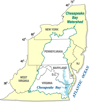
The Chesapeake Bay Program is the regional partnership that directs and conducts the restoration of the Chesapeake Bay in the United States. As a partnership, the Chesapeake Bay Program brings together members of various state, federal, academic and local watershed organizations to build and adopt policies that support Chesapeake Bay restoration. By combining the resources and unique strengths of each individual organization, the Chesapeake Bay Program is able to follow a unified plan for restoration. The program office is located in Annapolis, Maryland.
Fort Dupont Park is a 376-acre (1.52 km2) wooded park under the management of the National Park Service located in Washington, DC. The name of the park comes from the old Civil War earthwork fort that lies within the park. The fort was one of several designed to defend Washington from a Confederate attack during the Civil War. There are few remains of the actual fortifications.

Fort DeRussy is a United States military reservation in the Waikiki area of Honolulu, Hawaii, under the jurisdiction of the United States Army. Unfenced and largely open to public traffic, the installation consists mainly of landscaped greenspace. The former Battery Randolph now houses the U.S. Army Museum of Hawaiʻi, which is open to the public. The Hale Koa Hotel, an Armed Forces Recreation Center, and the Daniel K. Inouye Asia-Pacific Center for Security Studies are also located on Fort DeRussy.
The Battle of Fort De Russy, Louisiana, was the first engagement in the Red River Campaign of March–May 1864 in the American Civil War.

Fort Kearny was a fort constructed during the American Civil War as part of the defenses of Washington, D.C. Located near Tenleytown, in the District of Columbia, it filled the gap between Fort Reno and Fort DeRussy north of the city of Washington. The fort was named in honor of Maj. Gen. Philip Kearny of the Union Army, who was killed at the Battle of Chantilly on September 1, 1862. Three batteries of guns supported the fort, and are considered part of the fort's defenses.

René Edward De Russy was an engineer, military educator, and career United States Army officer who was responsible for constructing many Eastern United States coastal fortifications, as well as some forts on the West Coast. He also served as superintendent of the United States Military Academy. He was promoted to brigadier general during the American Civil War.

The Civil War Defenses of Washington were a group of Union Army fortifications that protected the federal capital city, Washington, D.C., from invasion by the Confederate States Army during the American Civil War.

Battery Kemble Park is a park in Northwest Washington D.C., administered by the National Park Service.
16th Indiana Battery Light Artillery was an artillery battery that served in the Union Army during the American Civil War.
The Civil War Trust's Civil War Discovery Trail is a heritage tourism program that links more than 600 U.S. Civil War sites in more than 30 states. The program is one of the White House Millennium Council's sixteen flagship National Millennium Trails. Sites on the trail include battlefields, museums, historic sites, forts and cemeteries.

Francis Scott Key Memorial is a park and memorial located in the District of Columbia neighborhood of Georgetown; at the intersection of 34th and M Streets, NW. This 0.77 acre site is administered by the National Park Service as a part of Rock Creek Park but is not contiguous with that park. Situated adjacent to the northeast corner of the Francis Scott Key Bridge, the park abuts to Chesapeake and Ohio Canal Towpath.
Fort Slocum was one of seven temporary earthwork forts, part of the Civil War Defenses of Washington, D.C., during the Civil War, built in the Northeast quadrant of the city after the beginning of the war by the Union Army to protect the city from the Confederate Army. From west to east, the forts were as follow: Fort Slocum, Fort Totten, Fort Slemmer, Fort Bunker Hill, Fort Saratoga, Fort Thayer and Fort Lincoln.
Oxon Run is a tributary stream of Oxon Creek and the Potomac River in Prince George's County, Maryland, and Washington, D.C.


![Extract from Topographical map, 1st Brigade, defenses north of Potomac, Washington, D.C., 1863, by Robert Adolfo Chodasiewicz [R. A. Hodasevich]. Fort DeRussy -- Topographical map, 1st Brigade, defenses north of Potomac, Washington, D.C. (West).jpg](http://upload.wikimedia.org/wikipedia/commons/thumb/c/c1/Fort_DeRussy_%E2%80%94_Topographical_map%2C_1st_Brigade%2C_defenses_north_of_Potomac%2C_Washington%2C_D.C._%28West%29.jpg/100px-Fort_DeRussy_%E2%80%94_Topographical_map%2C_1st_Brigade%2C_defenses_north_of_Potomac%2C_Washington%2C_D.C._%28West%29.jpg)