Foxfire, North Carolina

Last updated

Foxfire, North Carolina
Moore County North Carolina incorporated and unincorporated areas Foxfire highlighted.svg
Location in Moore County and the state of North Carolina.
Coordinates: 35°10′44″N79°33′50″W / 35.17889°N 79.56389°W / 35.17889; -79.56389
Country United States
State North Carolina
County Moore
Area
[1]
  Total7.13 sq mi (18.47 km2)
  Land7.07 sq mi (18.31 km2)
  Water0.06 sq mi (0.15 km2)
Elevation
[2]
486 ft (148 m)
Population
 (2020)
  Total1,288
  Density182.18/sq mi (70.34/km2)
Time zone UTC-5 (Eastern (EST))
  Summer (DST) UTC-4 (EDT)
ZIP code
27281
Area codes 910, 472
FIPS code 37-24570 [3]
GNIS feature ID2407459 [2]
Website www.foxfirenc.com

Foxfire is a village in Moore County, North Carolina, United States. The population was 902 at the 2010 census.

Contents

Geography

According to the United States Census Bureau, the village has a total area of 2.9 square miles (7.5 km2), of which 2.9 square miles (7.5 km2) is land and 0.1 square miles (0.26 km2) (2.05%) is water.

Foxfire is one of the few incorporated areas of North Carolina that does not host any primary numbered state highways (0-999).

Demographics

Historical population
CensusPop.Note
1980 153
1990 334118.3%
2000 47441.9%
2010 90290.3%
2020 1,28842.8%
U.S. Decennial Census [4]

2020 census

Foxfire racial composition [5]
RaceNumberPercentage
White (non-Hispanic)1,07683.54%
Black or African American (non-Hispanic)544.19%
Native American 131.01%
Asian 181.4%
Pacific Islander 10.08%
Other/Mixed 705.43%
Hispanic or Latino 564.35%

As of the 2020 United States census, there were 1,288 people, 646 households, and 402 families residing in the village.

2000 census

As of the census [3] of 2000, there were 474 people, 222 households, and 172 families residing in the village. The population density was 165.4 inhabitants per square mile (63.9/km2). There were 324 housing units at an average density of 113.1 per square mile (43.7/km2). The racial makeup of the village was 98.31% White, 1.27% African American and 0.42% Asian. Hispanic or Latino of any race were 1.05% of the population.

There were 222 households, out of which 12.2% had children under the age of 18 living with them, 73.9% were married couples living together, 2.3% had a female householder with no husband present, and 22.1% were non-families. 19.8% of all households were made up of individuals, and 11.7% had someone living alone who was 65 years of age or older. The average household size was 2.14 and the average family size was 2.40.

In the village, the population was spread out, with 11.0% under the age of 18, 3.0% from 18 to 24, 15.4% from 25 to 44, 22.8% from 45 to 64, and 47.9% who were 65 years of age or older. The median age was 64 years. For every 100 females, there were 100.0 males. For every 100 females age 18 and over, there were 98.1 males.

The median income for a household in the village was $54,750, and the median income for a family was $60,625. Males had a median income of $51,042 versus $24,643 for females. The per capita income for the village was $29,030. About 1.7% of families and 1.6% of the population were below the poverty line, including none of those under the age of eighteen or sixty-five or over.

Related Research Articles

<span class="mw-page-title-main">Valmeyer, Illinois</span> Village in Illinois, United States

Valmeyer is a village in Monroe County, Illinois, United States. The population was 1,233 at the 2020 census. It was originally located in the American Bottom floodplain of the Mississippi River but now occupies higher land to the east.

<span class="mw-page-title-main">Sunfield, Michigan</span> Village in Michigan, United States

Sunfield is a village in Eaton County in the U.S. state of Michigan. The population was 518 at the 2020 U.S. Census. The village is located within Sunfield Township.
<span class="mw-page-title-main">Village of Four Seasons, Missouri</span> Village in Missouri, United States

Village of Four Seasons is a village in Camden County, Missouri, United States. The population was 2,217 at the 2010 census. The village is situated on the shores of Lake of the Ozarks and is a popular tourist destination along with the other communities in the area.

<span class="mw-page-title-main">Parkdale, Missouri</span> Village in Missouri, United States

Parkdale is a village in northern Jefferson County, Missouri, United States. The population was 170 at the 2010 census.

<span class="mw-page-title-main">Scotsdale, Missouri</span> Village in Missouri, United States

Scotsdale is a village in Jefferson County, Missouri, United States. The population was 222 at the 2010 census.

<span class="mw-page-title-main">Innsbrook, Missouri</span> Village in Missouri, United States

Innsbrook is a village in Warren County, Missouri, United States. The population was 552 at the 2010 census. The village of Innsbrook is comprised almost entirely by Innsbrook Resort—a private, gated community. The village was founded in 1998.
<span class="mw-page-title-main">Grandfather, North Carolina</span> Village in North Carolina, United States

Grandfather is a village in Avery County, North Carolina, United States. It is the namesake of Grandfather Mountain. The village is a fully gated community within Grandfather Golf and Country Club, located along NC 105. The population was 24 at the 2020 census.

<span class="mw-page-title-main">South Rosemary, North Carolina</span> Census-designated place in North Carolina, United States

South Rosemary is an unincorporated area and census-designated place (CDP) in Halifax County, North Carolina, United States. The population was 2,836 at the 2010 census. It is part of the Roanoke Rapids, North Carolina Micropolitan Statistical Area.

<span class="mw-page-title-main">Whispering Pines, North Carolina</span> Village in North Carolina, United States

Whispering Pines is a village in Moore County, North Carolina, United States. The population was 2,928 at the 2010 census.

<span class="mw-page-title-main">Fort Shawnee, Ohio</span> CDP in Ohio, United States

Fort Shawnee is census-designated place (CDP) in Allen County, Ohio, United States. The population was 6,263 at the 2020 census. It is included in the Lima, Ohio Metropolitan Statistical Area. Fort Shawnee is adjacent to the city of Lima and the village of Cridersville in Auglaize County. In 2012, village residents voted to disincorporate the village. According to the United States Census Bureau, the village had a total area of 7.25 square miles (18.78 km2), of which 7.21 square miles (18.67 km2) is land and 0.04 square miles (0.10 km2) is water.
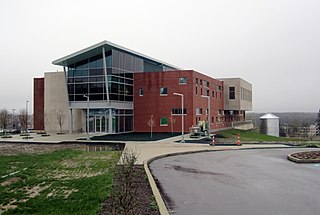
<span class="mw-page-title-main">Highland Hills, Ohio</span> Village in Ohio, United States

Highland Hills is a village in Cuyahoga County, Ohio, United States. The population was 662 at the 2020 census. A suburb of Cleveland, it was formally incorporated in 1990.

<span class="mw-page-title-main">Vinton, Ohio</span> Village in Ohio, United States

Vinton is a village in Gallia County, Ohio, United States. The population was 224 at the 2020 census. It is part of the rural Point Pleasant micropolitan area.

<span class="mw-page-title-main">New Athens, Ohio</span> Village in Ohio, United States

New Athens is a village in Harrison County, Ohio, United States. The population was 222 at the 2020 census.

<span class="mw-page-title-main">Darbyville, Ohio</span> Village in Ohio, United States

Darbyville is a village in Pickaway County, Ohio, United States. The population was 186 at the 2020 census.

<span class="mw-page-title-main">Risingsun, Ohio</span> Village in Ohio, United States

Risingsun is a village in Wood County, Ohio, United States. The population was 541 at the 2020 census.
<span class="mw-page-title-main">Gantt, South Carolina</span> Census-designated place in South Carolina, United States

Gantt is a census-designated place (CDP) in Greenville County, South Carolina, United States. The population was 14,229 at the 2010 census. It is part of the Greenville–Mauldin–Easley Metropolitan Statistical Area and a suburb of the city of Greenville.
<span class="mw-page-title-main">Poplar, Wisconsin</span> Village in Wisconsin, United States

Poplar is a village in Douglas County, Wisconsin, United States. The population was 603 at the 2010 census.

<span class="mw-page-title-main">Footville, Wisconsin</span> Village in Wisconsin, United States

Footville is a village in Rock County, Wisconsin, United States. The population was 772 at the 2020 census.

<span class="mw-page-title-main">Mukwonago (town), Wisconsin</span> Town in Wisconsin, United States

Mukwonago is a town in Waukesha County, Wisconsin, United States. The population was 7,781 at the 2020 census. The Village of Mukwonago is located mostly within the town. The unincorporated community of Jericho is also located in the town.
<span class="mw-page-title-main">Radisson, Wisconsin</span> Village in Wisconsin, United States

Radisson is a village in Sawyer County, Wisconsin, United States, along the Couderay River. The population was 241 at the 2010 census. The village is located within the Town of Radisson and was named in honor of the early French explorer, Pierre-Esprit Radisson (c.1636–1710).

References

  1. "ArcGIS REST Services Directory". United States Census Bureau. Retrieved September 20, 2022.
  2. 1 2 U.S. Geological Survey Geographic Names Information System: Foxfire, North Carolina
  3. 1 2 "U.S. Census website". United States Census Bureau . Retrieved January 31, 2008.
  4. "Census of Population and Housing". Census.gov. Retrieved June 4, 2015.
  5. "Explore Census Data". data.census.gov. Retrieved December 22, 2021.