The town, now known as Robbins, actually began in 1795 when gunsmith Alexander Kennedy and his family left Philadelphia to settle along Bear Creek. Kennedy set up a factory, which produced long rifles for American soldiers, near the site of the present day Robbins Water Plant. The Kennedy Rifle Works continued in operation until 1838 and the place became known as Mechanics Hill.
In 1891, the Durham and Charlotte Railroad connected Gulf in Chatham County to Troy in Montgomery County. The railroad reached Mechanics Hill around 1899. Railroad construction added many jobs and greatly increased the number of settlers. The railroad not only created its own jobs, it generated commerce by providing a ready means of transportation for turpentine, talc, pottery, lumber, agricultural products, and passengers. John B. Lennig was president and owner of the company (frequently misspelled as Lenning). Lennig's tenure with the company was off-and-on for about 12 years. During that time, town lots and streets were designed. A map was registered at the Moore County Register of Deeds Office on March 24, 1900, and the town was named Elise (pronounced A-lise), in honor of Lennig's daughter.
In 1896, the John L. Frye Company, a producer of lumber for the rail and pallet industries, was established. Railroads across the US are supported by cross ties made in Robbins. John Lennig Frye, a past mayor, was named after John B. Lennig, the railroad owner.
Education was a major concern for the citizens of Elise and the surrounding communities. Some local businessmen and Lennig met many times to discuss these concerns. These meetings resulted in the founding of Elise Academy in 1904. The academy had a very proud standing and children from the town, and from other states and countries, made up the first class. Elise Academy operated until 1940, when it was sold to the Moore County Board of Education. In 1940, Kennedy Funeral Home bought the Arrowhead Dormitory to use as the primary funeral location for the town. It is still used for that purpose today in the center of town.
In 1890, the inventor Thomas Edison visited the town to take option on gold mining interests in the Carter's Mill area. Between 1923 and 1924, generators were installed at Carter's Mill, along Bear Creek, adjacent to Elise, and the first power was supplied to this area. In 1924 and 1925, William Cowgill built the first textile plant here, operating it as Moore Mills Textiles Plant. Three different companies operated that mill until September 1930, when Karl Robbins (1892-1960), a Russian-American manufacturer and philanthropist, purchased the mill and renamed it Pinehurst Silk Mills.
In 1935, the town's name was changed again. The name was changed to Hemp, to avoid confusion between Elise and another town in North Carolina that had a similar name. For a while, the train depot had Elise on the track side and Hemp over the mail room side.
Karl Robbins brought great prominence to Hemp. He was responsible for a modern water treatment plant and a wastewater disposal system being completed in 1937. He also provided for recreational facilities, dial telephone service, a new firetruck, and a baseball park. Robbins started a non profit, Pinelands, and gave or loaned the first $400,000 for Research Triangle Park to be started just outside of Raleigh, North Carolina at the request of Governor Luther Hodges, who was a close personal friend of Mayor W.P. Saunders.
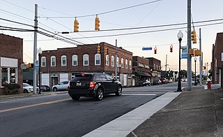
Historic Robbins Depot
In honor of Karl Robbins, the citizens of Hemp changed the name of the town to Robbins. The name of the town officially became Robbins in 1943, by act of the North Carolina General Assembly.
“Robin Sage” the final unconventional warfare exercise that all prospective US Army Special Forces candidates must pass before being awarded the Green Beret, was started in Robbins in 1952 and is partly named after Colonel Jerry Sage.
Later industries included a poultry processing plant, a mobile home manufacturing plant, and several textile mills. Ithaca Industries was a textile manufacturer that produced women's hosiery. At the height of its operation, the plant employed 1,100 people.
Robbins, like other rural towns in the South, suffered a loss to its manufacturing base that escalated during the 1990s. According to the Employment Security Commission, Robbins has lost 1,447 jobs since 1990. With the loss of jobs and manufacturing, the town lost a large portion of its water and sewer customers.
As of the 2020 United States census, there were 1,168 people, 526 households, and 332 families residing in the town.
2000 census
As of the census[4] of 2000, there were 1,195 people, 423 households, and 286 families residing in the city. The population density was 935.1 inhabitants per square mile (361.0/km2). There were 471 housing units at an average density of 368.6 per square mile (142.3/km2). The racial makeup of the city was 63.60% White, 2.34% African American, 0.33% Native American, 0.17% Asian, 0.42% Pacific Islander, 32.30% from other races, and 0.84% from two or more races. Hispanic or Latino of any race were 48.37% of the population.
There were 423 households, out of which 33.8% had children under the age of 18 living with them, 50.1% were married couples living together, 12.1% had a female householder with no husband present, and 32.2% were non-families. 29.1% of all households were made up of individuals, and 16.3% had someone living alone who was 65 years of age or older. The average household size was 2.81 and the average family size was 3.45.
In the city, the population was spread out, with 28.5% under the age of 18, 12.1% from 18 to 24, 28.7% from 25 to 44, 16.2% from 45 to 64, and 14.5% who were 65 years of age or older. The median age was 31 years. For every 100 females, there were 102.2 males. For every 100 females age 18 and over, there were 95.7 males.
The median income for a household in the city was $28,828, and the median income for a family was $33,523. Males had a median income of $21,346 versus $17,391 for females. The per capita income for the city was $14,468. About 18.4% of families and 22.0% of the population were below the poverty line, including 31.1% of those under age 18 and 10.7% of those age 65 or over.
Notable people
Karl Robbins (1892–1960), Namesake of Robbins, North Carolina, owned the textile mill that later became Milliken. Donated generously to the town establishing the water plant and water/wastewater infrastructure. He served as chairman of the Research Triangle Committee during its planning stages and donated over 4,000 acres to the state for the site of the research park. He founded a medical school at Yeshiva University in New York City and was a founder of the Federation of Jewish Philanthropies of New York and a patron of the New York University–Bellevue Medical Center. In 1951 he established the Karl Robbins Scholarship Fund at the Massachusetts Institute of Technology to further textile technology.
Charles E. Brady Jr. (1951–2006), Astronaut, flew on space shuttle STS-78 in 1996 and logged over 405 hours in space.
John Edwards (born 1953), American politician, former US Senator, two-time Presidential candidate, 2004 Vice-Presidential running mate of John Kerry, grew up in Robbins (he was born in Seneca, South Carolina).
Colonel Jerry Sage (1917-1993) Namesake for the US Army Special Forces training "Robin Sage" that started in Robbins 1952. Sage was the World War II prisoner of war portrayed by Steve McQueen in the movie “The Great Escape.”
Related Research Articles
Oconee County is the westernmost county in the U.S. state of South Carolina. As of the 2020 census, the population was 78,607. Its county seat is Walhalla and its largest community is Seneca. Oconee County is included in the Seneca, SC Micropolitan Statistical Area, which is also included in the Greenville-Spartanburg-Anderson, SC Combined Statistical Area. South Carolina Highway 11, the Cherokee Foothills National Scenic Highway, begins in southern Oconee County at Interstate Highway 85 at the Georgia state line.
Belmont is a town in Belknap County, New Hampshire, United States. The population was 7,314 at the 2020 census.
Haw River is a town in Alamance County, North Carolina, United States. It is part of the Burlington, North Carolina Metropolitan Statistical Area. At the 2010 census, the population was 2,298.
Lansing is a resort town in Ashe County, North Carolina, United States. The population was 126 at the 2020 census.
Southport is a city in Brunswick County, North Carolina, United States, near the mouth of the Cape Fear River. Its population was 3,828 as of the 2018 census. The current mayor, Rich Alt, was elected to a two-year term in November 2023.
Belmont is a small suburban city in Gaston County, North Carolina, United States, located about 9 miles (14 km) east of Gastonia. The population was 10,076 at the 2010 census. Once known as Garibaldi Station, it was named for the New York banker August Belmont. Belmont is home to Belmont Abbey College.
Cherryville is a city in northwestern Gaston County, North Carolina, United States. The population was 5,760 at the 2010 census. The New Year's Shooters celebrate the area's German heritage by beginning each year with a customary chant and the honorary shooting of muskets. Cherryville is located approximately 38 miles (61 km) west of Charlotte and 16 miles (26 km) northwest of Gastonia.
Mount Holly is a small suburban city in northeastern Gaston County, North Carolina, United States. The city is situated just west of the Catawba River, north of Interstate 85, south of North Carolina State Highway 16. The population was 17,703 at the 2020 census, up from 13,656 in 2010.
Ranlo is a small town in Gaston County, North Carolina, United States and a suburb of Charlotte, located north of Gastonia. As of the 2020 census, the town population was 4,511, up from 3,434 in 2010.
Spencer Mountain is a town in Gaston County, North Carolina, United States. The population was 37 at the 2010 census.
Erwin is a town that is located in the eastern part of Harnett County, North Carolina, United States, located approximately 5 miles (8.0 km) from Dunn and approximately 20 miles (32 km) from Fayetteville. The city is a part of the Dunn, NC Micropolitan Statistical Area, which is additionally a part of the greater Raleigh-Durham-Cary, NC CSA, according to the United States Census Bureau. Currently, the city has a population of 5,270 as of the 2020 census. Its current mayor is Randy Baker, who has been the mayor since being elected on May 17, 2022.
Canton is the second largest town in Haywood County, North Carolina, United States. It is located about 17 miles (27 km) west of Asheville and is part of that city's metropolitan area. The town is named after the city of Canton, Ohio. The population was 4,422 at the 2020 census.
Troy is a town in Montgomery County, North Carolina, United States. The population was 3,188 at the 2010 census. It is the county seat of Montgomery County. A short story by Charles W. Chesnutt, The Sheriff's Children, is set in Troy.
Vass is a town in Moore County, North Carolina, United States. The population was 720 at the 2010 census. Vass grew up along the railroad in the late 19th century. It was originally named Bynum and later Winder before being established as Vass in 1892. The town was incorporated in 1907.
Hamlet is a city in Richmond County, North Carolina, United States. The population was 6,042 at the 2020 census.
St. Pauls is a town in Robeson County, North Carolina, United States. The population was 2,035 at the 2010 census.
Mayodan is a town in Rockingham County, North Carolina, in the United States. It is a manufacturing site for Sturm, Ruger & Co., Bridgestone Aircraft Tire, and formerly General Tobacco. Washington Mills Company, later Tultex, operated a textile mill in Mayodan until 1999.
Seneca is a city in Oconee County, South Carolina, United States. The population was 8,102 at the 2010 census. It is the principal city of the Seneca Micropolitan Statistical Area, an (MSA) that includes all of Oconee County, and that is included within the greater Greenville-Spartanburg-Anderson, South Carolina Combined Statistical Area. Seneca was named for the nearby Cherokee town of Isunigu, which English colonists knew as "Seneca Town".
Gibsonville is a town in both Alamance and Guilford counties in the U.S. state of North Carolina. Most of Gibsonville is situated in the Greensboro-Winston-Salem-High Point Combined Statistical Area and the eastern portion is in the Burlington, North Carolina Metropolitan Statistical Area, encompassing all of Alamance County. According to the 2020 census, the population of Gibsonville was 8,971.
Piedmont is a census-designated place (CDP) along the Saluda River in Anderson and Greenville counties in the U.S. state of South Carolina. The population was 5,411 at the 2020 census.
This page is based on this Wikipedia article Text is available under the CC BY-SA 4.0 license; additional terms may apply. Images, videos and audio are available under their respective licenses.