
Marion County is a county located in the U.S. state of Mississippi. As of the 2020 census, the population was 24,441. Its county seat is Columbia. Marion County is named for American Revolutionary War guerrilla leader Francis Marion also known as The Swamp Fox.
Columbia is a U.S. city in and the county seat of Marion County, Mississippi, United States. Formed six years before Mississippi was admitted to statehood, Columbia was named for Columbia, South Carolina, from which many of the early settlers had migrated. The population was 5,864 as of the 2020 census, down from 6,582 in 2010.

Juliette is an unincorporated community and census-designated place (CDP) in Monroe County, Georgia, United States. The community is part of the Macon metropolitan statistical area. Named for Juliette McCracken, daughter of a railroad engineer, the town formed with the merging of Brownsville and Iceberg. The film Fried Green Tomatoes was filmed there, and the town has been the focal point of three popular Southern humor books. After the filming of Fried Green Tomatoes, the sets used for the town's main street were renovated into a tourist district, complete with a fully operational "Whistle Stop Cafe".

Eulonia is an unincorporated community and census-designated place (CDP) in McIntosh County in the U.S. state of Georgia. Part of the Brunswick, Georgia Metropolitan Statistical Area, it is in the Low Country between Savannah and Brunswick near Interstate 95.
Rainbow Lakes Estates is an unincorporated community and census-designated place (CDP) in Marion and Levy counties, Florida, United States, established as a Municipal Services District. The Marion County part of the community is part of the Ocala metropolitan area, while the Levy County portion is part of the Gainesville metropolitan area. It was first listed as a CDP for the 2020 census, at which time it had a population of 3,438.
Prairietown is an unincorporated community and census-designated place (CDP) in Madison County, Illinois, United States. As of the 2020 census, it had a population of 153. It is part of the Metro East region of Greater St. Louis.
Bogue Chitto is an unincorporated community and census-designated place (CDP) in Lincoln County, Mississippi, United States. As of the 2020 census, it had a population of 437. Bogue Chitto is the only municipal hamlet in the state of Mississippi.
Smarr is an unincorporated community and census-designated place (CDP) in Monroe County, in the U.S. state of Georgia. It was first listed as a CDP in the 2020 census with a population of 218.
Kokomo is a census-designated place and unincorporated community in Marion County, Mississippi, United States. As of the 2020 census, the first year it was listed as a census-designated place, it had a population of 150.
Fairport is an unincorporated community and census-designated place (CDP) along the Mississippi River and Iowa Highway 22 in Muscatine County, Iowa, United States. As of the 2020 census, the population was 204.
Moro is an unincorporated community and census-designated place (CDP) in Madison County, Illinois, United States. As of the 2020 census it had a population of 387. Moro, like all of Madison County, is part of the Illinois Metro-East region of the Greater St. Louis metropolitan area.
Gluckstadt is a city in Madison County, Mississippi, United States. It was a census-designated place and unincorporated community until the municipal incorporation of the City of Gluckstadt became effective in June 2021. As of the 2020 census, prior to incorporation, the Gluckstadt CDP had a population of 3,208. The city is located along Interstate 55 in south-central Madison County, between the cities of Madison and Canton. It is part of the Jackson Metropolitan Statistical Area.
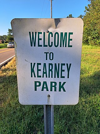
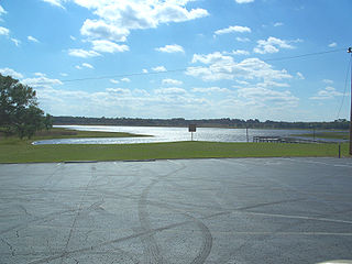
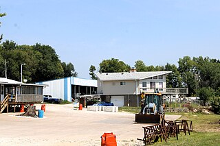
Kearney Park is an unincorporated community and census-designated place (CDP) located on Livingston-Vernon Road in western Madison County, Mississippi, United States. As of the 2020 census, the population was 1,048. Kearney Park is part of the Jackson Metropolitan Statistical Area.

Kingston is an unincorporated community and census-designated place (CDP) in northeast Madison County, Arkansas, United States. It was first listed as a CDP in the 2020 census with a population of 97.
Green Mountain is a rural unincorporated community and census-designated place (CDP) in Marshall County, Iowa, United States. It is located in Marion Township. As of the 2020 census the population of Green Mountain was 113.
Holiday Shores is an unincorporated community and census-designated place (CDP) in Madison County, Illinois, United States. Its population was 2,840 as of the 2020 census.
Roy Lake is a census-designated place and unincorporated community in Clearwater and Mahnomen counties, Minnesota, United States. Its population was 30 as of the 2020 census, up from 12 in 2010.
Lemannville is an unincorporated community and census-designated place in Ascension and St. James parishes, Louisiana, United States. It was first listed as a CDP in the 2010 Census. Per the 2020 census, the population was 695.

Smithville-Sanders is a census-designated place (CDP) encompassing the communities of Smithville and Sanders in Monroe County, Indiana, United States. Its population was 3,323 as of the 2020 census.

Tazewell is an unincorporated community and census-designated place (CDP) in Marion County, in the U.S. state of Georgia.


