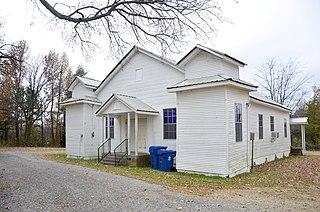
Progress Village is a census-designated place (CDP) in Hillsborough County, Florida, United States. Per the 2020 census, the population was 11,188.
University is a census-designated place (CDP) and unincorporated community in Orange County, Florida, United States, east of Orlando. The community is centered around the University of Central Florida and includes a location on its south side known as University Park. It is part of the Orlando–Kissimmee–Sanford, Florida Metropolitan Statistical Area. As of 2020, the CDP had a population of 45,284.
Mississippi State is a census-designated place in Oktibbeha County, Mississippi, United States. It is the official designated name for the area encompassing Mississippi State University, which lies partly in the nearby incorporated municipality of Starkville. The population at the 2020 census was 4,968.
Eagle Bend is a census-designated place and unincorporated community in Warren County, Mississippi. It is approximately 31 miles northwest of downtown Vicksburg, and is part of the Vicksburg Micropolitan Statistical Area.

Greenbackville is a census-designated place (CDP) 4.5 miles (5 km) south of Stockton, Maryland in Accomack County, Virginia, located just south of the Maryland state line. Per the 2020 census, the population was 173.

Darling is a census-designated place in Quitman County, Mississippi. Darling is located on Mississippi Highway 3, north of Marks. Per the 2020 Census, the population was 154.
Lamar is a census-designated place and unincorporated community in Benton County, Mississippi, United States. It is located along Mississippi Highway 7 in western Benton County. Lamar has a post office with the ZIP code 38642. The nearly abandoned Mississippi Central Railroad runs through Lamar, and is only used rarely for freight trafficking. Lamar shares its ZIP code with the nearby community of Slayden.

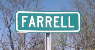
Farrell is an unincorporated community and census-designated place in Coahoma County, Mississippi, United States. Per the 2020 census, the population was 200. Farrell is located approximately 4 miles (6 km) south of Stovall and 4 miles (6 km) north of Sherard on Mississippi Highway 1. It is approximately 9 miles (14 km) northwest of Clarksdale, the county seat.

White Oak is a census-designated place located on Mississippi Highway 4 in Tunica County, Mississippi. White Oak is approximately 2 miles (3.2 km) east of Evansville and approximately 8 miles (13 km) west of Savage. The population at the 2020 census was 692.

Dennis is a census-designated place and unincorporated community located at the intersection of Mississippi Highway 25 and Mississippi Highway 4 in Tishomingo County, Mississippi, United States. Dennis is approximately 6 miles (9.7 km) south of Tishomingo and 3 miles (4.8 km) north of Belmont.

Waterford is a census-designated place and unincorporated community located in Marshall County, Mississippi, United States. It is a small town located between Holly Springs and Oxford on Highway 7.
Fernwood is a census-designated place and unincorporated community in Pike County, Mississippi, United States. Its ZIP code is 39635.
Lemannville is an unincorporated community and census-designated place in Ascension and St. James parishes, Louisiana, United States. It was first listed as a CDP in the 2010 Census. Per the 2020 census, the population was 695.
Morgantown is a census-designated place (CDP) in Adams County, Mississippi, United States, located to the northeast of the city of Natchez. As of the 2020 census, it had a population of 1,334.
Cloverdale is a census-designated place (CDP) in Adams County, Mississippi, United States, located to the south of the city of Natchez. As of the 2020 census, it had a population of 557.
Bethlehem is a census-designated place and unincorporated community in Marshall County, Mississippi, United States. Its ZIP code is 38659.
Welcome is an unincorporated community and census-designated place in St. James Parish, Louisiana, United States. The community is located along Louisiana Highway 18 on the west bank of the Mississippi River.
Cleary is an unincorporated community and census-designated place in Rankin County, Mississippi, United States. Per the 2020 census, the population was 1,688.
Robinhood is an unincorporated community and census-designated place in Rankin County, Mississippi, United States. Per the 2020 census, the population was 1,491.
Ten Mile Creek is a census-designated place in Montgomery County, Maryland, United States. It was first listed as a CDP for the 2020 census, when it had a population of 1,012.


