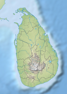
Horton Plains National Park is a national park in the central highlands of Sri Lanka that was designated in 1988. It is located at an elevation of 2,100–2,300 m (6,900–7,500 ft) and encompasses montane grassland and cloud forest. It is rich in biodiversity and many species found here are endemic to the region. It is also a popular tourist destination and is situated 8 kilometres (5.0 mi) from Ohiya, 6 kilometres (3.7 mi) from the world-famous Ohiya Gap/Dondra Watch and 32 kilometres (20 mi) from Nuwara Eliya.

Yala (යාල) National Park is the most visited and second largest national park in Sri Lanka, bordering the Indian Ocean. The park consists of five blocks, three of which are now open to the public. There are also two adjoining parks, Kumana National Park or 'Yala East' and Lunugamvehera National Park. The blocks have individual names, such as Palatupana. It is situated in the southeastern region of the country, in the Southern Province and Uva Province. The park covers 979 square kilometres (378 sq mi) and is located about 300 kilometres (190 mi) from Colombo. Yala was designated as a wildlife sanctuary in 1900, along with Wilpattu, designated in 1938, as the first two designated national parks in Sri Lanka. The park is best known for its variety of wildlife and is important conservation of Sri Lankan elephants, Sri Lankan leopards and aquatic birds.
Udawalawe National Park is a national park on the boundary of Sabaragamuwa and Uva Provinces in Sri Lanka. The park was created to provide a sanctuary for wild animals displaced by the construction of the Udawalawe Reservoir on the Walawe River, as well as to protect the catchment of the reservoir. The reserve covers 30,821 hectares (119.00 sq mi) of land area and was established on 30 June 1972.

The Deccan thorn scrub forests are a xeric shrubland ecoregion of south India and northern Sri Lanka. Historically this area was covered by tropical dry deciduous forest, but this only remains in isolated fragments. The vegetation now consists of mainly of southern tropical thorn scrub type forests. These consist of open woodland with thorny trees with short trunks and low, branching crowns; spiny and xerophytic shrubs; and dry grassland. This is the habitat of the great Indian bustard and blackbuck, though these and other animals are declining in numbers; this area was at one time home to large numbers of elephants and tigers. Almost 350 species of bird have been recorded here. The remaining natural habitat is threatened by overgrazing and invasive weeds, but there are a number of small protected areas which provide a haven for the wildlife. Trees in these forests have adapted to not require much water.

The Sri Lanka dry-zone dry evergreen forests are a tropical dry broadleaf forest ecoregion of the island of Sri Lanka.

Wasgamuwa National Park is a natural park in Sri Lanka situated in the Matale and Polonnaruwa Districts. It was declared to protect and to make a refuge for the displaced wild animals during the Mahaweli Development Project in 1984 and is one of the four National Parks designated under the Project. Originally it was designated as a nature reserve in 1938, and then in the early 1970s the area was regraded as a strict nature reserve. Wasgamuwa is one of the protected areas where Sri Lankan Elephants can be seen in large herds. It is also one of the Important Bird Areas in Sri Lanka. The name of the Wasgamuwa has derived from the words "Walas Gamuwa". "Walasa" is Sinhala for sloth bear and "Gamuwa" means a wood. The park is situated 225 km away from Colombo.

Monaragala is a district in Uva Province of Sri Lanka. It is the second largest of the 25 districts in Sri Lanka, with an area of 5,636 km2 (2,176 sq mi).

The Central Asian Flyway (CAF), Central Asian-Indian Flyway, or Central Asian-South Asian Flyway is a flyway covering a large continental area of Eurasia between the Arctic Ocean and the Indian Ocean and the associated island chains. The CAF comprises several important migration routes of waterbirds, most of which extend from the northernmost breeding grounds in Siberia to the southernmost non-breeding wintering grounds in West Asia, India, the Maldives and the British Indian Ocean Territory.
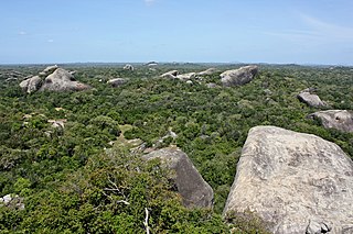
Kumana National Park in Sri Lanka is renowned for its avifauna, particularly its large flocks of migratory waterfowl and wading birds. The park is 391 kilometres (243 mi) southeast of Colombo on Sri Lanka's southeastern coast. Kumana is contiguous with Yala National Park. Kumana was formerly known as Yala East National Park, but changed to its present name on 5 September 2006.

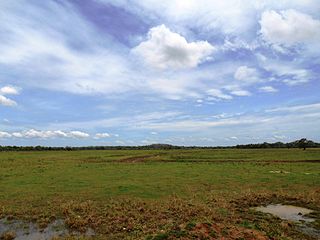
Lunugamvehera National Park in Sri Lanka was declared in 1995, with the intention of protecting the catchment area of the Lunugamvehera reservoir and wildlife of the area. The national park is an important habitat for water birds and elephants. The catchment area is vital to maintain the water levels of the five tanks in the down stream of Kirindi Oya and wetland characteristics of Bundala National Park. This national park also serves as a corridor for elephants to migrate between Yala National Park and Udawalawe National Park. The national park is situated 261 km (162 mi) southwest from Colombo. After being closed because of the Sri Lankan civil war, the national park is now open to the general public.
Lahugala Kitulana National Park is one of the smallest national parks in Sri Lanka. Despite its land area, the park is an important habitat for Sri Lankan elephant and endemic birds of Sri Lanka. The national park contains the reservoirs of Lahugala, Kitulana and Sengamuwa and they are ultimately empties to Heda Oya river. Originally it was designated as a wildlife sanctuary on July 1 of 1966. Then the protected area was upgraded to a national park on October 31 of 1980. Lahugala Kitulana is situated 318 km east of Colombo.

Kaudulla National Park is a national park on the island of Sri Lanka located 197 kilometres (122 mi) away from the largest city, Colombo. It was designated a national park on April 1, 2002, becoming the 15th such area on the island. In the 2004–2005 season more than 10,000 people visited the National Park, generating an income of Rs.100,000 from entrance fees. Along with Minneriya and Girithale BirdLife International have identified Kaudulla as an Important Bird Area.

Minneriya National Park is a national park in North Central Province of Sri Lanka. The area was designated as a national park on 12 August 1997, having been originally declared as a wildlife sanctuary in 1938. The reason for declaring the area as protected is to protect the catchment of Minneriya tank and the wildlife of the surrounding area. The tank is of historical importance, having been built by King Mahasen in third century AD. The park is a dry season feeding ground for the elephant population dwelling in forests of Matale, Polonnaruwa, and Trincomalee districts. The park earned revenue of Rs. 10.7 million in the six months ending in August 2009. Along with Kaudulla and Girithale, Minneriya forms one of the 70 Important Bird Areas (IBAs) of Sri Lanka. The park is situated 182 kilometres (113 mi) from Colombo.
Somawathiya National Park is one of the four national parks designated under the Mahaweli River development project. Somawathiya Chaitya, a stupa said to be containing a relic of the tooth of the Buddha, is situated within the park. The park was created on 2 September 1986, having been originally designated a wildlife sanctuary on 9 August 1966. The park is home to many megaherbivores. The national park is located 266 kilometres (165 mi) north-east of Colombo.
Flood Plains National Park is one of the four national parks set aside under the Mahaweli River development project in Sri Lanka. The park was created on 7 August 1984. The national park is situated along the Mahaweli flood plain and is considered a rich feeding ground for elephants. Flood Plains National Park is considered an elephant corridor for the elephants migrate between Wasgamuwa and Somawathiya national parks. The park is situated 222 kilometres (138 mi) north-east of Colombo.

Maduru Oya National Park is a national park of Sri Lanka, established under the Mahaweli development project and also acts as a catchment of the Maduru Oya Reservoir. The park was designated on 9 November 1983. Providing a sanctuary to wildlife, especially for elephants and protecting the immediate catchments of five reservoirs are the importance of the park. A community of Vedda people, the indigenous ethnic group of Sri Lanka lives within the park boundary in Henanigala. The park is situated 288 kilometres (179 mi) north-east of Colombo.
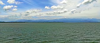
Senanayake Samudraya is the biggest reservoir and man-made lake in Sri Lanka. It is locally known as the sea. Senanayake Samudraya was opened on 28 August 1949 under the Gal Oya Multipurpose Scheme, which was completed in 1953 by D. S. Senanayake.

The Gal Oya Dam is an embankment dam in the Uva Province of Sri Lanka. The dam creates one of the largest reservoirs in the country, the Gal Oya Reservoir. Water from the reservoir is used primarily for irrigation in the Uva and Eastern provinces, in addition to powering a small hydroelectric power station. Construction of the dam and reservoir began in August 24, 1949, completing four years later in 1953.

The Gal Oya is a 108 km (67 mi) long river, in southeast Sri Lanka. It is the 16th longest river in Sri Lanka. It begins in the hills east of Badulla and flows northeast, emptying into the Indian Ocean south of Kalmunai.
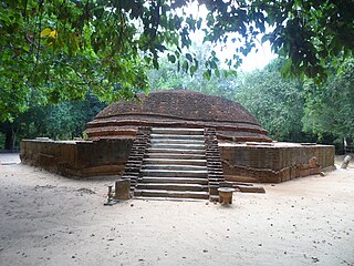
Ovagiriya is one of archaeological sites in Polwatta, Ampara District, Sri Lanka. It is situated on Ampara-Inginiyagala road, about 19 km (12 mi) away from Ampara town.