Klickitat County is a county located in the U.S. state of Washington. As of the 2020 census, the population was 22,735. The county seat and largest city is Goldendale. The county is named after the Klickitat tribe.

Battle Ground is a city in Clark County, Washington, United States. The population was 20,743 at the 2020 census. As of 2023, its population is 22,285.
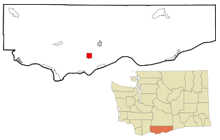
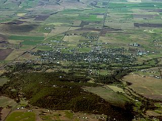
Centerville is an unincorporated community and census-designated place (CDP) in Klickitat County, Washington, United States. Settled in 1877 by Albert J. Brown, the population was 94 at the 2020 census.
Goldendale is a city and county seat of Klickitat County, Washington, United States, near the Columbia River Gorge. The population within city limits was 3,760 at the 2000 census and 3,407 at the 2010 census, a 9.4% decrease. It is situated in a primarily agricultural area and is also near Goldendale Observatory State Park. The valley in which Goldendale is located offers views of the Cascade Mountains to the west and the Simcoe Mountains to the north.

Klickitat is an unincorporated community and census-designated place (CDP) in Klickitat County, Washington, United States. The population was 320 at the 2020 census. Once the site of a lumber mill, it is now primarily a bedroom community.

Lyle is an unincorporated community and census-designated place (CDP) in Klickitat County, Washington, United States. The population was 518 at the 2020 census.

Maryhill is an unincorporated community and census-designated place (CDP) in Klickitat County, Washington, United States. The population was 55 at the 2020 census.

The Klickitat River is a tributary of the Columbia River, nearly 96 miles (154 km) long, in south-central Washington in the United States. It drains a rugged plateau area on the eastern side of the Cascade Range northeast of Portland, Oregon. In 1986, 10 miles (16 km) of the river were designated Wild and Scenic from the confluence with Wheeler Creek, near the town of Pitt, to the confluence with the Columbia River.

Goldendale Observatory State Park is an educational facility on the northern side of Goldendale, Washington, notable for its unusually large public telescope. The state park occupies five acres (2.0 ha) atop a 2,100-foot (640 m) hill.

State Route 14 (SR 14) is a 180.66-mile-long (290.74 km) state highway in the U.S. state of Washington. The highway travels east-west on the north side of the Columbia River, opposite Interstate 84 (I-84) to the south in Oregon. SR 14 forms a section of the Lewis and Clark Trail Scenic Byway and begins at an interchange with I-5 in Vancouver. The highway travels east as a four-lane freeway through Camas and Washougal and intersects I-205. SR 14 continues east as a two-lane highway through Clark, Skamania, Klickitat, and Benton counties before it ends at an interchange with I-82 and U.S. Route 395 (US 395) near Plymouth.
The Klickitat Trail is a 31-mile (50 km) rail trail along the Klickitat River in southern Washington in the Columbia River Gorge. The cycling and hiking trail offers river and canyon views throughout its length. It follows an old railroad corridor that at one time linked the towns of Lyle and Goldendale.
Brooks Memorial State Park is a public recreation area in the southern Cascade Mountains located eleven miles (18 km) northeast of Goldendale, Washington. The 682-acre (276 ha) state park features nine miles (14 km) of hiking and equestrian trails through ponderosa pine forest along a prong of the Little Klickitat River as well as camping, picnicking, wildlife viewing, and an environmental learning center, the Brooks Memorial Retreat Center. The park also contains a disc golf course in the forest that was established in 2017.

State Route 142 (SR 142) is a state highway in southern Washington. It is located entirely within Klickitat County and runs east–west for 35 miles (56 km) from Lyle to Goldendale. The highway terminates at SR 14 in Lyle and U.S. Route 97 (US 97) in Goldendale.

Binford & Mort Publishing is a book publishing company located in Hillsboro, Oregon, United States. Founded in 1930, the company was previously known as Metropolitan Press and Binfords & Mort. At one time they were the largest book publisher in the Pacific Northwest. The privately owned company focuses on books from the Pacific Northwest, and has printed many important titles covering Oregon's history.
Glenwood is an unincorporated community and census-designated place (CDP) in Klickitat County, Washington, United States. It is 26.5 miles (42.6 km) west-northwest of Goldendale and has a post office with ZIP code 98619. The community is on land whose jurisdiction is disputed between the Yakama Nation and Klickitat County.

Claude Ewing Rusk, also known as C. E. Rusk, was an American mountaineer, lawyer, and author from Washington who pioneered routes up Mount Adams, Mount Baker, and Glacier Peak. He also ascended many other peaks in Washington, Oregon, and California.
Mayfield is an unincorporated community on the southern shore of Lake Mayfield in Lewis County, Washington. It is located off U.S. Route 12, east of Silver Creek. The Mayfield Dam, which supplies hydroelectricity to Tacoma and its neighboring cities, sits 1-mile west of the area.

The Simcoe Mountains Volcanic Field, sometimes called the Simcoe Highlands, is a group of lava flows and extinct cinder cones located to the east of the Cascade Range in south-central Washington, United States. The mountains lie within Klickitat and Yakima Counties with the northern half making up part of the Yakama Indian Reservation. Although the volcanic field is located near the Cascade Arc of volcanoes, it is an intraplate volcanic field rather than having activity sourced from the Cascadia subduction zone. The last known eruption was about 631,000 years ago.

Gina Rae Mosbrucker, previously known as Gina McCabe, is an American politician who has served as a member of the Washington House of Representatives since January 1, 2015, when she was sworn in 11 days ahead of most new Washington state legislators. She was elected in 2014 to succeed retiring Republican Charles Ross.
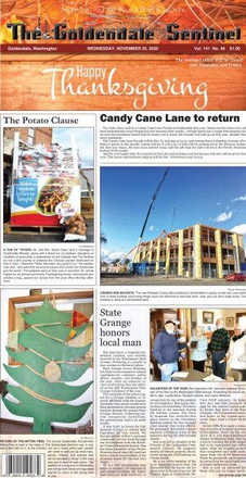
The Goldendale Sentinel is a newspaper that covers local news about Goldendale and the surrounding Klickitat county region of the U.S. state of Washington. It is the oldest paper in eastern Washington. The paper began publication in 1879 when two papers, the Klickitat Sentinel and Goldendale Gazette, were purchased and merged. It is recognized by Klickitat County as a community media source. Lou Marzeles is the current editor and publisher of the paper. It is owned by Tartan Publications Inc., Leslie Geatches, President.