Trout Lake, Washington

Last updated

Trout Lake, Washington
Klickitat County Washington Incorporated and Unincorporated areas Trout Lake Highlighted.svg
Location of Trout Lake in Klickitat County, Washington
Coordinates: 45°59′44″N121°31′14″W / 45.99556°N 121.52056°W / 45.99556; -121.52056
Country United States
State Washington
County Klickitat
Area
  Total6.98 sq mi (18.08 km2)
  Land6.94 sq mi (17.97 km2)
  Water0.04 sq mi (0.11 km2)
Elevation
1,893 ft (577 m)
Population
 (2020)
  Total672
  Density96/sq mi (37/km2)
Time zone UTC-8 (Pacific (PST))
  Summer (DST) UTC-7 (PDT)
ZIP code
98650
Area code 509
FIPS code 53-72450 [1]
GNIS feature ID1527414 [2]

Trout Lake is an unincorporated community and census-designated place (CDP) in Klickitat County, Washington, United States. The population was 672 at the 2020 census. The town is notable for its organic dairy and herb farms, and as an access point to Mount Adams and the Gifford Pinchot National Forest.

Contents

Geography

Mount Adams from Trout Lake Highway Mt Adams from Trout Lake Highway.jpg
Mount Adams from Trout Lake Highway

Trout Lake is in the northwest corner of Klickitat County, 14 miles (23 km) south of the 12,276-foot (3,742 m) summit of Mount Adams. State Route 141 passes through the community, traveling 22 miles (35 km) south to the town of White Salmon and 5 miles (8 km) west to its terminus at Gifford Pinchot National Forest.

According to the United States Census Bureau, the Trout Lake CDP has a total area of 7.0 square miles (18.1 km2), of which 0.04 square miles (0.1 km2), or 0.61%, are water. [3] The community sits in the Trout Lake Valley, drained to the southeast by Trout Lake Creek which flows to the White Salmon River, a south-flowing tributary of the Columbia River.

Climate

Climate data for Mount Adams Ranger Sation, Washington, 1991–2020 normals: 1950ft (594m)
MonthJanFebMarAprMayJunJulAugSepOctNovDecYear
Mean daily maximum °F (°C)38.6
(3.7)
43.2
(6.2)
49.3
(9.6)
58.0
(14.4)
67.6
(19.8)
73.9
(23.3)
83.9
(28.8)
83.7
(28.7)
75.2
(24.0)
59.8
(15.4)
45.2
(7.3)
36.8
(2.7)
59.6
(15.3)
Daily mean °F (°C)32.2
(0.1)
34.8
(1.6)
39.3
(4.1)
45.6
(7.6)
53.7
(12.1)
59.4
(15.2)
66.9
(19.4)
66.4
(19.1)
58.8
(14.9)
47.5
(8.6)
37.5
(3.1)
31.1
(−0.5)
47.8
(8.8)
Mean daily minimum °F (°C)25.8
(−3.4)
26.5
(−3.1)
29.3
(−1.5)
33.2
(0.7)
39.9
(4.4)
44.9
(7.2)
49.8
(9.9)
49.1
(9.5)
42.4
(5.8)
35.1
(1.7)
29.8
(−1.2)
25.3
(−3.7)
35.9
(2.2)
Average precipitation inches (mm)8.16
(207)
5.13
(130)
4.71
(120)
2.35
(60)
1.55
(39)
1.03
(26)
0.34
(8.6)
0.67
(17)
1.38
(35)
3.52
(89)
7.04
(179)
7.82
(199)
43.71
(1,110)
Average snowfall inches (cm)34.0
(86)
15.4
(39)
8.4
(21)
1.3
(3.3)
0
(0)
0
(0)
0
(0)
0
(0)
0
(0)
0.1
(0.25)
7.2
(18)
28.0
(71)
94.4
(240)
Source 1: NOAA [4]
Source 2: WRCC (precipitation & snowfall) [5]

Demographics

Historical population
CensusPop.Note
2010 557
2020 67220.6%
US Decennial Census [6]
2020 Census [7]

As of the 2010 United States Census, [8] there were 557 people, 224 households, and 171 families residing in the CDP. The population density was 78.5 people per square mile. There were 290 housing units at an average density of 40.8/sq mi. The racial makeup of the CDP was 92.6% White, 0.2% Black, 0.9% Native American, 0.7% Asian, 2.5% from other races, and 3.1% from two or more races. Hispanic or Latino of any race were 5.2% of the population.

There were 224 households, out of which 28.1% included children under the age of 18, 64.7% included a married husband and wife, 4.0% included a male householder with no wife present, 7.6% had a female householder with no husband present, and 23.7% were non-families. The average household size was 2.46 and the average family size was 2.81.

The demographic spread included 130 (23.3%) under the age of 18, 329 (59.1%) aged 20 to 64, and 85 (15.3%) who were 65 years of age or older. By gender, the population was 51.7% (288) male and 48.3% (269) female. The median age was 44.8 years.

In 2011, the American Community Survey estimated a median income of $31,563 (adjusted for inflation, 2011 dollars) for an individual, and $56,250 for a household. [9]

Related Research Articles

<span class="mw-page-title-main">Clark County, Washington</span> County in Washington, United States

Clark County is the southernmost county in the U.S. state of Washington. As of the 2020 census, the population was 503,311, making it Washington's fifth-most populous county. Its county seat and largest city is Vancouver. It was the first county in Washington, first named Vancouver County in 1845 before being renamed for William Clark of the Lewis and Clark Expedition in 1849. It was created by the Provisional Government of Oregon in Oregon Country on August 20, 1845, and at that time covered the entire present-day state. Clark County is the third-most-populous county in the Portland-Vancouver-Hillsboro Metropolitan Statistical Area, and is across the Columbia River from Portland, Oregon.

<span class="mw-page-title-main">Yakima County, Washington</span> County in Washington, United States

Yakima County is a county in the U.S. state of Washington. As of the 2020 census, its population was 256,728. The county seat and most populous city is Yakima. The county was formed out of Ferguson County in January 1865 and is named for the Yakama tribe of Native Americans.

<span class="mw-page-title-main">Skamania County, Washington</span> County in Washington, United States

Skamania County is a county located in the U.S. state of Washington. As of the 2020 census, the population was 12,036. The county seat and largest incorporated city is Stevenson, although the Carson River Valley CDP is more populous. Skamania County is included in the Portland-Vancouver-Hillsboro, OR-WA Metropolitan Statistical Area.

<span class="mw-page-title-main">Klickitat County, Washington</span> County in Washington, United States

Klickitat County is a county located in the U.S. state of Washington. As of the 2020 census, the population was 22,735. The county seat and largest city is Goldendale. The county is named after the Klickitat tribe.
<span class="mw-page-title-main">Salmon Creek, Washington</span> Census-designated place in Washington, United States

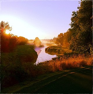
Salmon Creek is a census-designated place (CDP) in Clark County, Washington, United States. The population was 21,293 at the 2020 census.

<span class="mw-page-title-main">Castle Rock, Washington</span> City in Washington, United States

Castle Rock is a city in Cowlitz County, Washington, United States. Located between the Willapa Hills and the western base of Mount St. Helens, Castle Rock is at the heart of Washington timber country in the Pacific temperate rain forest. Castle Rock is part of the Longview, Washington Metropolitan Statistical Area; the population was 2,446 as of the 2020 census.

<span class="mw-page-title-main">Quilcene, Washington</span> Census-designated place in Washington, United States

Quilcene is an unincorporated community and census-designated place (CDP) in Jefferson County, Washington, United States. The population was 598 at the 2020 census.

<span class="mw-page-title-main">Lakeland South, Washington</span> Census-designated place in Washington, United States

Lakeland South is a census-designated place (CDP) in King County, Washington, United States. The population was 13,169 at the 2020 census.

<span class="mw-page-title-main">Bingen, Washington</span> City in Washington, United States

Bingen is a city in Klickitat County, Washington, United States. The population was 778 at the 2020 census.
<span class="mw-page-title-main">Centerville, Washington</span> Census-designated place in Washington, United States

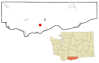
Centerville is an unincorporated community and census-designated place (CDP) in Klickitat County, Washington, United States. Settled in 1877 by Albert J. Brown, the population was 94 at the 2020 census.

<span class="mw-page-title-main">Dallesport, Washington</span> Census-designated place in Washington, United States

Dallesport is an unincorporated community and census-designated place (CDP) in Klickitat County, Washington, United States. The population was 1,328 at the 2020 census.

<span class="mw-page-title-main">Klickitat, Washington</span> Census-designated place in Washington, United States

Klickitat is an unincorporated community and census-designated place (CDP) in Klickitat County, Washington, United States. The population was 320 at the 2020 census. Once the site of a lumber mill, it is now primarily a bedroom community.

<span class="mw-page-title-main">Lyle, Washington</span> Census-designated place in Washington, United States

Lyle is an unincorporated community and census-designated place (CDP) in Klickitat County, Washington, United States. The population was 518 at the 2020 census.

<span class="mw-page-title-main">Maryhill, Washington</span> Census-designated place in Washington, United States

Maryhill is an unincorporated community and census-designated place (CDP) in Klickitat County, Washington, United States. The population was 55 at the 2020 census.

<span class="mw-page-title-main">Roosevelt, Washington</span> Census-designated place in Washington, United States

Roosevelt is an unincorporated community and census-designated place (CDP) in Klickitat County, Washington, United States. The population was 152 at the 2020 census. The Roosevelt Regional Landfill, one of the largest landfills in the United States, is located at Roosevelt.

<span class="mw-page-title-main">Mount Adams (Washington)</span> Southern Washington stratovolcano

Mount Adams, known by some Native American tribes as Pahto or Klickitat, is a potentially active stratovolcano in the Cascade Range. Although Adams has not erupted in more than 1,000 years, it is not considered extinct. It is the second-highest mountain in Washington, after Mount Rainier.
<span class="mw-page-title-main">Gifford Pinchot National Forest</span> Protected area in the state of Washington, United States

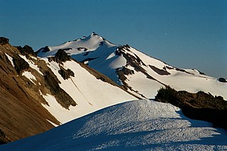
Gifford Pinchot National Forest is a National Forest located in southern Washington, managed by the United States Forest Service. With an area of 1.32 million acres (5300 km2), it extends 116 km (72 mi) along the western slopes of Cascade Range from Mount Rainier National Park to the Columbia River. The forest straddles the crest of the South Cascades of Washington State, spread out over broad, old growth forests, high mountain meadows, several glaciers, and numerous volcanic peaks. The forest's highest point is at 12,276 ft (3,742 m) at the top of Mount Adams, the second tallest volcano in the state after Rainier. Often found abbreviated GPNF on maps and in texts, it includes the 110,000-acre (450 km2) Mount St. Helens National Volcanic Monument, established by Congress in 1982.

<span class="mw-page-title-main">Carson, Washington</span> CDP in Washington, United States

Carson is a small census-designated place in the Columbia River Gorge National Scenic Area, north of the Columbia River in Skamania County, in the southwestern part of Washington, United States. The population was 2,323 at the 2020 census.

<span class="mw-page-title-main">White Salmon River</span> American river in the state of Washington

The White Salmon River is a 44-mile (71 km) tributary of the Columbia River in the U.S. state of Washington. Originating on the slopes of Mount Adams, it flows into the Columbia Gorge near the community of Underwood. Parts of the river have been designated Wild and Scenic. The principal tributaries of the White Salmon River include Trout Lake and Buck, Mill, Dry, Gilmer, and Rattlesnake Creeks.
<span class="mw-page-title-main">Washington State Route 141</span> State highway in Klickitat County, Washington

State Route 141 (SR 141) is a state highway in Klickitat County, Washington, United States. It runs north–south for 29 miles (47 km), connecting SR 14 in Bingen to White Salmon and Trout Lake. The highway follows the White Salmon River towards the base of Mount Adams, terminating at the Skamania County border at the entrance to the Gifford Pinchot National Forest, where it becomes Forest Road 24. SR 141 is a state scenic highway that provides access to recreation areas on the south side of Mount Adams.

References

  1. "U.S. Census website". United States Census Bureau . Retrieved January 31, 2008.
  2. "Trout Lake". Geographic Names Information System . United States Geological Survey, United States Department of the Interior.
  3. "Geographic Identifiers: 2010 Census Summary File 1 (G001), Trout Lake CDP, Washington". American FactFinder. U.S. Census Bureau. Archived from the original on February 13, 2020. Retrieved July 11, 2019.
  4. "Mt Adams RS, Washington 1991-2020 Monthly Normals" . Retrieved October 6, 2023.
  5. "Mount Adams Ranger Stn, WA". Western Regional Climate Center. Retrieved February 18, 2016.
  6. "US Gazetteer files: 2010, 2000, and 1990". United States Census Bureau. February 12, 2011. Retrieved April 23, 2011.
  7. "Census Bureau profile: Trout Lake, Washington". United States Census Bureau. May 2023. Retrieved May 13, 2024.
  8. "U.S. Census website". United States Census Bureau . Retrieved May 14, 2011.
  9. "American Community Survey". US Census Bureau. Archived from the original on February 12, 2020.