Wishram, Washington

Last updated

Wishram, Washington
Wishram-Washington-from-Amtrak-train.jpg
Passengers deboarding the Empire Builder at Wishram station
Klickitat County Washington Incorporated and Unincorporated areas Wishram Highlighted.svg
Location of Wishram in Klickitat County, Washington
Coordinates: 45°39′40″N120°57′32″W / 45.66111°N 120.95889°W / 45.66111; -120.95889
Country United States
State Washington
County Klickitat
Area
  Total1.3 sq mi (3.3 km2)
  Land1.3 sq mi (3.3 km2)
  Water0.0 sq mi (0.0 km2)
Elevation
177 ft (54 m)
Population
 (2020)
  Total366
  Density290/sq mi (110/km2)
Time zone UTC-8 (Pacific (PST))
  Summer (DST) UTC-7 (PDT)
ZIP code
98673
Area code 509
FIPS code 53-79485 [1]
GNIS feature ID1528268 [2]

Wishram is an unincorporated community and census-designated place (CDP) in Klickitat County, Washington, United States. The population was 366 at the 2020 census. The site of the historic Celilo Falls is nearby.

Contents

The community was originally named "Fallbridge"; it was changed to "Wishram" to honor the Wishram tribe of Native Americans. [3] The Dalles Dam, 9 miles (14 km) downstream on the Columbia River, was completed in 1957, and began filling Lake Celilo. The original fishing village near this location was inundated.

Geography

Wishram is located in southern Klickitat County, sitting on the north bank of the Columbia River at 45°39′40″N120°57′32″W / 45.66111°N 120.95889°W / 45.66111; -120.95889 (45.661198, -120.958788). [4] State Route 14 runs east–west through the community, traveling west towards Vancouver and Dallesport and east towards Maryhill; it intersects with two U.S. highways that provide access to Oregon via bridges over the Columbia River.

According to the United States Census Bureau, the Wishram CDP has a total area of 1.3 square miles (3.3 km2), all of it land. [5]

Geology

Wishram's location results from two major geological features: the location of the Celilo Falls on the Columbia River, and the access to the Central Oregon Plateau via the Deschutes River just across the falls from Wishram. The falls not only provided early peoples a reliable source of food, but it later provided a convenient location for an easily constructed railroad bridge crossing the Columbia. The Deschutes valley just to the south of the falls provided a route for rail access to the south, and ultimately to California.

Extensive erosion is visible across the river from Wishram near the mouth of the Deschutes River. Note the interstate highway along the far side of the river. Deschutes to left - scablands erosion directly ahead.jpg
Extensive erosion is visible across the river from Wishram near the mouth of the Deschutes River. Note the interstate highway along the far side of the river.

Wishram lies toward the upper end of the Columbia River Gorge, which began forming as far back as the Miocene (roughly 12 - 17 million years ago), depositing thick layers of Columbia River Basalt, and continued to take shape through the Pleistocene (700,000 - 2 million years ago). During this period the Cascade Range was forming, slowly moving the Columbia River's course north to its current location. [6]

Although the river slowly eroded the land over this period of time, the most drastic changes took place at the end of the last ice age when the Missoula Floods cut the steep, dramatic walls that exist around Wishram today. During the flood, the water level rose to 700 feet (210 m) above the current level, violently eroding and exposing the layered basalt. [7] This quick erosion left many layers of volcanic rock exposed. [6]

History

Wishram as seen from above. Note the rail bridge across the Columbia River in the west and Mount Hood in the distance. Wishram from above-July 2011.jpg
Wishram as seen from above. Note the rail bridge across the Columbia River in the west and Mount Hood in the distance.
Wishram railway yard with a BNSF freight train with Oregon cliffs and Mount Hood in the background. BNSF GE Dash-9 at Wishram.jpg
Wishram railway yard with a BNSF freight train with Oregon cliffs and Mount Hood in the background.

The area of Wishram was located 12 mile (0.8 km) above the head of the great Celilo Falls on the Columbia, and as a result has been populated for an extended period. For around 15,000 years, native peoples gathered to fish and exchange goods. [8] They built wooden platforms out over the water and caught salmon with dipnets and long spears on poles as the fish swam up through the rapids and jumped over the falls. [9] Celilo Falls and The Dalles were strategically located at the border between Chinookan and Sahaptian-speaking peoples and served as the center of an extensive trading network across the Pacific Plateau. [10] It was noted by early explorers and historians of the area. [11]

In 1892 the U.S. government completed a set of locks to bypass Celilo Falls on the southern shore, across from Wishram. Built at a cost of $5,000,000, these locks saw limited service as much of the freight in and out of the Pacific Northwest began to travel by rail. [11]

In 1912 the unincorporated town was known as "Fallbridge", named in recognition of the southern extension of the Spokane, Portland and Seattle Railway, which crossed the Columbia on the Oregon Trunk Rail Bridge constructed on the basalt rock of Celilo Falls. [12]

Lewis and Clark

Lewis and Clark mentioned the site of Wishram in their journal. In his journal for October 22, 1805, Clark recorded: [13]

"below this Island on the main Stard Shore is 16 Lodges of nativs; here we landed a fiew minits to Smoke, the lower point of one Island opposite which heads in the mouth of Towarnehiooks River (Deschutes River) which I did not observe until after passing these lodges about 1/2 a mile lower passed 6 more Lodges on the Same Side and 6 miles below the upper mouth of Towarnehiooks River the commencement of the pitch of the Great falls, opposite on the Stard. Side (Starboard or right side) is 17 Lodges [archaeologists have identified this as modern Wishram [14] ] of the nativs we landed and walked down accompanied by an old man to view the falls, and the best rout for to make a portage which we Soon discovered was much nearest on the Stard. Side, and the distance 1200 yards one third of the way on a rock, about 200 yards over a loose Sand collected in a hollar blown by the winds from the bottoms below which was disagreeable to pass, as it was Steep and loose. at the lower part of those rapids we arrived at 5 Large Lodges of nativs drying and prepareing fish for market, they gave us Philburts, and berries to eate, we returned droped down to the head of the rapids and took every article except the Canoes across the portag where I had formed a camp on ellegable Situation for the protection of our Stores from Thieft, which we were more fearfull of, than their arrows. we despatched two men to examine the river on the opposite Side, and reported that the Canoes could be taken down a narrow Chanel on the opposite Side after a Short portage at the head of the falls, at which place the Indians take over their Canoes. Indians assisted us over the portage with our heavy articles on their horses, the waters is divided into Several narrow chanels which pass through a hard black rock forming Islands of rocks at this Stage of the water, on those Islands of rocks as well as at and about their Lodges I observe great numbers of Stacks of pounded Salmon neetly preserved in the following manner, i e after Suffiently Dried it is pounded between two Stones fine, and put into a species of basket neetly made of grass and rushes of better than two feet long and one foot Diamiter, which basket is lined with the Skin of Salmon Stretched and dried for the purpose, in theis it is pressed down as hard as is possible, when full they Secure the open part with the fish Skins across which they fasten tho the loops of the basket that part very Securely, and then on a Dry Situation they Set those baskets the Corded part up, their common Custom is to Set 7 as close as they can Stand and 5 on the top of them, and secure them with mats which is raped around them and made fast with cords and Covered also with mats, those 12 baskets of from 90 to 100 w. each form a Stack. thus preserved those fish may be kept Sound and Sweet Several years, as those people inform me, Great quantities as they inform us are Sold to the whites people who visit the mouth of this river as well as to the nativs below." [13]

By the time they returned on April 16, 1806, they reported the village had moved about 300 yards below the spot where it had been located the previous fall, and tended to move with the favored fishing locations. [15]

Early history

The American author Washington Irving also mentioned the Native Americans resident at Wishram in his history of the Northwest titled Astoria or, Anecdotes of an Enterprise Beyond the Rocky Mountains and published in 1836. He stated:

"For like reason we would make especial mention of the village of Wishram, at the head of the Long Narrows, as being a solitary instance of an aboriginal trading mart, or emporium. Here the salmon caught in the neighboring rapids were 'warehoused,' to await customers. Hither the tribes from the mouth of the Columbia repaired with the fish of the sea-coast, the roots, berries, and especially the wappatoo, gathered in the lower parts of the river, together with goods and trinkets obtained from the ships which casually visit the coast. Hither also the tribes from the Rocky Mountains brought down horses, bear-grass, quamash, and other commodities of the interior. The merchant fishermen at the falls acted as middlemen or factors, and passed the objects of traffic, as it were, cross-handed; trading away part of the wares received from the mountain tribes to those of the rivers and plains, and vice versa: their packages of pounded salmon entered largely into the system of barter, and being carried off in opposite directions, found their way to the savage hunting camps far in the interior, and to the casual white traders who touched upon the coast." [16]

Wishram is extensively mentioned in regional histories and travelogues of the early 19th century. Visitors included Thomas Farnham, Hudson's Bay Company Governor Sir George Simpson, Alexander Ross, Father Pierre De Smet and Joseph Drayton's party of the Wilkes Expedition, among others. Ross reported that at Wishram the summer encampments when the salmon were running could swell to 3,000 natives. Father De Smet described it as a glorious time of rejoicing, gambling and feasting. [15]

There have been village sites at the Wishram location for millennia. Archeologists in the 1950s identified a multilevel site with centuries of waste accumulated in middens as well as petroglyphs and other indications of dense population. Most of the densely populated areas were close to the river and convenient to fishing. This lower area was flooded in 1957 by water backed up behind The Dalles Dam. [15]

The pioneer memorial raised in 1926. Wishram Monument-July 2011.jpg
The pioneer memorial raised in 1926.

In 1926 a pioneer memorial was raised at Wishram/Fallbridge. Still located in its original position 100 feet (30 m) east of the passenger train station today, it consists of two columns of basalt bound together with iron straps and mounted on a pedestal. A bronze plaque recognizing various pioneers who have been to Wishram begins with Meriwether Lewis and ends with John C. Fremont. It originally marked the beginning of a 12-mile (0.8 km) path from that monument to Celilo Falls; that path is now covered by the backwaters from The Dalles Dam. [11]

Wishram/Fallbridge as a rail center

The Spokane, Portland and Seattle Railway was chartered in 1905 by James J. Hill for the purposes of connecting the two transcontinental railroads owned by him, the Northern Pacific and Great Northern, to Portland, Oregon from Spokane, Washington, in order to gain a portion of the lumber trade in Oregon, a business that at the time was dominated by E. H. Harriman's Union Pacific and Southern Pacific railroads. Construction began in 1906 [17] under the name Portland & Seattle Railway, [17] proceeding eastward from Vancouver, Washington. [18] 1906 also saw the start of construction of the line between Vancouver and Portland. [17] This railroad included the first bridge of any kind to be built across the lower Columbia River: [19] the bridge now known as the BNSF Railway Bridge 9.6, in Vancouver.

Oregon Trunk Rail Bridge OregonTrunkRailBridge1.jpg
Oregon Trunk Rail Bridge

Within a year, and despite legal challenges from Harriman, who wished to block its construction, the line had been built as far as Pasco, Washington, along the Columbia River, where there was a connection with Northern Pacific lines. The first section to open was from Pasco west through Wishram to cliffs (near Maryhill), a length of 112 miles (180 km), on December 15, 1907. [20] Operation was extended west to Lyle, for a total of 145 miles (233 km), on January 15, 1908, as construction continued on the 56-mile (90 km) section from there to Vancouver. [20]

The town of Wishram (then known as Fallbridge) was fortuitously situated at a location which made bridging the Columbia River relatively easy. It was possible to construct a bridge that had piers resting on normally exposed basalt rock above the waterfall during low water periods such that during periods of high water, when this stretch of the Columbia River became raging rapids, the piers supported a bridge spanning the entire flood. This bridge over Celilo Falls became known as the Oregon Trunk Rail Bridge or the fallbridge. The location of this bridge also allowed construction of rail through the Deschutes River canyon, allowing access to eastern Oregon's high desert plateau and the eastern side of the Cascade Range. [18]

As a result, the SP&S was extended southward from Wishram toward Bend, Oregon. Hill and Harriman engaged in a head-to-head battle up the Deschutes grade, with intense competition for any advantageous routing. After the competition reached what has been described as ridiculous levels, Hariman died in 1909 and an agreement was reached that the extension was to be jointly operated with a Union Pacific subsidiary, the Oregon-Washington Railway & Navigation. This southern extension relied upon the Oregon Trunk Rail Bridge – the "fall bridge" – constructed just downstream of Wishram at the waterfall on the Columbia. [18] James J. Hill inaugurated this route, driving a golden spike in Bend in 1912. Fallbridge served as a passenger terminal, roundhouse and freight switch yard for traffic into Bend. Recognizing its central location, a 300-ton automatic coaling station was erected for the Spokane, Portland & Seattle Railroad at Fallbridge in 1920. [21]

The name was officially changed to "Wishram" in 1926. [11] However, the name of Fallbridge continues to appear in various documents. In 1931 the official schedules for the railway used "Wishram (Fallbridge)" as the designation for the stop at Wishram. [22] The town still appears as "Fallbridge" in 1940 U.S. Army Corps of Engineers port directories, [23] and in 1941 in standard textbooks. [24]

In 1931 the SP&S line to Bend was connected via Klamath Falls, Oregon, to Bieber, California, providing a shortcut to connect with the Western Pacific Railroad in northern California. [18]

Demographics

Historical population
CensusPop.Note
2000 213
2010 34260.6%
2020 3667.0%
US Decennial Census [4]
2020 Census [25]

As of the census of 2010, there were 342 people, 146 households, and 83 families residing in the CDP. The racial makeup of the CDP was 88.9% White, 1.2% African American, 6.1% Native American, 1.2% from other races, and 1.8% from two or more races. Hispanic or Latino of any race were 8.5% of the population.

As of the census [1] of 2000, there were 213 people, 122 households, and 89 families residing in the CDP. The population density was 254.2 people per square mile (98.5/km2). There were 122 housing units at an average density of 152.2/sq mi (59.0/km2). The racial makeup of the CDP was 84.9% White, 0% African American, 9.3% Native American, 3.1% from other races, and 2.8% from two or more races. Hispanic or Latino of any race were 3.1% of the population.

There were 122 households, out of which 21.7% had children under the age of 18 living with them, 40.1% were married couples living together, 13.2% had a female householder with no husband present, and 41.4% were non-families. 36.8% of all households were made up of individuals, and 16.4% had someone living alone who was 65 years of age or older. The average household size was 2.13 and the average family size was 2.74.

In the CDP, the population was spread out, with 25.0% under the age of 18, 5.2% from 18 to 24, 25.0% from 25 to 44, 25.3% from 45 to 64, and 19.4% who were 65 years of age or older. The median age was 41 years. For every 100 females, there were 110.4 males. For every 100 females age 18 and over, there were 99.2 males.

The median income for a household in the CDP was $26,667, and the median income for a family was $23,750. Males had a median income of $31,042 versus $23,229 for females. The per capita income for the CDP was $15,414. About 27.7% of families and 26.3% of the population were below the poverty line, including 43.3% of those under age 18 and 9.3% of those age 65 or over.
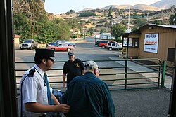
Transportation

Wishram is a small waystation - with a substantial maintenance facility - for train traffic coming north from Oregon and California, as well as those coming west. The section of railroad that runs from Vancouver to Pasco still bears the town's original name of Fallbridge.

Related Research Articles

<span class="mw-page-title-main">Columbia River</span> River in the Pacific Northwest of North America

The Columbia River is the largest river in the Pacific Northwest region of North America. The river forms in the Rocky Mountains of British Columbia, Canada. It flows northwest and then south into the U.S. state of Washington, then turns west to form most of the border between Washington and the state of Oregon before emptying into the Pacific Ocean. The river is 1,243 miles long, and its largest tributary is the Snake River. Its drainage basin is roughly the size of France and extends into seven states of the United States and one Canadian province. The fourth-largest river in the United States by volume, the Columbia has the greatest flow of any river entering the Pacific outside of Asia, and the 36th greatest discharge of any river in the world.

<span class="mw-page-title-main">Dallesport, Washington</span> Census-designated place in Washington, United States

Dallesport is an unincorporated community and census-designated place (CDP) in Klickitat County, Washington, United States. The population was 1,328 at the 2020 census.

<span class="mw-page-title-main">Columbia River Gorge</span> Canyon along the border of Oregon and Washington in the United States

The Columbia River Gorge is a canyon of the Columbia River in the Pacific Northwest of the United States. Up to 4,000 feet (1,200 m) deep, the canyon stretches for over eighty miles (130 km) as the river winds westward through the Cascade Range, forming the boundary between the state of Washington to the north and Oregon to the south. Extending roughly from the confluence of the Columbia with the Deschutes River in the east down to the eastern reaches of the Portland metropolitan area, the water gap furnishes the only navigable route through the Cascades and the only water connection between the Columbia Plateau and the Pacific Ocean. It is thus that the routes of Interstate 84, U.S. Route 30, Washington State Route 14, and railroad tracks on both sides run through the gorge.

<span class="mw-page-title-main">Deschutes River</span> River in Oregon, United States

The Deschutes River in central Oregon is a major tributary of the Columbia River. The river provides much of the drainage on the eastern side of the Cascade Range in Oregon, gathering many of the tributaries that descend from the drier, eastern flank of the mountains. The Deschutes provided an important route to and from the Columbia for Native Americans for thousands of years, and then in the 19th century for pioneers on the Oregon Trail. The river flows mostly through rugged and arid country, and its valley provides a cultural heart for central Oregon. Today the river supplies water for irrigation and is popular in the summer for whitewater rafting and fishing.

<span class="mw-page-title-main">Eastern Oregon</span> Geographic and cultural region of the U.S. state of Oregon

Eastern Oregon is a region of the U.S. state of Oregon. It is not an officially recognized geographic entity; thus, the boundaries of the region vary according to context. It is sometimes understood to include only the eight easternmost counties in the state; in other contexts, it includes the entire area east of the Cascade Range. Cities in the basic eight-county definition include Baker City, Burns, Hermiston, Pendleton, Boardman, John Day, La Grande, and Ontario. Umatilla County is home to the largest population base in Eastern Oregon, accounting for 42% of the region's residents — more than twice that of the region’s second most populous, Malheur County. Hermiston, located in Umatilla County, is the largest city in the region, accounting for 10% of the population. Major industries include transportation/warehousing, timber, agriculture and tourism. The main transportation corridors are I-84, U.S. Route 395, U.S. Route 97, U.S. Route 26, U.S. Route 30, and U.S. Route 20.

<span class="mw-page-title-main">The Dalles Dam</span> US hydroelectric dam on the Columbia River

The Dalles Lock and Dam is a concrete-gravity run-of-the-river dam spanning the Columbia River, two miles (3 km) east of the city of The Dalles, Oregon, United States. It joins Wasco County, Oregon with Klickitat County, Washington, 192 miles (309 km) upriver from the mouth of the Columbia near Astoria, Oregon. The closest towns on the Washington side are Dallesport and Wishram.

<span class="mw-page-title-main">Spokane, Portland and Seattle Railway</span> Defunct American Class I railroad (1908–1970)

The Spokane, Portland & Seattle Railway was a railroad in the northwest United States. Incorporated in 1905, it was a joint venture by the Great Northern Railway and the Northern Pacific Railway to build a railroad along the north bank of the Columbia River. The railroad later built or acquired other routes in Oregon. The SP&S was merged into the Burlington Northern in March, 1970. Remnants of the line are currently operated by BNSF Railway and the Portland and Western Railroad.

<span class="mw-page-title-main">Celilo Falls</span> Historical waterfall on the Columbia River in Washington (state), United States

Celilo Falls was a tribal fishing area on the Columbia River, just east of the Cascade Mountains, on what is today the border between the U.S. states of Oregon and Washington. The name refers to a series of cascades and waterfalls on the river, as well as to the native settlements and trading villages that existed there in various configurations for 15,000 years. Celilo was the oldest continuously inhabited community on the North American continent until 1957, when the falls and nearby settlements were submerged by the construction of The Dalles Dam. In 2019, there were calls by tribal leaders to restore the falls.

<span class="mw-page-title-main">Celilo Village, Oregon</span> Unincorporated community in Oregon, United States

Celilo Village, Oregon is an unincorporated Native American community on the Columbia River in northeastern Wasco County in the U.S. state of Oregon. It is near Lake Celilo, the former site of Celilo Falls; it is just south of the community of Wishram, Washington, across the Columbia River.

<span class="mw-page-title-main">Oregon Railroad and Navigation Company</span> Railway company

The Oregon Railroad and Navigation Company (OR&N) was a rail and steamboat transport company that operated a rail network of 1,143 miles (1,839 km) running east from Portland, Oregon, United States, to northeastern Oregon, northeastern Washington, and northern Idaho. It operated from 1896 as a consolidation of several smaller railroads.

<span class="mw-page-title-main">Burlington Northern Railroad Bridge 9.6</span> Railroad bridge crossing the Columbia River between Portland, Oregon and Vancouver, Washington

Burlington Northern Railroad Bridge 9.6 or BNSF Railway Bridge 9.6, also known as the Columbia River Railroad Bridge, is through truss railway bridge across the Columbia River, between Portland, Oregon, and Vancouver, Washington, owned and operated by BNSF Railway. Built by the Spokane, Portland and Seattle Railway (SP&S) and completed in 1908, it was the first bridge of any kind to be built across the lower Columbia River, preceding the first road bridge, the nearby Interstate Bridge, by a little more than eight years.

<span class="mw-page-title-main">Oregon Trunk Rail Bridge</span> Railway bridge in the United States

The Oregon Trunk Rail Bridge or Celilo Bridge is a single-track railroad bridge opened in 1912 over the Columbia River in the Pacific Northwest of the United States. It consists of eight steel truss spans and several deck girder spans, and since 1957 it has included a vertical-lift section. The bridge was designed by engineer Ralph Modjeski and erected by the Missouri Valley Bridge & Iron Co., of Leavenworth, Kansas.

<span class="mw-page-title-main">Oregon Steam Navigation Company</span> Transportation company

The Oregon Steam Navigation Company (O.S.N.) was an American company incorporated in 1860 in Washington with partners J. S. Ruckle, Henry Olmstead, and J. O. Van Bergen. It was incorporated in Washington because of a lack of corporate laws in Oregon, though it paid Oregon taxes.

<span class="mw-page-title-main">Steamboats of the Columbia River</span>

Many steamboats operated on the Columbia River and its tributaries, in the Pacific Northwest region of North America, from about 1850 to 1981. Major tributaries of the Columbia that formed steamboat routes included the Willamette and Snake rivers. Navigation was impractical between the Snake River and the Canada–US border, due to several rapids, but steamboats also operated along the Wenatchee Reach of the Columbia, in northern Washington, and on the Arrow Lakes of southern British Columbia.

<span class="mw-page-title-main">Celilo Canal</span> Columbia River bypass

Celilo Canal was a canal in Oregon connecting two points of the Columbia River, just east of The Dalles.

<i>Colonel Wright</i> (sternwheeler)

The Colonel Wright was the first steamboat to operate on the Columbia River above The Dalles in the parts of the Oregon Country that later became the U.S. states of Oregon, Washington and Idaho. She was the first steamboat to run on the Snake River. She was named after Colonel George Wright, an army commander in the Indian Wars in the Oregon Country in the 1850s. She was generally called the Wright during her operating career.

<span class="mw-page-title-main">Tenino people</span>

The Tenino people, commonly known today as the Warm Springs bands, are several Sahaptin Native American subtribes which historically occupied territory located in the North-Central portion of the American state of Oregon. The Tenino people included four localized subtribes — the Tygh or "Upper Deschutes" divided in Tayxɫáma, Tiɫxniɫáma and Mliɫáma, the Wyam (Wayámɫáma) (Wayámpam) or "Lower Deschutes", also known as "Celilo Indians", the Dalles Tenino or "Tinainu (Tinaynuɫáma)", also known as "Tenino proper"; and the Dock-Spus (Tukspush) (Takspasɫáma) or "John Day."

<span class="mw-page-title-main">Joseph Sherar</span> American bridge and hotel owner; road builder

Joseph Sherar was a 19th-century wagon road builder who, with his wife, Jane, owned and operated a Deschutes River toll bridge and a nearby stagecoach station and hotel in Wasco County in the U.S. state of Oregon. The bridge and buildings were slightly downstream of Sherars Falls, the river's lowermost waterfall, and a traditional fishing spot for the native inhabitants of the region.

The Crooked River Railroad Bridge, part of a BNSF Railway line between the Columbia River and Bend, Oregon, crosses Oregon's Crooked River Canyon in southern Jefferson County. The bridge is 320 feet (98 m) above the river and when it was completed in 1911, it was the second-highest railroad bridge in the United States. It is a steel two-hinge arch span with a total length of 460 feet (140 m).

<i>Relief</i> (1906 sternwheeler)

Relief was a stern-wheel steamboat that operated on the Columbia and Willamette rivers and their tributaries from 1906 to 1931. Relief had been originally built in 1902, on the Columbia at Blalock, Oregon, in Gilliam County, and launched and operated as Columbia, a much smaller vessel. Relief was used primarily as a freight carrier, first for about ten years in the Inland Empire region of Oregon and Washington, hauling wheat and fruit, and after that was operated on the lower Columbia river.

References

  1. 1 2 "U.S. Census website". United States Census Bureau . Retrieved January 31, 2008.
  2. "Wishram". Geographic Names Information System . United States Geological Survey, United States Department of the Interior.
  3. Vogt, Tom (November 9, 2014). "Company town celebrates 100 years". The Columbian . Retrieved May 6, 2019.
  4. 1 2 "US Gazetteer files: 2010, 2000, and 1990". United States Census Bureau. February 12, 2011. Retrieved April 23, 2011.
  5. "Geographic Identifiers: 2010 Census Summary File 1 (G001), Wishram CDP, Washington". American FactFinder. U.S. Census Bureau. Archived from the original on February 13, 2020. Retrieved July 12, 2019.
  6. 1 2 "Columbia River Gorge" . Retrieved June 2, 2008.
  7. Dietrich, William (September 30, 2007). "Trailing an Apocalypse". Pacific Northwest. The Seattle Times. Retrieved May 6, 2019.
  8. Barber, Katrine; Ed. William G. Robbins (2001). "Narrative Fractures and Fractured Narratives: Celilo Falls in the Columbia Gorge Discovery Center and the Yakama Nation Cultural Heritage Center". The Great Northwest: The Search for Regional Identity. Corvallis, Oregon: Oregon State University Press.
  9. Dietrich, William (1995). Northwest Passage: The Great Columbia River. Seattle, WA: University of Washington Press. p. 154. ISBN   0-671-79650-X.
  10. Ronda, James P. (1984). "Down the Columbia". Lewis & Clark among the Indians . Lincoln, Nebraska: University of Nebraska Press. ISBN   0-8032-3870-3 . Retrieved May 6, 2019.
  11. 1 2 3 4 Washington: A Guide to the Evergreen State, Federal Writers' Project - Page 397
  12. Railway Age Gazette, Volume 52, March 22, 1912
  13. 1 2 Lewis; Clark (1836). The Journals of Lewis and Clark. Project Gutenberg EBook. Retrieved July 31, 2011.
  14. Strong, William Duncan, William Egbert Schenck, Julian Haynes Steward, Archaeology of the Dalles-Deschutes Region, Volume 29. University of California Press, 1930
  15. 1 2 3 Boyd, Robert Thomas, People of The Dalles: The Indians of Wascopam Mission. University of Nebraska Press, 1996
  16. Irving, Washington (1836). "Chapter X". Astoria. Project Gutenberg. Retrieved July 31, 2011.
  17. 1 2 3 "Greatest Year for Railroad Construction: Building in Territory Tributary to Portland During 1906 Breaks All Records—City Now Strategic Point in Struggle of Giants". The Morning Oregonian . January 1, 1907. p. 20. Retrieved May 6, 2019.
  18. 1 2 3 4 Schafer, Mike (2003). Classic American Railroads, Volume III. Saint Paul, Minnesota: MBI Publishing. ISBN   978-0-7603-1649-8.
  19. "Finish Bridge Over Columbia; Steel Structure of the Spokane, Portland & Seattle Railroad [ sic ] Completed—Last Bolt In Yesterday". (June 26, 1908). The Morning Oregonian (Portland), p. 11.
  20. 1 2 "History of North Bank Road". (November 6, 1908). The Morning Oregonian, p. 12.
  21. Iron Age, Volume 106, p. 1716
  22. Official Guide of the Railways and Steam Navigation Lines of the United States, Porto Rico, Canada, Mexico and Cuba, 1931
  23. United States. Board of Engineers for Rivers and Harbors, United States Army Corps of Engineers, Port Series: Issue 32
  24. Nichols' Standard Railroad Textbook, Railroad Textbook Co., Inc., 1941
  25. "Census Bureau profile: Wishram, Washington". United States Census Bureau. May 2023. Retrieved May 13, 2024.