
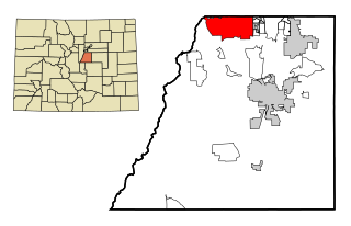
Castle Rock is a home rule town that is the county seat and the most populous municipality of Douglas County, Colorado, United States. The town population was 73,158 at the 2020 United States Census, a 51.68% increase since the 2010 United States Census. Castle Rock is the most populous Colorado town and the 16th most populous Colorado municipality. Castle Rock is a part of the Denver-Aurora-Lakewood, CO Metropolitan Statistical Area and the Front Range Urban Corridor.
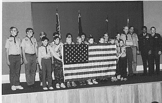
Scouting in Colorado has a long history, from the 1910s to the present day.
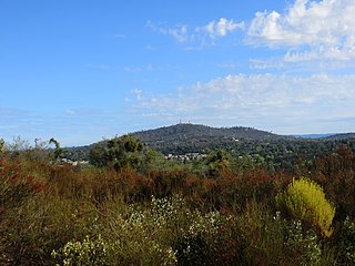
Cameron Park is a census-designated place (CDP) in El Dorado County, California, United States and is part of the Greater Sacramento Area. The population was 19,171 in the 2020 census, up from 18,228 in 2010. Cameron Park is a community located in the Northern California Gold Country of the Sierra Nevada foothills, approximately 30 miles (50 km) east of Sacramento and 70 miles (110 km) west of South Lake Tahoe.
Highlands Ranch is an unincorporated community and a census-designated place (CDP) located in and governed by Douglas County, Colorado, United States. The CDP is a part of the Denver–Aurora–Lakewood, CO Metropolitan Statistical Area. The population of the Highlands Ranch CDP was 105,631 at the United States Census 2020, making it the most populous unincorporated community in the State of Colorado. The Highlands Ranch Metropolitan District provides services to the community, which lies in ZIP Codes 80126, 80129, 80130, and 80163.
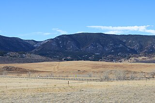
Perry Park is an unincorporated community and a census-designated place (CDP) located in Douglas County, Colorado, United States. The CDP is a part of the Denver–Aurora–Lakewood, CO Metropolitan Statistical Area. The population of the Perry Park CDP was 1,932 at the United States Census 2020. The Perry Park Metropolitan District and the Perry Park Water & Sanitation District provide services. The Larkspur post office serves the area.

Cañon City is a home rule municipality that is the county seat and the most populous municipality of Fremont County, Colorado, United States. The city population was 17,141 at the 2020 United States Census. Cañon City is the principal city of the Cañon City, CO Micropolitan Statistical Area and is a part of the Front Range Urban Corridor. Cañon City straddles the easterly flowing Arkansas River and is a popular tourist destination for sightseeing, whitewater rafting, and rock climbing. The city is known for its many public parks, fossil discoveries, Skyline Drive, The Royal Gorge railroad, the Royal Gorge, and extensive natural hiking paths. In 1994, the United States Board on Geographic Names approved adding the tilde to the official name of Cañon City, a change from Canon City as the official name in its decisions of 1906 and 1975. It is one of the few U.S. cities to have the Spanish Ñ in its name, others being La Cañada Flintridge, California; Española, New Mexico; Peñasco, New Mexico; and Peñitas, Texas.

Winter Park is a home rule municipality in Grand County, Colorado, United States. The permanent population was 1,033 at the 2020 census, although with 2,572 housing units within the town limits the seasonal population can be much higher.
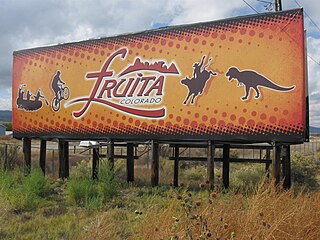
Fruita is a home rule municipality located in western Mesa County, Colorado, United States. The city population was 13,395 at the 2020 United States Census. Fruita is a part of the Grand Junction, CO Metropolitan Statistical Area and lies within the Grand Valley. The geography is identified by the bordering Colorado River on the southern edge of the town, the Uncompahgre Plateau known for its pinyon-juniper landscape, and the Book Cliffs range on the northern edge of the Grand Valley. Originally home to the Ute people, white farmers settled the town after founder William Pabor in 1884. Ten years later, Fruita was incorporated.

Alma is a statutory town in Park County, Colorado, United States. The town population was 296 at the 2020 United States Census. Alma is located West and South of the Denver-Aurora-Lakewood, CO Metropolitan Statistical Area and the Front Range Urban Corridor.

Fairplay is the Statutory Town that is the county seat and the most populous municipality of Park County, Colorado, United States. The town population was 724 at the 2020 United States Census. Fairplay is located in South Park at an elevation of 9,953 feet (3,034 m). The town is the fifth-highest incorporated place in the State of Colorado. Fairplay is now a part of the Denver–Aurora–Lakewood, CO Metropolitan Statistical Area and the Front Range Urban Corridor.

Greer is an unincorporated community and census-designated place in Apache County, Arizona, United States. Located within the White Mountains of Arizona and surrounded by the Apache-Sitgreaves National Forest, Greer is the highest town in the state at an elevation of approximately 8,400 feet. As of the 2020 census it had a population of 58. Greer was founded circa 1879 by Mormon settlers from Utah. The Greer post office has the ZIP code of 85927.

The Black Ridge Canyons Wilderness (BRCW) is located in western Colorado with a small portion extending into eastern Utah, USA, within the arid Colorado Plateau region approximately 15 miles (24 km) west of Grand Junction, Colorado. The wilderness lies on the northwest flank of the Uncompahgre Plateau. It is characterized by the high, east-west trending Black Ridge dissected by seven major canyon systems, draining into the Colorado River in Ruby Canyon. Elevations range from 4,700 feet (1,400 m) above sea level along the river to 6,800 feet (2,070 m). Canyons vary in length from several miles to twelve miles in length and may contain interesting side canyons. Geological features in these canyons include spires, windows, giant alcoves and desert varnish. Canyons may reach a depth of almost 1,000 feet (300 m), forming spectacular red rock cliffs. Spring runoff and summer thunderstorms create glistening waterfalls and plunge pools. Rattlesnake Canyon contains the second largest concentration of natural arches in the country. Mee Canyon is even more remote, and contains Arch Tower.

Littleton is a home rule municipality city located in Arapahoe, Douglas, and Jefferson counties, Colorado, United States. Littleton is the county seat of Arapahoe County and is a part of the Denver–Aurora–Lakewood, CO Metropolitan Statistical Area. The city population was 45,652 at the 2020 United States Census, ranking as the 20th most populous municipality in the State of Colorado.

Navajo Lake is a reservoir located in San Juan County and Rio Arriba County in northwestern New Mexico, in the southwestern United States. Portions of the reservoir extend into Archuleta County in southern Colorado. The lake is part of the Colorado River Storage Project, which here manages the upper reaches of the San Juan River, storing and releasing water that is used locally for irrigation, or ultimately reaching the Colorado River in Utah. Water is impounded in Navajo Lake by the earth- and rock-filled Navajo Dam, 3,800 feet (1,200 m) long and 400 feet (120 m) high, completed in 1962. The 15,600-acre (63 km2) lake is over 25 miles (40 km) long and lies at an elevation of up to 6,085 feet (1,855 m).

U.S. Route 50 (US 50) is a part of the U.S. Highway System that travels from West Sacramento, California, to Ocean City, Maryland. In the U.S. state of Colorado, US 50 is a major highway crossing through the lower midsection of the state. It connects the Western Slope with the lower Front Range and the Arkansas Valley. The highway serves the areas of Pueblo and Grand Junction as well as many other smaller areas along its corridor. The long-term project to widen the highway from two lanes to a four lane expressway between Grand Junction and Montrose was completed in January 2005. Only about 25% of the remainder of highway 50 in Colorado is four lane expressway.

Powderhorn Mountain Resort is a ski resort located 45 minutes east of Grand Junction, Colorado on the Grand Mesa.

Arizona is a landlocked state situated in the southwestern region of the United States of America. It has a vast and diverse geography famous for its deep canyons, high- and low-elevation deserts, numerous natural rock formations, and volcanic mountain ranges. Arizona shares land borders with Utah to the north, the Mexican state of Sonora to the south, New Mexico to the east, and Nevada to the northwest, as well as water borders with California and the Mexican state of Baja California to the southwest along the Colorado River. Arizona is also one of the Four Corners states and is diagonally adjacent to Colorado.
Moran is an unincorporated village in south central Teton County, Wyoming, United States: as the community has had two different names, the Board on Geographic Names officially ruled in favor of "Moran" in 1970. It lies in Grand Teton National Park, 29 miles northeast of the city of Jackson, the county seat of Teton County, just northwest by side road of the intersection of U.S. Routes 26, 89, 191 and 287. Its elevation is 6,749 feet (2,057 m) and includes one of the principal entrance-fee collection stations for the Park. Moran also has the post office serving ZIP code of 83013, and a public elementary school; and no other services or businesses.

The Serpents Trail, also known as the Trail of the Serpents and the Serpentine Trail, is a trail within the Colorado National Monument in Mesa County, Colorado, United States, that is listed on the National Register of Historic Places.
Sterling Ranch is an unincorporated community and a census-designated place (CDP) located in and governed by Douglas County, Colorado, United States. The population was 1,789 at the 2020 census. The CDP is a part of the Denver–Aurora–Lakewood, CO Metropolitan Statistical Area. Douglas County governs the unincorporated community and the Sterling Ranch Community Authority Board provides services through several metropolitan districts. The Littleton post office serves the area.

