Redlands, Colorado

Last updated

Redlands, Colorado
Redlands, Colorado.JPG
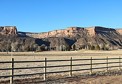
The northern part of Redlands in 2020
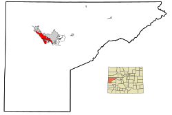
Mesa County Colorado Incorporated and Unincorporated areas Redlands Highlighted.svg
Usa edcp location map.svg
Red pog.svg
Redlands
Location in the United States
Coordinates: 39°05′21″N108°39′34″W / 39.08917°N 108.65944°W / 39.08917; -108.65944 (Redlands CDP, Colorado) [1]
Country Flag of the United States.svg United States
State Colorado
County Mesa County
Government
[1]
  Type unincorporated community
Area
[2]
  Total13.446 sq mi (34.82 km2)
  Land12.905 sq mi (33.42 km2)
  Water0.541 sq mi (1.40 km2)
Elevation
[1]
4,643 ft (1,415 m)
Population
 (2020) [3]
  Total9,061
  Density702.1/sq mi (271.1/km2)
Time zone UTC-7 (MST)
  Summer (DST) UTC-6 (MDT)
ZIP Code [4]
Area code 970
GNIS feature 2409153 [1]

Redlands is an unincorporated community and census-designated place (CDP) located in and governed by Mesa County, Colorado, United States. It is part of the Grand Junction, CO Metropolitan Statistical Area. The population of the Redlands CDP was 9,061 at the 2020 census. [3] The Grand Junction post office (ZIP Code 81507) serves the area. [4]

Contents

Geography

Redlands is in central Mesa County, lying on the southwest side of the Colorado River between the city of Grand Junction to the east and the city of Fruita to the northwest.

The Redlands CDP has an area of 13.4 square miles (35 km2), including 0.54 square miles (1.40 km2) of water (4.0% of the CDP area). [2]

Demographics

The United States Census Bureau initially defined the Redlands CDP for the 1990 United States Census.

Redlands CDP, Colorado
YearPop.±%
1990 9,355    
2000 8,043−14.0%
2010 8,685+8.0%
2020 9,061+4.3%
Source: United States Census Bureau

See also

Related Research Articles

<span class="mw-page-title-main">Mesa County, Colorado</span> County in Colorado, United States

Mesa County is a county located in the U.S. state of Colorado. As of the 2020 census, the population was 155,703. The county seat and most populous municipality is Grand Junction. The county was named for the many large mesas in the area, including the Grand Mesa, which is the largest flat-topped mountain in the world.

<span class="mw-page-title-main">Stonegate, Colorado</span> Census Designated Place in Colorado, United States

Stonegate is an unincorporated community and a census-designated place (CDP) located in and governed by Douglas County, Colorado, United States. The CDP is a part of the Denver–Aurora–Lakewood, CO Metropolitan Statistical Area. The population of the Stonegate CDP was 9,072 at the United States Census 2020. The Stonegate Village Metropolitan District provides services to the community, which lies in ZIP Code 80134.

<span class="mw-page-title-main">The Pinery, Colorado</span> Census Designated Place in Colorado, United States

The Pinery is an unincorporated community and a census-designated place (CDP) located in and governed by Douglas County, Colorado, United States. The CDP is a part of the Denver–Aurora–Lakewood, CO Metropolitan Statistical Area. The population of The Pinery CDP was 11,311 at the United States Census 2020. Douglas County governs the unincorporated community. The Parker post office serves the area.

<span class="mw-page-title-main">Cimarron Hills, Colorado</span> Census Designated Place in Colorado, United States

Cimarron Hills is an unincorporated community and a census-designated place (CDP) located in and governed by El Paso County, Colorado, United States. Cimarron Hills is an enclave of the City of Colorado Springs. The CDP is a part of the Colorado Springs, CO Metropolitan Statistical Area. The population of the Cimarron Hills CDP was 19,311 at the United States Census 2020. The Colorado Springs post office serves the area.

<span class="mw-page-title-main">Battlement Mesa, Colorado</span> Ceneus-designated place in Garfield County, Colorado, United States

Battlement Mesa is a census-designated place (CDP) and post office in and governed by Garfield County, Colorado, United States. The CDP is a part of the Glenwood Springs, CO Micropolitan Statistical Area. The Battlement Mesa post office has the ZIP Codes 81635 and 81636. At the United States Census 2020, the population of the Battlement Mesa CDP was 5,438. The Battlement Mesa Metropolitan District provides services.

<span class="mw-page-title-main">Aspen Park, Colorado</span> Census Designated Place in Colorado, United States

Aspen Park is an unincorporated community and a census-designated place (CDP) located in Jefferson County, Colorado, United States. The CDP is a part of the Denver–Aurora–Lakewood, CO Metropolitan Statistical Area. The population of the Aspen Park CDP was 810 at the United States Census 2020. The Aspen Park Metropolitan District provides services. The Conifer post office serves the area.

<span class="mw-page-title-main">Kittredge, Colorado</span> Census Designated Place in Colorado, United States

Kittredge is an unincorporated town, a post office, and a census-designated place (CDP) located in and governed by Jefferson County, Colorado, United States. The CDP is a part of the Denver–Aurora–Lakewood, CO Metropolitan Statistical Area. The Kittredge post office has the ZIP code 80457. At the United States Census 2020, the population of the Kittredge CDP was 1,308.

<span class="mw-page-title-main">Clifton, Colorado</span> Census-designated place in Mesa County, Colorado, United States

Clifton is a census-designated place (CDP) and post office in and governed by Mesa County, Colorado, United States. It is part of the Grand Junction, CO Metropolitan Statistical Area. The Clifton post office has the ZIP Code 81520. As of the 2020 census, the population of the Clifton CDP was 20,413.

<span class="mw-page-title-main">Fruitvale, Colorado</span> Census-designated place in Colorado, United States

Fruitvale is a census-designated place (CDP) in and governed by Mesa County, Colorado, United States. It is part of the Grand Junction, CO Metropolitan Statistical Area. The population was 8,271 at the 2020 census, up from 7,675 in 2010. The Grand Junction post office serves Fruitvale postal addresses.

<span class="mw-page-title-main">Orchard Mesa, Colorado</span> Census-designated places in Mesa County, United States

Orchard Mesa is a census-designated place (CDP) in and governed by Mesa County, Colorado, United States. It is part of the Grand Junction, CO Metropolitan Statistical Area. The population of the Orchard Mesa CDP was 6,688 at the 2020 census. The Grand Junction post office serves the area.

<span class="mw-page-title-main">Grand View Estates, Colorado</span> Census Designated Place in Colorado, United States

Grand View Estates is an unincorporated community and a census-designated place (CDP) located in and governed by Douglas County, Colorado, United States. The CDP is a part of the Denver–Aurora–Lakewood, CO Metropolitan Statistical Area. The population of the Grand View Estates CDP was 689 at the United States Census 2020. The area lies in ZIP code 80134.

<span class="mw-page-title-main">Loma, Colorado</span> Census-designated place in Colorado, United States

Loma is an unincorporated town, post office, and census-designated place (CDP) located in and governed by Mesa County, Colorado, United States. It is part of the Grand Junction, CO Metropolitan Statistical Area. The Loma post office has the ZIP Code 81524. At the 2020 census, the population of the Loma CDP was 1,314.

<span class="mw-page-title-main">Orchard, Colorado</span> Unincorporated community in Colorado, United States

Orchard is an unincorporated town, a post office, and a census-designated place (CDP) located in and governed by Morgan County, Colorado, United States. The CDP is a part of the Fort Morgan, CO Micropolitan Statistical Area. The Orchard post office has the ZIP Code 80649. As of the 2020 census, the population of the Orchard CDP was 76.

<span class="mw-page-title-main">Redvale, Colorado</span> Census-designated place in Colorado, United States

Redvale is an unincorporated town, a post office, and a census-designated place (CDP) located in and governed by Montrose County, Colorado, United States. The CDP is a part of the Montrose, CO Micropolitan Statistical Area. The Redvale post office has the ZIP Code 81431. At the 2020 census, the population of the Redvale CDP was 172, down from 236 in 2010.

<span class="mw-page-title-main">Altona, Colorado</span> Census Designated Place in Colorado, United States

Altona is an unincorporated community and a census-designated place (CDP) located in and governed by Boulder County, Colorado, United States. The CDP is a part of the Boulder, CO Metropolitan Statistical Area. The population of the Altona CDP was 512 at the United States Census 2020. The Boulder post office serves the area.

<span class="mw-page-title-main">Fairmount, Colorado</span> Census Designated Place in Colorado, United States

Fairmount is an unincorporated community and a census-designated place (CDP) in Jefferson County, Colorado, United States. The CDP is a part of the Denver–Aurora–Lakewood, CO Metropolitan Statistical Area. The population of the Fairmount CDP was 9,324 at the United States Census 2010. ZIP code 80403 applies to addresses in Fairmount.

<span class="mw-page-title-main">Glendale, Boulder County, Colorado</span> Census Designated Place in Colorado, United States

Glendale is an unincorporated community and a census-designated place (CDP) located in and governed by Boulder County, Colorado, United States. The CDP is a part of the Boulder, CO Metropolitan Statistical Area. The population of the Glendale CDP was 64 at the United States Census 2020. The Jamestown post office serves the area.

<span class="mw-page-title-main">Hidden Lake, Colorado</span> Census Designated Place in Colorado, United States

Hidden Lake is an unincorporated community and a census-designated place (CDP) located in and governed by Boulder County, Colorado, United States. The CDP is a part of the Boulder, CO Metropolitan Statistical Area. The population of the Hidden Lake CDP was 24 at the United States Census 2020. The Ward post office serves the area.

<span class="mw-page-title-main">St. Ann Highlands, Colorado</span> Census Designated Place in Colorado, United States

St. Ann Highlands is an unincorporated community and a census-designated place (CDP) located in and governed by Boulder County, Colorado, United States. The CDP is a part of the Boulder, CO Metropolitan Statistical Area. The population of the St. Ann Highlands CDP was 325 at the United States Census 2020. The Nederland post office serves the area.

<span class="mw-page-title-main">Four Square Mile, Colorado</span> Census Designated Place in Colorado, United States

Four Square Mile is an unincorporated community and a census-designated place (CDP) located in and governed by Arapahoe County, Colorado, United States. The population was 22,872 at the 2020 census. The CDP is a part of the Denver–Aurora–Lakewood, CO Metropolitan Statistical Area. The CDP is surrounded by Denver on the north, west, and south and by Aurora on the east. The name is derived from the four square miles bounded by Quebec Street, Mississippi Avenue, Havana Street and Yale Avenue. Annexation of the Arapahoe County enclave was contested between Denver and Aurora in the early 1970s, with Denver annexing east from Quebec Street and Aurora west from Havana Street. Denver’s annexations were ultimately stopped by the Poundstone Amendment; Aurora is not similarly limited but made its most recent annexation to Dayton Street in 1984, leaving nearly three of the four square miles unincorporated. The Four Square Mile CDP includes Sullivan, a previous unincorporated community designation. The area lies in ZIP codes 80231 and 80247.

References

  1. 1 2 3 4 U.S. Geological Survey Geographic Names Information System: Redlands, Colorado
  2. 1 2 "2022 U.S. Gazetteer Files: Colorado". United States Census Bureau. Retrieved November 29, 2022.
  3. 1 2 "P1. Race – Redlands CDP, Colorado: 2020 DEC Redistricting Data (PL 94-171)". U.S. Census Bureau. Retrieved November 29, 2022.
  4. 1 2 "Zip Code 81507 Map and Profile". zipdatamaps.com. 2020. Retrieved December 24, 2020.