John Forrest National Park is a national park in the Darling Scarp, 24 km (15 mi) east of Perth, Western Australia. Proclaimed as a national park in November 1900, it was the first national park in Western Australia and the second in Australia after Royal National Park.

Mundaring is a suburb located 34 km east of Perth, Western Australia on the Great Eastern Highway. The suburb is located within the Shire of Mundaring.
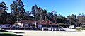
Mount Helena is an suburb on the outskirts of Perth, in Western Australia, 35 km from the city, in the Shire of Mundaring. Its population in 2016 was 3,185 people.

Darlington, Western Australia, is a locality in the Shire of Mundaring on the Darling Scarp, bisected by Nyaania Creek and north of the Helena River.

The Eastern Railway is the main railway route between Fremantle and Northam in Western Australia. It opened in stages between 1881 and 1893. The line continues east to Kalgoorlie as the Eastern Goldfields Railway.

Bellevue is an eastern suburb of Perth, Western Australia in the local government areas of the City of Swan and the Shire of Mundaring. It is at the foot of the slopes of Greenmount, a landmark on the Darling Scarp that is noted in the earliest of travel journals of the early Swan River Colony.

Greenmount is a locality and a geographical feature in the Shire of Mundaring, Western Australia, on the edge of the Darling Scarp. It is a vital point in the transport routes from the Swan Coastal Plain into the hinterland of Western Australia.

The Swan View Tunnel is a former railway tunnel located on the southern side of the Jane Brook valley in the outer Perth suburb of Swan View in the John Forrest National Park on the edge of the Darling Scarp. After its closure as a railway tunnel, it reopened as part of the John Forrest Heritage Trail, a rail trail.

The Railway Reserves Heritage Trail – also on some maps as Rail Reserve Heritage Trail or Rail Reserves Historical Trail, and frequently referred to locally as the Bridle Trail or Bridle Track – is within the Shire of Mundaring in Western Australia.
The Mundaring Branch Railway is a historical section of the original Eastern Railway main line across the Darling Scarp in the Western Australian Government Railways (WAGR) system.

Chidlow is a small community in the Shire of Mundaring approximately 45 kilometres east of Perth, Western Australia.
Swan View is an eastern suburb of Perth, Western Australia. Its local government areas are the City of Swan and the Shire of Mundaring. It is 25 kilometres (16 mi) from Perth in the Perth Hills on the edge of the Darling Scarp, just to the west of the John Forrest National Park, east of Roe Highway and north of the Great Eastern Highway.

Boya is a locality on the Darling Scarp, in the Shire of Mundaring, Western Australia; it is on the south side of Greenmount Hill, and just west of Darlington.

Mahogany Creek is a suburb of Perth, the state capital of Western Australia. It is part of the Shire of Mundaring local government area.
Bailup is a Western Australian locality and rural residential estate located 62 kilometres (39 mi) north-east of the state capital, Perth, along Toodyay Road. The population recorded at the 2021 census was 54. The area is split between the Shire of Toodyay and Shire of Mundaring, the latter of which contains most of the land area.
Stoneville is a suburb east of Perth in the Shire of Mundaring, Western Australia. It is named after Edward Albert Stone, who was Chief Justice of Western Australia when the place was named in 1905. The name was chosen by the local residents, who were developing the district for fruit growing. The town's population is 2,050, with a median age of 36 years and 7.1% of residents aged over 65.

Hovea is a suburb in the Shire of Mundaring in Perth, Western Australia.

Nyaania Creek is a creek in Western Australia. It is a seasonal tributary that flows into the Helena River with a catchment that moves through a number of hills suburbs just east of the Darling Scarp. Its source is in Mahogany Creek, and it flows through Glen Forrest, Darlington, and Boya before meeting the Helena River at Helena Valley.

The Shire of Mundaring is a local government area in eastern metropolitan Perth, the capital of Western Australia. The Shire covers an area of 645 square kilometres (249 sq mi) and had a population of approximately 38,000 as at the 2016 Census.