Glenrock, Wyoming

Last updated

Glenrock, Wyoming
Commerce Block commercial building in Glenrock, WY USA.jpg
Commerce Block in Glenrock, September 2012
Motto: 
"Big Enough to Enjoy - Small Enough to Care"
Converse County Wyoming Incorporated and Unincorporated areas Glenrock Highlighted 5632435.svg
Location of Glenrock in Converse County, Wyoming.
USA Wyoming location map.svg
Red pog.svg
Glenrock, Wyoming
Location of Glenrock, Wyoming
Usa edcp location map.svg
Red pog.svg
Glenrock, Wyoming
Glenrock, Wyoming (the United States)
Coordinates: 42°51′29″N105°51′58″W / 42.85806°N 105.86611°W / 42.85806; -105.86611
Country United States
State Wyoming
County Converse
Area
[1]
  Total2.30 sq mi (5.96 km2)
  Land2.30 sq mi (5.96 km2)
  Water0.00 sq mi (0.00 km2)
Elevation
5,020 ft (1,530 m)
Population
 (2010) [2]
  Total2,576
  Estimate 
(2019) [3]
2,575
  Density1,118.59/sq mi (431.97/km2)
Time zone UTC-7 (Mountain (MST))
  Summer (DST) UTC-6 (MDT)
ZIP code
82637
Area code 307
FIPS code 56-32435 [4]
GNIS feature ID1609095 [5]
Website glenrock.org

Glenrock is a town in Converse County, Wyoming, United States. The population was 2,576 at the 2010 census.

Contents

History

Glenrock, known as Deer Creek Station, had its beginning as a mail and stage station along the Oregon Trail. The station served as a stopping point along the trail and was a vital supply point for thousands of emigrants as they traveled westward. A significant number of industries were established after 1889 and expanded the growth and economy of many communities like Glenrock in central Wyoming.

Historical Sites

Rock in the Glen

Mormon Mines

Deer Creek Station

Glenrock train wreck

September 27, 1923 – near Glenrock, Wyoming, soon after the washout of Chicago, Burlington and Quincy Railroad's bridge over Cole Creek, a passenger train fell through the washout, killing 30 of the train's 66 passengers. This marked the worst railroad accident in Wyoming's history.

Geography

Glenrock is located at 42°51′29″N105°51′58″W / 42.85806°N 105.86611°W / 42.85806; -105.86611 (42.858145, -105.866170). [8]

According to the United States Census Bureau, the town has a total area of 2.28 square miles (5.91 km2), all land. [9]

Demographics

Historical population
CensusPop.Note
1920 1,003
1930 810−19.2%
1940 1,01425.2%
1950 1,1109.5%
1960 1,58442.7%
1970 1,515−4.4%
1980 2,73680.6%
1990 2,153−21.3%
2000 2,2313.6%
2010 2,57615.5%
2019 (est.)2,575 [3] 0.0%
[10]

2010 census

As of the census [2] of 2010, there were 2,576 people, 1,102 households, and 713 families residing in the town. The population density was 1,129.8 inhabitants per square mile (436.2/km2). There were 1,201 housing units at an average density of 526.8 per square mile (203.4/km2). The racial makeup of the town was 96.0% White, 0.5% African American, 0.9% Native American, 0.4% Asian, 0.9% from other races, and 1.3% from two or more races. Hispanic or Latino of any race were 4.9% of the population.

There were 1,102 households, of which 29.7% had children under the age of 18 living with them, 50.5% were married couples living together, 9.6% had a female householder with no husband present, 4.5% had a male householder with no wife present, and 35.3% were non-families. 29.8% of all households were made up of individuals, and 13.3% had someone living alone who was 65 years of age or older. The average household size was 2.32 and the average family size was 2.85.

The median age in the town was 41.3 years. 23.5% of residents were under the age of 18; 8.2% were between the ages of 18 and 24; 22.8% were from 25 to 44; 27.7% were from 45 to 64; and 17.7% were 65 years of age or older. The gender makeup of the town was 51.7% male and 48.3% female.

2000 census

As of the census [4] of 2000, there were 2,231 people, 925 households, and 641 families residing in the town. The population density was 1,155.3 people per square mile (446.3/km2). There were 1,131 housing units at an average density of 585.7 per square mile (226.3/km2). The racial makeup of the town was 94.53% White, 0.31% African American, 1.61% Native American, 0.40% Asian, 0.04% Pacific Islander, 1.03% from other races, and 2.06% from two or more races. Hispanic or Latino of any race were 3.81% of the population.

There were 925 households, out of which 33.8% had children under the age of 18 living with them, 54.1% were married couples living together, 11.5% had a female householder with no husband present, and 30.6% were non-families. 26.7% of all households were made up of individuals, and 11.9% had someone living alone who was 65 years of age or older. The average household size was 2.41 and the average family size was 2.89.

In the town, the population was spread out, with 28.8% under the age of 18, 6.6% from 18 to 24, 25.6% from 25 to 44, 25.8% from 45 to 64, and 13.2% who were 65 years of age or older. The median age was 38 years. For every 100 females, there were 96.2 males. For every 100 females age 18 and over, there were 89.4 males.

The median income for a household in the town was $32,300, and the median income for a family was $40,927. Males had a median income of $32,778 versus $18,795 for females. The per capita income for the town was $17,088. About 11.4% of families and 13.0% of the population were below the poverty line, including 18.7% of those under age 18 and 6.4% of those age 65 or over.

Education

Public education in the town of Glenrock is provided by Converse County School District #2. The district has three campuses – Grant Elementary School (grades PreK-3), Glenrock Intermediate School(grades 4-6), and Glenrock Junior/Senior High School (grades 7-12).

Glenrock has a public library, a branch of the Converse County Library [11]

Attractions & tourism

Dave Johnston power plant, a large coal-fired generating station at Glenrock, is owned by PacifiCorp Dave Johnson coal-fired power plant, central Wyoming.jpg
Dave Johnston power plant, a large coal-fired generating station at Glenrock, is owned by PacifiCorp

Outdoor recreation opportunities are plentiful in the area surrounding Glenrock, as the Laramie Mountains, Medicine Bow National Forest, and the Platte River are nearby.

The Deer Creek Days Festival, Jamborees, and outdoor activities attract visitors to the town.

Other attractions include:

Major highways

Notable people

See also

Related Research Articles

<span class="mw-page-title-main">Johnson County, Wyoming</span> County in Wyoming, United States

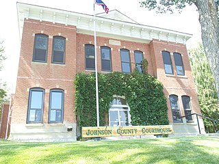
Johnson County is a county in the north central part of the U.S. state of Wyoming. At the 2020 United States Census, the population was 8,447. The county seat is Buffalo. Kaycee is the only other incorporated town in the county.

<span class="mw-page-title-main">Washakie County, Wyoming</span> County in Wyoming, United States

Washakie County is a county in the U.S. state of Wyoming. As of the 2020 United States Census, the population was 7,685. Its county seat is Worland.

<span class="mw-page-title-main">Platte County, Wyoming</span> County in Wyoming, United States

Platte County is a county located in the U.S. state of Wyoming. As of the 2020 United States Census, the population was 8,605. Its county seat is Wheatland.

<span class="mw-page-title-main">Niobrara County, Wyoming</span> County in the United States

Niobrara County is a county in the U.S. state of Wyoming. As of the 2020 United States Census, the population was 2,467, making it the least populous county in Wyoming. Its county seat is Lusk. Its eastern boundary abuts the west lines of the states of Nebraska and South Dakota.

<span class="mw-page-title-main">Goshen County, Wyoming</span> County in Wyoming, United States

Goshen County is a county in the U.S. state of Wyoming. As of the 2020 United States Census, the population was 12,498. Its county seat is Torrington. The eastern boundary of the County borders the Nebraska state line.

<span class="mw-page-title-main">Converse County, Wyoming</span> County in Wyoming, United States

Converse County is a county located in the U.S. state of Wyoming. As of the 2020 United States Census, the population was 13,751. Its county seat is Douglas.

<span class="mw-page-title-main">Deer Trail, Colorado</span> Town in Colorado, United States

The Town of Deer Trail is a Statutory Town located in eastern Arapahoe County, Colorado, United States. The town population was 1,068 at the 2020 United States Census, a +95.60% increase since the 2010 United States Census. Deer Trail is a part of the Denver–Aurora–Lakewood, CO Metropolitan Statistical Area and the Front Range Urban Corridor. The town is situated along Interstate 70, approximately 55 miles (89 km) east of Denver.

<span class="mw-page-title-main">Converse, Indiana</span> Town in Indiana, United States

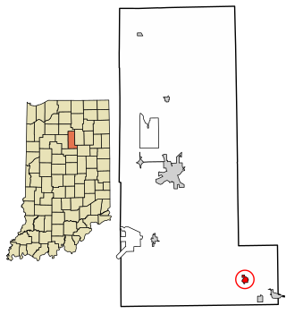
Converse is a town in Jackson Township, Miami County, and Richland Township, Grant County, in the U.S. state of Indiana. The population was 1,161 at the 2020 census.

<span class="mw-page-title-main">Amboy, Indiana</span> Town in Indiana, United States

Amboy is a town in Jackson Township, Miami County, in the U.S. state of Indiana. The population was 317 at the 2020 census, down from 384 in 2010.

<span class="mw-page-title-main">Deer Creek, Minnesota</span> City in Minnesota, United States

Deer Creek is a city in Otter Tail County, Minnesota, United States. The population was 330 at the 2020 census.

<span class="mw-page-title-main">Covington, New York</span> Town in New York, United States

Covington is an incorporated town in Wyoming County, New York. The population was 1,231 at the 2010 census. The town was named after General Leonard Covington.

<span class="mw-page-title-main">Pineville, West Virginia</span> Town in West Virginia, United States

Pineville is a town in and the county seat of Wyoming County, West Virginia, United States, situated along the Guyandotte River. The population was 648 at the 2020 census.

<span class="mw-page-title-main">Esterbrook, Wyoming</span> CDP in Wyoming, United States

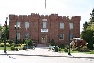
Esterbrook is a village, and the locus of a same-named census-designated place (CDP), in Converse County, Wyoming, United States in the Medicine Bow National Forest. The population was 52 at the 2010 census.

<span class="mw-page-title-main">Rolling Hills, Wyoming</span> Town in Wyoming, United States

Rolling Hills is a town in Converse County, Wyoming, United States, four miles north of Glenrock. It is a planned community incorporated as a town in 1984. The population at the 2010 census was 440.

<span class="mw-page-title-main">Atlantic City, Wyoming</span> CDP in Wyoming, United States

Atlantic City is a census-designated place (CDP) in Fremont County, Wyoming, United States. The population was 37 at the 2010 census. The community is a small mining settlement in a gulch near South Pass in southwestern Wyoming. It was founded as a mining camp following the 1867 gold rush in the region. The town declined following the end of the placer gold rush in the early 1870s, but continued to exist as advances in mining technology allowed further extraction of gold. From the 1960s until 1983, it was the location of US Steel iron ore mine. The town is accessible by gravel roads from nearby Wyoming Highway 28.

<span class="mw-page-title-main">Fort Laramie, Wyoming</span> Town in Wyoming, United States

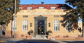
Fort Laramie is a town in Goshen County, Wyoming, United States. The population was 206 at the 2020 census. The town is named after historic Fort Laramie, an important stop on the Oregon, California and Mormon trails, as well as a staging point for various military excursions and treaty signings. The old fort was located south of town across the North Platte River, at the mouth of the Laramie River.

<span class="mw-page-title-main">Ranchester, Wyoming</span> Town in Wyoming, United States

Ranchester is a town in Sheridan County, Wyoming, United States. The population was 1,064 at the 2020 census.

<span class="mw-page-title-main">Pinedale, Wyoming</span> Town in Wyoming, United States

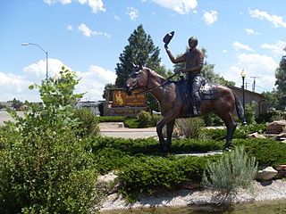
Pinedale is a town in and the county seat of Sublette County, Wyoming, United States. The population was 2,030 at the 2010 census. Pinedale is an important hunting outfitting town and a gateway to the Wind River Mountains. Additionally, Pinedale is near several large natural gas fields, including the Pinedale Anticline and Jonah Field. Attractions include the Museum of the Mountain Man, Green River Rendezvous Days, White Pine Ski Area, the Pinedale Aquatic Center and the Town Park System along the Pine Creek Corridor in the middle of town. The mayor is Matt Murdock, who was elected in 2018.

<span class="mw-page-title-main">Granger, Wyoming</span> Town in Sweetwater County, Wyoming, United States

Granger is a town along Blacks Fork near the western edge of Sweetwater County, Wyoming, United States. The population was 139 at the 2010 census. It is located near the confluence of the Blacks Fork and the Hams Fork rivers. The geography of the area is flat with semi-arid scrub.

<span class="mw-page-title-main">Newcastle, Wyoming</span> City in Wyoming, United States

Newcastle is a city in and the county seat of Weston County, Wyoming, United States. The population was 3,374 at the 2020 census.

References

  1. "2019 U.S. Gazetteer Files". United States Census Bureau. Retrieved August 7, 2020.
  2. 1 2 "U.S. Census website". United States Census Bureau . Retrieved December 14, 2012.
  3. 1 2 "Population and Housing Unit Estimates". United States Census Bureau. May 24, 2020. Retrieved May 27, 2020.
  4. 1 2 "U.S. Census website". United States Census Bureau . Retrieved January 31, 2008.
  5. "US Board on Geographic Names". United States Geological Survey. October 25, 2007. Retrieved January 31, 2008.
  6. 1 2 3 "Glenrock Historical Sites". Welcome to Glenrock, Wyoming. govoffice.com. Retrieved February 28, 2013.
  7. "Trails & Rails of the West". Converse County Wyoming. Archived from the original on April 15, 2013. Retrieved February 27, 2013.
  8. "US Gazetteer files: 2010, 2000, and 1990". United States Census Bureau. February 12, 2011. Retrieved April 23, 2011.
  9. "US Gazetteer files 2010". United States Census Bureau. Archived from the original on January 12, 2012. Retrieved December 14, 2012.
  10. "Historical Decennial Census Population for Wyoming Counties, Cities, and Towns". Wyoming Department of State / U.S. Census Bureau. Retrieved July 31, 2009.
  11. "Wyoming Public Libraries". PublicLibraries.com. Retrieved June 13, 2019.
  12. "Welcome to Glenrock, Wyoming" . Retrieved August 7, 2023.
  13. Senate biography