Glyntaff

Last updated

Glyntaff
Glyntaff Crematorium - geograph.org.uk - 622694.jpg
Rhondda Cynon Taf UK location map.svg
Red pog.svg
Glyntaff
Location within Rhondda Cynon Taf
Principal area
Preserved county
Country Wales
Sovereign state United Kingdom
Police South Wales
Fire South Wales
Ambulance Welsh
UK Parliament
Senedd Cymru – Welsh Parliament
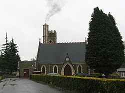
List of places
UK
Wales
Rhondda Cynon Taf
51°35′46″N3°19′23″W / 51.596°N 3.323°W / 51.596; -3.323

Glyntaff is a small village to the south-east of Pontypridd, in the County Borough of Rhondda Cynon Taf, Wales situated in the Treforest ward along with the village of Trefforest.

Contents

Education

Glyntaff is the location of the University of South Wales' Glyntaff Campus, which houses the Department for Health, Sport and Social Science (HESAS); [1] including Glamorgan's Police Science Centre and Glamorgan Centre for Art & Design Technology.

Places of worship

The parish church of St Mary's is on Glyntaff Road in the village.

Other information

Also Glyntaff Crematorium (pictured), the first such facility in Wales when opened in 1924, is located in this village. It is run by Rhondda Cynon Taf County Borough Council. [2]

Glyntaff was served between 1904 and 1932 by Glyntaff Halt railway station on the Pontypridd, Caerphilly and Newport Railway. [3]

Related Research Articles

<span class="mw-page-title-main">Pontypridd</span> Town in Wales

Pontypridd is a town and a community in Rhondda Cynon Taf, Wales.

<span class="mw-page-title-main">Rhondda Cynon Taf</span> County borough in Wales

Rhondda Cynon Taf is a county borough in the south-east of Wales. It consists of five valleys: the Rhondda Fawr, Rhondda Fach, Cynon, Taff and Ely valleys, plus a number of towns and villages away from the valleys. Results from the 2011 census showed 19.1% of its 234,410 residents self-identified as having some ability in the use of the Welsh language. The county borough borders Merthyr Tydfil County Borough and Caerphilly County Borough to the east, Cardiff and the Vale of Glamorgan to the south, Bridgend County Borough and Neath Port Talbot to the west and Powys to the north. Its principal towns are - Aberdare, Llantrisant with Talbot Green and Pontypridd, with other key settlements/towns being - Maerdy, Ferndale, Hirwaun, Llanharan, Mountain Ash, Porth, Tonypandy, Tonyrefail and Treorchy.

<span class="mw-page-title-main">University of Glamorgan</span> Former university in Wales

The University of Glamorgan was a university based in South Wales prior to the merger with University of Wales, Newport, that formed the University of South Wales in April 2013. The university was based in Pontypridd, in Rhondda Cynon Taf, with campuses in Trefforest, Glyntaff, Merthyr Tydfil, Tyn y Wern and Cardiff. The university had four faculties, and was the only university in Wales which had no link with the University of Wales.

<span class="mw-page-title-main">Ynysybwl</span> Human settlement in Wales

Ynysybwl is a village in Cwm Clydach in Wales. It is situated in the county borough of Rhondda Cynon Taf, roughly 15 miles (24 km) north-north-west of Cardiff, 4 miles (6 km) north of Pontypridd and 16 miles (26 km) south of Merthyr Tydfil, and forms part of the community of Ynysybwl and Coed-y-Cwm.

<span class="mw-page-title-main">Llwynypia</span> Human settlement in Wales

Llwynypia is a village and community in Rhondda Cynon Taf, Wales, near Tonypandy in the Rhondda Fawr Valley. Before 1850 a lightly populated rural farming area, Llwynypia experienced a population boom between 1860 and 1920 with the sinking of several coal mines after the discovery of large coal deposits throughout the Rhondda Valleys.

<span class="mw-page-title-main">Treforest</span> Village in Wales

Treforest is a village in the south-east of Pontypridd, in the county borough of Rhondda Cynon Taf, Wales. It is situated in the Treforest electoral ward, along with the village of Glyntaff. It is part of the Pontypridd Town community. Treforest runs along the west bank of the River Taff, while Glyntaff runs along its east bank.

<span class="mw-page-title-main">Rhydyfelin</span> Human settlement in Wales

Rhydyfelin is a large village and part of the community of Pontypridd Town, about two miles to its south east of Pontypridd, in the county borough of Rhondda Cynon Taf. It is on the eastern bank of the River Taff close to the A470, and historically was in the parish of Eglwysilan.

<span class="mw-page-title-main">Ynyshir</span> Village and community in Rhondda, Wales

Ynyshir is a village and community located in the Rhondda Valley, within Rhondda Cynon Taf, South Wales. The name of the village means "long island" in Welsh and takes its name from a farm in the area, falling within the historic parishes of Ystradyfodwg and Llanwynno (Llanwonno). The community of Ynyshir lies between the small adjoining village of Wattstown and the larger town of neighbouring Porth.

<span class="mw-page-title-main">Pontypridd (UK Parliament constituency)</span> Parliamentary constituency in the United Kingdom, 1918 onwards

Pontypridd is a constituency represented in the House of Commons of the UK Parliament since 2019 by Alex Davies-Jones of the Labour Party.

<span class="mw-page-title-main">Beddau</span> Human settlement in Wales

Beddau is a large former mining village situated within the South Wales Valleys around 1.5 miles (2.4 km) from Llantrisant and 4 miles (6.4 km) from the larger town of Pontypridd in the county borough of Rhondda Cynon Taf, South Wales.

<span class="mw-page-title-main">Talbot Green</span> Human settlement in Wales

Talbot Green is a town just north of the M4 motorway, in the County Borough of Rhondda Cynon Taf, Wales in the United Kingdom. The town is part of Llantrisant Community Council.

<span class="mw-page-title-main">Llanharry</span> A village in Rhonda Cynon Taff, Wales

Llanharry is a village, community and electoral ward in the county borough of Rhondda Cynon Taf, Wales.

<span class="mw-page-title-main">Rhondda Cynon Taf County Borough Council</span> Local government of Rhondda Cynon Taf, Wales

Rhondda Cynon Taf County Borough Council is the governing body for Rhondda Cynon Taf, one of the Principal Areas of Wales. The council headquarters are located in the community of Cwm Clydach on the outskirts of Tonypandy.

<span class="mw-page-title-main">Church Village</span> Village in Rhonda Cynon Taf, Wales

Church Village is a large village in the historic parish and community of Llantwit Fardre, located within the Taff Ely district of the County Borough of Rhondda Cynon Taf in Wales. The village is centrally located being around 4 miles (6.4 km) from the local principal towns of Llantrisant to the southwest and Pontypridd to the north and is situated around 10 miles (16 km) northwest of Cardiff city centre.

<span class="mw-page-title-main">Tonteg</span> Human settlement in Wales

Tonteg is a village around three and a half miles (6 km) from Pontypridd, south Wales. It is 9 miles (14.5 km) north west of Cardiff and four miles (6.5 km) north east of Llantrisant. The village is within the community of Llantwit Fardre. Tonteg is to the north west of the Garth Mountain, on the west side of the River Taff valley, at the top of a hill known locally as Powerstation Hill. The hill gets its name from the Upper Boat power station which was situated at the bottom of the hill until it was demolished in 1972. Tonteg is next to Church Village and the boundaries between the two villages are blurred. A significant part of the Treforest Industrial Estate falls within the Willowford area of Tonteg.

<span class="mw-page-title-main">Cwm Taf Morgannwg University Health Board</span> NHS local health board in South Wales

Cwm Taf Morgannwg University Health Board (CTMUHB) is the local health board of NHS Wales for Merthyr Tydfil, Rhondda Cynon Taf, and Bridgend in the south of Wales. It was renamed from Cwm Taf University Health Board on 1 April 2019 following the transfer of Bridgend County Borough from the former Abertawe Bro Morgannwg University Health Board.

Hawthorn is a village and electoral ward within the community of the town of Pontypridd in the County Borough of Rhondda Cynon Taf, located 10 miles north west of Cardiff, the capital city of Wales. Historically this fell within the parish of Eglwysilan within Mid Glamorgan.

<span class="mw-page-title-main">Glyncoch</span> Human settlement in Wales

Glyncoch is a village to the north of Pontypridd in Rhondda Cynon Taf, Wales. It is also the name of an electoral ward.

<span class="mw-page-title-main">Graigwen</span> Village in Mid Glamorgan, Wales

Graigwen is the name of the large hill and the village or district located thereon, sited to the north of Pontypridd town centre and south of Glyncoch and Ynysybwl in the county borough of Rhondda Cynon Taf, Wales, and within the ancient parish of Llanwonno (Llanwynno). It falls within the Rhondda and Pontypridd Town electoral wards, and comprises the sub-districts of Pantygraigwen, Penygraigwen, the Whiterock Estate, and Lanwood. It is also bounded by the districts of Pwllgwaun and Hopkinstown.

<span class="mw-page-title-main">Graig, Pontypridd</span> Human settlement in Wales

Graig is a historic district of the town of Pontypridd, Rhondda Cynon Taf, South Wales. It is also the name of an electoral ward for the town and county councils.

References

  1. "Academic Facilities at the Glyntaff Campus". University of Glamorgan. Archived from the original on 12 August 2012. Retrieved 3 August 2012.
  2. Cremations - Rhonda Cynon Taf Council bereavement services page.
  3. Hutton, J. The Newport Dock & Railway Company. Silver Link. 1996, p. 85