Groton is a town in Caledonia County, Vermont, United States. The population was 1,022 at the 2010 census. It contains the places Groton Pond, Rickers Mills, Rickers and West Groton. The unincorporated village of Groton in the southeast corner of town is recorded as the Groton census-designated place (CDP), with a population of 437 at the 2010 census.

Springfield is a census-designated place (CDP) comprising the main settlement within the town of Springfield, Windsor County, Vermont, United States. The population of the CDP was 3,979 at the 2010 census, compared with 9,373 for the town as a whole.

Lealman, known as East Lealman until 2010, is a census-designated place (CDP) in Pinellas County, Florida, United States. The population was 19,879 at the 2010 census. Prior to 2010, Lealman was part of a larger CDP named West and East Lealman.

Warrenville is a census-designated place (CDP) in Aiken County, South Carolina, United States. The population was 1,233 at the 2010 census. It is located just south of Graniteville and is part of the Augusta, Georgia metropolitan area. Warrenville is located in historic Horse Creek Valley.

South Royalton is a census-designated place (CDP) in the town of Royalton, Windsor County, Vermont, United States. With a population at the 2010 census of 694, South Royalton is the largest village in the town. It is the home to Vermont Law School. The central portion of the village is a historic district, listed on the National Register of Historic Places as the South Royalton Historic District. The Joseph Smith Birthplace Memorial is located approximately 2 miles to the east. South Royalton is the town pictured in the opening credits of the WB television show Gilmore Girls.

West Nanticoke is a census-designated place (CDP) in Plymouth Township, Luzerne County, Pennsylvania, United States, across the Susquehanna River from the city of Nanticoke. The population of the CDP was 749 at the 2010 census.

Harleigh is a census-designated place (CDP) in Hazle Township, Luzerne County, Pennsylvania, United States, north of the city of Hazleton. The CDP population was 1,104 at the 2010 census.

Plains is a census-designated place (CDP) in Plains Township, Luzerne County, Pennsylvania, United States. The population of the CDP was 4,335 at the 2010 census, out of 9,961 in the entire township.

East Barre is a census-designated place (CDP) in the town of Barre, Washington County, Vermont, United States. The population of the CDP was 826 at the 2010 census. Prior to 2010, East Barre was part of the Graniteville-East Barre CDP, which consisted of three unincorporated villages in the town: Graniteville, East Barre, and Websterville.

Websterville is a census-designated place (CDP) in the town of Barre, Washington County, Vermont, United States. The population of the CDP was 550 at the 2010 census. Prior to 2010, it was part of the Graniteville-East Barre CDP, which consisted of three unincorporated villages in the town: Graniteville, East Barre, and Websterville.

Georgetown is a census-designated place (CDP) in Wilkes-Barre Township, Luzerne County, Pennsylvania, United States, adjacent to the city of Wilkes-Barre. The CDP population was 1,640 at the 2010 census.

Hickory Hills is a census-designated place (CDP) in Foster Township, Luzerne County, Pennsylvania, United States, southwest of the borough of White Haven. The CDP population was 562 at the 2010 census.

Silkworth is a census-designated place (CDP) in Lehman Township, Luzerne County, Pennsylvania, United States. The population was 820 at the 2010 census.

West Lealman is a census-designated place (CDP) in Pinellas County, Florida, United States. The population was 15,651 at the 2010 census. Prior to 2010, West Lealman was part of a larger CDP named West and East Lealman.

Casco is a census-designated place (CDP) in the town of Casco in Cumberland County, Maine, United States. The population of the CDP was 587 at the 2010 census. It is part of the Portland–South Portland–Biddeford, Maine Metropolitan Statistical Area.

Windsor is a census-designated place (CDP) comprising the main settlement within the town of Windsor, Windsor County, Vermont, United States. The population of the CDP was 2,066 at the 2010 census, compared with 3,553 for the town as a whole.

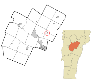
East Montpelier is a census-designated place (CDP) comprising the central village of the town of East Montpelier, Washington County, Vermont, United States. The population of the CDP was 80 at the 2010 census.

Plainfield is a census-designated place (CDP) comprising the main village of the town of Plainfield, Washington County, Vermont, United States. The population of the CDP was 401 at the 2010 census.

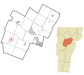
Waitsfield is a census-designated place (CDP) in the town of Waitsfield, Washington County, Vermont, United States. The population of the CDP was 164 at the 2010 census.

Worcester is a census-designated place (CDP) that comprises the main village in the town of Worcester, Washington County, Vermont, United States. The population of the CDP was 112 at the 2010 census.


