Waterbury, Vermont

Last updated

Waterbury, Vermont
Waterbury VT.JPG
Downtown Waterbury
Washington County Vermont Incorporated and Unincorporated areas Waterbury highlighted.svg
Location in Washington County and the state of Vermont.
USA Vermont relief location map.svg
Red pog.svg
Waterbury
Location in the United States
Usa edcp relief location map.png
Red pog.svg
Waterbury
Waterbury (the United States)
Coordinates: 44°20′15″N72°45′20″W / 44.33750°N 72.75556°W / 44.33750; -72.75556
Country United States
State Vermont
County Washington
Area
  Total49.7 sq mi (128.8 km2)
  Land48.2 sq mi (124.9 km2)
  Water1.5 sq mi (3.9 km2)
Elevation
614 ft (187 m)
Population
 (2020)
  Total5,331
  Density110/sq mi (41/km2)
Time zone UTC-5 (Eastern (EST))
  Summer (DST) UTC-4 (EDT)
ZIP codes
05671, 05676 ,05677
Area code 802
FIPS code 50-76975 [1]
GNIS feature ID1462244 [2]
Website www.waterburyvt.com

Waterbury is a town in Washington County in central Vermont, United States. Although the town is still home to the Waterbury Village Historic District, the village sharing the name of the town officially dissolved as a municipality in 2018. [3] As of the 2020 census, the population was 5,331. [4]

Contents

History

The location where Waterbury now lies was once the frontier between the Mahican and Pennacook people. European settlement of the area dates from 1763, when King George III granted a charter for land in the Winooski River valley. James Marsh became the first permanent white settler in the region in 1783. Many of the early settlers came from Waterbury, Connecticut, and named their new town in honor of the hometown.[ citation needed ] The village of Waterbury was incorporated in 1882 with a population of over 2,000.

The Central Vermont Railroad came to Waterbury in 1849. [5] The railroad expanded a passenger station for the railroad in 1875, making the station a more major stop on the Vermonter. [5] The Green Mountain Seminary was built in Waterbury Center in 1869.

The state opened the Vermont State Asylum for the Insane here in 1891. [6] The hospital, renamed the Vermont State Hospital, grew to occupy over 40 buildings, but by the 1980s the number of patients had declined to the point where only one building was required. The remainder of the campus came to be used for state offices. [7]

Like many New England towns, Waterbury's economy was based around the local river mill industry and the surrounding agricultural producers. The mills produced products such as lumber and finished wood products, wicker products, leather, starch, and alcohol. The agriculture was based on sheep through the 19th century but switched over to dairy farming by the 20th century. Waterbury had a ski factory in the 1940s, the Derby & Ball Company.

In 1927, Waterbury, like many other Vermont communities, was devastated by flooding. Inscriptions on the sides of some buildings in Waterbury village purport to show where the level of the water rose during the 1927 flood. The village recovered, and in 1938 the Waterbury Dam was built on the Little River by the Army Corps of Engineers to control future flooding in areas downstream of the town center.

On August 29, 2011, Tropical Storm Irene flooded downtown Waterbury and filled the buildings of the Vermont State Hospital, Vermont's public psychiatric complex, with up to 6 feet (1.8 m) of water. Patients from the mental hospital were temporarily housed in various locations around Vermont, and over 1,100 of the 1,586 state employees were working in office space in other towns as of October 2011. The state was expected to decide by 2012 whether to relocate all or part of the workforce back to Waterbury. [8] [ needs update ]

In 2017, the citizens within the Village of Waterbury voted to dissolve it as a municipality, completing their merger with the Town of Waterbury. The Village dissolved on June 30, 2018. [3]

Economy

A sign leading to Ben & Jerry's Ice Cream factory in Waterbury Ben&JarrysWaterbury.jpg
A sign leading to Ben & Jerry's Ice Cream factory in Waterbury

Waterbury is the location of Ben & Jerry's Ice Cream, whose factory tours have become one of Vermont's most popular tourist attraction. [9] Other local businesses include a number of restaurants and bars. Businesses in the town, which sits between several major mountains including Mount Mansfield, typically thrive during the month of October, when tourism swells thanks to fall foliage.

Demographics

Historical population
CensusPop.Note
1800 644
1810 96650.0%
1820 1,26931.4%
1830 1,65030.0%
1840 1,99220.7%
1850 2,35218.1%
1860 2,198−6.5%
1870 2,63319.8%
1880 2,297−12.8%
1890 2,232−2.8%
1900 2,81025.9%
1910 3,27316.5%
1920 3,5428.2%
1930 4,04514.2%
1940 4,1181.8%
1950 4,2763.8%
1960 4,3030.6%
1970 4,6147.2%
1980 4,465−3.2%
1990 4,5892.8%
2000 4,9157.1%
2010 5,0643.0%
2020 5,3315.3%
U.S. Decennial Census [10] [11]

As of the census [1] of 2000, there were 4,915 people, 2,011 households, and 1,321 families residing in the town. The population density was 810.4 people per square mile (312.9/km2). There were 2,106 housing units at an average density of 347.2 per square mile (134.1/km2). The racial makeup of the town was 97.80% White, 0.26% African American, 0.12% Native American, 0.65% Asian, 0.26% from other races, and 0.89% from two or more races. Hispanic or Latino of any race were 0.67% of the population.

There were 2,011 households, out of which 24.0% had children under the age of 18 living with them, 54.2% were married couples living together, 7.9% had a female householder with no husband present, and 34.3% were non-families. 25.6% of all households were made up of individuals, and 9.5% had someone living alone who was 65 years of age or older. The average household size was 2.42 and the average family size was 2.93.

In the town, the population was spread out, with 25.1% under the age of 18, 5.5% from 18 to 24, 32.8% from 25 to 44, 26.2% from 45 to 64, and 10.3% who were 65 years of age or older. The median age was 37.7 years. For every 100 females, there were 97.4 males. For every 100 females age 18 and over, there were 93.4 males.

The median income for a household in the town was $44,940, and the median income for a family was $60,547. Males had a median income of $35,566 versus $25,838 for females. The per capita income for the town was $25,858. About 3.3% of families and 6.1% of the population were below the poverty line, including 7.0% of those under age 18 and 4.9% of those age 65 or over.

Government and infrastructure

The State of Vermont operates the Waterbury Office Complex. [12] The Vermont Department of Corrections has its headquarters in the Waterbury Office Complex. [13] [14]

Education

Waterbury belongs to the Washington West Supervisory Union. Students attend Brookside Primary School for grades preschool and Kindergarten through 4th grade, Crossett Brook Middle School for grades 5–8, and Harwood Union High School for grades 9–12.

Transportation

Amtrak, the national passenger rail system, provides daily service to Waterbury, operating its Vermonter between St. Albans and Washington, D.C.

The Green Mountain Transit Agency (GMTA) provides public transit bus services to Burlington, Montpelier, Morrisville, and Stowe. [15]

Waterbury is served by Interstate 89, U.S. Route 2, and Route 100.

Media

Radio station WDEV  -550 AM & 96.1 FM (News/Talk), is located in town, with its offices and studios on Stowe Street. WWMP  (Rock 103.3) – 103.3 FM (Mainstream rock) is officially licensed to Waterbury and has its transmission tower located on Ricker Mountain (which it shares with sister station WNCS Montpelier), but its offices and studios are located in South Burlington.

The Waterbury Record was a weekly newspaper that served the local area. On March 26, 2020, the Vermont Community Newspaper Group announced that it was suspending publication of the Waterbury Record, after 13 years of publication, citing the lack of widespread advertising support and now the economic impact of the coronavirus pandemic. [16]

In May 2020 a web-based publication, the Waterbury Roundabout, was founded by Lisa Scagliotti to provide local news with support from the University of Vermont’s Community News Service. A partnership was formed with the Barre Montpelier Times Argus to distribute a free weekly printed "Waterbury Reader" to residents of Waterbury. That partnership ended in September 2022 and the Waterbury Roundabout returned to being a web-only publication. [17]

Notable people

Climate

This climatic region is typified by large seasonal temperature differences, with warm to hot (and often humid) summers that are known to occasionally reach 90 to 100 degrees and cold (sometimes severely cold) winters. According to the Köppen Climate Classification system, Waterbury has a humid continental climate, abbreviated "Dfb" on climate maps. [19]

Related Research Articles

<span class="mw-page-title-main">Montpelier, Vermont</span> Capital city of Vermont, United States

Montpelier is the capital of the U.S. state of Vermont and the county seat of Washington County. The site of Vermont's state government, it is the least populated state capital in the United States. As of the 2020 census, the population was 8,074, with a daytime population growth of about 21,000 due to the large number of jobs within city limits. The Vermont College of Fine Arts is located in the municipality. It was named after Montpellier, a city in the south of France.

<span class="mw-page-title-main">Washington County, Vermont</span> County in Vermont, United States

Washington County is a county located in the U.S. state of Vermont. Named after George Washington, its shire town is the city of Montpelier and the most populous municipality is the city of Barre. As of the 2020 census, the population was 59,807, making it the third-most populous county in Vermont, but the third-least populous capital county in the United States after Hughes County, South Dakota and Franklin County, Kentucky. Washington County comprises the Barre, Vermont micropolitan statistical area. In 2010, the center of population of Vermont was located in Washington County, in the town of Warren.

<span class="mw-page-title-main">Danville, Vermont</span> Town in Vermont, United States

Danville is a town in Caledonia County, Vermont, United States. The population was 2,335 at the 2020 census. The primary settlement in town is recorded as the Danville census-designated place (CDP) and had a population of 385 at the 2020 census.

<span class="mw-page-title-main">Huntington, Vermont</span> Town in Vermont, United States

Huntington is a town in Chittenden County, Vermont, United States. The population was 1,938 at the 2020 census.

<span class="mw-page-title-main">Shelburne, Vermont</span> Town in Vermont, United States

Shelburne is a town in Chittenden County, Vermont, United States. Located along the shores of Lake Champlain, Shelburne's town center lies approximately 7 miles (11 km) south of the city center of Burlington, the largest city in the state of Vermont. As of the 2020 census, the population of Shelburne was 7,717.

<span class="mw-page-title-main">Stowe, Vermont</span> Town in Vermont, United States

Stowe is a town in Lamoille County, Vermont, United States. The population was 5,223 at the 2020 census. The town lies on Vermont Routes 108 and 100. It is nicknamed "The Ski Capital of the East" and is home to Stowe Mountain Resort, a ski facility with terrain on Mount Mansfield, the highest peak in Vermont, and Spruce Peak.

<span class="mw-page-title-main">Randolph, Vermont</span> Town in Vermont, United States

Randolph is a town in Orange County, Vermont, United States. The population was 4,774 at the 2020 census, making Randolph the largest town in Orange County. The town is a commercial center for many of the smaller, rural farming communities that surround it.
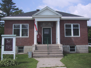
<span class="mw-page-title-main">Washington, Vermont</span> Town in Vermont, United States

Washington is a town in Orange County, Vermont, in the United States. The population was 1,032 at the 2020 census. The town is believed to be named after George Washington, although the town may also be named after Washington, Connecticut, as there are records of individuals moving from that town in Connecticut to Vermont around 1766.

<span class="mw-page-title-main">Berlin, Vermont</span> Town in Vermont, United States

Berlin is a town in Washington County, Vermont, United States, founded in 1763.

<span class="mw-page-title-main">Calais, Vermont</span> Town in Vermont, United States

Calais is a town in Washington County, Vermont, United States. The population was 1,661 at the 2020 census. Calais is homophonous with callous. Calais contains the unincorporated communities of Adamant, East Calais, North Calais, Kent's Corner, Maple Corner and Pekin.
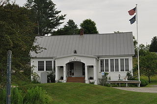
<span class="mw-page-title-main">East Montpelier, Vermont</span> Town in Vermont, United States

East Montpelier is a town in Washington County, Vermont, United States. The population was 2,598 at the 2020 census.
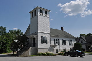
<span class="mw-page-title-main">Middlesex, Vermont</span> Town in Vermont, United States

Middlesex is a town in Washington County, Vermont, United States. The population was 1,779 at the 2020 census.

<span class="mw-page-title-main">Windsor, Vermont</span> Town in Vermont, United States

Windsor is a town in Windsor County, Vermont, United States. As the "Birthplace of Vermont", the town is where the Constitution of Vermont was adopted in 1777, thus marking the founding of the Vermont Republic, a sovereign state until 1791, when Vermont joined the United States. Over much of its history, Windsor was home to a variety of manufacturing enterprises. Its population was 3,559 at the 2020 census.

<span class="mw-page-title-main">Barre (town), Vermont</span> Town in Vermont, United States

Barre is a town in Washington County, Vermont, United States. The population was 7,923 at the 2020 census, making it the 3rd largest municipality in Washington County and the 16th largest municipality in Vermont. Popularly referred to as "Barre Town", the town of Barre almost completely surrounds "Barre City", which is a separate municipality. The original town now known as Barre was first chartered in 1780 as the Town of Wildersburgh. In 1793 the name Wildersburgh was unpopular with the inhabitants and the name of the town was changed to Barre. In 1895 the City of Barre was incorporated and separated from the town of Barre, and both continue to exist as separate municipalities.
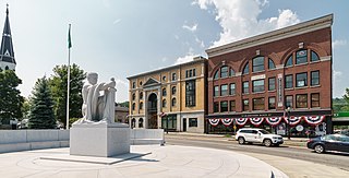
<span class="mw-page-title-main">Barre (city), Vermont</span> City in Vermont, United States

Barre is the most populous city in Washington County, Vermont, United States. As of the 2020 census, the municipal population was 8,491. Popularly referred to as "Barre City", it is almost completely surrounded by "Barre Town", which is a separate municipality.

<span class="mw-page-title-main">Northfield, Vermont</span> Town in Vermont, United States

Northfield is a town in Washington County, Vermont, United States. The town lies in a valley within the Green Mountains and has been home to Norwich University since 1866. It contains the village of Northfield, where over half of the population lives. The town's total population was 5,918 at the 2020 census.

<span class="mw-page-title-main">Cabot, Vermont</span> Town in Vermont, United States

Cabot is a six-mile-square New England town located in the northeast corner of Washington County, Vermont, United States. The population was 1,443 at the 2020 census. It contains the unincorporated villages of Cabot Village, Cabot Plain, South Cabot (Hookerville), East Cabot, Lower Cabot, and West Hill. There was also a community known as Petersville until property owners there sold a total of 100 acres to Molly’s Falls Electric Light and Power Company, and in 1925 a large dam was constructed on Molly’s Brook, that completely flooded the area that had been farms and homes to create what is now known as Molly’s Falls Reservoir, or sometimes “Marshfield Dam,” which is located close to the Cabot/Marshfield town line. 
<span class="mw-page-title-main">WDEV</span> Full service radio station in Waterbury, Vermont

WDEV is a commercial AM radio station in Waterbury, Vermont, United States. Programming is simulcast on WDEV-FM licensed to Warren, Vermont. The stations' studios and offices are located near U.S. Route 2 in Waterbury. WDEV also operates two translator stations, W243AT, licensed to Barre, Vermont, and W252CU, licensed to Montpelier, Vermont. WDEV can also be heard on a privately owned translator, W270BR, licensed to Island Pond, Vermont. The stations are owned by Radio Vermont, Inc., and air a full service radio format, including news, talk, sports and different genres of music.
<span class="mw-page-title-main">Vermont Department of Corrections</span> American state government agency

The Vermont Department of Corrections is the government agency in the U.S. state of Vermont charged with overseeing correctional facilities, supervising probation and parolees, and serving in an advisory capacity in the prevention of crime and juvenile delinquency. It is a part of the Vermont Agency of Human Services.

The COVID-19 pandemic in the U.S. state of Vermont is part of an ongoing worldwide viral pandemic of coronavirus disease 2019, a novel infectious disease caused by severe acute respiratory syndrome coronavirus 2.

References

  1. 1 2 "U.S. Census website". United States Census Bureau . Retrieved January 31, 2008.
  2. "US Board on Geographic Names". United States Geological Survey. October 25, 2007. Retrieved January 31, 2008.
  3. 1 2 "Waterbury History". Waterbury Town Website. Retrieved September 23, 2022.
  4. "Census - Geographic Profile - Waterbury town, Washington County, Vermont". United States Census Bureau . Retrieved October 28, 2021.
  5. 1 2 "Waterbury, VT (WAB)". Great American Stations. Retrieved March 3, 2017.
  6. Sanders, Stephen (April 12, 1984). "Brattleboro Retreat (Vermont Asylum for the Insane)". www.crjc.org. Retrieved May 13, 2008.
  7. "History of Waterbury". www.central-vt.com. Archived from the original on April 15, 2012. Retrieved October 17, 2011.
  8. Nemethy, Andrew (September 15, 2011). "State begins post-Irene move of more than 1,100 state employees". VTDigger. Retrieved October 17, 2011.
  9. Attractions - Ben Jerrys Archived June 10, 2013, at the Wayback Machine . VTLiving.com. Retrieved on April 12, 2014.
  10. "Census of Population and Housing". Census.gov. Retrieved June 4, 2015.
  11. "Vermont History Explorer" . Retrieved August 7, 2015.
  12. "Waterbury State Office Complex Archived 2010-08-25 at the Wayback Machine ." Vermont Department of Corrections. Retrieved on December 7, 2009.
  13. "Contact the Vermont Department of Corrections." Vermont Department of Corrections. Retrieved on December 7, 2009.
  14. "About the Department of Corrections." Vermont Department of Corrections. Retrieved on December 7, 2009."A map showing where the Department of Corrections Central Office is in the Waterbury State Office complex."
  15. "Stowe/Lamoille". ridegmt.com. Retrieved March 13, 2018.
  16. "Waterbury Record publishes its last issue". Waterbury Record. Vermont Community Newspaper Group. March 26, 2020. Retrieved April 8, 2020.
  17. Shulman-Hall, Juliet (September 19, 2022). "Waterbury journalist struggles to keep local news alive". VTDigger. Retrieved September 20, 2022.
  18. "Obituary, Charles J. Adams". Times Argus. Barre, VT. May 17, 2008. Archived from the original on November 5, 2016. Retrieved November 5, 2016.
  19. "Waterbury, Vermont Köppen Climate Classification (Weatherbase)". Weatherbase. Retrieved March 13, 2018.