Grantham, New Hampshire

Last updated

Grantham, New Hampshire
GranthamNHUMC.jpg
United Methodist Church in center of Grantham along Route 10, May 2010
Grantham-Town-Seal.png
Sullivan County New Hampshire incorporated and unincorporated areas Grantham highlighted.svg
Location in Sullivan County and the state of New Hampshire
Coordinates: 43°29′21″N72°08′15″W / 43.48917°N 72.13750°W / 43.48917; -72.13750
Country United States
State New Hampshire
County Sullivan
Incorporated1761
Villages
  • Grantham
  • East Grantham
  • Eastman
  • North Grantham
Government
   Board of Selectmen
  • Peter H. Garland, Chair
  • Warren Kimball
  • Constance A. Jones
Area
[1]
  Total28.05 sq mi (72.65 km2)
  Land27.22 sq mi (70.49 km2)
  Water0.83 sq mi (2.16 km2)  2.97%
Elevation
948 ft (289 m)
Population
 (2020)
  Total3,404
  Density152/sq mi (58.6/km2)
Time zone UTC-5 (Eastern)
  Summer (DST) UTC-4 (Eastern)
ZIP code
03753
Area code 603
FIPS code 33-31220
GNIS feature ID0873610
Website www.granthamnh.net

Grantham is a town in Sullivan County, New Hampshire, United States. The population was 3,404 at the 2020 census, [2] an increase over the figure of 2,985 tabulated in 2010. The planned community of Eastman is in the eastern part of the town.

Contents

History

Incorporated in 1761, Grantham takes its name from Thomas Robinson, 1st Baron Grantham, Secretary of State for the Southern Department from March 1754 to October 1755. Prior to county division in 1827, Grantham was in Cheshire County.

The families of Howe, Dunbar and Leavitt were all early Grantham settlers. All three families secured lands in Grantham as part of the charter granted to Baron Grantham in 1761, and all three families "have Grantham hills named after them," according to Elmer M. Hunt in New Hampshire Town Names And Whence They Came. "The Leavitts are said to have had at one time fifty children in attendance at the town's school, and over the years no fewer than seventeen teachers." [3]

Historical population
CensusPop.Note
1790 333
1800 713114.1%
1810 86421.2%
1820 1,03219.4%
1830 1,0794.6%
1840 1,034−4.2%
1850 784−24.2%
1860 648−17.3%
1870 608−6.2%
1880 540−11.2%
1890 424−21.5%
1900 374−11.8%
1910 286−23.5%
1920 49573.1%
1930 302−39.0%
1940 36721.5%
1950 359−2.2%
1960 332−7.5%
1970 36610.2%
1980 70492.3%
1990 1,24777.1%
2000 2,16773.8%
2010 2,98537.7%
2020 3,40414.0%
U.S. Decennial Census [4]

Demographics

As of the census of 2000, there were 2,167 people, 924 households, and 707 families residing in the town. The population density was 80.9 inhabitants per square mile (31.2/km2). There were 1,513 housing units at an average density of 56.5 per square mile (21.8/km2). The racial makeup of the town was 98.29% White, 0.28% African American, 0.09% Native American, 0.42% Asian, 0.09% from other races, and 0.83% from two or more races. Hispanic or Latino of any race were 0.55% of the population.

There were 924 households, out of which 24.1% had children under the age of 18 living with them, 70.2% were married couples living together, 4.7% had a female householder with no husband present, and 23.4% were non-families. 19.2% of all households were made up of individuals, and 7.1% had someone living alone who was 65 years of age or older. The average household size was 2.35 and the average family size was 2.67.

In the town, the population was spread out, with 19.9% under the age of 18, 2.9% from 18 to 24, 25.7% from 25 to 44, 29.7% from 45 to 64, and 21.7% who were 65 years of age or older. The median age was 46 years. For every 100 females, there were 96.1 males. For every 100 females age 18 and over, there were 95.6 males.

The median income for a household in the town was $63,239, and the median income for a family was $69,271. Males had a median income of $43,250 versus $34,773 for females. The per capita income for the town was $32,174. About 1.4% of families and 2.5% of the population were below the poverty line, including 1.8% of those under age 18 and 3.8% of those age 65 or over.

Geography

Eastman Pond, August 2006 Full Lake View WEB Size.jpg
Eastman Pond, August 2006

According to the United States Census Bureau, the town has a total area of 28.0 square miles (72.6 km2), of which 27.2 square miles (70.5 km2) are land and 0.85 square miles (2.2 km2) are water, comprising 2.97% of the town. [1] Grantham is drained by the North Branch Sugar River and its tributaries Sawyer Brook, Stocker Brook, and Eastman Brook. Eastman Pond lies at the head of Eastman Brook and serves as the focal point of the Eastman planned community. [5] Other water bodies in the town include Anderson and Butternut Ponds. Grantham lies fully within the Connecticut River watershed. [6] The highest point in town is Grantham Mountain, 2,660 feet (810 m) above sea level, a peak along the ridge of Croydon Mountain, which follows the western edge of the town.

Interstate 89 crosses the town, leading northwest to Lebanon and southeast to Concord. Access is from Exit 13 (New Hampshire Route 10) near the center of town and from Exit 14 at the northern border of town. Route 10 leads south to Newport, the county seat, and north with I-89 to Lebanon.

The town is home to the Grantham Village School (opened 1981) and Dunbar Free Library (opened 1903).

Adjacent municipalities

See also

Related Research Articles

<span class="mw-page-title-main">Sullivan County, New Hampshire</span> County in New Hampshire, United States

Sullivan County is a county in the U.S. state of New Hampshire. As of the 2020 census, the population was 43,063, making it the second-least populous county in New Hampshire. Its county seat is Newport.

<span class="mw-page-title-main">Limerick, Maine</span> Town in Maine, United States

Limerick is a town in York County, Maine, United States. It is part of the Portland–South Portland–Biddeford, Maine metropolitan statistical area. The population was 3,188 at the 2020 census.

<span class="mw-page-title-main">Effingham, New Hampshire</span> Town in New Hampshire, United States

Effingham is a town in Carroll County, New Hampshire, United States. At the 2020 census, the town population was 1,691, up from 1,465 at the 2010 census. Effingham includes the villages of Effingham Falls, Effingham, Center Effingham, and South Effingham. Pine River State Forest is in the south.

<span class="mw-page-title-main">Surry, New Hampshire</span> Town in New Hampshire, United States

Surry is a town in Cheshire County, New Hampshire, United States. The population was 820 at the 2020 census, up from 732 at the 2010 census.

<span class="mw-page-title-main">Ellsworth, New Hampshire</span> Town in New Hampshire, United States

Ellsworth is a town in Grafton County, New Hampshire, United States. The population was 93 at the 2020 census.

<span class="mw-page-title-main">Lyman, New Hampshire</span> Town in New Hampshire, United States

Lyman is a town in Grafton County, New Hampshire, United States. The population was 585 at the 2020 census.

<span class="mw-page-title-main">Orange, New Hampshire</span> Town in New Hampshire, United States

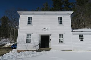
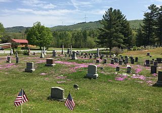
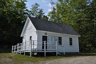
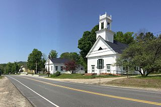
Orange is a town in Grafton County, New Hampshire, United States. The population was 277 at the 2020 census, down from 331 at the 2010 census.

<span class="mw-page-title-main">Piermont, New Hampshire</span> Town in New Hampshire, United States

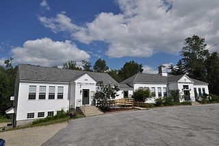
Piermont is a town in Grafton County, New Hampshire, United States. The population was 769 at the 2020 census. It is home to Camp Walt Whitman and Kingswood Camp for Boys.

<span class="mw-page-title-main">Thornton, New Hampshire</span> Town in New Hampshire, United States

Thornton is a town in Grafton County, New Hampshire, United States. The population was 2,708 at the 2020 census, up from 2,490 at the 2010 census.

<span class="mw-page-title-main">Greenfield, New Hampshire</span> Town in New Hampshire, United States

Greenfield is a town in Hillsborough County, New Hampshire, United States. The population was 1,716 at the 2020 census. Greenfield is home to the Crotched Mountain Rehabilitation Center, to Greenfield State Park, and to part of the Wapack Trail.

<span class="mw-page-title-main">Temple, New Hampshire</span> Town in New Hampshire, United States

Temple is a town in Hillsborough County, New Hampshire, United States. The population was 1,382 at the 2020 census. It is home to Temple Mountain State Reservation, formerly the Temple Mountain Ski Area.

<span class="mw-page-title-main">Danbury, New Hampshire</span> Town in New Hampshire, United States

Danbury is a town in Merrimack County, New Hampshire, United States. The population was 1,250 at the 2020 census.

<span class="mw-page-title-main">Wilmot, New Hampshire</span> Town in New Hampshire, United States

Wilmot is a town in Merrimack County, New Hampshire, United States. The population was 1,407 at the 2020 census. The town includes the communities of Wilmot, Wilmot Flat, and North Wilmot.

<span class="mw-page-title-main">South Hampton, New Hampshire</span> Town in New Hampshire, United States

South Hampton is a town in Rockingham County, New Hampshire, United States. The population was 894 at the 2020 census. South Hampton is home to Cowden State Forest and Powwow River State Forest.

<span class="mw-page-title-main">Croydon, New Hampshire</span> Place in New Hampshire, United States

Croydon is a town in Sullivan County, New Hampshire, United States. The population was 801 at the 2020 census.

<span class="mw-page-title-main">Langdon, New Hampshire</span> Place in New Hampshire, United States

Langdon is a town in Sullivan County, New Hampshire, United States. The population was 651 at the 2020 census.

<span class="mw-page-title-main">Plainfield, New Hampshire</span> Place in New Hampshire, United States

Plainfield is a town in Sullivan County, New Hampshire, United States. At the time of the 2020 census, the town had a population of 2,459. The town is home to the Helen Woodruff Smith Bird Sanctuary and Annie Duncan State Forest.

<span class="mw-page-title-main">Springfield, New Hampshire</span> Place in New Hampshire, United States

Springfield is a town in Sullivan County, New Hampshire, United States. The population was 1,259 at the 2020 census. Gile State Forest is located within the town.

<span class="mw-page-title-main">Lunenburg, Vermont</span> Town in Vermont, United States

Lunenburg is a town in Essex County, Vermont, United States. The population was 1,246 at the 2020 census, the most populous in Essex County. Lunenburg contains the villages of Lunenburg and Gilman and hamlets of West Lunenburg, South Lunenburg, and Mill Village, and is part of the Berlin, NH–VT Micropolitan Statistical Area.

<span class="mw-page-title-main">Wilton, Maine</span> Town in Maine, United States

Wilton is a town in Franklin County, Maine, United States. The population was 3,835 at the 2020 census. Situated beside Wilson Pond, the former mill town is today primarily a recreation area.

References

  1. 1 2 "2021 U.S. Gazetteer Files – New Hampshire". United States Census Bureau. Retrieved January 7, 2022.
  2. "Census - Geography Profile: Grantham town, Sullivan County, New Hampshire" . Retrieved December 24, 2021.
  3. Hunt, Elmer Munson (1970). New Hampshire Town Names And Whence They Came, p. 15. Peterborough, New Hampshire: Noone House. ISBN   0-87233-009-5.
  4. United States Census Bureau. "Census of Population and Housing" . Retrieved November 4, 2014.
  5. Eastman Community Association
  6. Foster, Debra H.; Batorfalvy, Tatianna N.; Medalie, Laura (1995). Water Use in New Hampshire: An Activities Guide for Teachers. U.S. Department of the Interior and U.S. Geological Survey.