Grassmoor, Hasland and Winsick

Last updated

Grassmoor, Hasland and Winsick
Civil parish
Grassmoor - Community Centre - geograph.org.uk - 1247343.jpg
Grassmoor Community Centre
Grassmoor, Hasland and Winsick
Derbyshire UK location map.svg
Red pog.svg
Grassmoor, Hasland and Winsick
Location within Derbyshire
Area1.76 sq mi (4.6 km2)  [1]
Population3,360 (2011) [1]
  Density 1,909/sq mi (737/km2)
OS grid reference SK404678
  London 130 mi (210 km)  SE
District
Shire county
Region
Country England
Sovereign state United Kingdom
Settlements
Post town CHESTERFIELD
Postcode district S42
Dialling code 01246
Police Derbyshire
Fire Derbyshire
Ambulance East Midlands
UK Parliament
Website grassmoorhwpc.org.uk
List of places
UK
England
Derbyshire
53°12′22″N1°23′46″W / 53.206°N 1.396°W / 53.206; -1.396 Coordinates: 53°12′22″N1°23′46″W / 53.206°N 1.396°W / 53.206; -1.396

Grassmoor, Hasland and Winsick is a civil parish within the North East Derbyshire district, which is in the county of Derbyshire, England. Named for local settlements, with a mix of a number of villages and hamlets amongst a semi-rural area, it had a population of 3,360 residents in 2011. [1] The parish is 130 miles (210 km) north west of London, 20 miles (32 km) north of the county city of Derby, and 2 miles (3.2 km) south east of the nearest market town of Chesterfield. It shares a boundary with the borough of Chesterfield, along with the parishes of Calow, North Wingfield, Temple Normanton, Tupton as well as Wingerworth. [2] The parish paradoxically does not include the majority of the nearby built-up suburb of Hasland which is now within an adjacent unparished area of Chesterfield.

Contents

Geography

Location

Grassmoor, Hasland and Winsick parish is surrounded by the following local locations: [2]

It is 1.76 square miles (4.6 km2; 460 ha) in area, 2 miles (3.2 km) in height and 1+34 miles (2.8 km) in width, within the eastern middle of the North East Derbyshire district, south of Chesterfield district. The parish is roughly bounded by land features such as Hasland cemetery and Winsick housing estate to the north, the Midland Main Line to the west, Calow Brook to the east, and Hagg Hill to the south.

Settlements and routes

There are four villages within the parish, all are linear settlements situated along the main local roads: [3]

The B6038 road has these two settlements aligned along its route:

  • Grassmoor is the largest, and south of the area. It has Grasshill and South End in the north and south as community areas
  • Churchside is 1 mile (1.6 km) away from Grassmoor, to the north west

The B6039 road has the following places:

  • Corbriggs is 1 mile (1.6 km) north of Grassmoor
  • Winsick is 12 mile (0.80 km) away from Corbriggs, to the north west

Additionally, an isolated portion of Hasland village extends into the parish at Winsick and is situated alongside the A617 road. It is focused around Honeysuckle Road and Snowberry Close.

Outside of these settlements, the parish is predominantly an agricultural and rural area.

The key route through the parish is the A617 road from Chesterfield through to the M1 motorway, running through the north eastern portion of the area. The B6039 also from Chesterfield, runs parallel through the south to Tibshelf. The B6038 branches off and then also runs parallel but directly through Grassmoor village to North Wingfield.

Environment

Landscape

Primarily farming and pasture land throughout the parish outside the populated areas, there is some forestry throughout, mainly to the east at Grassmoor Country Park.

Geology

Being a few miles from the Peak District National Park, the composition of the parish is broadly similar, with clay, coal, ironstone and gritstone featuring in the geology of the wider area. It rises through mudstones, sandstones, shales and siltstone, making up the Pennine Middle and Lower Coal Measures Group formed between 309 and 318 million years ago during the Carboniferous period. [4] Along the River Rother, there are superficial deposits of alluvium comprising gravel, sand, silt and clay, being formed between 11.8 thousand years ago and the present during the Quaternary period. [5]

Water features

The parish rests between the River Rother which flows through pools at the Avenue Washlands Nature Reserve, and Calow Brook which runs alongside the Grassmoor Country Park which also has a number of pools.

Land elevation

The Rother and Calow brook valleys contain the low points at their northern extremities, at ~80 metres (260 ft), with the villages on plateaus sitting a little higher; Churchside varies from 95–120 metres (312–394 ft), Corbriggs 95–110 metres (312–361 ft), Winsick ranges from 100–115 metres (328–377 ft), and Grassmoor 100–140 metres (330–460 ft) peaking along the southern boundary.

History

Toponymy

It appears Grassmoor was recorded as a non-settled area during the 1086 Domesday Survey called Gre(y)hirst meaning 'grey copse'. [6] [7]

Hasland was next earliest, being recorded in the 12th century as Haselont, meaning 'hazel grove'. [8]

Winsick was first seen in public record as Winwell Syk from the late 15th century onwards. [9]

Local area

Early history

While there are not many prehistoric remains locally, there are Bronze Age finds such as an arrowhead near Hasland, [10] and slightly further afield, a stone ax at Tupton [11] dating human occupation in the region from 2350 BC to 701 BC. More common have been Roman Britain occupation evidence (43AD to 405AD) such as coins. [12] [13] [14] Grassmoor, Hasland and Winsick lay in what was the Scarsdale hundred, which was one of the six ancient divisions of the county, dating back from medieval times until 1894. Grassmoor was referred to as Greyhirst and was associated to Wingerworth in those times. In historic Derbyshire charter records, Greyhirst Wood is mentioned as being between the hamlet of Williamtorp and the 'great road' to Chesterfield, the only route of real note at the time (1300) was called Rykneld Street which was an old Roman Road and ran from Little Chester at Derby to Chesterfield in the Rother Valley. [15] [16] Peter Perez Burdett's Derbyshire map of 1762 shows Grassmoor to be land bounded on the west by the River Rother, to the east by the Chesterfield to Mansfield road, on the south by Lings and in the north by the area now known as Hasland.

In the 13th century the Welbeck Abbey cartulary register mentions Grayhirst and Greyhyrst, the name Gresmore is shown in an unpublished Court Roll dated 1549 and as Grassmore in Chesterfield parish registers from 1568. Only a few rough paths crossed the "moor" at this time, from north to south diagonally one ran along what is now the Hasland to North Wingfield B6038 road, on the southern edge of the moor. Running from east to west and crossing the north–south road was a path which became Birkin Lane and Hagg Hill, now the road from Temple Normanton to Ashover. Approximately in the centre of Grassmoor village a pathway branched off westwards (modern day Mill Lane) passing a windmill on the left, then falling sharply to ford the River Rother and pass a water mill on a tributary of the river before joining the Derby-Chesterfield road near Wingerworth Park. [16]

For much of its medieval life, the area became more widely known as Hasland with it being a township within the broader Chesterfield ancient parish. [17] Many parish townships were eventually converted to parishes themselves, with Hasland becoming one in 1850 with the opening of the parish church at Churchside. [18] The manor of Hasland passed through marriage by means of one of the coheiresses of William Briwere, to Ralph de Midleham and eventually the Duke of Portland, before an exchange with the Duke of Devonshire meant he became lord of the manor by the 19th century. A branch of the Leake family, for several generations, resided at Hasland Hall, in which John Linacre died during 1488. In the middle of the 17th century, the hall belonged to Colonel Roger Molineux, who sold it to Captain John Lowe, of the Alderwasley family, later becoming the property and residence of Thomas Lucas, whose ancestor bought it from the Lowes in 1727. [19]

Coal industry

Coal mining has taken place since antiquity throughout the UK, but very little evidence of this being done locally until later medieval times. The extraction of coal was at first restricted to those which lay close to the surface. By the early 18th century there were no deep coal mines, the day of businesses exploiting this for commercial gain had not yet begun, coal mines locations were typically leased from the lord of the manor or landowners by yeomen and well-to-do farmers who required coal for lime burning. These sank shallow pits which supplied the domestic and industrial needs of their neighbours and themselves. This type of mine was known as a bell-pit, the depression of a few of these are still visible in the hollow north of Grasshill, with another site possibly identified for this activity, [20] from these tentative beginnings developed deeper coal mines of later days.

Following the Industrial Revolution and smelting of coke to produce iron, which stimulated the demand for coal, deeper mine workings were sunk in Grassmoor in the mid 19th century by Alfred Barnes. [21] Two rows of houses were built for workers, the lengthiest was named East Street, but in local parlance called 'Sluggards Row', because although the miners living here were nearest the colliery, they were usually the last to arrive for their shift. The second row named Grasshill was for colliery officials and was known as 'Four Bob', the rent for them being only four shillings per week. [22] Coal mining would dominate the lives of the majority of inhabitants of Grassmoor until the local demise of the industry. Grassmoor Colliery closed in 1971, with Grassmoor Country Park created from the location of its spoil tips. [23] The Avenue Coking Plant was built in 1935, and although mostly in nearby Wingerworth parish (its railway sidings were in Grassmoor) it provided a sustained source of local employment until its closure in 1993. However, this left an unwanted legacy with the site becoming one of the most contaminated of its type in the country. Following a lengthy 20 year clean up process, the area is now clear and redevelopment is ongoing, including the Avenue Washlands Nature Reserve on the site of the former sidings. [3]

Amenities and government reorganisation

Barnes Park, in the centre of Grassmoor and named after the colliery family, was opened in 1920, with tennis courts, bowling green, football field, cricket field and children's swings. The tennis courts and bowling green were later removed. A cinema was to the far end of the village, it was opened in 1936 and was called the Electric Theatre, later becoming The Roxy, before being redeveloped into a garage and forecourt. Yet another cinema was located at the top of New Street, later became a billiards hall (named the Drum) and a betting shop, before being demolished. Prior to being a cinema, it was the location of the Grassmoor Primitive Methodist Church, which opened in 1879, replacing a small chapel built earlier in 1877, which had become too small for practical use. In 1899 the existing building was opened, and the old building continued to be used as a Sunday School, and leased to the local education board for use as a school. It was sold in 1913 to the Corporation Theatre Company. [22]

1894 was the beginning of a loss of parish territory administratively which originally stretched up to the rivers Rother and Hipper, and encompassed Chesterfield suburbs Boythorpe, Hady and Spital, with further land transfers in 1910 and 1920 when much of the village of Hasland was absorbed into Chesterfield parish and borough. Further perimeter adjustments were made in 1988. However even with these changes, the parish was still named Hasland. In 1982, the formal name of the council was changed to include Grassmoor and Winsick. [18] Since the 1980s, much of the housing stock is terraced properties and council housing, although new estates have been developed including larger detached properties by the Windwhistle Farm build off Birkin Lane, [3] and since the 2010s the Honeysuckle Road/Snowberry Close development in Winsick. [24] The Big Lottery Fund in 2012 designated Grassmoor and Hasland as a Big Local Area, and in 2014 it awarded £1+ million of funds to spend over 10 years aimed at supporting residents with community led initiatives to improve the overall well-being of those localities. [25]

Governance and demography

Population

There are 3,360 residents recorded within the parish for the 2011 census, [1] a decrease from 3,452 (3%) of the 2001 census.

Local bodies

Grassmoor, Hasland and Winsick parish is managed at the first level of public administration through a parish council. [3]

At district level, the wider area is overseen by North East Derbyshire district council. Derbyshire County Council provides the highest level strategic services locally.

Economy

The present business sector types other than agriculture in the parish are varied, but are located evenly throughout except for the moor areas, with these employment areas including:

Community and leisure

Amenties

There is a village community centre at Grassmoor. [33]

There are public houses at Grassmoor and Winsick.

There is a working men's club at Grassmoor.

Family and health services are at Grassmoor. [34]

Community allotments are in Grassmoor.

The village has a limited selection of shops including a post office, which cater for every day needs. Shopping for other items generally requires travelling to Chesterfield or other nearby towns such as Clay Cross or Mansfield. [3]

Recreation

Barnes Park is at Grassmoor with a play ground and football pitch, while a small park with play area is at Winsick village.

Grassmoor Country Park is situated at the northern end of the Five Pits Trail which provides an off-road route for walkers, cyclists and horse riders. The park includes former nearby colliery and coking plant tar lagoons which have been reclaimed to provide a recreational site for the benefit and enjoyment of the local community. [23]

Community groups

Several interest groups exist in the community, predominantly at Grassmoor: [35]

Education

There is a school at Grassmoor village, Grassmoor Primary. [36]

Landmarks

Conservation

Listed building

There is one location of architectural merit throughout the parish with statutory listed status at Grade II, the 1850 built Church of St Paul at Churchside. [37]

Green belt

Much of the parish, except for Grassmoor village and Winsick is covered by the North East Derbyshire Green Belt, which is a part of the more extensive South and West Yorkshire Green Belt, its core function affording planning protection from urban sprawl and inappropriate development. [38]

War memorials

There are monuments commemorating locals who served in but did not return from the World War I and WWII conflicts within Grassmoor village at Barnes Park, and Winsick Park. [39] There is a tablet in St Paul's Church, Churchside with names inscribed.

Sport

North of Grassmoor lies South Chesterfield Golf Club. It is an 18-hole golf course. [40]

There is a cricket club and grounds, [41] a ball court and a facility for skating at Barnes Park in Grassmoor.

Grassmoor F.C. are a locally based football club in the Chesterfield and District Sunday Football League of the Derbyshire County Football Association. [42]

Transport

Grassmoor is relatively well served by public bus transport with buses running to Chesterfield every weekday. [3]

Although the Derby to Sheffield Midland Main Line forms the western edge of the parish, the nearest railway station is at Chesterfield.

Religious sites

St Paul's, Churchside Hasland Church - geograph.org.uk - 2335411.jpg
St Paul's, Churchside

St Paul's in Churchside village is an Anglican place of worship which was built in 1850, [43] alongside it is Hasland Cemetery. There is also a Methodist church in Grassmoor. [44]

Notable people

Related Research Articles

<span class="mw-page-title-main">Chesterfield, Derbyshire</span> Town in Derbyshire, England

Chesterfield is a market town and unparished area in the Borough of Chesterfield, Derbyshire, England, 24 miles (39 km) north of Derby and 11 miles (18 km) south of Sheffield at the confluence of the River Rother and River Hipper. In 2011 the built-up-area subdivision had a population of 88,483, making it the second-largest settlement in Derbyshire, after Derby. The wider borough had a population of 103,801 in 2011. In 2011, the town had a population of 76,753. It has been traced to a transitory Roman fort of the 1st century CE. The name of the later Anglo-Saxon village comes from the Old English ceaster and feld (pasture). It has a sizeable street market three days a week. The town sits on an old coalfield, but little visual evidence of mining remains. The main landmark is the crooked spire of the Church of St Mary and All Saints.

<span class="mw-page-title-main">North East Derbyshire</span> Local government district in England

North East Derbyshire is a local government district in Derbyshire, England. It borders the districts of Chesterfield, Bolsover, Amber Valley and Derbyshire Dales in Derbyshire, and Sheffield and Rotherham in South Yorkshire. The population of the district as taken at the 2011 Census was 99,023. The district council is a non-constituent partner member of the Sheffield City Region Combined Authority. The district is a non-constituent member of the Sheffield City Region and shares a membership along with neighbouring Derbyshire Dales, Borough of Chesterfield, Bolsover District and Bassetlaw District in Nottinghamshire. The district is also part of The Derby, Derbyshire, Nottingham and Nottinghamshire Local Enterprise Partnership.

<span class="mw-page-title-main">Clay Cross</span> Human settlement in England

Clay Cross is a town and a civil parish in the North East Derbyshire district of Derbyshire, England. It is a former industrial and mining town, about 5 miles (8.0 km) south of Chesterfield. It is directly on the A61. Surrounding settlements include North Wingfield, Tupton, Pilsley and Ashover.

<span class="mw-page-title-main">North East Derbyshire (UK Parliament constituency)</span> Parliamentary constituency in the United Kingdom, 1885 onwards

North East Derbyshire is a constituency created in 1885 represented in the House of Commons of the UK Parliament since 2017 by Lee Rowley of the Conservative Party. This was the first time a Conservative candidate had been elected since 1935.

<span class="mw-page-title-main">Hasland</span> Human settlement in England

Hasland is a suburb in the Borough of Chesterfield in the town of Chesterfield, Derbyshire, England. Hasland is located south of Spital, east of Birdholme and north of Grassmoor. Hasland is a ward of the Borough of Chesterfield. The ward population at the 2011 Census was 6,969. The A617 links Hasland, along with Chesterfield, to the M1.

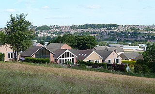
Wingerworth is a large village and parish in North East Derbyshire, England. Its population, according to the 2011 census, was 6,533. Wingerworth is 3 miles (4.8 km) southwest of Chesterfield, 15 miles (24 km) south of Sheffield and 150 miles (240 km) north of London.

<span class="mw-page-title-main">Temple Normanton</span> Village in Derbyshire, England

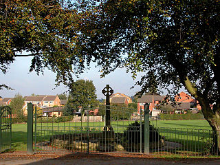
Temple Normanton is a village and a civil parish in the North East Derbyshire district in Derbyshire, England. The population of the civil parish at the 2011 census was 490.

<span class="mw-page-title-main">Tupton</span> Human settlement in England

Tupton is a village and civil parish in North East Derbyshire, Derbyshire, England, 4.5 miles (7 km) south of Chesterfield. The population of the civil parish including Egstow and Old Tupton was at the 2011 Census 3,428. It lies just north of Clay Cross on the A61 which runs from Chesterfield to Alfreton. It comprises the areas of Old Tupton and New Tupton. However, it is generally referred to as Tupton. A similarly named area, Tapton, is a few miles away, being part of Chesterfield.

<span class="mw-page-title-main">North Wingfield</span> Human settlement in England

North Wingfield is a large village and civil parish in the North East Derbyshire district in the county of Derbyshire, England. Located approximately 4½ miles south-east of Chesterfield, and 1 mile north-east of Clay Cross. The population of the civil parish as of the 2011 census was 6,505. The A6175 road from the M1 motorway to the A61 road runs through the village.

<span class="mw-page-title-main">Pilsley, North East Derbyshire</span> Human settlement in England

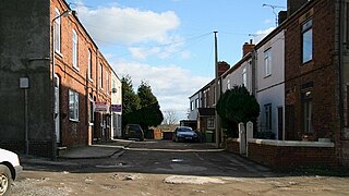
Pilsley is a village and civil parish in the district of North East Derbyshire in the county of Derbyshire, England. It is located near to the town of Chesterfield. At the 2011 Census the population was 3,487.

<span class="mw-page-title-main">Grassmoor</span> Human settlement in England

Grassmoor is a village in Derbyshire, England, approximately three miles to the south of Chesterfield. Its original name, according to 16th-century parish records, was Gresmore. The appropriate civil parish is called Grassmoor, Hasland and Winsick. The population of this civil parish at the 2011 Census was 3,360. Grassmoor formerly housed many miners, however all of the local mines in the area have been closed since the mid-eighties.

<span class="mw-page-title-main">Birdholme</span> Human settlement in England

Birdholme is a suburb of the town of Chesterfield, Derbyshire, England. To its south is Wingerworth, to its north is the town centre, to its west is Boythorpe, and to its east Hasland. The large St. Augustines council estate makes up much of its area, though there are a few more affluent areas such as Langer Lane (pictured). The Bryan Donkin factory and Chesterfield Tube works used to dominate the landscape of the area, both have now closed being replaced by new housing, Alma Leisure Park, B&Q and Toys R Us.

<span class="mw-page-title-main">Corbriggs</span> Human settlement in England

Corbriggs is a small settlement in Derbyshire, England. The appropriate civil parish is called Grassmoor, Hasland and Winsick. It is beside the A617 road and is 2 kilometres (1 mi) southeast of Chesterfield.

<span class="mw-page-title-main">Winsick</span> Human settlement in England

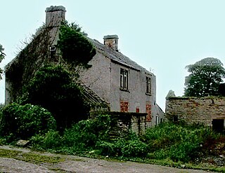
Winsick is a hamlet in Derbyshire, England. It is located on the B6039 Mansfield Road, 2 miles south of Chesterfield. It is part of the civil parish of Grassmoor, Hasland and Winsick.

<span class="mw-page-title-main">Borough of Chesterfield</span> Borough and non-metropolitan local government district in north eastern Derbyshire, England

The Borough of Chesterfield is a non-metropolitan district with borough status in Derbyshire, England. It is named after its main settlement of Chesterfield.

<span class="mw-page-title-main">Holymoorside and Walton</span> Civil parish in Derbyshire, England

Holymoorside and Walton is a civil parish within the North East Derbyshire district, which is in the county of Derbyshire, England. Named for its main settlements, with a mix of a number of villages and hamlets amongst a large rural area, it had a population of 2,223 residents in 2011. The parish is 130 miles (210 km) north west of London, 20 miles (32 km) north of the county city of Derby, and 2 miles (3.2 km) south west of the nearest market town of Chesterfield. It is adjacent with the Peak District national park to the west, and shares a border with the district of Chesterfield, along with the parishes of Ashover, Beeley, Brampton as well as Wingerworth. The parish paradoxically does not include the majority of the nearby built-up suburb of Walton, Chesterfield which is now within an adjacent unparished area of the borough.

References

  1. 1 2 3 4 UK Census (2011). "Local Area Report – Grassmoor, Hasland and Winswick parish (E04002869)". Nomis. Office for National Statistics.
  2. 1 2 "Grassmoor, Hasland and Winswick". Ordnance Survey.{{cite web}}: CS1 maint: url-status (link)
  3. 1 2 3 4 5 6 "About The Parish | Grassmoor, Hasland and Winsick Parish Council" . Retrieved 2 January 2022.
  4. "BGS Lexicon of Named Rock Units - Result Details". webapps.bgs.ac.uk. Retrieved 19 December 2021.
  5. "Derbyshire County Council - Part One: Landscape Character Descriptions - 4. Nottinghamshire, Derbyshire and Yorkshire Coalfield - LANDSCAPE TYPE: COALFIELD VILLAGE FARMLAND" (PDF).{{cite web}}: CS1 maint: url-status (link)
  6. "Grassmoor :: Survey of English Place-Names". epns.nottingham.ac.uk. Retrieved 3 January 2022.
  7. "Greyhirst | Domesday Book". opendomesday.org. Retrieved 3 January 2022.
  8. "Hasland :: Survey of English Place-Names". epns.nottingham.ac.uk. Retrieved 3 January 2022.
  9. "Winsick :: Survey of English Place-Names". epns.nottingham.ac.uk. Retrieved 3 January 2022.
  10. "MDR5053 - Barbed and tanged arrowhead, west of Churchside, Hasland - Derbyshire Historic Environment Record". her.derbyshire.gov.uk. Retrieved 3 January 2022.
  11. "MDR5030 - Stone axe-hammer, field east of White House Farm, Tupton - Derbyshire Historic Environment Record". her.derbyshire.gov.uk. Retrieved 3 January 2022.
  12. "MDR5005 - Roman coin, Hasland - Derbyshire Historic Environment Record". her.derbyshire.gov.uk. Retrieved 3 January 2022.
  13. "MDR5016 - Roman coin, Churchside Lane, Hasland - Derbyshire Historic Environment Record". her.derbyshire.gov.uk. Retrieved 3 January 2022.
  14. "MDR7824 - Grassmoor coin hoard (location withheld), Lings Farm, North Wingfield - Derbyshire Historic Environment Record". her.derbyshire.gov.uk. Retrieved 3 January 2022.
  15. "MDR10207 - Ryknield Street Roman Road (conjectural route of) - Derbyshire Historic Environment Record". her.derbyshire.gov.uk. Retrieved 4 January 2022.
  16. 1 2 Garlic, S.L. (1979). "Derbyshire Miscelleny - BYGONE GRASSMOOR" (PDF).{{cite web}}: CS1 maint: url-status (link)
  17. Tithe map of Chesterfield, Brimington, Hasland, Newbold, Tapton, Temple Normanton and... 1849.
  18. 1 2 "Chesterfield Registration District". www.ukbmd.org.uk. Retrieved 28 December 2021.
  19. "Parishes: Calke - Chesterfield | British History Online". www.british-history.ac.uk. Retrieved 3 January 2022.
  20. "MDR10606 - Possible coal mining remains, Mill Lane Farm, Grassmoor - Derbyshire Historic Environment Record". her.derbyshire.gov.uk. Retrieved 4 January 2022.
  21. Bridgewater, Andrew Neil. "Grassmoor - oldminer.co.uk". www.oldminer.co.uk. Retrieved 5 January 2022.
  22. 1 2 "Grassmoor village in Derbyshire". www.derbyshireuk.net. Retrieved 7 January 2022.
  23. 1 2 "Grassmoor Country Park - Derbyshire County Council". www.derbyshire.gov.uk. Retrieved 7 January 2022.
  24. "Completion in North East Derbyshire: new family homes unveiled". Derwent Living. 22 January 2013. Retrieved 7 January 2022.
  25. "Funding". www.grasslandhasmoor.co.uk. Retrieved 7 January 2022.
  26. "Hasland MOT Centre | MOT Garage & Vehicle Servicing | MOT from £35". Hasland MOT Centre | Chesterfield MOT Garage & Vehicle Servicing. Retrieved 6 January 2022.
  27. "Used Cars Chesterfield, Derbyshire". Woodleigh Motor Sales. Retrieved 6 January 2022.
  28. "Kudos Alloys – Kudos Alloys Specialists in polished Alloy Refurbs" . Retrieved 6 January 2022.
  29. "VAN GEMEREN & CO LTD – at Chesterfield Garden Centre" . Retrieved 6 January 2022.
  30. "GoStore Self Storage Chesterfield - Derbyshire Storage Units". GoStore. Retrieved 6 January 2022.
  31. "Welcome to Swim 121 - Swim 121". www.swim121.co.uk. Retrieved 6 January 2022.
  32. "Manor House". Sykes Cottages. Retrieved 6 January 2022.{{cite web}}: CS1 maint: url-status (link)
  33. "Community Centre | Grassmoor, Hasland and Winsick Parish Council" . Retrieved 6 January 2022.
  34. "Peak Pharmacy | Healthcare Services | UK Pharmacy". Peak Pharmacy. 25 October 2019. Retrieved 6 January 2022.
  35. "Community Profile for the Grassland Hasmoor...Big Local (GHBL) area" (PDF).{{cite web}}: CS1 maint: url-status (link)
  36. "Grassmoor Primary School - Home". www.grassmoor.derbyshire.sch.uk. Retrieved 6 January 2022.
  37. "Listed Buildings in Grassmoor, Hasland and Winswick, North East Derbyshire, Derbyshire". britishlistedbuildings.co.uk. Retrieved 6 January 2022.
  38. "Map 3: Inset C-Killamarsh, Inset D-Renishaw, Inset E-Calow & Long Duckmanton & Inset F-Wingerworth, Tupton & Grassmoor". North East Derbyshire District Council. Retrieved 6 January 2022.
  39. "WINSICK AND CORBIGGS". www.warmemorialsonline.org.uk. Retrieved 6 January 2022.
  40. "South Chesterfield Golf Club -". South Chesterfield Golf Club. Retrieved 6 January 2022.
  41. "Grassmoor Works CC". grassmoor.play-cricket.com. Retrieved 6 January 2022.
  42. "Grassmoor Sports First - Chesterfield And District Sunday Football League". www.teamstats.net. Retrieved 7 January 2022.
  43. "St Peter's Church, Holymoorside, Old Brampton, Derbyshire, Church History". churchdb.gukutils.org.uk. Retrieved 29 December 2021.
  44. "Grassmoor Methodist Church, Grassmoor, Hasland, Derbyshire, Church History". churchdb.gukutils.org.uk. Retrieved 6 January 2022.