
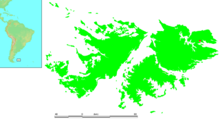
Lafonia is a peninsula forming the southern part of East Falkland, the largest of the Falkland Islands.

The Falkland Sound is a sea strait in the Falkland Islands. Running southwest-northeast, it separates West and East Falkland.
Port Louis is a settlement on northeastern East Falkland. It was established by Louis de Bougainville in 1764 as the first French settlement on the islands, but was then transferred to Spain in 1767 and renamed Puerto Soledad.

The Camp is the term used in the Falkland Islands to refer to any part of the islands outside the islands' only significant town, Stanley, and often the large RAF base at Mount Pleasant. It is derived from the Spanish word campo, for "countryside".

Salvador Settlement, also called Salvador, Salvador Settlement Corral, is a small harbour and settlement on East Falkland, in the Falkland Islands, It is on the north east coast, on the south shore of Port Salvador. It is one of a handful of Spanish place names on the islands, still in use.

Choiseul Sound is a stretch of sea in the Falkland Islands. It runs parallel to Eagle Passage and is between Lafonia and the north of East Falkland. Lively Island is in its mouth. At its entrance, on the northern shore, is the Bertha's Beach Important Bird Area which is also a Ramsar site, recognising it as a wetland of international importance.
No Man's Land is an area on East Falkland island, in the Falkland Islands. It probably derives its name from its extremely rough ground, and is partly co-extensive with the Wickham Heights. It lies to the north-west of RAF Mount Pleasant, on the northern half of East Falkland.
Walker Creek is a settlement on East Falkland, in the Falkland Islands, in Lafonia. It is on the shore of the Choiseul Sound, and overlooks Sea Lion Island in the distance. It is the second largest settlement on East Falkland south of Goose Green, after North Arm.
Teal Inlet, once named Evelyn Station, is a settlement on East Falkland, in the Falkland Islands, on the south shore of Salvador Water. It is overshadowed by Jack's Mountain.
Rincon or Rincon Grande is a settlement on East Falkland, in the Falkland Islands, on the east shore of Salvador Water, at its north end. Rincon refers to a point of land, and such early settlements were often started where cattle could be herded onto boats. It is east of Salvador across the water, and west of Port Louis and Johnson's Harbour It is one of the oldest settlements in the area.

Salvador Water or Port Salvador is a bay/inlet on the northeast coast of East Falkland, the largest of the Falkland Islands. It has an intricate shoreline, but could be described as being shaped like an "M".
Cape Bougainville is the second–most northerly point on East Falkland, Falkland Islands, after Cape Dolphin, and is the second most northerly point of the two main islands, East and West Falkland. Many of the smaller islands, such as the Jason Islands are further north.

Mare Harbour is a small settlement on East Falkland, on Choiseul Sound. It is mostly used as a port facility and depot for RAF Mount Pleasant, as well as a deepwater port used by the Royal Navy ships patrolling the South Atlantic and Antarctica, which means that the main harbour of the islands, Stanley Harbour tends to deal with commercial transport.
The Malo River, is a river in East Falkland, Falkland Islands. Its name is derived from the Breton port of St Malo, due to the French settlement established at Port Louis in 1764.

Mount Kent is a mountain on East Falkland, Falkland Islands, It is north of Mount Challenger and saw action in the Falklands War during the Battle of Mount Harriet – some of the area is still mined. The mountain's top is occupied by the RRH Mount Kent of the British Forces South Atlantic Islands (BFSAI), part of an early warning and airspace control network including also RRH Mount Alice and RRH Byron Heights on West Falkland.
Green Glacier is a glacier on the east side of Graham Land, Antarctica, 15 nautical miles (28 km) long and 4 nautical miles (7 km) wide, flowing from the plateau northeast between Dugerjav Peak and Rugate Ridge, and then east into Vaughan Inlet next north of Pirne Peak and south of the terminus of Hektoria Glacier.

Bertha's Beach Important Bird Area comprises 3300 ha of coastal wetlands at the entrance to Choiseul Sound, on the east coast of East Falkland, in the Falkland Islands. It lies about 8 km south-east of Mount Pleasant Airport and 40 km south-west of Stanley. It has been identified by BirdLife International as an Important Bird Area (IBA) because of its significancer for a variety of migratory waders and other waterbirds. Overlapping it is the 4000 ha Bertha's Beach Ramsar site, recognising it as a wetland of international importance.


