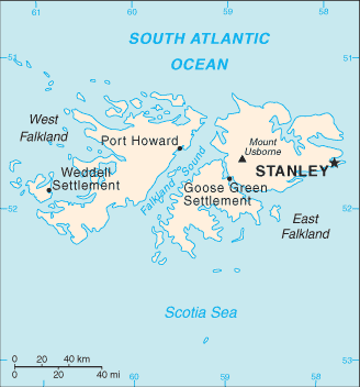
The following is a list of islands that form the Falkland Islands .
The following is a list of islands that form the Falkland Islands .


| Island | Area (km2) | Population | Height (m) |
|---|---|---|---|
| East Falkland | 6,605 km2 (2,550 sq mi) | 2197 | 705 |
| West Falkland | 4,532 km2 (1,750 sq mi) | 144 | 700 |
| Island | Area (km2) | Population | Height (m) |
|---|---|---|---|
| Barren Island | 11.5 [1] | 0 | ca. 18 |
| Beauchene Island | 1.72 [1] | ? | 82 |
| Beaver Island | 48.56 [1] | ? | ? |
| Bird Island | 1.2 [1] | 0 | ? |
| Bleaker Island | 20.7 [1] | ? | 29 |
| Broken Island | ? | 0 | ? |
| Carcass Island | 18.94 | ? | 304 |
| Centre Island | ? | 0 | ? |
| Dunbar Island | 2.25 [1] | 0 | ? |
| Dyke Island | ? | 0 | ? |
| East Island | ? | 0 | ? |
| Eddystone Rock | ? | 0 | 44 |
| Fox Island | ? | 0 | ? |
| George Island | 24.0 [1] | ? | ca.1 18 |
| Golding Island | ? | 0 | ? |
| Great Island | ? | 0 | ? |
| Hog Island | ? | 0 | ? |
| Horse Block | <1 | 0 | ? |
| Hummock Island | 3 | 0 | 190 |
| Keppel Island | 36.26 [1] | ? | 341 |
| Kidney Island | 0.33 | 0 | ? |
| Lively Island | 55.85 [1] | ? | ? |
| Long Island | ? | 0 | ? |
| Low Island | 0.76 | 0 | ? |
| Middle Island | ? | 0 | ? |
| Narrow Island | ? | 0 | ? |
| New Island | 11.81 [1] | ? | ? |
| Passage Island | ? | 0 | ? |
| Pebble Island | 103.36 [1] | ? | 277 |
| Rabbit Island | 1.78 [1] | 0 | 91 |
| River Island | ? | 0 | ? |
| Ruggles Island | ? | 0 | ? |
| Saunders Island | 124 [1] | ? | 457 |
| Sea Lion Island | 9.05 [1] | ? | 46 |
| Sedge Island | 3.8 | 0 | ? |
| Speedwell Island | 51.5 [1] | ? | ? |
| Split Island | ? | 0 | ? |
| Staats Island | 5 [1] | 0 | ? |
| Tea Island | 3.1 [1] | 0 | ? |
| Weddell Island | 254 | 2 | 383 |
| West Point Island | 12.55 [1] | ? | 369 |
None of the Jason Islands are permanently inhabited.
| Island | Area (ha) [1] | Height (m) [1] |
|---|---|---|
| Elephant Jason | 2.60 | 208 |
| Flat Jason | 3.75 | ? |
| Grand Jason | 13.80 | 361 |
| South Jason | 3.75 | ca. 300 |
| Steeple Jason | 7.90 | 263 |


| Rank | Island | Mountain | Height (m) | Height (ft) |
|---|---|---|---|---|
| 1 | East Falkland | Mt Usborne [2] | 705 | 2,313 |
| 2 | West Falkland | Mt Adam | 700 | 2,297 |
| 3 | Weddell Island | Mt Weddell | 383 | 1,257 |
| 4 | West Point Island | Mt Misery | 369 | 1,211 |
| 5 | Carcass Island | Stanley Hill & Mt Bing | 304 | 997 |
This is a short list of islands, which are known to be named after someone. Until at least 1781, the Falklands as a whole were known as the Sebald or Sebaldine Island after Sebald de Weert, who sighted them and tried to make landfall on the Jason Islands in January 1600. [3] [4]
A list of the derivations of Spanish names, where they differ substantially from the English versions.

The history of the Falkland Islands goes back at least five hundred years, with active exploration and colonisation only taking place in the 18th century. Nonetheless, the Falkland Islands have been a matter of controversy, as they have been claimed by the French, British, Spaniards and Argentines at various points.

Louis-Antoine, Comte de Bougainville was a French admiral and explorer. A contemporary of the British explorer James Cook, he took part in the Seven Years' War in North America and the American Revolutionary War against Britain. Bougainville later gained fame for his expeditions, including a circumnavigation of the globe in a scientific expedition in 1763, the first recorded settlement on the Falkland Islands, and voyages into the Pacific Ocean. Bougainville Island of Papua New Guinea as well as the Bougainvillea flower were named after him.

Weddell Island is one of the Falkland Islands in the South Atlantic, lying off the southwest extremity of West Falkland. It is situated 1,545 km (960 mi) west-northwest of South Georgia Island, 1,165 km (724 mi) north of Livingston Island, 606 km (377 mi) northeast of Cape Horn, 358 km (222 mi) northeast of Isla de los Estados, and 510 km (320 mi) east of the Atlantic entrance to Magellan Strait.

The Jason Islands are an archipelago in the Falkland Islands, lying to the far north-west of West Falkland. Three of the islands, Steeple Jason, Grand Jason and Clarke's Islet, are private nature reserves owned by the Wildlife Conservation Society of New York City. Other islands in the group are National Nature Reserves owned by the Falkland Islands Government.
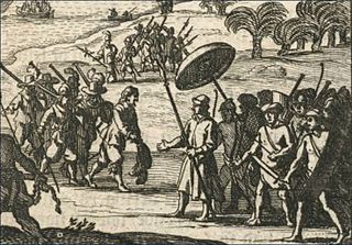
Sebald or Sebalt de Weert was a Flemish captain and vice-admiral of the Dutch East India Company. He is most widely remembered for accurately plotting the Falkland Islands in 1600.

Port Egmont was the first British settlement in the Falkland Islands, on Saunders Island off West Falkland, and is named after the Earl of Egmont.
The Horse Block is a sea stack of the Falkland Islands. It is situated off the southwest coast of Weddell Island, 1.8 km southwest of Pillar Bluff.

Duplicate: List of Falkland Islands-related topics

Swan Point is the point on the southwest side of the entrance to Queen Charlotte Bay, forming the northeast extremity of Weddell Island in the Falkland Islands.
Mount Weddell is the summit of Weddell Island in the Falkland Islands. The mountain rises to 383 metres (1,257 ft) and is situated 8 km northeast of Race Point, 9.8 km east of Pillar Bluff, 4.35 km southwest of Weddell Settlement and 4.6 km west-northwest of Circum Point.
Chatham Harbour is the large bay indenting the central part of Weddell Island in the Falkland Islands. It is entered east of Beacon Point and west of Loop Head. The 3 km wide bay extends 5 km in southeast direction, this part of the feature forming an anchorage named Bald Road, and north of Clay Point turning for 10 km in southwest direction. Chatham Harbour is centred at 51°50′16″S60°57′32″W.
French Harbour is the 500 m wide bay indenting for 3.1 km the west coast of Weddell Island in the Falkland Islands. It is entered 5.5 km north of Weddell Point, and centred at 51°51′03″S61°06′50″W.
Quaker Harbour is the irregularly shaped bay indenting for 3.7 km the north coast of Weddell Island in the Falkland Islands. It is centred at 51°49′00″S61°04′35″W, and has its head fed by Pitt Creek. The bay takes its name from nearby Quaker Island.
Loop Head is the point on the east side of the entrance to Chatham Harbour in Weddell Island, Falkland Islands. It is located at 51°45′48″S60°53′49″W, which is 2.4 kilometres (1.5 mi) west of Swan Point and 5.5 kilometres (3.4 mi) east-northeast of Beacon Point.
New Year Cove is the 1.7 km wide bay indenting for 2.45 km the southeast coast of Weddell Island in the Falkland Islands. It is entered north of Hadassah Point and south of Circum Point and centred at 51°56′30″S60°54′30″W.
Smylie Channel is the 1.4 kilometres (0.76 nmi) wide and 16 kilometres (8.6 nmi) long sea passage in the Falkland Islands between Weddell Island to the north and West Falkland and Dyke Island to the south. It is centred at 51°59′04″S61°03′48″W.
Circum Peak is a mountain rising to 198 m (650 ft) in the southeast part of Weddell Island in the Falkland Islands. It is located at, which is 2.12 km (1.32 mi) southeast of Mount Weddell, and surmounts New Year Cove to the southeast and Gull Harbour to the northeast.