Grike (Lake District)

Last updated

Grike
Grike summit cairns.jpg
Grike summit with its massive cairn and two smaller ones.
Highest point
Elevation 488 m (1,601 ft)
Prominence c. 37 m
Parent peak Crag Fell
Listing Wainwright
Coordinates 54°30′47″N3°24′54″W / 54.513°N 3.415°W / 54.513; -3.415
Geography
Lake District National Park UK relief location map.png
Red triangle with thick white border.svg
Grike
Location in the Lake District
Location relief map Borough of Copeland.svg
Red triangle with thick white border.svg
Grike
Location in Copeland Borough
Location Cumbria, England
Parent range Lake District, Western Fells
OS grid NY086141
Topo map OS Landranger 89, 90, Explorer OL4

Grike is a hill in the west of the English Lake District, near Ennerdale Water. It is part of the Lank Rigg group, the most westerly Wainwright as the fells diminish toward the coastal plain. It can be climbed from Kinniside or Ennerdale Bridge.

Contents

Topography

The Western Fells occupy a triangular sector of the Lake District, bordered by the River Cocker to the north east and Wasdale to the south east. Westwards, the hills diminish toward the coastal plain of Cumberland. At the central hub of the high country are Great Gable and its satellites, while two principal ridges fan out on either flank of Ennerdale, the western fells in effect being a great horseshoe around this long wild valley. [1] Grike stands at the extremity of the southern arm.

The main watershed runs broadly westwards from Great Gable, dividing the headwaters of Ennerdale and Wasdale. The fells in this section are Kirk Fell, Pillar, Scoat Fell, Haycock and Caw Fell. The surrounding valleys gradually diverge until other rivers spring up to drain the intervening country. Worm Gill is one such watercourse, running southwards from Caw Fell and forcing the ridge to detour northwards around the head of its valley. Beyond this stand the fells of the Lank Rigg group, the final high country within the National Park. Crag Fell and Grike complete the westward line of the ridge, while Lank Rigg itself lies to the south across the head of the River Calder.

The western ridge of Crag Fell narrows to a marshy depression at 1,480 ft, before climbing again up the easy slopes of Grike. The southern flanks of both fells have been planted with a long belt of conifers, running down to the headwaters of the Calder. Grike's northern slopes are also forested where gradient and crags allow. The Ennerdale face is less impressive than that of Crag Fell, although deeply riven by the beds of Ben Gill and Red Gill. Grike looks down not upon the lake itself, but on the floodplain of the River Ehen, its outflowing stream.

West of the summit is a broad slope leading down to Heckbarley (1,280 ft), a wide plateau with little prominence which is separated from the main fell by Stinking Gill and Goat Gill. Heckbarley has Grike's only real crags on its northern face. The ridge now turns south over a wooded depression to cross the minor tops of Blakeley Raise (1,276 ft), Burn Edge (1,050 ft) and Swarth Fell (1,099 ft). In his influential Pictorial Guide to the Lakeland Fells , Alfred Wainwright [1] included only the first of these within the territory of Grike, although some later writers like Bill Birkett have added the whole of the ridge as far as the National Park boundary. [2] The Coldfell road runs along the western side of these tops.

Mining

Iron mines operated beneath the northern slopes of Grike and Crag Fell from 1860 to 1896. Levels were driven into the banks of Goat Gill and Red Gill, with the principal working, Main Drift Mine, between the two. The yields were never as great as hoped and the venture was a commercial failure. [3]

Summit

The top bears a massive stone cairn together with two smaller ones, built from the many specimens lying near the summit on an otherwise grassy dome. The main cairn gives the fell its alternative local name, Stone Man. A weather station is a rather more modern addition to the summit decorations. [1] [2]

The view seawards is extensive, but to the east the Lakeland panorama is partly obscured by Crag Fell. The horseshoe of the Western Fells is all that can be seen well, although the summits of Dollywaggon Pike and Fairfield put in unexpected appearances, along with Skiddaw and a small section of the North Western Fells. The foot of Ennerdale Water is also in sight. [1]

Ascents

From Ennerdale Bridge, or the car parks near the outflow of the lake, the lane to Crag Farm can be used to give access onto the fell. A good path makes for Crag Fell and this can be followed as far as Ben Gill before turning right up the hillside. The Coldfell road provides another starting point, a track heading eastward from near the Kinniside Stone Circle. This was once the road to the Crag Fell Iron Mines and crosses the initial ridge between Heckbarley and Blakeley Raise. It then contours along the southern flank of Grike, just above the trees. [1] [2]

Related Research Articles

<span class="mw-page-title-main">Pillar (Lake District)</span> Mountain in the English Lake District, Cumbria, England

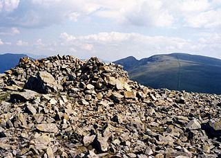
Pillar is a mountain in the western part of the English Lake District. Situated between the valleys of Ennerdale to the north and Wasdale to the south, it is the highest point of the Pillar group. At 892 metres (2,927 ft) it is the eighth-highest mountain in the Lake District. The fell takes its name from Pillar Rock, a prominent feature on the Ennerdale side, regarded as the birthplace of rock climbing in the district.

<span class="mw-page-title-main">Buckbarrow</span>

Buckbarrow is a small fell in the English Lake District overlooking the western end of Wastwater. It is featured in Alfred Wainwright’s Pictorial Guide to the Lakeland Fells and is given a height of 1,410 ft approximately; however, the Ordnance Survey and other guidebooks now give an altitude of 423 m (1,388 ft). The fell’s name means ‘The hill of the buck or goat’. It is derived either from the Old English word bucc meaning buck or the Old Norse word bokki meaning a male goat.

<span class="mw-page-title-main">High Stile</span> Fell in the Lake District, Cumbria, England

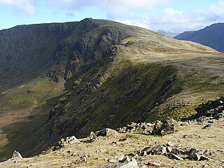
High Stile is a mountain in the western part of the Lake District in North West England. It is the eleventh-highest English Marilyn, standing 807 metres (2,648 ft) high, and has a relative height of 362 metres (1,187 ft).

<span class="mw-page-title-main">Kirk Fell</span>

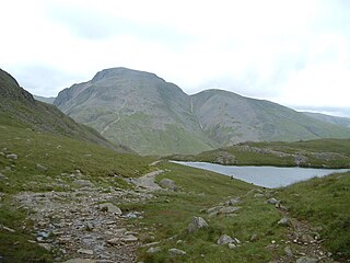
Kirk Fell is a fell in the Western part of the English Lake District. It is situated between Great Gable and Pillar on the long ring of fells surrounding the valley of Ennerdale, and also stands over Wasdale to the south. However, it is separated from its two higher neighbours by the low passes of Black Sail and Beck Head, giving it a high relative height and making it a Marilyn, the thirteenth highest in the Lake District.

<span class="mw-page-title-main">Seatallan</span>

Seatallan is a mountain in the western part of the English Lake District. It is rounded, grassy and fairly unassuming, occupying a large amount of land. However, it is classed as a Marilyn because of the low elevation of the col connecting it to Haycock, its nearest higher neighbour to the north. The name Seatallan is believed to have a Cumbric origin, meaning "Aleyn's high pasture".

<span class="mw-page-title-main">Base Brown</span> Fell in England

Base Brown is a fell in England's Lake District, near the head of the Borrowdale Valley. It forms one side of the Seathwaite Valley, and on the western side it is flanked by the hanging valley of Gillercomb.

<span class="mw-page-title-main">Red Pike (Buttermere)</span> Mountain in the English Lake District, Cumbria, England

Red Pike is a fell in the High Stile range in the western English Lake District, which separates Ennerdale from the valley of Buttermere and Crummock Water. It is 2,476 ft (755 m) high. The direct ascent of Red Pike from Buttermere is very popular and the ridge walk from Red Pike to Haystacks is regarded as one of the finest in the area, with excellent views of the Scafells, Great Gable and Pillar.

<span class="mw-page-title-main">Red Pike (Wasdale)</span> Mountain in the English Lake District, Cumbria, England

Red Pike is a fell in the English Lake District. It is 826 m or 2,709 ft (826 m) high and lies due north of Wast Water. It is often climbed as part of the Mosedale Horseshoe, a walk which also includes Pillar.

<span class="mw-page-title-main">Scoat Fell</span> Mountain in the English Lake District, Cumbria, England

Scoat Fell is a fell in the western part of the English Lake District. It stands at the head of the Mosedale Horseshoe with its back to Ennerdale. Paths lead to Scoat Fell from Ennerdale over Steeple, from Wasdale over Red Pike, and along the ridge from Pillar.

<span class="mw-page-title-main">Green Gable</span> Mountain in the Lake District, England

Green Gable is a fell in the English Lake District often traversed by walkers en route to its more famous neighbour Great Gable. It can be ascended from Honister Pass, Seathwaite in Borrowdale, or Ennerdale. There are good views of Gable Crag, Scafell Pike and the Buttermere valley from the summit.

<span class="mw-page-title-main">Yewbarrow</span> Mountain in the English Lake District, Cumbria, England

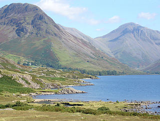
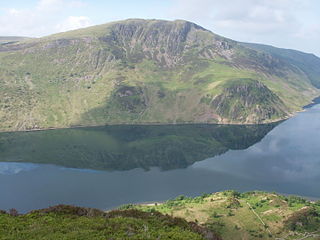
Yewbarrow is a fell, in the English Lake District, which lies immediately north of the head of Wast Water. It is 628 metres high and in shape resembles the upturned hull of a boat or a barrow. Yewbarrow is on the left in the classic view of Great Gable and Wast Water.

<span class="mw-page-title-main">Haycock (Lake District)</span> Fell in the Lake District, Cumbria, England

Haycock is a mountain in the western part of the English Lake District. It rises between Scoat Fell and Caw Fell to the south of Ennerdale and the north of Wasdale. Haycock is an imposing dome-shaped fell, its popularity with walkers diminished somewhat by its remoteness. It can be climbed from either valley and offers fine mountain views.

<span class="mw-page-title-main">Hen Comb</span>

Hen Comb is a fell in the west of the English Lake District. One of the Loweswater Fells it lies to the south of Loweswater lake and Loweswater village. Although of only moderate height, its ascent can be difficult as it is largely surrounded by bogs.

<span class="mw-page-title-main">Starling Dodd</span>

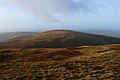
Starling Dodd is a fell in the western part of the English Lake District, located between the valleys of Ennerdale and Buttermere, on the ridge between Great Borne to its west and Red Pike to its east. Not visible from Buttermere and rounded in profile, Starling Dodd is a relatively unfrequented top.

<span class="mw-page-title-main">Caw Fell</span> Fell in the Lake District, Cumbria, England

Caw Fell is a fell in the English Lake District, standing between Haycock the Lank Rigg group. It occupies a wide upland area with Ennerdale to the north and Blengdale to the south. Caw Fell is distant from any point of access by Lakeland standards, but can be climbed from Blengdale or Bowness Knott car-parks.

<span class="mw-page-title-main">Crag Fell</span> Fell in the Lake District, England

Crag Fell is a hill in the English Lake District. It is part of the Lank Rigg group, standing above Ennerdale Water in the Western Fells. The craggy northern face above the lake gives the fell its name, prominent in views from the car park at Bowness Knott. Ascents are commonly made from the foot of Ennerdale Water.

<span class="mw-page-title-main">Lank Rigg</span> Fell in the Lake District, England

Lank Rigg is a fell in the English Lake District. It stands to the south of Ennerdale in the Western Fells. A sprawling hill with gentle grassy slopes it can be climbed from various points on the Coldfell road. It carries various remains from ancient habitation.

Middle Fell is a hill or fell in the English Lake District. It is a satellite of Seatallan standing above the northern shore of Wastwater. Middle Fell can be climbed from Greendale near the foot of Wastwater, and a fine view of the lake backed by the Wastwater Screes is visible from the summit.

<span class="mw-page-title-main">Iron Crag</span>

Iron Crag is a mountain in the English Lake District, standing between Crag Fell and Caw Fell. The name of the fell is the source of some confusion, as the summit is unnamed on Ordnance Survey maps. Iron Crag apparently refers to the rocky outcrop below the summit, while the lower slopes are referred to as Ennerdale Fell. The Western aspect of the lower slopes, facing Ennerdale Water is known as The Side.

<span class="mw-page-title-main">Western Fells</span>

The Western Fells are a group of hills in the English Lake District. Centred on Great Gable they occupy a triangular area between Buttermere and Wasdale. The Western Fells are characterised by high ridges and an abundance of naked rock.

References

  1. 1 2 3 4 5 Alfred Wainwright: A Pictorial Guide to the Lakeland Fells, Volume 7 The Western Fells: Westmorland Gazette (1966): ISBN   0-7112-2460-9
  2. 1 2 3 Bill Birkett: Complete Lakeland Fells: Collins Willow (1994): ISBN   0-00-713629-3
  3. Adams, John: Mines of the Lake District Fells: Dalesman (1995) ISBN   0-85206-931-6