Gringegalgona, Victoria

Last updated
Gringegalgona
Victoria
Gringegalgona Hall.jpg
Gringegalgona Hall and Fire Shed, 2023
Gringe View to Mt Dundas.jpg
View from Gringegalgona towards Mount Dundas
Australia Victoria Southern Grampians Shire location map.svg
Red pog.svg
Gringegalgona
Gringegalgona, Victoria
Coordinates 37°25′S141°47′E / 37.417°S 141.783°E / -37.417; 141.783
Population44 (2021 census)
Postcode(s) 3315, 3407
Location
LGA(s) Shire of Southern Grampians
State electorate(s) Lowan
Federal division(s) Wannon
Localities around Gringegalgona:
Coojar Englefield Vasey
Brit Brit Gringegalgona Vasey
Wootong Vale Melville Forest Gatum

Gringegalgona, also known as Gringe, is a locality in Western Victoria, Australia. At the 2021 Census Gringegalgona had a population of 44. [1]

Contents

Etymology

The area is named for the homestead and station, squatted by Simon Cadden in 1843. The name is believed to be indigenous in origin, with locals believing it means "water like urine" or to "micturate on a tussock". [2]

History

The original size of Gringegalgona station was approximately 58,880 acres and could run approximately 16,000 sheep. [3] Simon Cadden was killed by local indigenous people in and was buried in a lone grave on the station. The grave still exists nearby the ruins of Cadden's original homestead. [4] The station was passed on to William Lewis in 1854. In 1860 the station was subdivided and was co-owned by William Lewis and John Lewis until 1861 when Duncan Robertson purchased Gringegalgona. [5] Robertson was from Scotland and spoke Scottish Gaelic as a first language. Robertson built the present homestead in 1873, utilising sandstone from nearby Mt Melville in the Dundas Ranges. [4]

It was common for kangaroo drives to take place on Gringegalgona. Kangaroos were rounded up into yards and beaten to death. [2]

Sheep on the station were washed in a large dam, known as a sheepwash, prior to shearing. A sawmill was nearby to the sheepwash.

In 1920 Gringegalgona was subdivided as part of the Soldier Settlement scheme for soldiers returning from the First World War. Blocks were subdivided into approximately 900 acre sections, and leased to soldiers on the proviso that they were improved, fenced and cleared appropriately. [6] A monument to the original soldier settlers is on a plaque in Gringegalgona. [7]

Gringegalgona Settlers Memorial Plaque Gringe Settlers Plaque.jpg
Gringegalgona Settlers Memorial Plaque

In 1925 a soldiers' memorial hall was built in Gringegalgona to honour the fallen in World War One. Built on land donated by soldier settler William Toleman, it was designed by fellow soldier settler Vine Yuill and cost £490 to build. [8] The hall was proposed to be rebuilt in the late 2000s, however some public outcry meant that this did not occur. The hall was re-roofed however the interior was not renovated and the hall is no longer in use.

Gringegalgona Settlers Memorial Reserve Gringe Settlers Reserve.jpg
Gringegalgona Settlers Memorial Reserve

Gringegalgona State School (no. 4349) was opened near the hall in 1927. It was run part time with Brit Brit State School until 1928, after which it became a full time school. In 1948 the school closed and was moved to Balmoral to become one of the classrooms of Balmoral Consolidated School. [9] Bil-Bil-Wyt SS no. 1936 and Gringe North no. 4234 State Schools were also located in Gringegalgona. [10] Bil-Bil-Wyt closed in 1903 when the five families with the surname Brown who used the school all moved to Coleraine. [11] Gringe North was closed in 1945 and the building was moved approximately five kilometres from its original location.

Gringegalgona once had a tennis club, football club and cricket club, [12] however these have all folded.

Gringe Fire Brigade has been based at Gringegalgona since moving from Brit Brit in 1995.

Related Research Articles

<span class="mw-page-title-main">City of Stonnington</span> Local government area in Melbourne, Victoria, Australia

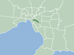
The City of Stonnington is a local government area located within the metropolitan area of Melbourne, Australia. It comprises the inner south-eastern suburbs, between 3 and 13 km, from the Melbourne CBD. The city covers an area of 25.7 km2 (9.9 sq mi).

<span class="mw-page-title-main">Box Hill, Victoria</span> Suburb of Melbourne, Victoria, Australia

Box Hill is a suburb of Melbourne, Victoria, Australia, 14 kilometres (8.7 mi) east of the city's Central Business District (CBD), located within the City of Whitehorse local government area. Box Hill recorded a population of 14,353 at the 2021 census.

<span class="mw-page-title-main">Bundoora</span> Suburb of Melbourne, Victoria, Australia

Bundoora is a suburb in Melbourne, Victoria, Australia, 15 km (9.3 mi) north-east of Melbourne's Central Business District, located within the Cities of Banyule, Darebin and Whittlesea local government areas. Bundoora recorded a population of 28,068 at the 2021 census.

<span class="mw-page-title-main">Waramanga, Australian Capital Territory</span> Suburb of Canberra, Australian Capital Territory

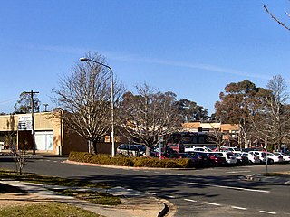
Waramanga is a suburb of Canberra, Australian Capital Territory, Australia in the district of Weston Creek.

<span class="mw-page-title-main">Lethbridge, Victoria</span> Town in Victoria, Australia

Lethbridge is a rural township outside Geelong, Victoria, Australia. Bluestone from Lethbridge quarries was used to build several significant buildings in Melbourne, including the steps to the Parliament House. At the 2016 census, Lethbridge had a population of 1,014.

<span class="mw-page-title-main">Mortdale, New South Wales</span> Suburb of Sydney, Australia

Mortdale is a suburb located in southern Sydney, in the state of New South Wales, Australia. Mortdale is located 20 kilometres south of the Sydney central business district and is part of the St George area. Mortdale is situated in the local government area of Georges River Council. Mortdale extends south to Lime Kiln Bay, on the Georges River. Mortdale Heights is a locality in the western corner of the suburb.

<span class="mw-page-title-main">Kenilworth, Queensland</span> Town in Queensland, Australia

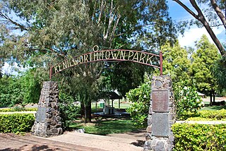
Kenilworth is a rural town and locality in the Sunshine Coast Region, Queensland, Australia. In the 2016 census, the locality of Kenilworth had a population of 558 people. In the 2021 census, Kenilworth had a population of 604 people. The residents of Kenilworth comprise of 49.0% males, 51.0% females, and reported a median age of 51 years old.

<span class="mw-page-title-main">Casterton, Victoria</span> Town in Victoria, Australia

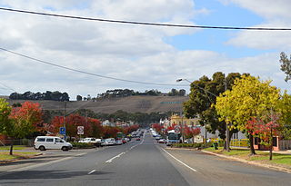
Casterton is a town in Victoria, Australia, located on the Glenelg Highway, 42 kilometres east of the South Australian border, in the Shire of Glenelg. The Glenelg River passes through the town. Casterton is named after the village of Casterton in south-east Cumbria in England.

<span class="mw-page-title-main">Wollert, Victoria</span> Suburb of City of Whittlesea, Victoria, Australia

Wollert is a suburb in Melbourne, Victoria, Australia, 26 km north of Melbourne's central business district, located within the City of Whittlesea local government area. Wollert recorded a population of 24,407 at the 2021 census.

<span class="mw-page-title-main">Burrumbuttock</span> Town in New South Wales, Australia

Burrumbuttock is a town in the central southern part of the Riverina region of the Australian state of New South Wales. The town is about 16 kilometres (10 mi) south east of Walbundrie and 34 kilometres (21 mi) north-west of Albury.

<span class="mw-page-title-main">Soldier settlement (Australia)</span> Type of settlement in Australia

Soldier settlement was the settlement of land throughout parts of Australia by returning discharged soldiers under soldier settlement schemes administered by state governments after World War I and World War II. The post-World War II settlements were co-ordinated by the Commonwealth Soldier Settlement Commission.

<span class="mw-page-title-main">Baerami, New South Wales</span> Town in New South Wales, Australia

Baerami is a locality in the Muswellbrook Shire in the Upper Hunter region of New South Wales, Australia.

<span class="mw-page-title-main">Trawalla, Victoria</span> Town in Victoria, Australia

Trawalla is a town in central Western Victoria, Australia, located on the Western Highway, 41 kilometres (25 mi) west of Ballarat and 154 kilometres (96 mi) west of Melbourne, in the Shire of Pyrenees. At the 2006 census, Trawalla and the surrounding agricultural area had a population of 224.

<span class="mw-page-title-main">Branxholme, Victoria</span> Town in Victoria, Australia

Branxholme is a township in the Shire of Southern Grampians in the Western District of Victoria, Australia on the Henty Highway between Heywood and Hamilton. At the 2016 census, Branxholme and the surrounding area had a population of 351.

<span class="mw-page-title-main">Cavendish, Victoria</span> Town in Victoria, Australia

Cavendish is a township in the Shire of Southern Grampians in the Western District of Victoria, Australia, on the Wannon River. At the 2006 census, Cavendish and the surrounding area had a population of 454.

<span class="mw-page-title-main">County of Dundas, Victoria</span> Cadastral in Victoria, Australia

The County of Dundas is one of the 37 counties of Victoria which are part of the cadastral divisions of Australia, used for land titles. The county is in the Western District of Victoria bounded by the Glenelg River in the west and north, by a line from Casterton to Penshurst in the south, and by the eastern edge of the Grampians in the east. Larger towns include Hamilton, Casterton and Coleraine. The county was proclaimed in 1849.

<span class="mw-page-title-main">Wickliffe, Victoria</span> Town in Victoria, Australia

Wickliffe is a small town in the Rural City of Ararat local government area in western Victoria, Australia. At the 2021 census, Wickliffe and the surrounding area had a population of 123.

<span class="mw-page-title-main">Geoffrey Sambell</span>

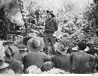
Geoffrey Tremayne Sambell CMG, Mention in Dispatches was an Australian Anglican bishop and World War 2 army chaplain.

<span class="mw-page-title-main">Brit Brit, Victoria</span> Town in Victoria, Australia

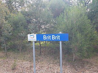
Brit Brit is a locality and parish in the Shire of Southern Grampians in the Western District of Victoria, Australia.

Homewood is a locality in Victoria, Australia. It is part of Shire of Murrindindi, and had a population of 70 in 2021.

References

  1. "2021 Gringegalgona, Census All persons QuickStats | Australian Bureau of Statistics". www.abs.gov.au. Retrieved 2023-08-17.
  2. 1 2 Victorian historical magazine 1927  Volume: 11 Issue: 44. (1927). Melbourne: Historical Society of Victoria.
  3. "Claims to Leases of Crown Lands" (PDF). Port Phillip Government Gazette. 21 February 1849.
  4. 1 2 "Gringegalgona". vhd.heritagecouncil.vic.gov.au. Retrieved 2023-08-18.
  5. "Heritage Place - Gringegalgona" (PDF).
  6. "Public Record Office Victoria Collection | PROV". prov.vic.gov.au. Retrieved 2023-08-18.
  7. "Gringegalgona Soldier Settlement | Monument Australia". monumentaustralia.org.au. Retrieved 2023-08-18.
  8. "Gringegalgona Soldiers Memorial Hall | Monument Australia". monumentaustralia.org.au. Retrieved 2023-08-18.
  9. "Gringegalgona SS 4349, Coleraine, Victoria, Australia". www.swvic.org. Retrieved 2023-08-18.
  10. Vision and Realisation: a centenary history of state education in Victoria, Vols. 2 & 3, Education Department of Victoria, Melbourne, 1973
  11. "Bil-bil-wyt SS 1936, Coleraine, Victoria, Australia". www.swvic.org. Retrieved 2023-08-18.
  12. Coleraine District Cricket Association Premiers 1952.