Local government areas of Victoria

Last updated

Types of LGAs. Australia Victoria location map colored by type.svg
Types of LGAs.
Victoria LGAs by largest council faction as of December 2022. Australia Victoria LGAs by largest council faction.svg
Victoria LGAs by largest council faction as of December 2022.

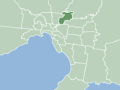
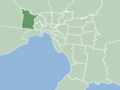
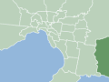
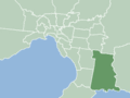
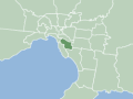
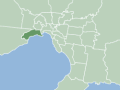
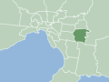
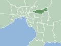
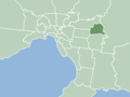
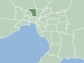
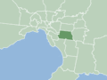
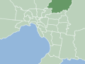
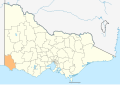
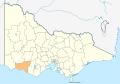
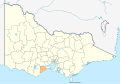
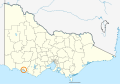
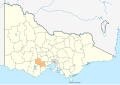
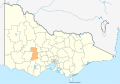
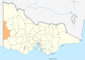
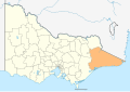
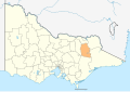
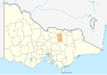
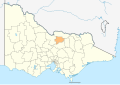
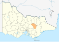
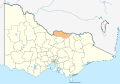
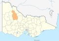
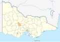
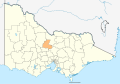
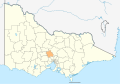
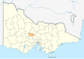
This is a list of local government areas (LGAs) in Victoria, sorted by region.

Contents

Also referred to as municipalities, the 79 Victorian LGAs are classified as cities (34), shires (38), rural cities (6) and boroughs (1). In general, an urban or suburban LGA is called a city and is governed by a city council, while a rural LGA covering a larger rural area is usually called a shire and is governed by a shire council. Local councils have the same administrative functions and similar political structures, regardless of their classification.

Local elections are held in Victoria every four years with the most recent elections being held in 2020.

Current local government areas

Greater Melbourne

Detail of Local Government Areas in and around Melbourne. Australia Victoria Melbourne Metro Area LGA names.svg
Detail of Local Government Areas in and around Melbourne.
Local government areaCouncil seatDate establishedLand areaPopulation

(2021) [1]

Pop. densityCouncillors
(2022)
MapCouncil / Shire Icon
City of Melbourne Melbourne 12 August 184237 km2 (14 sq mi)149,61511,89711 MelbLGA-Melbourne.gif
City of Port Phillip St Kilda 22 June 199421 km2 (8.1 sq mi)101,94213,9619 MelbLGA-PortPhillip.gif
City of Stonnington Malvern 22 June 199426 km2 (10 sq mi)104,70311,5769 MelbLGA-Stonnington.gif
City of Yarra Richmond 22 June 199420 km2 (7.7 sq mi)90,11412,7589 MelbLGA-Yarra.gif
City of Banyule Greensborough 15 December 199463 km2 (24 sq mi)126,2365,3549 MelbLGA-Banyule.gif
City of Bayside Sandringham 15 December 199437 km2 (14 sq mi)101,3067,4007 MelbLGA-Bayside.gif
City of Boroondara Camberwell 22 June 199460 km2 (23 sq mi)167,9007,82611 MelbLGA-Boroondara.gif
City of Darebin Preston 22 June 199454 km2 (21 sq mi)148,5707,7519 MelbLGA-Darebin.gif
City of Glen Eira Caulfield North 15 December 199439 km2 (15 sq mi)148,90810,2189 MelbLGA-GlenEira.gif
City of Hobsons Bay Altona 22 June 199464 km2 (25 sq mi)91,3223,9047 MelbLGA-HobsonsBay.gif
City of Kingston Cheltenham 15 December 199491 km2 (35 sq mi)158,1294,6519 MelbLGA-Kingston.gif
City of Manningham Doncaster 15 December 1994113 km2 (44 sq mi)124,7002,8779 MelbLGA-Manningham.gif
City of Maribyrnong Footscray 15 December 199431 km2 (12 sq mi)85,2097,6357 MelbLGA-Maribyrnong.gif Maribyrnong city council logo.svg
City of Monash Glen Waverley 15 December 199482 km2 (32 sq mi)190,3976,31911 MelbLGA-Monash.gif
City of Moonee Valley Moonee Ponds 15 December 199443 km2 (17 sq mi)121,8517,7039 MelbLGA-MooneeValley.gif
City of Merri-bek Coburg 22 June 199451 km2 (20 sq mi)171,3579,22911 MelbLGA-Merri-bek.gif Merri-bek logo.png
City of Whitehorse Nunawading 15 December 199464 km2 (25 sq mi)169,3467,13011 MelbLGA-Whitehorse.gif
City of Brimbank Sunshine 15 December 1994123 km2 (47 sq mi)194,6184,39511 MelbLGA-Brimbank.gif
Shire of Cardinia Officer 15 December 19941,283 km2 (495 sq mi)118,1942169 MelbLGA-Cardinia.gif
City of Casey Narre Warren 15 December 1994409 km2 (158 sq mi)365,2392,15611 MelbLGA-Casey.gif
City of Frankston Frankston 15 December 1994130 km2 (50 sq mi)139,2812,8269 MelbLGA-Frankston.gif
City of Greater Dandenong Dandenong 15 December 1994130 km2 (50 sq mi)158,2083,30911 MelbLGA-GreaterDandenong.gif
City of Hume Broadmeadows 15 December 1994504 km2 (195 sq mi)243,9011,15311 MelbLGA-Hume.gif
City of Knox Wantirna South 16 November 1963114 km2 (44 sq mi)159,1033,5529 MelbLGA-Knox.gif
City of Maroondah Ringwood 15 December 199461 km2 (24 sq mi)115,0434,9899 MelbLGA-Maroondah.gif
City of Melton Melton 16 September 1862528 km2 (204 sq mi)178,9607699 MelbLGA-Melton.gif
Shire of Mornington Peninsula Rosebud 15 December 1994724 km2 (280 sq mi)168,94859311 MelbLGA-MorningtonPeninsula.gif
Shire of Nillumbik Greensborough 15 December 1994432 km2 (167 sq mi)62,8953897 MelbLGA-Nillumbik.gif Nillumbik logo new.jpg
City of Whittlesea South Morang 12 December 1862490 km2 (190 sq mi)229,3961,18011 MelbLGA-Whittlesea.gif
City of Wyndham Werribee 6 October 1862542 km2 (209 sq mi)292,0111,22011 MelbLGA-Wyndham.gif Wyndham City logo.svg
Shire of Yarra Ranges Lilydale 15 December 19942,468 km2 (953 sq mi)156,0681669 MelbLGA-YarraRanges.gif

Regional Victoria

Map of LGAs in regional Victoria. Australia Victoria with LGA names.svg
Map of LGAs in regional Victoria.

Barwon South West

Local government areaCouncil seatDate establishedLand area [2] PopulationCouncillors
(2022)
Map
km2 sq mi (2013) [3] (2021) [2]
Colac Otway Shire Colac 19943,4381,32721,03522,4237 Australia Victoria Colac Otway Shire.svg
Corangamite Shire Camperdown 19944,4081,70216,41016,1157 Australia Victoria Corangamite Shire.svg
Shire of Glenelg Portland 19946,2192,40119,79720,1527 Australia Victoria Glenelg Shire.svg
City of Greater Geelong Geelong 19931,248482223,357271,05711 Australia Victoria Greater Geelong City.svg
Shire of Moyne Port Fairy 19945,4822,11716,43117,3747 Australia Victoria Moyne Shire.svg
Borough of Queenscliffe Queenscliff 18638.633,0023,2765 Australia Victoria Queenscliffe Borough.svg
Shire of Southern Grampians Hamilton 19946,6542,56916,35516,5887 Australia Victoria Southern Grampians Shire.svg
Surf Coast Shire Torquay 19941,55360028,22837,6949 Australia Victoria Surf Coast Shire.svg
City of Warrnambool Warrnambool 18551214733,42335,4067 Australia Victoria Warrnambool City.svg

Grampians

Local government areaCouncil seatDate establishedLand area [2] PopulationCouncillors
(2022)
Map
km2 sq mi (2013) [3] (2021) [2]
Rural City of Ararat Ararat 19944,2111,62611,49011,8807 Australia Victoria Ararat RC.svg
City of Ballarat Ballarat 199473928598,344113,7639 Australia Victoria Ballarat City.svg
Golden Plains Shire Bannockburn 19942,7031,04420,36224,9857 Australia Victoria Golden Plains Shire.svg
Shire of Hepburn Daylesford 19951,47356915,02216,6047 Australia Victoria Hepburn Shire.svg
Shire of Hindmarsh Nhill 19957,5242,9055,8525,6986 Australia Victoria Hindmarsh Shire.svg
Rural City of Horsham Horsham 19954,2671,64719,69420,4297 Australia Victoria Horsham RC.svg
Shire of Moorabool Ballan 19942,11181530,41037,6327 Australia Victoria Moorabool Shire.svg
Shire of Northern Grampians Stawell 19955,7302,21211,88011,9487 Australia Victoria Northern Grampians Shire.svg
Pyrenees Shire Beaufort 19943,4351,3266,9387,6715 Australia Victoria Pyrenees Shire.svg
Shire of West Wimmera Edenhope 19959,1083,5174,1244,0065 Australia Victoria West Wimmera Shire.svg
Shire of Yarriambiack Warracknabeal 19957,3262,8297,0326,5567 Australia Victoria Yarriambiack Shire.svg

Gippsland

Local government areaCouncil seatDate establishedLand area [2] PopulationCouncillors
(2022)
Map
km2 sq mi (2013) [3] (2021) [2]
Bass Coast Shire Wonthaggi 199486633431,33140,7899 Australia Victoria Bass Coast Shire.svg
Shire of Baw Baw Warragul 19944,0281,55545,62757,6269 Australia Victoria Baw Baw Shire.svg
Shire of East Gippsland Bairnsdale 199420,9408,08543,80948,7159 Australia Victoria East Gippsland Shire.svg
City of Latrobe Morwell 19941,42655174,12477,3189 Australia Victoria Latrobe City.svg
South Gippsland Shire Leongatha 19943,4351,32628,27330,5779 Australia Victoria South Gippsland Shire.svg
Shire of Wellington Sale 199410,8174,17642,72145,6399 Australia Victoria Wellington Shire.svg

Hume

Local government areaCouncil seatDate establishedLand area [2] PopulationCouncillors
(2022)
Map
km2 sq mi (2013) [3] (2021) [2]
Alpine Shire Bright 19944,7881,84912,28313,2357 Australia Victoria Alpine Shire locator map.svg
Rural City of Benalla Benalla 20022,35390813,87814,5287 Australia Victoria Benalla RC locator map.svg
City of Greater Shepparton Shepparton 19942,42293563,24468,4099 Australia Victoria Greater Shepparton City.svg
Shire of Indigo Beechworth 19942,04078815,60517,3687 Australia Victoria Indigo Shire.svg
Shire of Mansfield Mansfield 20023,8441,4848,27610,1785 Australia Victoria Mansfield Shire.svg
Shire of Mitchell Broadford 19942,8621,10537,78849,4609 Australia Victoria Mitchell Shire.svg
Shire of Moira Cobram 19944,0461,56225,40130,5229 Australia Victoria Moira Shire.svg
Shire of Murrindindi Alexandra 19943,8801,49813,56315,1977 Australia Victoria Murrindindi Shire.svg
Shire of Strathbogie Euroa 19943,3031,2759,11911,4557 Australia Victoria Strathbogie Shire.svg
Shire of Towong Tallangatta 19946,6752,5775,9616,2235 Australia Victoria Towong Shire.svg
Rural City of Wangaratta Wangaratta 19973,6451,40727,65029,8087 Australia Victoria Wangaratta RC.svg
City of Wodonga Wodonga 187643316737,57543,2537 Australia Victoria Wodonga City.svg

Loddon Mallee

Local government areaCouncil seatDate establishedLand area [2] PopulationCouncillors
(2022)
Map
km2 sq mi (2013) [3] (2021) [2]
Shire of Buloke Wycheproof 19958,0003,0896,3886,1787 Australia Victoria Buloke Shire.svg
Shire of Campaspe Echuca 19944,5191,74537,21338,7359 Australia Victoria Campaspe Shire.svg
Shire of Central Goldfields Maryborough 19951,53359212,81513,4837 Australia Victoria Central Goldfields Shire.svg
Shire of Gannawarra Kerang 19953,7351,44210,52610,6837 Australia Victoria Gannawarra Shire.svg
City of Greater Bendigo Bendigo 19943,0001,158105,957121,4709 Australia Victoria Greater Bendigo City.svg
Shire of Loddon Wedderburn 19956,6962,5857,5187,7595 Australia Victoria Loddon Shire.svg
Shire of Macedon Ranges Kyneton 19941,74867544,59551,4589 Australia Victoria Macedon Ranges Shire.svg
Rural City of Mildura Mildura 199522,0838,52653,15656,9729 Australia Victoria Mildura RC.svg
Shire of Mount Alexander Castlemaine 19951,53059118,24720,2537 Australia Victoria Mount Alexander Shire.svg
Rural City of Swan Hill Swan Hill 19956,1152,36121,00321,4037 Australia Victoria Swan Hill RC.svg

Former local government areas

This is a list of former local government areas in Victoria. Many of these existed from the 19th century until the 1994 statewite local government amalgamations. [4]

Greater Melbourne

This is a list of former Greater Melbourne local government areas. These local government areas were considered part of Greater Melbourne at the time of their dissolution.

Local government areaDate establishedDate dissolvedAmalgamated into:
City of Altona 20 February 195722 June 1994 City of Hobsons Bay
City of Box Hill 7 August 185715 December 1994 City of Whitehorse
City of Brighton 18 January 185915 December 1994 City of Bayside
City of Broadmeadows 27 November 185715 December 1994 City of Hume

City of Merri-bek

City of Brunswick 29 September 185722 June 1994 City of Merri-bek
City of Camberwell 11 July 186422 June 1994 City of Boroondara
City of Caulfield 17 April 187115 December 1994 City of Glen Eira
City of Chelsea 1 May 192015 December 1994 City of Kingston
City of Coburg 185915 December 1994 City of Merri-bek

City of Darebin

City of Collingwood 24 April 185522 June 1994 City of Yarra
City of Croydon 24 May 196115 December 1994 City of Maroondah
City of Dandenong 185715 December 1994 City of Greater Dandenong
Shire of Diamond Valley 30 September 196415 December 1994 City of Banyule

Shire of Nillumbik

City of Darebin

City of Doncaster & Templestowe 19 December 185615 December 1994 City of Manningham
City of Essendon 27 December 186115 December 1994 City of Moonee Valley
City of Fitzroy 10 September 185822 June 1994 City of Yarra
Borough of Flemington and Kensington 17 March 188230 October 1905 City of Melbourne
City of Footscray 10 June 185915 December 1994 City of Maribyrnong

City of Hobsons Bay

City of Frankston (former) 6 November 186015 December 1994 City of Frankston (new)

Shire of Mornington Peninsula

City of Hawthorn 27 July 186022 June 1994 City of Boroondara
City of Heidelberg 184015 December 1994 City of Banyule

City of Darebin

City of Keilor 3 March 186315 December 1994 City of Brimbank

City of Moonee Valley

City of Hume

City of Kew 19 December 186022 June 1994 City of Boroondara
City of Malvern 17 October 185622 June 1994 City of Stonnington
City of Moorabbin 27 February 187115 December 1994 City of Glen Eira

City of Bayside

City of Kingston

City of Mordialloc 26 May 192015 December 1994 City of Kingston

City of Bayside

Town of North Melbourne 30 September 185930 October 1905 City of Melbourne
City of Northcote 25 May 188322 June 1994 City of Darebin

City of Darebin

City of Nunawading 26 May 192515 December 1994 City of Whitehorse
City of Oakleigh 13 March 189115 December 1994 City of Monash

City of Kingston

City of Port Melbourne 13 July 186022 June 1994 City of Port Phillip
City of Prahran 24 April 185522 June 1994 City of Stonnington

City of Port Phillip

City of Preston 8 November 187122 June 1994 City of Darebin
City of Richmond 24 April 185522 June 1994 City of Yarra
City of Ringwood 22 October 192415 December 1994 City of Maroondah
City of Sandringham 28 February 191715 December 1994 City of Bayside
City of South Melbourne 26 May 185522 June 1994 City of Port Phillip
City of Springvale 6 February 185715 December 1994 City of Greater Dandenong

City of Kingston

City of St Kilda 24 April 185522 June 1994 City of Port Phillip
City of Sunshine 28 May 186015 December 1994 City of Brimbank

City of Maribyrnong

City of Waverley 1 January 185715 December 1994 City of Monash
City of Williamstown 14 March 185622 June 1994 City of Hobsons Bay

Regional Victoria

This is a list of former regional local government areas around Geelong and surrounding the Greater Melbourne area. These local government areas were not considered part of Greater Melbourne at the time of their dissolution.

Local government areaDate establishedDate dissolvedAmalgamated into:
Shire of Bannockburn 31 October 18626 May 1994 Golden Plains Shire
Shire of Barrabool 28 December 185318 May 1993 City of Greater Geelong

Surf Coast Shire

Rural City of Bellarine 12 December 185318 May 1993 City of Greater Geelong
City of Berwick 1 October 197315 December 1994 City of Casey

City of Greater Dandenong

Shire of Bulla 16 September 186215 December 1994 City of Hume
Shire of Corio 3 April 186118 May 1993 City of Greater Geelong
City of Cranbourne 6 March 186815 December 1994 City of Casey

City of Frankston

City of Greater Dandenong

Bass Coast Shire

Shire of Mornington Peninsula

Shire of Eltham 26 September 185615 December 1994 Shire of Nillumbik

Shire of Murrindindi

City of Banyule

Shire of Flinders 24 December 187415 December 1994 Shire of Mornington Peninsula
City of Geelong 1 October 184918 May 1993 City of Greater Geelong
City of Geelong West 29 May 187518 May 1993 City of Greater Geelong
Shire of Hastings 19 October 196015 December 1994 Shire of Mornington Peninsula
Shire of Healesville 30 September 188715 December 1994 Shire of Yarra Ranges
Shire of Lilydale 19 September 185615 December 1994 Shire of Yarra Ranges
Shire of Mornington 31 May 189315 December 1994 Shire of Mornington Peninsula
City of Newtown 9 March 185818 May 1993 City of Greater Geelong
Shire of Pakenham 24 October 186215 December 1994 Shire of Cardinia
Shire of Sherbrooke 23 May 188915 December 1994 Shire of Yarra Ranges

Shire of Cardinia

City of Knox

City of South Barwon 2 June 18579 March 1994 City of Greater Geelong

Surf Coast Shire

Shire of Upper Yarra 19 October 188815 December 1994 Shire of Yarra Ranges

See also

Related Research Articles

<span class="mw-page-title-main">Shire of Mornington Peninsula</span> Local government area in Victoria, Australia

The Shire of Mornington Peninsula is a local government area in southeastern Metropolitan Melbourne, Victoria, Australia. It is located to the south of the Melbourne City Centre. It has an area of 724 square kilometres and in June 2018 it had a population of 165,822.

<span class="mw-page-title-main">Local government areas of Western Australia</span> Local government administrative areas in Western Australia

There are 137 local government areas (LGAs) in Western Australia, which comprise 27 cities, 102 shires, and 8 towns that manage their own affairs to the extent permitted by the Local Government Act 1995. The Local Government Act 1995 also makes provision for regional local governments (referred to as "regional councils", established by two or more local governments for a particular purpose.

<span class="mw-page-title-main">City of Wyndham</span> Local government area in Victoria, Australia

The City of Wyndham is a local government area in Victoria, Australia in the outer south-western suburbs of Melbourne, within the Melbourne Metropolitan Area, between Melbourne and the regional city of Geelong. It has an area of 542 square kilometres (209 sq mi). The city had a population of 255,322 in June 2018. For the year to 2018 the City of Wyndham increased its population by 14,251, the largest number of any LGA in Victoria, as well as being the second most populous and the second fastest growing at a rate of 5.9 per cent.

<span class="mw-page-title-main">City of Melton</span> Local government area in Victoria, Australia

The City of Melton is a local government area in Victoria, Australia, on Melbourne's western rural–urban fringe.

<span class="mw-page-title-main">Rural City of Ararat</span> Local government area in Victoria, Australia

The Rural City of Ararat is a local government area in Victoria, Australia, located in the western part of the state. It covers an area of 4,211 square kilometres (1,626 sq mi) and in the 2021 had a population of 11,880.

<span class="mw-page-title-main">City of Ballarat</span> Local government area in Victoria, Australia

The City of Ballarat is a local government area in the west of the state of Victoria, Australia. It covers an area of 739 square kilometres (285 sq mi) and, in June 2018, had a population of 107,325. It is primarily urban with the vast majority of its population living in the Greater Ballarat urban area, while other significant settlements within the LGA include Buninyong, Waubra, Learmonth and Addington. It was formed on 6 May 1994 from the amalgamation of the City of Ballarat, Shire of Ballarat, Borough of Sebastopol and parts of the Shire of Bungaree, Shire of Buninyong, Shire of Grenville and Shire of Ripon.

<span class="mw-page-title-main">City of Greater Geelong</span> Local government area in Victoria, Australia

The City of Greater Geelong is a local government area in the Barwon South West region of Victoria, Australia, located in the western part of the state. It covers an area of 1,248 square kilometres (482 sq mi) and, had a population of 271,057 as of the 2021 Australian census. It is primarily urban with the vast majority of its population living in the Greater Geelong urban area, while other significant settlements within the LGA include Anakie, Balliang, Barwon Heads, Batesford, Ceres, Clifton Springs, Drysdale, Lara, Ocean Grove, Portarlington and St Leonards. It was formed in 1993 from the amalgamation of the Rural City of Bellarine, Shire of Corio, City of Geelong, City of Geelong West, City of Newtown, City of South Barwon, and parts of Shire of Barrabool and Shire of Bannockburn.

<span class="mw-page-title-main">City of Greater Bendigo</span> Local government area in Victoria, Australia

The City of Greater Bendigo is a local government area in Victoria, Australia, located in the central part of the state. It covers an area of 3,000 square kilometres (1,200 sq mi) and, in August 2021, had a population of 121,470. It includes the city of Bendigo and the towns of Axedale, Elmore, Heathcote, Marong, Raywood and Strathfieldsaye. It was formed in 1994 from the amalgamation of the former City of Bendigo with the Borough of Eaglehawk, Shire of Strathfieldsaye, Shire of Huntly and parts of the Rural City of Marong and Shire of McIvor. It is the state’s third largest economy base and is considered a service and infrastructure centre for north central Victoria. The city is surrounded by 40,000 hectares of regional, state and national parkland.

<span class="mw-page-title-main">Rural City of Horsham</span> Local government area in Victoria, Australia

The Rural City of Horsham is a local government area in Victoria, Australia, located in the western part of the state. It covers an area of 4,267 square kilometres (1,647 sq mi) and in June 2018, had a population of 19,875. It includes the towns of Brimpaen, Dadswells Bridge, Dooen, Haven, Horsham, Laharum, Natimuk, Noradjuha and Pimpinio. It was formed in 1995 by the amalgamation of the City of Horsham, most of the Shire of Wimmera and Shire of Arapiles, and part of the Shire of Kowree.

<span class="mw-page-title-main">Rural City of Swan Hill</span> Local government area in Victoria, Australia

The Rural City of Swan Hill is a local government area in Victoria, Australia, located in the north-western part of the state. It covers an area of 6,115 square kilometres (2,361 sq mi) and, in August 2021, had a population of 21,403. It includes the towns of Swan Hill, Lake Boga, Manangatang, Nyah, Nyah West, Piangil, Robinvale, Ultima and Woorinen South. It was formed in 1995 from the amalgamation of the City of Swan Hill, Shire of Swan Hill and part of the Shire of Kerang.

<span class="mw-page-title-main">Shire of Colac Otway</span> Local government area in Victoria, Australia

The Shire of Colac Otway is a local government area in the Barwon South West region of Victoria, Australia, located in the south-western part of the state. It covers an area of 3,438 square kilometres (1,327 sq mi) and in June 2018 had a population of 21,503. It includes the towns of Apollo Bay, Beeac, Beech Forest, Birregurra, Colac, Cressy, Forrest, Johanna, Kennett River, Lavers Hill, Warrion and Wye River. It came into existence on 23 September 1994 through the amalgamation of the local government areas of City of Colac, Shire of Colac, part of the Shire of Otway and part of the Shire of Heytesbury.

<span class="mw-page-title-main">Shire of Glenelg</span> Local government area in Victoria, Australia

The Shire of Glenelg is a local government area in the Barwon South West region of Victoria, Australia, located in the south-western part of the state. It covers an area of 6,219 square kilometres (2,401 sq mi) and in June 2018 had a population of 19,665. It includes the towns of Casterton, Heywood, Merino and Portland. Although a shire of the same name existed before the amalgamations of the mid-1990s, the current Shire was formed in 1994 from the amalgamation of the former Shire of Glenelg with the Shire of Heywood and City of Portland.

<span class="mw-page-title-main">Shire of Hindmarsh</span> Local government area in Victoria, Australia

The Shire of Hindmarsh is a local government area in Victoria, Australia, located in the western part of the state. It covers an area of 7,527 square kilometres (2,906 sq mi) and in June 2018 had a population of 5,645, having fallen from 5,852 in June 2013.

<span class="mw-page-title-main">City of Latrobe</span> Local government area in Victoria, Australia

The City of Latrobe is a local government area in the Gippsland region in eastern Victoria, Australia, located in the eastern part of the state. It covers an area of 1,426 square kilometres (551 sq mi) and in June 2018 had a population of 75,211. It is primarily urban with the vast majority of its population living within the four major urban areas of Moe, Morwell, Traralgon, and Churchill, and other significant settlements in the LGA include Boolarra, Callignee, Glengarry, Jeeralang, Newborough, Toongabbie, Tyers, Yallourn North and Yinnar. It was formed in 1994 from the amalgamation of the City of Moe, City of Morwell, City of Traralgon, Shire of Traralgon, and parts of the Shire of Narracan and Shire of Rosedale. The Yallourn Works Area was added in 1996. When formed, the municipality was called the Shire of La Trobe, but on 6 April 2000, it adopted its current name.

<span class="mw-page-title-main">Shire of Mitchell</span> Local government area in Victoria, Australia

Mitchell Shire is a local government area in the Hume region of Victoria, Australia, located North of Melbourne. It covers an area of 2,862 square kilometres (1,105 sq mi) and, in August 2024, had a projected population of 61,362. Larger towns include Beveridge, Broadford, Kilmore, Seymour, Tallarook, Pyalong and Wallan. It was formed in 1994 from the amalgamation of the Shire of Pyalong, the Shire of Kilmore, most of the Shire of Broadford, and parts of the Shire of McIvor and Rural City of Seymour.

<span class="mw-page-title-main">Shire of Yarriambiack</span> Local government area in Victoria, Australia

The Shire of Yarriambiack is a local government area of Victoria, Australia, located in the north-western part of the state. It covers an area of 7,326 square kilometres (2,829 sq mi) and, in June 2018, had a population of 6,658, having fallen from 7,438 in 2008. It includes the towns of Hopetoun, Murtoa, Rupanyup and Warracknabeal. It was formed in 1995 from the amalgamation of the Shire of Warracknabeal, Shire of Karkarooc, and parts of the Shire of Dunmunkle and Shire of Wimmera.

<span class="mw-page-title-main">Shire of Mansfield</span> Local government area in Victoria, Australia

The Shire of Mansfield is a local government area in the Hume region of Victoria, Australia, located in the north-east part of the state. It covers an area of 3,844 square kilometres (1,484 sq mi) and in August 2021, had a population of 10,178.

<span class="mw-page-title-main">Alpine Shire</span> Local government area in Victoria, Australia

The Shire of Alpine is a local government area in the Hume region of Victoria, Australia, located in the north-east part of the state. It covers an area of 4,788 square kilometres (1,849 sq mi) and in August 2021 had a population of 13,235.

A local government area (LGA) is an administrative division of a country that a local government is responsible for. The size of an LGA varies by country but it is generally a subdivision of a state, province, division, or territory.

<span class="mw-page-title-main">Local government in Victoria</span> Third tier of government in Victoria, Australia

Local government in the Australian state of Victoria consists of 79 local government areas (LGAs). Also referred to as municipalities, Victorian LGAs are classified as cities (34), shires (38), rural cities (6) and boroughs (1). In general, an urban or suburban LGA is called a city and is governed by a City Council, while a rural LGA covering a larger rural area is usually called a shire and is governed by a Shire Council. Local councils have the same administrative functions and similar political structures, regardless of their classification.

References

  1. "2021 Victoria, Census All persons QuickStats". Australian Bureau of Statistics. Retrieved 25 July 2022.
  2. 1 2 3 4 5 6 7 8 9 10 "3218.0 – Regional Population Growth, Australia, 2017-18: Population Estimates by Local Government Area (ASGS 2018), 2017 to 2018" (XLS). Australian Bureau of Statistics. 27 March 2019. Retrieved 25 October 2019. Estimated resident population, 30 June 2018.
  3. 1 2 3 4 5 "People: Population: ERP by LGA (ASGS 2018), 2001 to 2018". ABS.Stat. Australian Bureau of Statistics. 27 March 2019. Retrieved 29 November 2019.
  4. Royce Millar & Jason Dowling (25 April 2004). "Kennett's blitz a decade on". The Age. Melbourne. Retrieved 24 July 2010.