Gualchos

Last updated
Gualchos
Gualchos (Granada).jpg
Bandera de Gualchos (Granada).svg
Escudo de Gualchos (Granada) 2.svg
LocationGualchos.png
Location of Gualchos
Spain location map with provinces.svg
Red pog.svg
Gualchos
Location in Spain
Coordinates: 36°45′N3°23′W / 36.750°N 3.383°W / 36.750; -3.383 Coordinates: 36°45′N3°23′W / 36.750°N 3.383°W / 36.750; -3.383
CountryFlag of Spain.svg  Spain
Autonomous community Flag of Andalucia.svg  Andalusia
Province Granada
Comarca Costa Tropical
Judicial district Motril
Government
   Alcalde Miguel Díaz Juárez(2007)
Area
  Total31.03 km2 (11.98 sq mi)
Population
 (2018) [1]
  Total5,210
  Density170/km2 (430/sq mi)
Demonym gualchero/a
Time zone UTC+1 (CET)
  Summer (DST) UTC+2 (CEST)

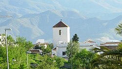
Gualchos (or Gualchos-Castell de Ferro) is a town in the Spanish province of Granada. It has an area of 31 square kilometers and a population, in 2001, of 2,759, for a population density of 89 people per square kilometer.

Contents

Natural environment

The environment of what the natives call Eagle Peak, has elements of remarkable value, which grow spontaneously and without any cropping the it, esparto, palm, several species of thyme and other medicinal plants such as zahareña (cattails), very good for healing wounds, according to popular belief, though the natives attributed other properties. You can also find numerous species of fauna: ibex, boar is, rabbits, hares, etc.

Related Research Articles

<span class="mw-page-title-main">Sonoran Desert</span> Desert in northwestern Mexico and the southwestern United States

The Sonoran Desert is a desert in North America and ecoregion that covers the northwestern Mexican states of Sonora, Baja California, and Baja California Sur, as well as part of the southwestern United States. It is the hottest desert in both Mexico and the United States. It has an area of 260,000 square kilometers (100,000 sq mi).

<span class="mw-page-title-main">Gandia</span> Municipality in Valencian Community, Spain

Gandia is a city and municipality in the Valencian Community, eastern Spain on the Mediterranean. Gandia is located on the Costa del Azahar, 65 kilometres (40 mi) south of Valencia and 110 km (68 mi) north of Alicante. Vehicles can access the city through road N-332.

<span class="mw-page-title-main">Dinghai District</span> District in Zhejiang, Peoples Republic of China

Dinghai  is a district of Zhoushan City made of 128 islands in Zhejiang province, China.The total area is 1,444 square kilometres.The land area is 568.8 square kilometers, the sea area is 875.2 square kilometers, and the coastline is more than 400 kilometers.It is based on the larger northwestern half of Zhoushan Island, where it borders Putuo in the east. The district boundary meets that of Daishan County out at sea to the north of the island. Its southwestern boundary intersects the border of Ningbo, also entirely at sea.

<span class="mw-page-title-main">Pedernales Province</span> Province of the Dominican Republic

Pedernales is the southernmost province of the Dominican Republic, including the offshore island of Isla Beata. It was split from Barahona in 1957. Of its 2,074.53 km2, 1374 km2 belong to the Jaragua National Park. A third of its population is of Haitian origin, the highest ratio within the country.

<span class="mw-page-title-main">Majayjay</span> Municipality in Calabarzon

Majayjay, officially the Municipality of Majayjay, is a 4th class municipality in the province of Laguna, Philippines. According to the 2020 census, it has a population of 27,893 people. 

<span class="mw-page-title-main">Zipaquirá</span> Place in Cundinamarca, Colombia

Zipaquirá is a municipality and city of Colombia in the department of Cundinamarca. Its neighboring municipalities are Cogua and Nemocón to the north; Tocancipá to the east; Tabio, Cajicá and Sopó to the south; and Subachoque and Pacho to the west. Its seat of municipal government is 49 kilometers from the national capital Bogotá. It is part of the Greater Bogotá Metropolitan Area, and is the capital of the Sabana Centro province. It is also the headquarters of the diocese of the same name and that includes much of the Department of Cundinamarca, extending to the centre of Bogotá, the region of Rionegro, the Ubaté Valley, and the region of Guavio.

<span class="mw-page-title-main">Bato, Camarines Sur</span> Municipality in Bicol Region, Philippines

Bato, officially the Municipality of Bato, is a 3rd class municipality in the province of Camarines Sur, Philippines. According to the 2020 census, it has a population of 52,155 people. 

<span class="mw-page-title-main">Nueva Santa Rosa</span>

Nueva Santa Rosa is a town and municipality in the Santa Rosa department of Guatemala. The municipality has a population of 36,464 and cover an area of 147 km2.

<span class="mw-page-title-main">Lindi Region</span> Region of Tanzania

Lindi Region is one of Tanzania's 31 administrative regions. The region covers an area of 66,040 km2 (25,500 sq mi). The region is comparable in size to the combined land area of the nation state of Sri Lanka. The regional capital is the municipality of Lindi. The Lindi Region borders on Pwani Region, Morogoro Region, Ruvuma Region, and Mtwara Region. The name Lindi is an old Swahili word meaning "hiding pits", a place where Swahili people will hide to defend themselves from hostile invasions. The region is home to two UNESCO World Heritage Sites, namely; Kilwa Kisiwani and Selous Game Reserve. According to the 2012 national census, the region had a population of 864,652, which was lower than the pre-census projection of 960,236. For 2002–2012, the region's 0.9 percent average annual population growth rate was the 29th highest in the country. It was also the least densely populated region with 13 people per square kilometer.

<span class="mw-page-title-main">Lake Tota</span> Largest lake in Colombia

Lake Tota is the largest lake in Colombia, located in the east of Boyacá department, inside the Sugamuxi Province, it is the source of the Upia River which flows into the Orinoco River basin.

Jeju is a woreda in Oromia Region, Ethiopia. Part of the Arsi Zone, Jeju is bordered by Dodotana Sire to the west, the Misraq Shewa Zone to the north, Merti to the east, and Sude to the south. Its administrative centre is Arboye, located 168 kilometres southeast of Addis Ababa. Other towns in this woreda include Bolo.

Amibara is a woreda in Afar Region, Ethiopia. Part of the Administrative Zone 3, Amibara is bordered on the south by Awash Fentale, on the west by the Awash River which separates it from Dulecha, on the northwest by the Administrative Zone 5, on the north by Gewane, on the east by the Somali Region, and on the southeast by Oromia Region. Towns in Amibara include Awash Arba, Awash Sheleko, Melka Sedi and Melka Were.

Sodo Zuria is one of the woredas in the Southern Nations, Nationalities, and Peoples' Region of Ethiopia. Part of the Wolayita Zone, Sodo Zuria is bordered on the southwest by Offa, on the west by Kindo Koysha, on the northwest by Damot Sore, on the north by Boloso Sore, on the northeast by Damot Gale, on the east by Damot Weyde, and on the southeast by Humbo. Town of Sodo was separated from Sodo woreda.

Didessa is one of the woredas in the Oromia Region of Ethiopia. It is named after the Didessa River, a tributary of the Abay River. Part of the Illubabor Zone, Didessa is bordered on the south by the Didessa River which separates it from the Jimma Zone, and on the north by Gechi. The major town in Didessa is Denbi.

<span class="mw-page-title-main">Volcán Isluga National Park</span> A national park of Chile

Volcán Isluga National Park is located in the Andes, in the Tarapacá Region of Chile, near Colchane and south of Lauca Biosphere Reserve. It covers 1,747 square kilometers, with elevations ranging between 2,100 and 5,550 meters. It is named after Volcán Isluga, which at 5,550 m, is the tallest mountain in this park.

Gomma is a woreda in Oromia Region, Ethiopia. It is named after the former Kingdom of Gomma, whose territory was roughly the same as the modern woreda. Part of the Jimma Zone, Gomma is bordered on the south by Seka Chekorsa, on the southwest by Gera, on the northwest by Setema, on the north by the Didessa River which separates it from the Illubabor Zone, on the northeast by Limmu Kosa, and on the east by Mana. Towns include Beshasha, Choche, Ghembe, and Limmu Shaye. Guma woreda was separated from Gomma.

<span class="mw-page-title-main">Chinácota</span> Municipality in Norte de Santander Department, Colombia

Chinácota is a small town and municipality located in the Department of Norte de Santander in Colombia, South America. This department is located in the north-eastern region of the country, near the border with Venezuela. Chinácota has a population of approximately 15,000 people according to the 2005 Colombian census.

<span class="mw-page-title-main">Fauna of Nicaragua</span>

The fauna of Nicaragua is characterized by a very high level of biodiversity. Much of Nicaragua's wildlife lives in protected areas. There are currently 78 protected areas in Nicaragua, covering more than 22,000 square kilometers (8,500 sq mi), or about 17% of its landmass.

<span class="mw-page-title-main">Algarrobo, Spain</span> Municipality and town in Andalucía, Spain

Algarrobo is a town and municipality in the province of Málaga, part of the autonomous community of Andalusia in southern Spain. The municipality is situated in the coastal area of La Axarquía, 32 kilometers from the city of Málaga. It is bordered on the north by the municipality of Arenas and Sayalonga, to the east and west by Vélez-Málaga and to the south by the Mediterranean Sea. It is situated at an altitude of 86 meters. The main center for the population is Algarrobo, a town of Arab architecture situated 3.5 kilometers from the coast. Other towns in the municipality are Algarrobo Costa, Mezquitilla and Trayamar.

<span class="mw-page-title-main">Cuevas Bajas</span> Place in Andalusia, Spain

Cuevas Bajas is a town and municipality in the province of Málaga, part of the autonomous community of Andalusia in southern Spain. It belongs to the comarca of Nororma. It is part of the judicial district of Archidona. The municipality is situated 75 kilometers from Málaga and 495 km from Madrid In 2011 it had a population of 1,482 inhabitants. Its surface area is 16.53 km2. Cuevas Bajas has a density of 89.66 inhabitants/km2. The natives are called Cueveños.

References

  1. Municipal Register of Spain 2018. National Statistics Institute.