
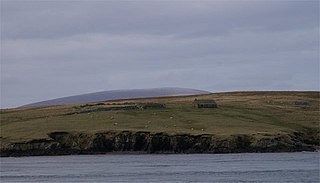
Haaf Gruney is a small island in the north east of the Shetland Islands.
Haaf Gruney is a small island in the north east of the Shetland Islands.
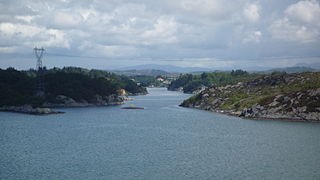
The island is between Unst and Fetlar which are to the north and south respectively. Between it and Yell are a mini-archipelago of small islands including Linga, Sound Gruney, Urie Lingey, Daaey and Wedder Holm. Uyea is also to the west.
The island's name is a corruption of the Norse hafgröney, [1] gröney meaning "green island", and "ha(a)f" being an old word (still in some use in Shetland), meaning deep open water, especially that used for fishing. "Haaf" is added to distinguish it from other islands, such as Sound Gruney nearby.
On August 4, 1745, two girls from Uyea rowed here to milk some of the cows grazing here. Unfortunately, their return was marred by a strong storm, and eventually they found their tiny boat blown to Karmøy in south west Norway. The Uyea girls ended up marrying Karmøy men, and their descendants still live there. [1] [2]
Haaf Gruney is used as a setting in the 2014 novel The Sixteen Trees of the Somme (Svøm med dem som drunker) by Norwegian author Lars Mytting.
Haaf Gruney is a national nature reserve for the storm petrels which breed there. Mousa in the southern Shetland islands also has a strong colony.
The islet is no longer used for grazing, but there are marine Eurasian otters living here, and the usual seals.
Karmøy is a municipality in Rogaland county, Norway. It is southwest of the town of Haugesund in the traditional district of Haugaland. The administrative centre of the municipality is the town of Kopervik.

Fetlar is one of the North Isles of Shetland, Scotland, with a usually resident population of 61 at the time of the 2011 census. Its main settlement is Houbie on the south coast, home to the Fetlar Interpretive Centre. Fetlar is the fourth-largest island of Shetland and has an area of just over 4,000 hectares.
Papa Stour is one of the Shetland Islands in Scotland, with a population of under fifteen people, some of whom immigrated after an appeal for residents in the 1970s. Located to the west of mainland Shetland and with an area of 828 hectares, Papa Stour is the eighth largest island in Shetland. Erosion of the soft volcanic rocks by the sea has created an extraordinary variety of caves, stacks, arches, blowholes, and cliffs. The island and its surrounding seas harbour diverse populations of wildlife. The west side of the island is a Site of Special Scientific Interest and the seas around the island are a Special Area of Conservation.

Mousa is a small island in Shetland, Scotland, uninhabited since the nineteenth century. The island is known for the Broch of Mousa, an Iron Age round tower, and is designated as a Special Protection Area for storm-petrel breeding colonies.
The Isle of Noss or Noss is a small, previously inhabited island in Shetland, Scotland. Noss is separated from the island of Bressay by the narrow Noss Sound. It has been run as a sheep farm since 1900, and has been a national nature reserve since 1955.

Gruney is a small, uninhabited island in Shetland, Scotland. It lies north of the Northmavine peninsula of the Shetland Mainland, from which it is separated by the Gruney Sound.

Vementry is an uninhabited Scottish island in Shetland on the north side of the West Mainland, lying south of Muckle Roe.
Vaila is an island in Shetland, Scotland, lying south of the Westland peninsula of the Shetland Mainland. It has an area of 327 hectares, and is 95 metres (312 ft) at its highest point.
Uyea is an uninhabited island, lying south of Unst in Shetland, Scotland.

Linga is a very small uninhabited island in the Bluemull Sound, Shetland, Scotland. It is one of many islands in Shetland called Linga. It has an area of 45 ha and is 26m at its highest point.

The North Mainland of the Shetland Islands, Scotland is the part of the Mainland lying north of Voe.
Bigga is an uninhabited island in the Yell Sound between the Mainland and Yell in Shetland, Scotland.

Uyea is an uninhabited tidal island located to the northwest of Mainland, Shetland. Uyea lies off the Northmavine peninsula, from where it can be reached by foot at low tide. The island's highest elevation is 70 metres (230 ft) and its area is 45 hectares (0.17 sq mi).

The Ramna Stacks are a group of skerries in the Shetland islands. They are north of the northern tip of Mainland, and along with nearby Gruney they are a special protection area on account of their birdlife.

Little Roe is an island in Yell Sound in the Shetland Islands

Yell Sound is the strait running between Yell and Mainland, Shetland, Scotland. It is the boundary between the Mainland and the North Isles and it contains many small islands. Sullom Voe, on the shores of which is a substantial oil terminal, is an arm of Yell Sound.

Urie Lingey is one of the Shetland Islands. It is between Fetlar and Unst, and Yell is to the west.

Sound Gruney is one of the Shetland islands. It lies about 1.5 kilometres (0.93 mi) north of Hamars Ness on Fetlar, south of Unst, and to the east of Yell.

Fethaland or Fedeland is an abandoned settlement at the extreme north end of Mainland, Shetland. It was the site of the largest Haaf fishing station in Shetland.
| Wikimedia Commons has media related to Haaf Gruney . |
| Inhabited islands | ||
|---|---|---|
| Other islands | ||
| Towns and villages | ||
| Points of interest | ||
Coordinates: 60°39′48″N0°50′12″W / 60.66333°N 0.83667°W
| | This Shetland location article is a stub. You can help Wikipedia by expanding it. |