
Dundalk, meaning "the fort of Dealgan", is the county town of County Louth, Ireland. The town is on the Castletown River, which flows into Dundalk Bay on the east coast of Ireland. It is halfway between Dublin and Belfast, close to the border with Northern Ireland. It is the eighth largest urban area in Ireland, with a population of 39,004 as of the 2016 census.
Gelignite, also known as blasting gelatin or simply "jelly", is an explosive material consisting of collodion-cotton dissolved in either nitroglycerine or nitroglycol and mixed with wood pulp and saltpetre.

County Louth is a coastal county in the Eastern and Midland Region of Ireland, within the province of Leinster. Louth is bordered by the counties of Meath to the south, Monaghan to the west, Armagh to the north and Down to the north-east, across Carlingford Lough. It is the smallest county in Ireland by land area and the 17th most populous, with just over 139,100 residents as of 2022. The county is named after the village of Louth. Louth County Council is the local authority for the county.
Monasteraden is a village in County Sligo, Ireland. The village is located on the shores of Lough Gara. St Aiden's church is the village's church. Other sites include Lough Gara Lodge, Slí na Croí's Roundhouse Ecolodge, Drury's pub and the general store.
Drumkeeran is a village in County Leitrim, Ireland located at the junction of the R280 and R200 roads. It is situated in drumlin hills at the foot of Corry Mountain, just north of Lough Allen.

Hurlers Cross is a small village in County Clare, Ireland. It is situated close to Shannon Town and 6 km (3.7 mi) from both Sixmilebridge and Newmarket-on-Fergus. It forms a part of Newmarket-on-Fergus parish.

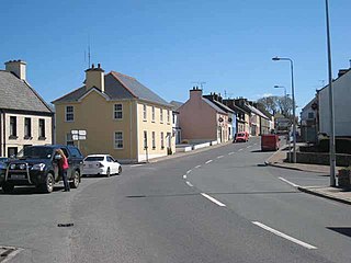
Omeath is a village on the Cooley Peninsula in County Louth, Ireland, close to the border with Northern Ireland. It is roughly midway between Dublin and Belfast, very near the County Louth and County Armagh / County Down border. As of the 2016 census, Omeath had a population of 603, up from 439 during the 2006 census. It is approximately 6 km (3.7 mi) from Carlingford and about 8 km (5.0 mi) from Newry. By sea, Omeath's nearest land neighbour is Warrenpoint on the south County Down coast.

The Louth County Board of the Gaelic Athletic Association (GAA) or Louth GAA is one of the 32 county boards of the GAA in Ireland, and is responsible for Gaelic games in County Louth. The county board is also responsible for the Louth county teams.
Collon is a village and townland in the south west corner of County Louth, Ireland, on the N2 national primary road. The village is home to the Cistercian Abbey of New Mellifont, and to Collon House, ancestral home of the Foster family.
Louth County Council is the authority responsible for local government in County Louth, Ireland. As a county council, it is governed by the Local Government Act 2001. The council is responsible for housing and community, roads and transportation, urban planning and development, amenity and culture, and environment. The council has 29 elected members. Elections are held every five years and are by single transferable vote. The head of the council has the title of Cathaoirleach (Chairperson). The county administration is headed by a Chief Executive, Joan Martin. The county town is Dundalk.

An Fál Carrach, sometimes called Na Crois Bhealaí is a small Gaeltacht town and townland in north-west County Donegal, Ireland. The settlement is in the old parish of Cloughaneely.
Louth is a village at the heart of County Louth, Ireland. It is roughly 11 km south-west of the town of Dundalk, 10.9 km to neighbouring town Ardee. The village is approximately 15 km south-east of Carrickmacross town in County Monaghan. The village gave its name to the county.

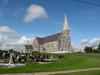
Knockbridge is a village in County Louth, Ireland. It is located in the townland of Ballinlough in the historical barony of Dundalk Upper. As of the 2016 census, the village had a population of 667 people. Knockbridge won a "best kept village" award in the 2008 Tidy Towns competition.

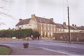
Drumconrath or Drumcondra is a small village in north County Meath, Ireland. The parish borders County Louth and is also close to the borders of Counties Monaghan and Cavan. As of the 2016 census, the village had a population of 345 people.

Tallanstown is a village in County Louth, Ireland. It lies on the R171 Regional road and on the banks of the River Glyde, 11 km southwest of Dundalk. It was the winner of the 2010 Tidy Towns competition.

The Táin Way is a long-distance trail around the Cooley Peninsula in County Louth, Ireland. It is a 40-kilometre (25-mile) long circular route that begins and ends in Carlingford. It is typically completed in two days. It is designated as a National Waymarked Trail by the National Trails Office of the Irish Sports Council and is managed by Louth County Council, Coillte and the Walks Partnership Group.

Aiken Barracks is an army barracks located in Dundalk, County Louth, Ireland. The barracks was originally known as Dundalk Barracks and was renamed after Frank Aiken, a commander of the Irish Republican Army and an Irish politician. It is the current Headquarters of the 27 Infantry Battalion of the Irish Army.
The 1970 All-Ireland Under-21 Football Championship was the seventh staging of the All-Ireland Under-21 Football Championship since its establishment by the Gaelic Athletic Association in 1964.
The 1971 All-Ireland Under-21 Football Championship was the eighth staging of the All-Ireland Under-21 Football Championship since its establishment by the Gaelic Athletic Association in 1964.
The 2001 Birmingham bombing was a terrorist attack on the city centre of Birmingham.


