Related Research Articles

The Pulwama district is located to the south of Srinagar in the Indian-administered union territory of Jammu and Kashmir. Its district headquarters are situated in the city of Pulwama. It is located in the central part of the Kashmir Valley.

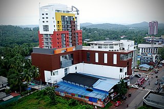
Manjeri is a major town and municipality in Malappuram district, Kerala, India. It is the fourth-most populous municipality in state. It is situated 23 kilometres (14 mi) southeast to Karipur International Airport and 13 kilometres (8.1 mi) northeast to Malappuram, the district headquarters, and forms a part of Malappuram metropolitan area. It is one of the major commercial towns under the Malappuram urban agglomeration and serves as the headquarters of Eranad Taluk. Manjeri Municipality is a Local Self Government Institution with a jurisdiction of three villages namely Manjeri, Payyanad, and Narukara.

Anantnag, also called Islamabad, is the administrative headquarters of the Anantnag district in the Indian union territory of Jammu and Kashmir. It is located at a distance of 53 kilometres from the union territory's capital Srinagar. It is the third largest city in Jammu and Kashmir after Srinagar and Jammu with an urban agglomerate population of 159,838 and municipal limit population of 109,433.
Ganderbal is a town and a municipality committee in Ganderbal district in the Indian union territory of Jammu and Kashmir. It is the headquarters of Ganderbal district. It has an average elevation of 1,619 metres. It is bordered by district Srinagar in the south, Bandipore to the north, Kargil in the northeast, Anantnag to the south-east and Baramulla in the south-west.
Kulgam, known as Kolgom in Kashmiri, is a town, administrative division, and capital of the Kulgam district in the Indian union territory of Jammu and Kashmir. It is located at a distance of 67 km (42 mi) from the summer state capital of Jammu and Kashmir, Srinagar. The city is divided into 16 electoral wards that has population of 23,584, of which 12,605 are males while 10,979 are females.

Anjarakandy is a census town and grama panchayat in Kannur district of Kerala, India. Anjrakandy river is flowing through Anjarakandy town.
Brakpora (Brakpur) is a village in Anantnag district of Jammu and Kashmir, India. It is located 3 km east of District headquarters Anantnag. 5 km from Achabal. 62 km from State capital Srinagar,.The River Arpath divides Brakpur into two parts " Balh Brakpur " and Brakpur. Government Horticulture nursery Brakpur is situated in the centre of Brakpur.It is hub of major educational institutions in Anantnag.

Shopian or Shupiyan, known as Shupyan in Kashmiri, is a hill district with its administrative division in Shopian, located in the Indian union territory of Jammu and Kashmir, since it is situated on the historical road commonly known as Mughal Road, most of its area is occupied by forests. Shopian district comes under the Pir Panjal Range which makes it very cold in winter. After partition of India, it was a tehsil of Pulwama district. In March, 2007, the district status was granted by the Government of India. The economy of the district depends on agriculture, particularly apple growing. Shopian is 22 km (14 mi) from Aglar which connects it with Pulwama district and is one of the border towns of the district.
Khanabal is a small town located in Anantnag District's Anantnag City. The main National Highway of Kashmir passes through it. It is the center for Anantnag City's Railway Station. Khanabal is situated on both banks of the Jehlum River. The part on the western bank is called Dak Banglow Khanabal, and the part on the eastern bank is called Khanabal Bazaar. The oldest college of the district, Govt. Degree College, Anantnag, is situated on the western bank of the Jehlum River near Dak Banglow Khanabal. Besides, Dak Banglow is an army cantonment area and has a housing colony for the district administrative officers of the police. The district police lines and the office of SSP Anantnag is also situated at Khanabal. Besides the college, Khanabal has a Govt. Higher Secondary School and an army goodwill school run by the Indian Army.

Fatehpora also known as Fateh Pora & Fatehpura, is an economic hub area of Anantnag district in the union territory of Jammu and Kashmir, India. Fatehpora is located at 33.656027°N 75.160375°E. It has an average elevation of 1600 metres (5478 feet) above mean sea level.
Dialgam is a large village situated in Anantnag tehsil, in Anantnag district of Jammu and Kashmir. It is one of 150 villages in Anantnag Block along with villages like Hardu Shichan and Pal Pora.Prominent Kashmiri and Urdu poet Mysar Nashaad also belong to this village.
Forah is a village in the Anantnag district of the disputed territory of Jammu and Kashmir. It has nearly 1500 households.
Akura is a village in Anantnag sub district in Anantnag district in the Indian state of Jammu and Kashmir. It is located on the bank of river lidder in Anantnag district India union territory of Jammu and Kashmir. There is a power receiving station, ^Anmt^ EIDGAH located on the banks of lidder. High schools of the district include Anantnag M.I.E (MODEL INSTITUTE OF EDUCATION AKURA,

Akingam is a village in South Kashmir in the Anantnag district, in the Indian union territory of Jammu and Kashmir. It is at a distance of approximately 14.2 kilometres (8.8 mi) from the Lal Chowk along a route passing through the tourist resorts of Achabal and Kokernag. In revenue records, the village of Akingam is still called Maqan Shiva Bhagwati. The adjacent villages are Mohripura, Hiller, Badasgam, Hardpora and Badoora.
Sifan is a village in Anantnag tehsil in Anantnag district in Jammu and Kashmir, India.
Shalwan Pora is a village in Anantnag tehsil in Anantnag district in Jammu and Kashmir, India.
Brinty Bat Pora village is located in Anantnag tehsil of Anantnag district in Jammu and Kashmir, India.

Padgampora, also known as Padgampur, is a village in Awantipora tehsil in Pulwama district of Jammu and Kashmir in India. It is located 14 km (8.7 mi) towards East from District headquarters Pulwama. 14 km (8.7 mi) from Tral. 25 km from State capital Srinagar.
Zainapora is a Village in Shopian district in the Indian union territory of Jammu and Kashmir. It is also known as land of springs because of its countless springs. Zainapora is located 19 km (12 mi) from district headquarter Shopian, 4 km (2.5 mi) from Aglar ,17 km from Pulwama, and 63 km (39 mi) from the capital Srinagar.
Aglar is a notified area and a town in Zainapora Sub District of Kashmir. It is situated on the left bank of Rambi Ara which demarcates between Pulwama district with Shopian district. Aglar is located 13 km (8.1 mi) towards east from Pulwama, 4 km (2.5 mi) from Zainapora and 18 km (11 mi) towards west from Anantnag. Aglar is 3rd most populous town, located in Zainapora sub district of the state Jammu & Kashmir in India and 3rd biggest town by area in the sub district. The Pin code of Aglar is 192305.
References
- ↑ "Primary census abstract data". Census of India. Retrieved 22 February 2014. (For villages, select "rural" button, then select state, district and sub-district. A drop down list of villages well appear. Select the village.)