Hartford, Illinois

Last updated

Hartford, Illinois
Madison County Illinois Incorporated and Unincorporated areas Hartford Highlighted.svg
Location in Madison County, Illinois
Usa edcp location map.svg
Red pog.svg
Hartford
Location in the United States
Coordinates: 38°49′28″N90°5′33″W / 38.82444°N 90.09250°W / 38.82444; -90.09250
CountryUnited States
StateIllinois
County Madison
Townships Chouteau, Wood River
Area
[1]
  Total5.44 sq mi (14.08 km2)
  Land5.17 sq mi (13.38 km2)
  Water0.27 sq mi (0.70 km2)
Elevation
[2]
430 ft (130 m)
Population
 (2020) [3]
  Total1,185
  Density229.38/sq mi (88.57/km2)
Time zone UTC-6 (CST)
  Summer (DST) UTC-5 (CDT)
ZIP code
62048
Area code 618
FIPS code 17-33279
GNIS feature ID2398258 [2]
Wikimedia CommonsHartford, Illinois
Website hartfordillinois.net
Camp Dubois where Lewis and Clark spent the winter before beginning their famous expedition Camp-dubois-start.jpg
Camp Dubois where Lewis and Clark spent the winter before beginning their famous expedition

Hartford is a village in Madison County, Illinois, United States, on the Mississippi River near the mouth of the Missouri River. The population was 1,185 at the 2020 census, [3] down from 1,429 in 2010. [4] Lewis and Clark spent the winter of 1803-04 there, near what has been designated the Lewis and Clark State Historic Site.

Contents

Geography

Hartford is located in western Madison County at 38°49′28″N90°5′33″W / 38.82444°N 90.09250°W / 38.82444; -90.09250 (38.824498, -90.092509). [5] It is approximately 15 miles (24 km) north of downtown St. Louis, Missouri, and it is bordered to the west by the Mississippi River, across which are St. Charles County and St. Louis County, Missouri. The Missouri River joins the Mississippi across from the southwest corner of the village, about 1 mile (1.6 km) southwest of the village center. Lewis and Clark State Historic Site is within the village limits, directly across from the Missouri River confluence.

Hartford is bordered to the north by the city of Wood River, to the east by the village of South Roxana, and to the south by Granite City. Illinois Route 3 passes through the west side of the village, leading northwest 7 miles (11 km) to Alton and south 17 miles (27 km) to East St. Louis. Illinois Route 111 runs along the eastern border of Hartford, leading north 2 miles (3 km) to the center of Wood River and south 13 miles (21 km) to Fairmont City.

According to the U.S. Census Bureau, Hartford has a total area of 5.44 square miles (14.09 km2), of which 5.17 square miles (13.39 km2) are land and 0.27 square miles (0.70 km2), or 4.97%, are water. [1] The Cahokia Creek Diversion Channel passes through the southern part of the village limits, reaching the Mississippi River at the Lewis and Clark Historic Site.

Demographics

Historical population
CensusPop.Note
1930 1,566
1940 1,84217.6%
1950 1,9093.6%
1960 2,35523.4%
1970 2,243−4.8%
1980 1,887−15.9%
1990 1,676−11.2%
2000 1,545−7.8%
2010 1,429−7.5%
2020 1,185−17.1%
U.S. Decennial Census [6]

As of the census [7] of 2000, there were 1,545 people, 650 households, and 434 families residing in the village. The population density was 396.4 inhabitants per square mile (153.1/km2). There were 710 housing units at an average density of 182.1 per square mile (70.3/km2). The racial makeup of the village was 98.45% White, 0.13% African American, 0.19% Native American, 0.32% Asian, 0.06% Pacific Islander, 0.32% from other races, and 0.52% from two or more races. Hispanic or Latino of any race were 0.71% of the population.

There were 650 households, of which 27.8% had children under the age of 18 living with them, 52.9% were married couples living together, 11.1% had a female householder with no husband present, and 33.1% were non-families. 28.5% of all households were made up of individuals, and 13.8% had someone living alone who was 65 years of age or older. The average household size was 2.38 and the average family size was 2.89.

In the village, the population was spread out, with 23.3% under the age of 18, 7.5% from 18 to 24, 28.9% from 25 to 44, 23.6% from 45 to 64, and 16.8% who were 65 years of age or older. The median age was 39 years. For every 100 females, there were 101.4 males. For every 100 females age 18 and over, there were 94.6 males.

The median income for a household in the village was $33,828, and the median income for a family was $40,652. Males had a median income of $31,694 versus $20,156 for females. The per capita income for the village was $16,160. About 10.3% of families and 13.0% of the population were below the poverty line, including 20.8% of those under age 18 and 4.6% of those age 65 or over.

Underground gas plume

Numerous oil refineries have occupied the area for many years. An estimated 4 million gallons of gasoline have seeped into the ground under Hartford. [8] The village filed suit on July 21, 2008, against multiple parties over the underground gas plume.

Chemetco, Inc

The copper smelter Chemetco operated nearby for around 30 years, ending in 2001. The corporation was found guilty of Clean Water Act offenses after its sustained pollution of Long Lake, a tributary of the Mississippi River, over a ten-year period. This ended following the detection by EPA inspectors of a secret hazardous waste pipe in September 1996. The location, just south of Hartford near the community of Mitchell, was listed as a Superfund priority cleanup site March 4, 2010.

Notable people

Hartford is the birthplace of actor Clint Walker, known for the television series Cheyenne and for the movies The Ten Commandments and The Dirty Dozen .

See also

Related Research Articles

<span class="mw-page-title-main">Randolph County, Illinois</span> County in Illinois, United States

Randolph County is a county located in the U.S. state of Illinois. According to the 2020 census, it had a population of 30,163. Its county seat is Chester.

<span class="mw-page-title-main">Madison County, Illinois</span> County in Illinois, United States

Madison County is a county in the U.S. state of Illinois. It is a part of the Metro East in southern Illinois. According to the 2020 census, it had a population of 264,776, making it the eighth-most populous county in Illinois and the most populous in the southern portion of the state. The county seat is Edwardsville, and the largest city is Granite City.

<span class="mw-page-title-main">Alhambra, Illinois</span> Village in Illinois, United States

Alhambra is a village in Madison County, Illinois, United States. The population was 622 at the 2020 census.

<span class="mw-page-title-main">East Alton, Illinois</span> Village in Illinois, United States

East Alton is a village in Madison County, Illinois, United States. The population was 5,786 at the 2020 census, down from 6,301 in 2010.

<span class="mw-page-title-main">Godfrey, Illinois</span> Village in Illinois, United States

Godfrey is a village in Madison County, Illinois, United States. The population was 17,825 at the 2020 census. Godfrey is located within the River Bend portion of the Greater St. Louis metropolitan area.
<span class="mw-page-title-main">Grantfork, Illinois</span> Village in Illinois, United States

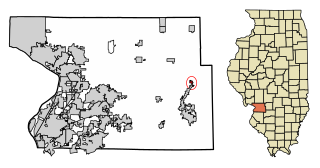
Grantfork is a village in Madison County, Illinois, United States. The population was 341 as of the 2020 census. It is part of the St. Louis Metropolitan Area.

<span class="mw-page-title-main">Madison, Illinois</span> City in Illinois, United States

Madison is a city in Madison and St. Clair counties in the U.S. state of Illinois. The population was 3,171 at the 2020 census, down from 3,891 in 2010. It is home to World Wide Technology Raceway at Gateway and the first Bulgarian Orthodox church in the United States.

<span class="mw-page-title-main">Maryville, Illinois</span> Village in Illinois, United States

Maryville is a village in Madison County, Illinois, United States. The population was 8,221 at the 2020 census, up from 7,487 in 2010.
<span class="mw-page-title-main">South Roxana, Illinois</span> Village in Illinois, United States

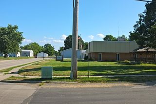
South Roxana, incorporated in March 1967, is a village in Madison County, Illinois, United States. The population was 1,891 at the 2020 census.

<span class="mw-page-title-main">Troy, Illinois</span> City in Illinois, United States

Troy is a city in Madison County, Illinois, United States. The population was 10,960 at the 2020 census, up from 9,888 in 2010.

<span class="mw-page-title-main">Venice, Illinois</span> City in Illinois, United States

Venice is a city in Madison County, Illinois, United States. The population was 1,498 at the 2020 census, down from 1,890 in 2010.

<span class="mw-page-title-main">Wood River, Illinois</span> City in Illinois, United States

Wood River is a city in Madison County, Illinois. The population was 10,464 as of the 2020 census.
<span class="mw-page-title-main">Worden, Illinois</span> Village in Illinois, United States

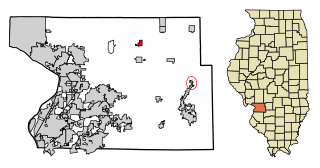
Worden is a village in Madison County, Illinois, United States. The population was 1,096 at the 2020 census.

<span class="mw-page-title-main">Kell, Illinois</span> Village in Illinois, United States

Kell is a village in Marion County, Illinois, United States. The population was 173 at the 2020 census, down from 219 in 2010.

<span class="mw-page-title-main">Viola, Illinois</span> Village in Illinois, United States

Viola is a village in Mercer County, Illinois, United States. The population was 869 at the 2020 census, a decline of 9 percent from 955 in 2010.

<span class="mw-page-title-main">Valmeyer, Illinois</span> Village in Illinois, United States

Valmeyer is a village in Monroe County, Illinois, United States. The population was 1,233 at the 2020 census. It was originally located in the American Bottom floodplain of the Mississippi River but now occupies higher land to the east.

<span class="mw-page-title-main">Alexandria, Missouri</span> City in Missouri, United States

Alexandria is a city in eastern Clark County, Missouri, United States. As of the 2020 census, its population was 105.

<span class="mw-page-title-main">Portage Des Sioux, Missouri</span> City in Missouri, United States

Portage Des Sioux is a city in St. Charles County, Missouri, United States. The town sits on the Mississippi River roughly opposite Elsah, Illinois, and is the home of the riverside shrine of Our Lady of the Rivers. The population was 328 at the 2010 census. The city was founded in 1799 by Spanish Lt. Gov. Zenon Trudeau and François Saucier in reaction to American plans to build a military post about twelve miles (19 km) downstream. The French name derives from the overland escape route between the Missouri River and Mississippi River used by a band of Sioux, fleeing enemies; they used this area as a portage for their canoes, outdistancing their rivals who instead paddled all of the way to the confluence of the rivers.
<span class="mw-page-title-main">Three Forks, Montana</span> City in Montana, United States

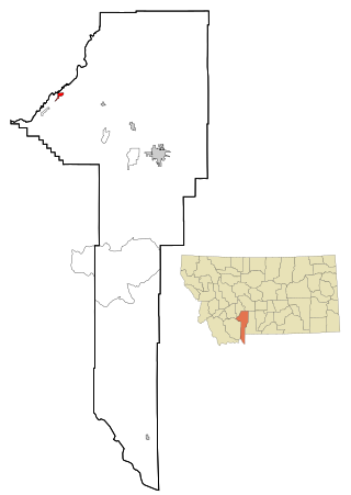
Three Forks is a city in Gallatin County, Montana, United States and is located within the watershed valley system of both the Missouri and Mississippi rivers drainage basins — and is historically considered the birthplace or start of the Missouri River. The population was 1,989 at the 2020 census. The city of Three Forks is named so because it lies geographically near the point, in nearby Missouri Headwaters State Park, where the Jefferson, Madison, and Gallatin rivers converge to form the Missouri River — the longest single river in North America, as well as the major portion of the Missouri–Mississippi River System from the headwaters near Three Forks to its discharge into the Gulf of Mexico. Three Forks is part of the Bozeman, MT Micropolitan Statistical Area of approximately 100,000 people and located thirty miles west of Bozeman.

<span class="mw-page-title-main">Pinhook, Missouri</span> Inactive Village in Missouri, United States

Pinhook is an inactive village in Mississippi County, Missouri, United States. The population was 6 at the 2020 census, down from 30 in 2010.

References

  1. 1 2 "2022 U.S. Gazetteer Files: Illinois". United States Census Bureau. Retrieved February 17, 2023.
  2. 1 2 U.S. Geological Survey Geographic Names Information System: Hartford, Illinois
  3. 1 2 "P1. Race – Hartford village, Illinois: 2020 DEC Redistricting Data (PL 94-171)". U.S. Census Bureau. Retrieved February 17, 2023.
  4. "P1. Race – Hartford village, Illinois: 2010 DEC Redistricting Data (PL 94-171)". U.S. Census Bureau. Retrieved February 17, 2023.
  5. "US Gazetteer files: 2010, 2000, and 1990". United States Census Bureau. February 12, 2011. Retrieved April 23, 2011.
  6. "Census of Population and Housing". Census.gov. Retrieved June 4, 2015.
  7. "U.S. Census website". United States Census Bureau . Retrieved January 31, 2008.
  8. http://www.thetelegraph.com/news/suit_16407___article.html/village_claims.html Local Newspaper article